This is a partial list of dams in France.

Jura is a department in the Bourgogne-Franche-Comté region in Eastern France. Named after the Jura Mountains, its prefecture is Lons-le-Saunier. Its subprefectures are Dole and Saint-Claude. In 2019, Jura had a population of 259,199. Its INSEE code is 39. It has a short portion of the border of Switzerland.

The Chaudière River is a 185-kilometre-long (115 mi) river with its source near the Town of Lac-Mégantic, in southeast Quebec, Canada. From its source Lake Mégantic in the Estrie region, it runs northwards to flow into the St. Lawrence River opposite Quebec City.

The arrondissement of Saint-Paul is an arrondissement of France in the Réunion department in the Réunion region. It has five communes. Its population is 214,073 (2016), and its area is 537.2 km2 (207.4 sq mi).

The Étang de Thau or Bassin de Thau is the largest of a string of lagoons (étangs) that stretch along the French coast from the Rhône river to the foothills of the Pyrenees and the border to Spain in the Languedoc-Roussillon. Although it has a high salinity, it is considered the second largest lake in France.

Arcachon Basin or alternatively Arcachon Bay is a bay of the Atlantic Ocean on the southwest coast of France, situated in Pays de Buch between the Côte d'Argent and the Côte des Landes, in the region of Aquitaine. The bay covers an area of 150 square kilometres (60 sq mi) at high tide and 40 km2 (15 sq mi) at low tide. Some of its geological features are natural preservation areas.

Bages is a commune in the Aude department in the Occitanie region of southern France.

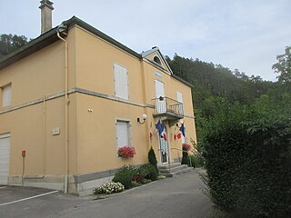
Auriac is a commune in the Corrèze department in the Nouvelle-Aquitaine region of central France.
Lect is a commune in the Jura department in Bourgogne-Franche-Comté in eastern France. The hamlet of Vouglans has been attached to Lect since 1822.

Saint-Priest-des-Champs is a commune in the Puy-de-Dôme department in the Auvergne of central France.

The Montmorency River is a tributary of North-East bank of St. Lawrence river, flowing in the administrative region of Capitale-Nationale, in the province of Quebec, Canada. The course of the river successively crosses the regional county municipality of:

Pinet is a dam and hydroelectric power station on the River Tarn in Saint-Victor-et-Melvieu in Aveyron, southern France.
Batiscanie is the watershed of the Batiscan River, located in the center of the province of Quebec, Canada, covering 4690 km² on the North Shore of the St. Lawrence River. The area covered by Batiscanie is 53% in the administrative région of Mauricie and 47% in the administrative region of the Capitale-Nationale.
The Mékinac river is a located in the RCM Mekinac Regional County Municipality, in the administrative region of Mauricie, the province of Quebec, in Canada. This river of Middle Mauricie has played an important role in the forestry industry at the end of the 19th century.
The Riverin River is a river in the Côte-Nord region of the province of Quebec, Canada. It is a tributary of the Gulf of Saint Lawrence. There is a small hydroelectric power plant near the mouth of the river.

The Sainte-Marguerite River is a 316 kilometres (196 mi) long river in the Côte-Nord region of Quebec, Canada. It flows into the Gulf of Saint Lawrence to the west of Sept-Îles. There are traces of human activity along the river from 4,000 years ago. Pulp and paper exploitation in the river basin began in the early 20th century, followed by mining. The river has a large hydroelectric power dam, the Denis-Perron dam, that contains a reservoir that is 140 kilometres (87 mi) long.
The Véco River is a salmon river in the Côte-Nord region of Quebec, Canada, that empties into the Gulf of Saint Lawrence. It has been dammed to supply a hydroelectric power plant. The shoreline around the mouth of the river is protected as part of a federal bird sanctuary.

The Kécarpoui River is a salmon river in the Côte-Nord region of Quebec, Canada. It flows south and empties into the Gulf of Saint Lawrence.
Eudist Lake is a lake in the Côte-Nord region of the province of Quebec, Canada. The Manitou River flows through the lake from north to south, and continues to the Gulf of Saint Lawrence.
Lake Manitou is a lake located in the unorganized territory of Lac-Jérôme, in the Minganie Regional County Municipality, in the Côte-Nord, in the province of Quebec, Canada. The Manitou River flows through the lake from north to south, and continues to the Gulf of Saint Lawrence.
| Africa |  | |
|---|---|---|
| Asia | ||
| Australasia | ||
| Europe |
| |
| North America | ||
| South America | ||