Contents
The topic of this article may not meet Wikipedia's notability guideline for stand-alone lists .(May 2023) |
The topic of this article may not meet Wikipedia's notability guideline for stand-alone lists .(May 2023) |

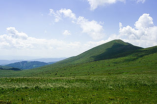
The Rhodopes are a mountain range in Southeastern Europe, and the largest by area in Bulgaria, with over 83% of its area in the southern part of the country and the remainder in Greece. Golyam Perelik is its highest peak at 2,191 meters (7,188 ft). The mountain range gives its name to the terrestrial ecoregion Rodope montane mixed forests that belongs in the temperate broadleaf and mixed forests biome and the Palearctic realm. The region is particularly notable for its karst areas with their deep river gorges, large caves and specific sculptured forms, such as the Trigrad Gorge.
A yer is either of two letters in Cyrillic alphabets, ъ and ь. The Glagolitic alphabet used, as respective counterparts, the letters (Ⱏ) and (Ⱐ). They originally represented phonemically the "ultra-short" vowels in Slavic languages, including Old Church Slavonic, and are collectively known as the yers.

Vitosha, the ancient Scomius or Scombrus, is a mountain massif, on the outskirts of Sofia, the capital of Bulgaria. Vitosha is one of the symbols of Sofia and the closest site for hiking, alpinism and skiing. Convenient bus lines and rope ways render the mountain easily accessible. Vitosha has the outlines of an enormous dome. The territory of the mountain includes Vitosha nature park that encompasses the best known and most frequently visited parts. The foothills of Vitosha shelter resort quarters of Sofia; Knyazhevo quarter has mineral springs. Vitosha is the oldest nature park in the Balkans. The mountain emerged as a result of volcanic activity and has been subsequently shaped by the slow folding of the granite rock layers and a series of gradual uplifts of the area. It appears dome shaped at first sight, but the mountain, 19 km long by 17 km wide, actually consists of concentric denudational plateaus rising in tiers one above the other. Vitosha is separated into four main parts whose main ridges gather at a crown known as Cherni Vrah. This is the highest point of the mountain at 2290 m and is one of 12 peaks of Vitosha over 2000 m in height. It is the highest massif of Srednogorie mountain chain system, together with Sredna gora, Plana (mountain), Lyulin Mountain, Greben (mountain), Viskyar Mountain, etc. They all are a result of the folding of the earth layers through the Mesozoic, causing also magma sheet-like intrusion that has been injected between layers of sedimentary rock. The laccolithic domed form of Vitosha is a typical example.

Rila is the highest mountain range of Bulgaria, the Balkan Peninsula and Southeast Europe. It is situated in southwestern Bulgaria and forms part of the Rila–Rhodope Massif. The highest summit is Musala at an elevation of 2,925 m which makes Rila the sixth highest mountain range in Europe after the Caucasus, the Alps, Sierra Nevada, the Pyrenees and Mount Etna, and the highest one between the Alps and the Caucasus. It spans a territory of 2,629 km2 with an average elevation of 1487 m. The mountain is believed to have been named after the river of the same name, which comes from the Old Bulgarian verb "рыти" meaning "to grub".

Rezen Knoll is a knoll rising to 433 m in eastern Livingston Island in the South Shetland Islands, Antarctica. The knoll is bounded to the east, north and west by Perunika Glacier, and linked to Burdick Ridge by Rezen Saddle. The feature is 250 m wide, extending 500 m in east-west direction. Composed of lavas, with precipitous slopes except to the east. Partly ice-free height and western and northern slopes.
Malak-Malak, also known as Ngolak-Wonga (Nguluwongga), is an Australian Aboriginal language spoken by the Mulluk-Mulluk people. Malakmalak is nearly extinct, with children growing up speaking Kriol or English instead. The language is spoken in the Daly River area around Woolianna and Nauiyu. The Kuwema or Tyaraity (Tyeraty) variety is distinct.

Slavyanka or Orvilos, formerly known as Alibotush and Kitka Planina, is a mountain located on the border of southwestern Bulgaria and northernmost Greece, located south of the Pirin Mountains and connected with it by the Paril Saddle. The highest peak of Slavyanka is Gotsev Vrah at 2,212 m, while other notable peaks include Golyam Tsarev Vrah, Malak Tsarev Vrah, Shabran and Salyuva Dzhamiya. The Bulgarian section of the mountain is part of the Ali Botush Reserve.

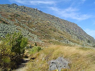
Golyam Rezen is a peak on Vitosha Mountain in Bulgaria. Rising to 2,277 m, the peak is second to the mountain's summit Cherni Vrah situated 900 m to the west. Golyam Rezen hosts an Air Traffic Services facility, as well as military communications installations. The precipitous east slopes of the peak are a popular rock climbing site, overlooking Bistritsa River Valley in Bistrishko Branishte Biosphere Reserve.

Bistrishko Branishte is a nature reserve in the Vitosha Nature Park on Vitosha Mountain in Bulgaria.

Malak Rezen is a peak rising to 2,191 m in northeastern Vitosha Mountain in Bulgaria. The peak is situated 1.5 km northeast of the summit Cherni Vrah, and 1.3 km north by east of Golyam Rezen Peak, surmounting Stenata ski run and Aleko site to the north.
Slivo Pole is a town in northeastern Bulgaria, part of Rousse Province. It is the administrative centre of the homonymous Slivo Pole Municipality, which lies in the northeastern part of the Province. The town is located five kilometres from the Danube, along the main road from Rousse to Silistra. As of December 2009, it has a population of 3,169 inhabitants.

Kom Peak or Golyam Kom is a peak in the western Balkan Mountains, located in western Bulgaria, not far from the Serbian border. The peak is 2,016 metres high and lies south of the town of Berkovitsa, of which it is a traditional symbol. Kom, along with the lower peaks Sreden Kom and Malak Kom to the east, form a west-east elevation with a round grassy ridge, a steep rocky northern slope and a slant grassy southern slope. Looking north, one can see Berkovitsa and the surrounding fields, as well as Montana and the Ogosta Reservoir some 30 kilometres away.

Vardim Rocks are a group of rocks situated on the south side of Hell Gates, facing Devils Point in the southwest extremity of Byers Peninsula on Livingston Island in the South Shetland Islands, Antarctica. Extending 1.3 km (0.81 mi) in east-west direction. The two principal islets in the group, Demon and Sprite, are extending 420 by 400 m and 270 by 150 m respectively, with surface area of the former 9 hectares. The area was visited by early 19th century sealers.

Vardim is a village in Svishtov Municipality, Veliko Tarnovo Province, north central Bulgaria, located on the right bank of the Danube river. The village of Vardim is located in the central part of the Danubian plain about 10 km east of Svishtov towards Ruse. The village is believed to date back to the time of the Thracians and Slavs and shows significant remains from subsequent Roman inhabitants, particularly in the nearby Roman town of Novae which has been dated to 45 AD and is considered to be the most examined Roman camp in Bulgaria.
Polich Island is the 250 m long in southeast–northwest direction and 100 m wide rocky island lying off the northeast coast of Astrolabe Island in Bransfield Strait, Antarctica. It is “named after Golyam (Great) Polich and Malak (Little) Polich Peaks in Rila Mountain, Bulgaria.”

Golyam Sechko Cove is the 2.45 km wide cove indenting for 780 m the northwest coast of Nelson Island in the South Shetland Islands, Antarctica southwest of Sabin Point. The area was visited by early 19th century sealers.
Rogosh is a village in southern Bulgaria, located in Maritsa Municipality, Plovdiv Province. As of 15 June 2020, the village has a population count of 3109 people.

Frisius Point is the rocky north entrance point of Malak Sechko Cove and southwest entrance point of Golyam Sechko Cove projecting 450 m westwards from the northwest coast of Guangzhou Peninsula on Nelson Island in the South Shetland Islands, Antarctica. The area was visited by early 19th century sealers. Frisius Point is part of both Antarctic Specially Protected Area Harmony Point and the BirdLife International Important Bird Area Harmony Point, Nelson Island.

Marishki Chal is a summit in the eastern part of the Rila mountain range in southwestern Bulgaria reaching height of 2,765 m. It is located in Rila National Park. The summit is built up of granite.