List of roads in Louisville, Kentucky

Last updated

The roads in Louisville, Kentucky include Interstates 64, 65 and 71, with an interchange in the city center. There are six U.S. highways serving the city. Two beltways surround Louisville.

Contents

Interstates

Interstate highwayAdditional information
I-64.svg I-64 A major west–east interstate that enters the city's West End via the Sherman Minton Bridge from New Albany, Indiana where it becomes the Riverfront Expressway. The highway continues through Downtown Louisville, and proceeds eastward through Cherokee Park and the eastern suburbs.
I-65.svg I-65 A major north–south interstate that enters downtown from Louisville's Indiana suburbs via the John F. Kennedy Memorial Bridge (and exits to Jeffersonville, Indiana on the parallel Abraham Lincoln Bridge), continues southward to Louisville International Airport, and proceeds through the southern suburbs. I-65 is named Dr. Martin Luther King Jr. Expressway through the city.
I-71.svg I-71 The highway has its terminus at the interchange with Interstates 64 and 65 in downtown Louisville and connects to Louisville's northeastern suburbs and bedroom communities in Oldham County.
I-264.svg I-264 The inner beltway, whose southern and eastern legs are named the Henry Watterson Expressway. The western leg between I-64 and US 31W/US 60 was originally called the Shawnee Expressway, but was renamed in 2010 as the Georgia Davis Powers Expressway.
I-265.svg I-265 The outer beltway originally named the Jefferson Freeway and renamed the Gene Snyder Freeway. Highway is also signed as Kentucky Route 841. This is the only Interstate route in the Louisville area to use the technically correct suffix of Freeway in its formal name, rather than the traditional, but misleading term Expressway. Now connected to I-265 in Indiana via the Lewis and Clark Bridge plus freeway segments on both sides of the Ohio River.

U.S. Highways

Route numberLocal street name(s)
US 31E.svg US 31E Main and Market Streets, Baxter Avenue, Bardstown Road
US 31W.svg US 31W Main and Market Streets, Doctor W. J. Hodge, 21st and 22nd Streets, Dixie Highway
US 42.svg US 42 Story and Mellwood Avenues, Brownsboro Road (Begins/ends at Story and Baxter Avenues)
US 60.svg US 60 Shelbyville Road, Frankfort Avenue, Story and Mellwood Avenues, Main and Market Streets, Doctor W. J. Hodge Street, 21st and 22nd Streets, Dixie Highway
Alternate plate.svg
US 60.svg
US 60 Alt.
Lexington Road, Cherokee Parkway, Willow Avenue, Eastern Parkway, Crittenden Drive, Central Avenue, Taylor Boulevard, Berry Boulevard, Seventh Street Road
US 150.svg US 150 Bardstown Road, Broadway, Doctor W. J. Hodge (21st) and 22nd Streets, I-64

State routes

Route numberLocal street name(s)
Elongated circle 22.svg KY 22 Brownsboro Road, Ballardsville Road
Elongated circle 44.svg KY 44 Stites Station Road
Elongated circle 61.svg KY 61 Jackson Street, Preston Street, I-65, Arthur Street, Brandeis Avenue, Shelby Street, Lynn Street, Preston Street, Preston Highway
Elongated circle 146.svg KY 146 LaGrange Road, New LaGrange Road, Ridge Road
Elongated circle 148.svg KY 148 Fisherville Clark Station Road
Elongated circle 155.svg KY 155 Taylorsville Road
Elongated circle 329.svg KY 329 Covered Bridge Road
Elongated circle 660.svg KY 660 Waterford Road
Elongated circle 841.svg KY 841 [n 1] Gene Snyder Freeway
Elongated circle 864.svg KY 864 Campbell, Shelby, and Logan Streets, Goss Avenue, Poplar Level Road, Fegenbush Lane, Beulah Church Road, Cooper Chapel Road, Cedar Creek Road
Elongated circle 913.svg KY 913 Blankenbaker Parkway
Elongated circle 907.svg KY 907 Third Street Road, Valley Station Road, Southside Drive
Elongated circle 1020.svg KY 1020 Second and Third Streets, Southern Parkway, Southside Drive, National Turnpike
Elongated circle 1065.svg KY 1065 Outer Loop, Beulah Church Road, Seatonville Road, Lovers Lane
Elongated circle 1142.svg KY 1142 Palatka Road
Elongated circle 1230.svg KY 1230 Cane Run Road, Lower River Road, Watson Lane
Elongated circle 1447.svg KY 1447 Westport Road
Elongated circle 1450.svg KY 1450 Blue Lick Road
Elongated circle 1531.svg KY 1531 Aiken Road, Johnson Road, Eastwood and Fisherville Road, Routt Road
Elongated circle 1631.svg KY 1631 Crittenden Drive
Elongated circle 1694.svg KY 1694 Brownsboro Road
Elongated circle 1699.svg KY 1699 Whipps Mill Road
Elongated circle 1703.svg KY 1703 Baxter Avenue, Newburg Road
Elongated circle 1727.svg KY 1727 Terry Road
Elongated circle 1747.svg KY 1747 [n 2] Hurstbourne Parkway, Fern Valley Road
Elongated circle 1819.svg KY 1819 Watterson Trail, Billtown Road, Seatonville Road, Brush Run Road
Elongated circle 1849.svg KY 1849 Moorman Road
Elongated circle 1865.svg KY 1865 New Cut Road, Taylor Blvd, Penile Road
Elongated circle 1931.svg KY 1931 Seventh Street Road, Manslick Road in Jacobs, Hazelwood, Cloverleaf, and Iroquois Park neighborhoods, St. Andrew's Church Road, Greenwood Road
Elongated circle 1932.svg KY 1932 Breckenridge Lane
Elongated circle 1934.svg KY 1934 [n 3] Cane Run Road, Greenbelt Highway, Wilson Avenue
Elongated circle 2048.svg KY 2048 Cannons Lane, Dutchmans Lane
Elongated circle 2049.svg KY 2049 Crums Lane
Elongated circle 2050.svg KY 2050 Herr Lane, Lyndon Lane
Elongated circle 2051.svg KY 2051 Camp Ground Road, Rockford Lane
Elongated circle 2052.svg KY 2052 Shepherdsville Road
Elongated circle 2053.svg KY 2053 Mount Washington Road, Thixton Road
Elongated circle 2054.svg KY 2054 Algonquin Parkway
Elongated circle 2055.svg KY 2055 Manslick Road, in Fairdale neighborhood
Elongated circle 2056.svg KY 2056 Bells Lane
Elongated circle 2241.svg KY 2241 Willis Avenue
Elongated circle 2265.svg KY 2265 Routt Road
Elongated circle 2801.svg KY 2801 Florence Avenue, Southern Heights Avenue
Elongated circle 2803.svg KY 2803 Arthur Street
Elongated circle 2840.svg KY 2840 Old Shelbyville Road (Middletown Main Street)
Elongated circle 2841.svg KY 2841 Eastwood Cut-Off Road
Elongated circle 2843.svg KY 2843 Grade Lane
Elongated circle 2844.svg KY 2844 Hounz Lane
Elongated circle 2845.svg KY 2845 Shepherdsville Road, Manslick Road in Okolona neighborhood
Elongated circle 2860.svg KY 2860 Grinstead Drive
Elongated circle 3064.svg KY 3064 Portland Avenue
Elongated circle 3077.svg KY 3077 River Road, I-64 ramps
Elongated circle 3082.svg KY 3082 Bank Street
Elongated circle 3084.svg KY 3084 Old Henry Road
Elongated circle 3222.svg KY 3222 Rose Island Road
Notes
  1. Concurrent with I-265 east of I-65 and south of I-71, exists as its own entity west of I-65 and north of I-71. Functions as an outer bypass for Louisville.
  2. KY 1747 formerly had its southern terminus at Bardstown Road, the roadway was extended and connected to the existing Fern Valley Road (KY 1631). KY 1747 replaced KY 1631 in that area and KY 1631 currently exists only between the Watterson Expressway and Eastern Parkway. All KY 1747 mile markers have been replaced along the new roadway.
  3. An extension of KY 841 to the eastern banks of the Ohio River, connecting to major distribution and industrial centers.

Renamed streets

Current Street NameFormer Street Name(s)
3rd StreetCentral Plank Road (To Indiana) US 31
5th StreetPope Street
13th StreetColumbia Street
14th StreetBoone Street
15th StreetClark Street
16th StreetElizabeth Street, Mulberry Street
17th StreetMaria Street, Sycamore Street
18th StreetBridge Street, DeWolfe Street
19th StreetClinton Street
20th StreetCromie Street, Montgomery Street, Orleans Street
21st StreetEleventh Cross Street
22nd StreetTenth Cross Street
23rd StreetNinth Cross Street, Sayre Street
24th StreetEighth Cross Street, Mercer Street
25th StreetSeventh Cross Street
26th StreetSixth Cross Street, Lock Street, Salt River Road, Shippingport Road
27th StreetFifth Cross Street, Union Street
28th StreetFourth Cross Street
29th StreetThird Cross Street, Cherry Street
30th StreetSecond Cross Street, Plum Street
31st StreetColumbia Street, Thompson's Lane
32nd StreetSycamore Street
33rd StreetFulton Avenue
34th StreetFirst Cross Street, Commercial Street
35th StreetGrove Street
36th StreetFerry Street
37th StreetGravier Street
39th StreetKennedy Street
43rd StreetFalls City Avenue
Arlington AvenueProspect Avenue
Armory PlaceCenter Street
Atwood Avenue'F' Street
Barbee Avenue'E' Street
Barret AvenueUnderhill Street
Baxter AvenueVon Borries Ave
Beech StreetRosenberg Lane
Bloom Avenue'B' Street
Bradley AvenueFlat Lick Road
Brandeis Avenue'D' Street
Breckinridge StreetHoward Street
BroadwayDunkirk Road, Prather Street
Brook StreetEast Street
Burnett AvenueStonewall Street
Calhoun Avenue'T' Street, Kenton Street
Cannons LaneBeauchamp Road
Cardinal Boulevard'C' Street, Avery Avenue
Cherokee ParkwayFinzer Parkway, East Broadway, New Broadway
Cedar StreetGrayson St.
Central Avenue'P' Street
Chestnut StreetSouth Street
E. Chestnut Street (> #917 east)Garden Street [1]
Colorado Avenue'H' Street
Creel Avenue'J' Street
Crittenden DriveAshbottom Road
Dixie Highway18th Street Road
Dr. Martin Luther King Jr. PlaceFederal Place
Doctor W. J. Hodge Street21st Street
Dundee RoadZimlich Avenue
Fairmount Avenue'V' Street
Garland Avenue (east of about 14th St)Delaware Street
Garland Avenue (between 18th and 14th Sts.)Southgate St.
Gaulbert Avenue'A' Street
Gray StreetKellar Street
Griffiths AvenueHarney Street
Grinstead DriveDaisy Lane, Transit Avenue
Heywood Avenue'O' Street
Hoertz AvenueMerry Street
Iowa Avenue'N' Street
Lexington RoadWorkhouse Road
Liberty StreetGreen Street
Liberty Street (east of Preston, between 1880 and 1960)Fehr Ave. [2]
Longview AvenueJessie Avenue
Louis Coleman Jr. Drive [3] [4] South 34th Street (south of West Market)
Lytle StreetTodd Street
Magnolia AvenueVictoria Place
Mellwood AvenueReservoir Avenue
Missouri AvenueFront Street
Montana Avenue'K' Street
Montgomery StreetMidway Avenue
Morton AvenueCaroline Street
Muhammad Ali Boulevard Walnut Street
Myrtle StreetMott Street
Oak StreetMilk Street
Overlook TerraceVassar Drive
Park AvenueWeissinger Street
Patterson AvenueSlaughter Avenue
Racine Avenue'Q' Street
Reservoir AvenueSouthall Street
Rogers StreetWard Street
Roy Wilkins Avenue(Co-signed with 9th Street)
Rubel AvenueOverhill Street
Rufer AvenueKrupps Lane
St. Catherine CourtMechanic Street
Schiller AvenueDupuy Street
Seneca AvenueCherokee Avenue
Shelby ParkwayRupp Street
Southern Parkway Grand Boulevard
Speed AvenueRopewalk Lane
Stoecker AvenueLost Alley
Stoll AvenueAsylum Avenue
Story AvenueBeargrass Street
Thornberry Avenue'R' Street, 'S' Street
Upland RoadSelby Road
Unity PlaceConfederate Place
University BoulevardWarnock Avenue, 'G' Street
Vine StreetJacob Ave. (> #1000 East) [5]
Wenzel StreetBraddock Street
Winkler Avenue'L' Street
Zorn AvenuePipe Line Lane

See also

Related Research Articles

<span class="mw-page-title-main">Jefferson County, Kentucky</span> County in Kentucky, United States

Jefferson County is located in the north central portion of the U.S. state of Kentucky. As of the 2020 census, the population was 782,969. It is the most populous county in the commonwealth.

<span class="mw-page-title-main">U.S. Route 42</span> Highway in the United States

U.S. Route 42 is an east–west United States highway that runs southwest–northeast for 350 miles (560 km) from Louisville, Kentucky to Cleveland, Ohio. The route has several names including Pearl Road from Cleveland to Medina in Northeast Ohio, Reading Road in Cincinnati, Cincinnati and Lebanon Pike in southwestern Ohio and Brownsboro Road in Louisville. Traveling northeast, the highway ends in downtown Cleveland and traveling southwest ends in Louisville.

<span class="mw-page-title-main">Interstate 264 (Kentucky)</span> Highway in Kentucky

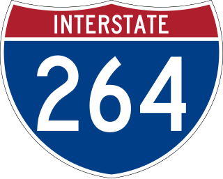
Interstate 264 (I-264) is a partial loop around the city of Louisville, Kentucky, south of the Ohio River. An auxiliary route of I-64, it is signed as the Shawnee Expressway for its first eight miles (13 km) from its western terminus at I-64/U.S. Route 150 (US 150) to US 31W/US 60 and as the Watterson Expressway for the remainder of its length from US 31W/US 60 to its northeastern terminus at I-71. It is 22.93 miles (36.90 km) in length and runs an open circle around central Louisville. The highway begins four miles (6.4 km) west of Downtown Louisville at I-64 just east of the Sherman Minton Bridge, which links Southern Indiana with Kentucky as it crosses the Ohio River. The Interstate ends approximately six miles (9.7 km) northeast of Downtown Louisville, where it connects to I-71. It is the only auxiliary route of I-64 outside of Virginia.

<span class="mw-page-title-main">Interstate 265</span> Highway in Indiana and Kentucky

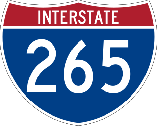
Interstate 265 (I-265) is a 41.8-mile (67.3 km) Interstate Highway partially encircling the Louisville metropolitan area. Starting from I-65 in the southern part of Louisville, it runs through Jefferson County, Kentucky, crosses the Ohio River on the Lewis and Clark Bridge into Indiana, meets I-65 for a second time, and then proceeds westbound to terminate at the I-64 interchange.

<span class="mw-page-title-main">U.S. Route 31W</span> U.S. Highway in Kentucky and Tennessee

U.S. Route 31W is the westernmost of two parallel routes for U.S. Route 31 from Nashville, Tennessee to Louisville, Kentucky.

<span class="mw-page-title-main">Kentucky Route 1747</span>

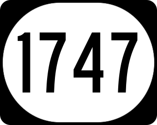
Kentucky Route 1747 is an 18.424 mile (29.651 km) long north–south state highway in the immediate suburbs of Louisville, Kentucky.

<span class="mw-page-title-main">Kentucky Route 22</span> Highway in Kentucky

Kentucky Route 22 is a 121.213-mile-long (195.073 km) east–west highway running from the eastern suburbs of Louisville to an unincorporated place called Willow in Bracken County in Northern Kentucky.

<span class="mw-page-title-main">Interstate 65 in Kentucky</span> Interstate Highway in Kentucky, United States

Interstate 65 (I-65) enters the US state of Kentucky from Tennessee, five miles (8.0 km) south of Franklin. It passes by the major cities of Bowling Green, Elizabethtown, and Louisville before exiting the state into Indiana.

<span class="mw-page-title-main">Interstate 64 in Kentucky</span> Highway in Kentucky

Interstate 64 (I-64) in the US state of Kentucky travels for 191 miles (307 km), passing by the major towns and cities of Louisville, Frankfort, Lexington, and Ashland. It has several major junctions with other Interstates, including I-65, I-71, I-264, and I-265 in Louisville and I-75 in Lexington.

<span class="mw-page-title-main">Kentucky Route 101</span> State highway in Kentucky, United States

Kentucky Route 101 (KY 101) is a north–south highway traversing three counties in south central Kentucky.

<span class="mw-page-title-main">Interstate 64 in Indiana</span> Section of Interstate Highway in Indiana

Interstate 64 (I-64) in the US state of Indiana is a major east–west highway providing access between Illinois and Kentucky. It passes through southern Indiana as part of its connection between the two metropolitan areas of St Louis, Missouri, and Louisville, Kentucky.

<span class="mw-page-title-main">U.S. Route 231 in Kentucky</span> Section of U.S. Highway in Kentucky

U.S. Route 231 in Kentucky runs 86.465 miles (139.152 km) from the Tennessee state line near Adolphus to the William H. Natcher Bridge on the Ohio River near Rockport, Indiana. It crosses the state mainly in the west-central region, traversing Allen, Warren, Butler, Ohio, and Daviess Counties.

<span class="mw-page-title-main">U.S. Route 421 in Kentucky</span> Section of U.S. Highway in Kentucky

U.S. Route 421 (US 421) in the U.S. state of Kentucky is a 250.536-mile-long (403.199 km) north–south United States highway that traverses twelve counties in the central and eastern parts of the state. It travels in a southeast-to-northwest path from the Virginia state line near Pennington Gap to the Indiana state line, on the Ohio River at Milton, Kentucky and Madison, Indiana.

<span class="mw-page-title-main">Kentucky Route 1020</span>

Kentucky Route 1020 is a 17.806-mile-long (28.656 km) north–south state highway in north central Kentucky, traversing portions of Bullitt and Jefferson counties, including the Louisville metropolitan area.

<span class="mw-page-title-main">Kentucky Route 864</span>

Kentucky Route 864 is a 16.339-mile-long (26.295 km) state highway located entirely in the Louisville metropolitan area of Jefferson County in north central Kentucky.

References

  1. old Louisville maps
  2. old Louisville maps
  3. "Council poised to rename 34th Street for Louis Coleman". Louisville Metro Police Department. Courier-Journal. Retrieved 25 May 2020.
  4. "Jefferson County KY Street Centerlines". Louisville (LOJIC) Open GeoSpatial Data. Louisville MetroSafe. Retrieved 25 May 2020.
  5. old Louisville maps before 1925

Further reading