List of parks in the Louisville metropolitan area

Last updated

The following is a list of parks, forests and nature preserves in the Louisville metropolitan area .

Contents

View of Downtown Louisville from the overlook atop Iroquois Park. Iroquois park.jpg
View of Downtown Louisville from the overlook atop Iroquois Park.

Louisville Metro (Jefferson County)

Frederick Law Olmsted Parks

The Jefferson Memorial Forest is the largest municipal urban forest in the United States. Jcf-tuliptree trail 6-2.JPG
The Jefferson Memorial Forest is the largest municipal urban forest in the United States.

The Frederick Law Olmsted Parks [1] (formerly called the Olmsted Park System) in Louisville was the last of five such systems designed by Frederick Law Olmsted. [2] All of the parks in this system are managed by Louisville Metro Parks.

Flagship

Other Olmsted parks

  • Algonquin Park [3]
  • Baxter Square [4]
  • Bingham Park [5] — Originally known as Clifton Park (Locals called it Coral Park)
Walking trails in Central Park, located in the Old Louisville neighborhood. Central Park Sentier.jpg
Walking trails in Central Park, located in the Old Louisville neighborhood.

Parkways

Other parks managed by Louisville Metro Parks

Parks not managed by Louisville Metro Parks

Louisville Waterfront Park, once an industrial wasteland, Louisville's reclaimed waterfront now features trees and walking paths WaterfrontPkDwnt.jpg
Louisville Waterfront Park, once an industrial wasteland, Louisville's reclaimed waterfront now features trees and walking paths

Kentucky metropolitan counties outside Jefferson

Sign at the entrance of Bernheim Arboretum and Research Forest, 25 miles south of Louisville. Bernheim Sign.jpg
Sign at the entrance of Bernheim Arboretum and Research Forest, 25 miles south of Louisville.

Bullitt

Meade

Nelson

Oldham

Shelby

Spencer

Trimble

Indiana metropolitan counties

Postcard of a scene from Cherokee Park at the base of Baringer Hill, early 20th century. CherokeePark4-0.jpg
Postcard of a scene from Cherokee Park at the base of Baringer Hill, early 20th century.

Clark

Jeffersonville parks and recreation

[114]

  • Bob Hedge Park
  • Colston Park
  • Connie Seller Park
  • Highland Park
  • John Wilcoxson Park
  • Lansden Park
  • Lottie Oglesby Park
  • Meijer Little League Fields
  • Oak Park
  • Optimist Park
  • Port Fulton Park
  • Shannon Memorial Park
  • Shirley Hall Park
  • Vissing Park
  • Warder Park
  • Wathen Park

Clarksville parks and recreation

[115]

  • Ashland Park
  • Beechwood Park
  • Cedar Park
  • Colgate Park
  • Gaskell Park
  • Lapping Park
  • Little League Park
  • Midway Park
  • Moser Park
  • Parkwood Park
  • Ray Lawrence Park

Others and state parks

Harrison

See also

Related Research Articles

<span class="mw-page-title-main">Louisville, Kentucky</span> Largest city in Kentucky, United States

Louisville is the most populous city in the Commonwealth of Kentucky, sixth-most populous city in the Southeast, and the 27th-most-populous city in the United States. By land area, it is the country's 24th-largest city, although by population density, it is the 265th most dense city. Louisville is the historical county seat and, since 2003, the nominal seat of Jefferson County, on the Indiana border.

<span class="mw-page-title-main">Bardstown, Kentucky</span> City in Kentucky, United States

Bardstown is a home rule-class city in Nelson County, Kentucky, United States. The population was 13,567 in the 2020 census. It is the county seat of Nelson County.

<span class="mw-page-title-main">Cherokee Park</span> Municipal park in Louisville, KY, US

Cherokee Park is a 409-acre (166 ha) municipal park located in Louisville, Kentucky, United States and is part of the Louisville Olmsted Parks Conservancy. It was designed in 1891 by Frederick Law Olmsted, the father of landscape architecture along with 18 of Louisville's 123 parks. Beargrass Creek runs through much of the park, and is crossed by numerous pedestrian and automobile bridges.

<span class="mw-page-title-main">Louisville metropolitan area</span> Geographic region surrounding Louisville, KY, USA

The Louisville metropolitan area is the 43rd largest metropolitan statistical area (MSA) in the United States. It had a population of 1,395,855 in 2020 according to the latest official census, and its principal city is Louisville, Kentucky.

<span class="mw-page-title-main">Roman Catholic Archdiocese of Louisville</span> Latin Catholic ecclesiastical jurisdiction in Kentucky, United States

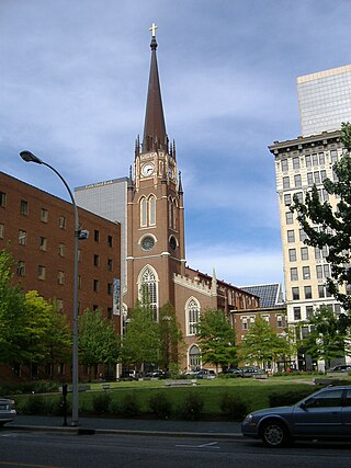
The Archdiocese of Louisville a Latin Church ecclesiastical territory, or archdiocese, of the Catholic Church in central Kentucky in the United States. The cathedral church of the archdiocese is the Cathedral of the Assumption in Louisville, Kentucky. The archdiocese is the seat of the metropolitan see of the Province of Louisville, which encompasses the states of Kentucky and Tennessee. The archdiocese is the second-oldest diocese west of the Appalachian Mountains, after the Archdiocese of New Orleans. As of 2023, the archbishop of Louisville is Shelton Fabre.

<span class="mw-page-title-main">Deer Park, Louisville</span> Louisville neighborhood in Kentucky, United States

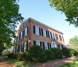
Deer Park is a neighborhood four miles southeast of downtown Louisville, Kentucky, USA. Most of the neighborhood was developed from 1890 through the 1920s as a streetcar suburb, with all but six of its 24 subdivisions being developed by 1917, and the last laid out by 1935, although some development west of Norris Place continued after World War II.

<span class="mw-page-title-main">Tyler Park, Louisville</span>

Tyler Park is a neighborhood three miles (5 km) southeast of downtown Louisville, Kentucky, USA. It is considered a part of a larger area of Louisville called The Highlands. Near the middle of the neighborhood is a city park of the same name, and many houses in the neighborhood feature park views. The neighborhood boundaries are St Louis Cemetery to the north, Bardstown Road to the east, Eastern Parkway to the south and Beargrass Creek to the west.

<span class="mw-page-title-main">Original Highlands, Louisville</span> United States historic place

The Original Highlands is a historic neighborhood in the Highlands area of Louisville, Kentucky, United States.

Germantown is a neighborhood three miles southeast of downtown Louisville, Kentucky, USA. Germantown is also a general term for an area of Louisville from the Original Highlands to St Joseph and Bradley neighborhoods that were predominantly settled by Germans. The actual neighborhood is bounded by Barrett Ave, Eastern Parkway, and the South Fork of Beargrass Creek.

<span class="mw-page-title-main">Neighborhoods in Louisville, Kentucky</span>

This is a list of official neighborhoods in Louisville, Kentucky. Like many older American cities, Louisville has well-defined neighborhoods, many with well over a century of history as a neighborhood.

Poplar Level is a neighborhood five miles (8 km) southeast of downtown Louisville, Kentucky, United States. It is part of the larger Camp Zachary Taylor area.

<span class="mw-page-title-main">Iroquois Park</span>

Iroquois Park is a 725-acre (3.0 km2) municipal park in Louisville, Kentucky, United States. It was designed by Frederick Law Olmsted, who also designed Louisville's Cherokee Park and Shawnee Park, at what were then the edges of the city. Located south of downtown, Iroquois Park was promoted as "Louisville's Yellowstone". It is built on a large knob covered with old growth forest, and its most prominent feature are the scenic viewpoints atop the hill.

City of Parks is a municipal project to create a continuous paved pedestrian and biking trail around the city of Louisville, Kentucky while also adding a large amount of park land. The project was announced on February 22, 2005. Current plans call for making approximately 4,000 acres (1,600 ha) of the Floyds Fork floodplain in eastern Jefferson County into park space, expanding area in the Jefferson Memorial Forest, and adding riverfront land and wharfs along the Riverwalk Trail and Levee Trail. There are also plans to connect the 100-mile (160 km) Louisville trail to a planned seven mile (11 km) trail connecting the Southern Indiana cities of New Albany, Clarksville and Jeffersonville.

<span class="mw-page-title-main">The Highlands, Louisville</span>

The Highlands is an area in Louisville, Kentucky which contains a high density of nightclubs, eclectic businesses, and many upscale and fast food restaurants. It is centered along a three-mile (5 km) stretch of Bardstown Road and Baxter Avenue and is so named because it sits atop a ridge between the middle and south forks of Beargrass Creek. The commercial area extends from the intersection of Bardstown Road and Taylorsville Road/Trevillian Way in the south, to the intersection of Baxter Avenue and Lexington Road in the north, a length of 3.2 miles (5.1 km). A 12-mile (800 m) section of the nearby Barret Avenue also contains many similar businesses. The residential area is separated from other adjacent areas like Germantown and Crescent Hill by the south and north forks of Beargrass Creek. The middle fork runs through Cherokee Park, and the south fork divides Germantown from Tyler Park, after flowing past several cemeteries and undeveloped forests downstream from Joe Creason Park. Due to its large collection of night clubs and restaurants, it is locally known as "Restaurant Row".

<span class="mw-page-title-main">Cityscape of Louisville, Kentucky</span>

Louisville, Kentucky is home to numerous structures that are noteworthy due to their architectural characteristics or historic associations, the most noteworthy being the Old Louisville neighborhood, the third largest historic preservation district in the United States. The city also boasts the postmodern Humana Building and an expanding Waterfront Park which has served to remove the former industrial appearance of the riverfront.

<span class="mw-page-title-main">Parkways of Louisville, Kentucky</span> United States historic place

The parkway system of Louisville, Kentucky, also known as the Olmsted Park System, was designed by the firm of preeminent 19th century landscape architect Frederick Law Olmsted. The 26-mile (42 km) system was built from the early 1890s through the 1930s, and initially owned by a state-level parks commission, which passed control to the city of Louisville in 1942.

Transportation in Kentucky includes roads, airports, waterways and rail.

<span class="mw-page-title-main">Jefferson County Fire Service</span>

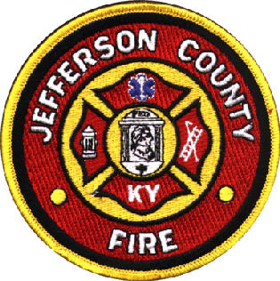
The Jefferson County Fire Service is an organization that coordinates the independent fire protection districts in Jefferson County, Kentucky. The JCFS was formed for the purpose of mutual aid, dispatch, training, and local standardization. The Shively Fire Department is the only suburban department that has not joined the JCFS; it uses the same dispatch and radio channels as the Louisville Division of Fire.

References

  1. Elson, Martha (2011-04-20). "Historic parks in Louisville to be named for Frederick Law Olmsted". The Courier Journal. Archived from the original on 2012-01-04. Retrieved 2011-04-24. Alt URL
  2. "Louisville Olmsted Parks Conservancy". Olmstedparks.org. 2010-06-12. Archived from the original on 2011-05-16. Retrieved 2010-07-30.
  3. "Algonquin Park". Louisvilleky.gov. 2014-09-18. Archived from the original on 2014-07-07. Retrieved 2019-07-23.
  4. "Baxter Square". Louisvilleky.gov. 2014-09-18. Archived from the original on 2018-09-09. Retrieved 2019-07-23.
  5. "Bingham Park". Louisvilleky.gov. 2014-09-18. Archived from the original on 2018-09-09. Retrieved 2019-07-23.
  6. "Churchill Park". Louisvilleky.gov. 2014-09-19. Archived from the original on 2017-04-07. Retrieved 2019-07-23.
  7. "Elliott Square". Louisvilleky.gov. 2014-09-19. Archived from the original on 2018-09-09. Retrieved 2019-07-23.
  8. "Shelby Park". Louisvilleky.gov. 2014-09-23. Archived from the original on 2018-09-09. Retrieved 2019-07-23.
  9. "William B. Stansbury Park". Louisvilleky.gov. 2014-09-23. Archived from the original on 2018-09-09. Retrieved 2019-07-23.
  10. Kleber, John E., ed. (2001). "Stansbury, William Brown". The Encyclopedia of Louisville. Lexington, Kentucky: University Press of Kentucky. pp. 848–49. ISBN   0-8131-2100-0. OCLC   247857447. Archived from the original on March 13, 2023. Retrieved December 11, 2023.
  11. "Tyler Park". Louisvilleky.gov. 2014-09-23. Archived from the original on 2018-09-09. Retrieved 2019-07-23.
  12. "Victory Park". Louisvilleky.gov. 2014-09-23. Archived from the original on 2014-07-20. Retrieved 2019-07-23.
  13. "Wayside Park". Louisvilleky.gov. 2014-09-23. Archived from the original on 2020-08-09. Retrieved 2019-07-23.
  14. "Willow Park". Louisvilleky.gov. 2014-09-23. Archived from the original on 2019-05-12. Retrieved 2019-07-23.
  15. "35th Street Park". Louisvilleky.gov. 2014-09-26. Archived from the original on 2020-09-30. Retrieved 2019-07-23.
  16. "Auburndale Park". Archived from the original on 2007-09-29. Retrieved 2007-06-02.
  17. "Ballard Park". Archived from the original on 2007-09-29. Retrieved 2007-06-02.
  18. "Eva Bandman Park". Archived from the original on 2007-09-29. Retrieved 2007-06-02.
  19. "Beargrass Creek Greenway at Irish Hill". Archived from the original on 2007-09-26. Retrieved 2007-06-02.
  20. "Beechmont Tot Lot". Archived from the original on 2006-10-01. Retrieved 2007-06-02.
  21. "Bellevue Park". Archived from the original on 2007-09-26. Retrieved 2007-06-02.
  22. "Berrytown Park". Archived from the original on 2006-10-01. Retrieved 2007-06-02.
  23. "Black Mudd Park". Archived from the original on 2006-09-30. Retrieved 2007-06-02.
  24. "Blue Lick Park". Archived from the original on 2006-09-30. Retrieved 2007-06-02.
  25. "Bradley Park". Archived from the original on 2007-09-26. Retrieved 2007-06-02.
  26. "Breslin Park". Archived from the original on 2009-06-18. Retrieved 2007-06-02.
  27. "William Britt Park". Archived from the original on 2007-09-29. Retrieved 2007-06-02.
  28. "Buechel Park". Archived from the original on 2007-09-26. Retrieved 2007-06-02.
  29. "California Park". Archived from the original on 2012-12-13. Retrieved 2007-06-02.
  30. "Camp Taylor Memorial Park". Louisvilleky.gov. 2014-09-18. Archived from the original on 2014-07-08. Retrieved 2019-07-23.
  31. "Cane Run Park". Archived from the original on 2007-09-29. Retrieved 2007-06-02.
  32. "Caperton Swamp". Archived from the original on 2007-09-29. Retrieved 2007-06-02.
  33. "Castlewood Open Space". Archived from the original on 2007-09-29. Retrieved 2007-06-02.
  34. "George Rogers Clark Park". Louisvilleky.gov. 2017-04-20. Archived from the original on 2014-08-21. Retrieved 2019-07-23.
  35. "Cliff Park". Archived from the original on 2007-09-26. Retrieved 2007-06-02.
  36. "Clifton Park". Archived from the original on 2007-09-26. Retrieved 2007-06-02.
  37. "Carrie Gaulbert Cox Park". Archived from the original on 2007-09-29. Retrieved 2007-06-02.
  38. "Joe Creason Park". Archived from the original on 2008-12-31. Retrieved 2007-06-02.
  39. "Crescent Hill Park". Louisvilleky.gov. 2014-09-18. Archived from the original on 2014-07-20. Retrieved 2019-07-23.
  40. "Crosby Park". Archived from the original on 2007-09-29. Retrieved 2007-06-02.
  41. "Des Pres Park". Archived from the original on 2007-09-29. Retrieved 2007-06-02.
  42. "Douglass Park". Archived from the original on 2007-09-29. Retrieved 2007-06-02.
  43. "Dumeyer Park". Archived from the original on 2006-09-29. Retrieved 2007-06-02.
  44. "Eastover Park". Archived from the original on 2007-09-29. Retrieved 2007-06-02.
  45. "Eastwood Park". Archived from the original on 2007-09-29.
  46. "Fairmount Falls Park". Archived from the original on 2007-09-29. Retrieved 2007-06-02.
  47. "Farman Park". Archived from the original on 2007-09-26.
  48. "Farnsley Park". Archived from the original on 2007-09-29. Retrieved 2007-06-02.
  49. "Fern Creek Park". Louisvilleky.gov. 2014-09-19. Archived from the original on 2014-07-08. Retrieved 2019-07-23.
  50. "Fisherman's Park". Louisvilleky.gov. 2014-09-19. Archived from the original on 2014-07-07. Retrieved 2019-07-23.
  51. "Flaget Field Park". Archived from the original on 2007-09-26. Retrieved 2007-06-02.
  52. "Floyd's Fork Park". Archived from the original on 2007-09-29. Retrieved 2007-06-02.
  53. "German-Paristown Park". Archived from the original on 2007-09-29. Retrieved 2007-06-02.
  54. "William Harrison Park". Archived from the original on 2007-09-29. Retrieved 2007-06-02.
  55. "Highview Park". Louisvilleky.gov. 2014-09-19. Archived from the original on 2014-07-08. Retrieved 2019-07-23.
  56. "Nelson Hornbeck Park". Louisvilleky.gov. 2014-09-19. Archived from the original on 2014-07-07. Retrieved 2019-07-23.
  57. "Hounz Lane Park". Archived from the original on 2006-09-30. Retrieved 2007-06-02.
  58. "Irish Hill Park". Archived from the original on 2007-09-26. Retrieved 2007-06-02.
  59. "Louis B. Israel Park". Archived from the original on 2007-09-29. Retrieved 2007-06-02.
  60. "Ivy Court Park". Archived from the original on 2007-09-29. Retrieved 2007-06-02.
  61. "Kennedy Court Park". Archived from the original on 2007-09-29. Retrieved 2007-06-02.
  62. "Hays Kennedy Park". Archived from the original on 2007-09-29. Retrieved 2007-06-02.
  63. "Klondike Park". Archived from the original on 2007-09-29. Retrieved 2007-06-02.
  64. "Kulmer Reserve". Archived from the original on 2007-09-26. Retrieved 2007-06-02.
  65. "Lake Dreamland Park". Archived from the original on 2007-09-29. Retrieved 2007-06-02.
  66. "Lampton Park". Archived from the original on 2007-09-26. Retrieved 2007-06-02.
  67. "Lannan Park". Archived from the original on 2007-09-26. Retrieved 2007-06-02.
  68. "LaPorte Park". Archived from the original on 2007-09-29. Retrieved 2007-06-02.
  69. "Russell Lee Park". Archived from the original on 2007-09-29. Retrieved 2007-06-02.
  70. "Liberty Bell Playground". Archived from the original on 2007-09-29.
  71. "Long Run Park". Louisvilleky.gov. 2014-09-19. Archived from the original on 2014-07-07. Retrieved 2019-07-23.
  72. "Louisville Champions Park". Archived from the original on 2007-09-29.
  73. "Magnolia Park". Archived from the original on 2007-09-29. Retrieved 2007-06-02.
  74. "McNeely Lake Park". Louisvilleky.gov. 2014-09-19. Archived from the original on 2014-08-20. Retrieved 2019-07-23.
  75. "Medora Park". Archived from the original on 2007-09-26. Retrieved 2007-06-02.
  76. "Memorial Park". Archived from the original on 2007-09-29. Retrieved 2007-06-02.
  77. "William F. Miles Park". Archived from the original on 2007-09-29. Retrieved 2007-06-02.
  78. "G.G. Moore Park". Archived from the original on 2007-09-26. Retrieved 2007-06-02.
  79. "Nightingale Park". Archived from the original on 2007-09-29.
  80. "Norfolk Acres Park". Archived from the original on 2006-09-30. Retrieved 2007-06-02.
  81. "Okolona Park". Archived from the original on 2007-09-29. Retrieved 2007-06-02.
  82. "Old Walnut/Beecher Park". Archived from the original on 2007-09-29. Retrieved 2007-06-02.
  83. "Parkhill Park". Archived from the original on 2006-09-30. Retrieved 2007-06-02.
  84. "Patterson Playground". Archived from the original on 2007-09-26. Retrieved 2007-06-02.
  85. "PeeWee Park". Archived from the original on 2007-09-29. Retrieved 2007-06-02.
  86. "Petersburg Park". Archived from the original on 2007-09-29. Retrieved 2007-06-02.
  87. "Portland Park". Archived from the original on 2007-09-26. Retrieved 2007-06-02.
  88. "Portland Wharf Park". Archived from the original on 2007-09-29. Retrieved 2007-06-02.
  89. "Huston Quin Park". Archived from the original on 2007-09-29. Retrieved 2007-06-02.
  90. "Ginny Reichard Park". Archived from the original on 2007-09-29. Retrieved 2007-06-02.
  91. "Riverside Gardens Park". Archived from the original on 2007-09-29. Retrieved 2007-06-02.
  92. "Riverview Park". Louisvilleky.gov. 2014-09-19. Archived from the original on 2014-07-07. Retrieved 2019-07-23.
  93. "Roberson Run Park". Archived from the original on 2007-09-26. Retrieved 2007-06-02.
  94. "Rubel Park". Archived from the original on 2007-09-26. Retrieved 2007-06-02.
  95. "A.B. Sawyer Park". Archived from the original on 2006-09-30. Retrieved 2007-06-02.
  96. "Sheppard Park". Archived from the original on 2007-09-26. Retrieved 2007-06-02.
  97. "Slevin Park". Archived from the original on 2007-09-26. Retrieved 2007-06-02.
  98. "South Central Park". Archived from the original on 2007-09-29. Retrieved 2007-06-02.
  99. "St. Louis Park". Archived from the original on 2007-09-26. Retrieved 2007-06-02.
  100. "Story Avenue Park". Archived from the original on 2007-09-26. Retrieved 2007-06-02.
  101. "Sun Valley Park". Louisvilleky.gov. 2014-09-23. Archived from the original on 2014-07-08. Retrieved 2019-07-23.
  102. "Sylvania Park". Archived from the original on 2007-09-29. Retrieved 2007-06-02.
  103. "E. Leland Taylor (Jewell) Park". Archived from the original on 2012-12-12. Retrieved 2007-06-02.
  104. "Thurman Hutchins Park". Archived from the original on 2006-09-30. Retrieved 2007-06-02.
  105. "Toonerville Trolley Park". Archived from the original on 2007-09-29. Retrieved 2007-06-02.
  106. "Twin Park". Archived from the original on 2007-09-29. Retrieved 2007-06-02.
  107. "Charlie Vettiner Park". Louisvilleky.gov. 2014-09-18. Archived from the original on 2014-07-07. Retrieved 2019-07-23.
  108. "Ben Washer Park". Archived from the original on 2006-10-01. Retrieved 2007-06-02.
  109. "Watterson Lake Park". Archived from the original on 2007-09-29. Retrieved 2007-06-02.
  110. "Waverly Park". Louisvilleky.gov. 2014-09-23. Archived from the original on 2014-07-08. Retrieved 2019-07-23.
  111. "Westonia Park". Archived from the original on 2007-09-29. Retrieved 2007-06-02.
  112. "Wyandotte Park". Archived from the original on 2007-09-26. Retrieved 2007-06-02.
  113. "Charles Young Park". Archived from the original on 2007-09-26. Retrieved 2007-06-02.
  114. "Jeffersonville Parks and Recreation". Jeffparks.org. Archived from the original on 2019-08-02. Retrieved 2019-07-23.
  115. "Clarksville Parks". Clarksville Parks. Archived from the original on 2010-03-30. Retrieved 2010-07-30.