Related Research Articles

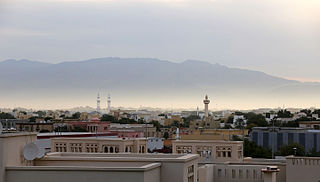
Wadi Qada'ah is a valley or dry river, with intermittent flow, which flows almost exclusively during the rainy season, located about 10 kilometers east of Ras Al Khaimah, United Arab Emirates. The wadi flows into the Wadi Bih.
Jabal Al-Mebraḥ, also known by the name Jabal Yibir, is a 1,527 m (5,010 ft) tall mountain in the Emirate of Fujairah, the U.A.E.
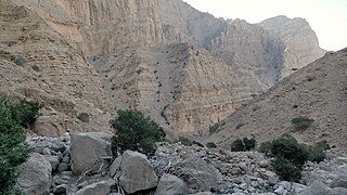
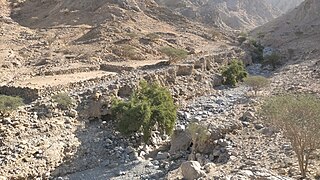
Maydaq is the name of a wadi and also a settlement in Fujairah, United Arab Emirates (UAE), traditionally associated with the Sharqiyin tribe. Wadi Maydaq is a popular venue for hiking and offroading.
Baqal is a small agricultural and livestock town, located in the northeast of the United Arab Emirates (UAE), in the Al Hajar Mountains, Emirate of Ras al Khaimah.

Wadi Fara is a seasonal watercourse, or wadi, in Ras Al Khaimah, United Arab Emirates. It runs from the confluence of the Wadi Asimah and Wadi Sidr, to the village of Ghayl.

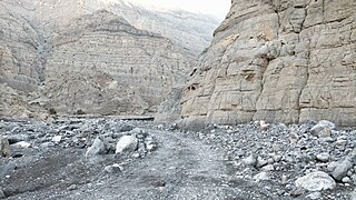
Wadi Maydaq is a seasonal watercourse in the Hajar Mountains of Fujairah, United Arab Emirates. The wadi runs from the village of Marbad, through the village of Maydaq, and down to the Ajman exclave of Manama.

Wadi Sidr is a seasonal watercourse, or wadi, in the Hajar Mountains of Fujairah, United Arab Emirates. It runs in a south-westerly direction from the village of Wadi Sidr, where it is dammed by the Wadi Sidr Dam, constructed in 2001, to the confluence of the Wadi Asimah with the Wadi Fara.

Jabal ar Raḩraḩ is a peak in the Hajar Mountains, northeast of the United Arab Emirates, in the Emirate of Ras Al Khaimah. It has a height of 1,691 metres, and is situated entirely within the United Arab Emirates, at the coordinates 25.94419°N, 56.15219°E.
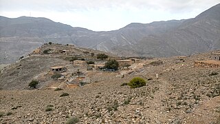
Musaibat is a small agricultural and livestock village, located in the northeast of the United Arab Emirates (UAE), in the Al Hajar Mountains, Emirate of Ras al Khaimah.
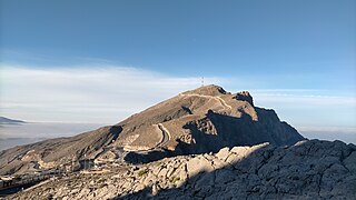
Jabal Raḩabah is a peak in the Hajar Mountains, northeast of the United Arab Emirates, in the Emirate of Ras Al Khaimah. At 1,543 m (5,062 ft), it is one of the highest peaks in the UAE, located entirely within the territory of the Emirates
The Wadi Litibah is a valley or dry river, with intermittent flow, flowing almost exclusively during the rainy season, located northeast of the United Arab Emirates, in the Emirate of Ras al Khaimah.
The Wadi Halhal is a valley or dry river, with intermittent flow, which flows almost exclusively during the rainy season, located in the northeast of the United Arab Emirates, in the Emirate of Ras al Khaimah.
The Wadi Khabb is a valley or dry river, with intermittent flow, which flows almost exclusively during the rainy season, located in the northeast of the United Arab Emirates, in the Emirate of Ras al Khaimah.
The Wadi Arus is a valley or dry river, with intermittent flow, which flows almost exclusively during the rainy season, belonging to the river basin of Wadi Bih, north-east of the United Arab Emirates (UAE), in the Emirate of Ras al Khaimah.

The Wadi Ghalilah is a valley or dry river, with intermittent flow, which flows almost exclusively during the rainy season, located in the northeast of the United Arab Emirates, in the Emirate of Ras al Khaimah.

The Wadi Naqat is a valley or dry river, with intermittent flow, flowing almost exclusively during the rainy season, belonging to the river basin of the Wadi Bih,, northeast of the United Arab Emirates, in the Emirate of Ras al Khaimah.
The Wadi Nahela, also known as Wādī Ghēl, Wadi Ghil, Wadi Nahail, Wadi Nahala, Wadi Nehaila or Wadi Nuhaila, is a dry valley or river with intermittent flow, which flows almost exclusively during the rainy season, located at the northeast of the United Arab Emirates, in the Emirate of Ras al Khaimah.
Wadi Rahabah, is a dry valley or river with intermittent flow, which flows almost exclusively during the rainy season, located in the northeast of the United Arab Emirates, in the Emirate of Ras Al Khaimah.
The Wadi Kub , is a dry valley or river with intermittent flow, which flows almost exclusively during the rainy season, located northeast of the United Arab Emirates, in the emirates of Fujairah and Ras al Khaimah.
References
- 1 2 3 4 5 6 Map of Trucial States, Muscat and Oman - Rams - Scale 1:100 000 - Published by D Survey, Ministry of Defence, United Kingdom (1971) - Edition 3-GSGS - The National Archives, London, England <https://www.agda.ae/en/catalogue/tna/fco/18/1785>
- ↑ Mindat.org - Wādī Afiya, Ra’s al Khaymah, United Arab Emirates
- 1 2 FCO 8/586 - 1967-1968 Boundary between East Aden Protectorate and Muscat and Oman - The National Archives, London, England <https://www.agda.ae/en/catalogue/tna/fco/8/586/n/50>
- ↑ Application of a hydrological model in a data poor arid region catchment: a case study of Wadi Ham - Mohamed Mustafa Al Mulla PhD Thesis Academic Year 2005-2006 - Supervisor: Dr Ian P. Holman - December 1, 2005 - Cranfield University at Silsoe - Institute of Water and Environment <https://dspace.lib.cranfield.ac.uk/bitstream/handle/1826/3061/Mohamed%20Al%20Mulla%20Thesis%202005.pdf?sequence=1&isAllowed=y>
- 1 2 3 Lancaster, William; Lancaster, Fidelity (2011). "A discussion of rock carvings in Ra's al Khaimah Emirate, UAE, and Musandam province, Sultanate of Oman, using local considerations". Arabian Archaeology and Epigraphy. 22 (2): 166–195. doi:10.1111/j.1600-0471.2011.00338.x. ISSN 1600-0471.
- ↑ Tribulus - Volume 19 - 2011 - Journal of the Emirates Natural History Group - The Flora of the Ru'us al-Jibal -the Mountains of the Musandam Peninsula: An Annotated Checklist and Selected Observations - Gary R. Feulner - Abu Dhabi, United Arab Emirates, 2011<https://enhg.org/Portals/1/trib/V19/TribulusV19.pdf>
- ↑ Geoview.info - Wādī al Bīḩ
- ↑ Mindat.org - Wādī Faqarah, Ra’s al Khaymah, United Arab Emirates
- 1 2 3 4 5 6 7 8 9 10 11 Jāmiʻat al-Imārāt al-ʻArabīyah al-Muttaḥidah. Geoprojects (U.K.) Ltd., The National atlas of the United Arab Emirates, Al Ain : United Arab Emirates University - 1993
- ↑ Geoview.info - Wādī Ghalīlah
- ↑ Mindat.org - Wādī Ghāfīyah, Ra’s al Khaymah, United Arab Emirates
- ↑ Mindat.org - Wadi Haqil
- ↑ Mindat.org - Wādī Kirībā
- ↑ Mindat.org - Wādī Naqab
- ↑ Geoview.info - Wādī Naqab
- ↑ Geoview.info - Wādī Raḩbah
- ↑ Mindat.org - Wādī Raybīyah, Ra’s al Khaymah, United Arab Emirates
- ↑ Mindat.org - Wādī ash Sha‘m
- ↑ Geoview.info - Wādī ash Sha‘m
- ↑ Mindat.org - Wādī Hām
- ↑ Mindat.org - Wādī Ḩattā
- ↑ GeoNames.org - Wādī Ḩattā
- ↑ Geoview.info - Wādī al Qūr
- ↑ Mindat.org - Wādī al Qūr
- ↑ Geographic.org - Wādī al Qūr
- ↑ Geoview.info - Wadi Saham
- ↑ Mindat.org - Wadi Saham
- ↑ Geoview.info - Wadi Sījī
- ↑ Geographic.org - Wadi Sījī
- ↑ Mindat.org - Wadi Sījī
- ↑ Mindat.org - Wādī Wurayyah
- ↑ UNESCO - Wadi Wurayah
- ↑ Geoview.org - Wadi Wurayah
- ↑ Mindat.org - Wādī Zikt
- ↑ Geoview.info - Wādī ‘Arūs
- ↑ Geoview.info - Wādī ‘Asimah
- ↑ Mindat.org - Wādī ‘Asimah
- ↑ Geoview.info - Wādī Barut
- ↑ Geoview.info - Wādī al Fara‘
- ↑ Geoview.info - Wādī Ḩalḩal
- ↑ GeoNames - Wādī Halū
- ↑ Getamap.net - Wādī Halū
- ↑ Geoview.info - Wādī Halū
- 1 2 Map FCO 18/1791 - 1972 - Oman and the United Arab Emirates (UAE): Dibba - Scale 1:100 000 - Published by D Survey, Ministry of Defence, United Kingdom (1971) - Edition 3-GSGS - The National Archives, London, England <https://www.agda.ae/en/catalogue/tna/fco/18/1787>
- ↑ Mindat.org - Wādī al Hiyar, Al Fujayrah, United Arab Emirates
- ↑ Geoview.info - Wādī Jib
- ↑ Lancaster, William, 1938- (2011). Honour is in contentment : life before oil in Ras al-Khaimah (UAE) and some neighbouring regions. Lancaster, Fidelity. Berlin: De Gruyter. p. 158. ISBN 978-3-11-022340-8. OCLC 763160662.
{{cite book}}: CS1 maint: multiple names: authors list (link) CS1 maint: numeric names: authors list (link) - ↑ Geoview.info - Wādī Khabb
- ↑ Mindat.org - Wādī Khabb
- ↑ Geoview.info - Wādī Kūb
- ↑ - Wādī Limarit
- ↑ Geoview.info - Wādī Litibah
- ↑ Mindat.org - Wādī Madnan
- ↑ Geoview.info - Wādī Madnan
- ↑ Mindat.org - Wādī Maydaq
- ↑ Geoview.info - Wādī Maydaq
- ↑ Map FCO 18/1791 - 1972 - Oman and the United Arab Emirates (UAE): Dibba - Scale 1:100 000 - Published by D Survey, Ministry of Defence, United Kingdom (1971) - Edition 3-GSGS - The National Archives, London, England
- ↑ Geoview.info - Wādī Muhaylī
- ↑ Map FCO 18/1932 - 1958 - Sketch map drawn by Julian Walker for boundary delimitation: Ras Al Khaimah - The National Archives, London, England
- ↑ Map FCO 18/1785 - 1971 - Trucial States, Muscat and Oman: Al Rams - Scale 1:100 000 - Published by D Survey, Ministry of Defence, United Kingdom (1971) - Edition 3-GSGS - The National Archives, London, England
- ↑ Mindat.org - Wadi Naqat
- ↑ Mindat.org - Wādī Qada‘ah
- ↑ Geoview.info - Wādī Shāh
- ↑ Geoview.info - Wādī Shīşah
- ↑ - Wādī Shuway
- ↑ Mindat.org - Wādī Sidr
- ↑ Getamap.net - Wādī Sidr
- ↑ Geoview.info - Wādī Sidr
- ↑ Mindat.org - Wādī Shī
- ↑ Geoview.info - Wādī Shī
- ↑ Geoview.info - Wādī Tarabat
- ↑ Getamap.net - Wādī Tarabat
- ↑ - Wādī Wayqah