
Trelech is a village in the parish of Tre-lech a'r Betws, Carmarthenshire, in south-west Wales. It is also the name of the community. Trelech is located some 10 miles north-west of Carmarthen and 6.5 miles south of Newcastle Emlyn.

Llanelli Rural is a community in the southeast of Carmarthenshire, Wales.
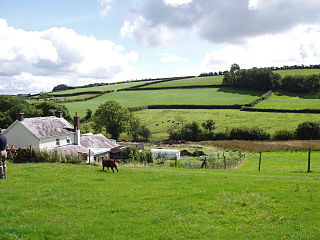
Cwmamman is a community in Carmarthenshire, about 12 miles north of Swansea in southwest Wales. Literally meaning "Amman valley", it takes its name from the River Amman which runs through the area.
Llwchwr is a community and electoral ward in the central western part of the City and County of Swansea, Wales, UK. It lies 9 km west-north-west of Swansea city centre and is bounded by the communities of Gorseinon to the north, Penllergaer to the east, and Gowerton to the south, as well as by the estuary of the River Loughor to the west, on the far side of which lies Bynea in Carmarthenshire, connected to Llwchwr by road and rail bridges.

Llangyndeyrn is a village, community and electoral ward in the River Gwendraeth valley, Carmarthenshire, in Dyfed region of West Wales, United Kingdom. The village name is often spelt as Llangendeirne.

Llanboidy is a village and community in Carmarthenshire, West Wales. The community includes the village of Llanglydwen.

St Ishmael is a hamlet and community in Carmarthenshire, Wales. The community population taken at the 2011 census was 1,370. It comprises the villages of Ferryside and Llansaint and the surrounding rural areas. The community is bordered by the communities of: Llandyfaelog; Kidwelly; Pembrey and Burry Port Town; and Llansteffan, all being in Carmarthenshire. It is named for the 6th-century Breton prince and Welsh saint Isfael.
Llanarthney is a village and community in Carmarthenshire, south-west Wales. Situated on the B4300 road 12 km east of Carmarthen and 10 km west of Llandeilo, the community had a population at the 2001 census of 738, of whom 61 per cent were Welsh-speaking. At the 2011 Census the population had increased slightly to 765.
Dyffryn Cennen is a community located in Carmarthenshire, Wales. The population of the community taken at the 2011 census was 1,176.

Cynwyl Elfed is a village and community in the county of Carmarthenshire, Wales. The community includes the villages of Cynwyl Elfed, Blaenycoed and Cwmduad. It is situated about 5 miles (8.0 km) north of Carmarthen and had a population of 953 in 2001, increasing to 1,044 at the 2011 Census.
Gorslas is a village and community in Carmarthenshire, Wales, located on the A476 road northwest of Cross Hands. The village population at the 2011 census was 4,066. Neighbouring villages are Cefneithin and Penygroes. The community is bordered by the Carmarthenshire communities of Llanarthney, Llanfihangel Aberbythych, Llandybie, Llannon, Pontyberem, and Llanddarog. The community includes the settlements of Drefach, Cwmmawr, Foelgastell, and Cefneithin. Gorslas will have a new primary school, opening on 7 September 2022, a year later than planned following the coronavirus pandemic. The school will be a community based centre with local groups able to make use of its facilities.
Llanddeusant is a community in the Black Mountain Range of the Brecon Beacons National Park in Carmarthenshire, Wales. It is about 5 miles southeast of Llangadog.
Llandyfaelog is a community located in Carmarthenshire, Wales.

Llanegwad is a village and community located in Carmarthenshire, Wales. The population taken at the 2011 census was 1,473.
Llanfihangel Aberbythych is a community in Carmarthenshire, Wales. The population recorded at the 2011 census was 1,344. It is bordered by Llangathen, Llandeilo, Dyffryn Cennen, Llandybie, Gorslas and Llanarthney, all of which are in Carmarthenshire. There is no village of Llanfihangel Aberbythych – the name is taken from St Michael's Church, which dates from 1849, at Golden Grove, about 3 miles (5 km) south-west of Llandeilo. It now belongs to the Church in Wales parish of Catheiniog. Villages include Carmel and Maesybont.
Llanllawddog is a community located in Carmarthenshire, south-west Wales. The population of the community taken at the 2011 census was 703.
Manordeilo and Salem is a community located in Carmarthenshire, Wales. The population taken at the 2011 census was 1,754.
Newchurch and Merthyr is a community located in Carmarthenshire, Wales including the villages of Newchurch and Merthyr. The community population at the 2011 census was 676.
Quarter Bach is a community located in the east of Carmarthenshire, Wales.
Saron is a mining village near the town of Ammanford in Carmarthenshire, Wales. Saron is in the community of Llandybie.