
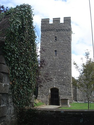
Milton Abbas is a village and civil parish in Dorset, England, lying around 5 miles southwest of Blandford Forum. In the 2011 Census the civil parish had a population of 755.

Blunsdon is a civil parish in the Borough of Swindon, in Wiltshire, England, about 4 miles (6 km) north of the centre of Swindon, with the A419 forming its southern boundary. Its main settlement is the village of Broad Blunsdon, with Lower Blunsdon nearby; the hamlet of Broadbush is now contiguous with Broad Blunsdon.

St Dogmaels is a village, parish and community in Pembrokeshire, Wales, on the estuary of the River Teifi, a mile downstream from the town of Cardigan in neighbouring Ceredigion. A little to the north of the village, further along the estuary, lies Poppit Sands beach. The parish includes the small settlement of Cippyn, south of Cemaes Head.

Ticknall is a small village and civil parish in South Derbyshire, England. The population of the civil parish at the 2011 Census was 642. Situated on the A514 road, close to Melbourne, it has three pubs, several small businesses, and a primary school. Two hundred years ago it was considerably larger and noisier with lime quarries, tramways and potteries. Coal was also dug close to the village. Close to the village is Calke Abbey, now a National Trust property.

Thurston is a village and a parish in Suffolk situated about 4 miles (6 km) east of Bury St Edmunds and 10 miles (16 km) west of Stowmarket.

Baddiley is a scattered settlement and civil parish in the unitary authority of Cheshire East and the ceremonial county of Cheshire, England. The civil parish also includes the north-western part of the village of Ravensmoor, as well as the small settlements of Baddiley Hulse, Batterley Hill, and parts of Gradeley Green and Swanley. According to the 2001 Census the parish had a total population of 226, increasing at the 2011 Census to 249.

Burton is a small village, parish and community in Pembrokeshire, Wales, set on a hill overlooking the River Cleddau with views of the estuary to the south, east and west. The community includes the village of Hill Mountain.

Thorpe is a village in northwest Surrey, England, around 20 miles (32 km) west of central London. It is in the Borough of Runnymede, between Egham, Virginia Water and Chertsey. It is adjacent to the M25, near the M3 — its ward covers 856 hectares (3.3 sq mi). Its traditional area with natural boundaries covers one square mile less. Thorpe is a former civil parish.

Eglwysbach is a village and community in Conwy county borough, Wales. The village plays host to an annual Agricultural show and horticultural show in August, which includes displays of local cattle, sheep, heavy and light horses, showjumping a horticulture marquee, fairground rides and trades stands. At the 2001 census, it had a population of 928, increasing slightly to 935 at the 2011 census.

St Florence is a village, parish and community in Pembrokeshire, Wales. St Florence sits on the River Ritec that flows 4 miles (6 km) eastwards to its estuary in Tenby. The Church of St Florence is a grade II* listed building.
Cilycwm is a village, parish and community located in Carmarthenshire, Wales. The community population taken at the 2011 census was 487.

Monk Fryston is a small village and civil parish in the former Selby district of North Yorkshire, England.

Ixworth is a village and civil parish in the West Suffolk district of Suffolk, England, 6 miles (9.7 km) north-east of Bury St Edmunds on the A143 road to Diss and 9 miles (14 km) south-east of Thetford. The parish had a population of 2,365 at the 2011 Census.

Ixworth Thorpe is a small village and civil parish in the West Suffolk district of the English county of Suffolk. The village is located on the A1088 road around 2 miles (3.2 km) north-west of the larger village of Ixworth and 7 miles (11.3 km) north-east of Bury St Edmunds. In 2005 its estimated population was 60. The parish council is operated jointly with Ixworth. From the 2011 Census the population of the village was not recorded separately.

Nowton is a small village and civil parish in the West Suffolk district of Suffolk in eastern England. Located on the southern edge of Bury St Edmunds, in 2005 its population was estimated to be 140. At the 2011 census 163 people were recorded as living in the village.

Dolbenmaen is a village and community in the Welsh county of Gwynedd, located in Eifionydd, of which it was the administrative centre until 1239. The community includes the villages of Bryncir, Cenin, Garndolbenmaen, Golan, Llanfihangel-y-Pennant, Penmorfa, Pentrefelin, Wern, Glan-dwyfach, and the hamlet of Prenteg. It has a population of 1,300, increasing slightly to 1,343 at the 2011 Census. The summit of Moel Hebog is shared between Beddgelert and Dolbenmaen. It is a sparsely populated area and covers nearly 100 square kilometres.

Shottisham is a village and civil parish in the East Suffolk district, in the county of Suffolk. It lies in the Wilford Hundred, about four and a half miles south-east of Woodbridge, between the parishes of Sutton, Alderton, Ramsholt and Hollesley, in the Bawdsey peninsula. About three miles from the coast at Hollesley Bay and Shingle Street, the village street overlooks a slight hollow of meads and copses at the road crossing of Shottisham Creek, a tributary brook of the river Deben.
Llansantffraid, or Llansantffraed, is a small rural village and community and practically merged with the village of Llanon just west of the main A487 coastal road between Aberaeron and Aberystwyth, about 11 mi (18 km) from Aberystwyth. The population in 2001 was 1,241, declining to 1,212 at the 2011 census.

Llanegryn is a village and a community in Gwynedd, north-west Wales. It was formerly part of the historic county of Merionethshire. It is located within Snowdonia National Park south of the Snowdonia (Eryri) mountain range. Travelling by road, it is around 4 miles (6 km) north-east of Tywyn and 17 miles (27 km) south-west of Dolgellau. The nearest railway stations are at Tonfanau and Llwyngwril, both less than 3 miles (5 km) away.

Llanddoged and Maenan is a community in Conwy County Borough, in Wales. It is located in the Conwy Valley, on the eastern bank of the River Conwy, 2.3 miles (3.7 km) north east of Llanrwst, 15.7 miles (25.3 km) south west of Abergele and 13.3 miles (21.4 km) south of Conwy. The community includes the village of Llanddoged and the rural settlements around Maenan. At the 2001 census it had a population of 574, increasing to 602 at the 2011 census.


