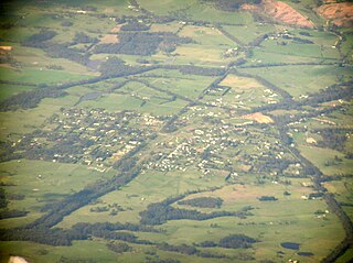
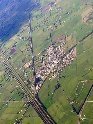
Clyde is a suburb of Melbourne, Victoria, Australia, 48 km south-east of Melbourne's Central Business District, located within the City of Casey local government area. Clyde recorded a population of 11,177 at the 2021 census.

Tooradin is a town in Victoria, Australia, 57 km south east of Melbourne's Central Business District, located within the City of Casey and the Shire of Cardinia local government areas. Tooradin recorded a population of 1,722 at the 2021 census.
South Gippsland Highway is a partially divided highway connecting the south-eastern suburbs of Melbourne through the South Gippsland region of in Victoria, Australia to the town of Sale. The highway serves as a gateway from Melbourne to many attractions including Wilsons Promontory and Phillip Island as well as being an important road for farmers in Gippsland.

The Cranbourne line is a commuter railway line in the city of Melbourne, Victoria, Australia. Operated by Metro Trains Melbourne, it is the city's second longest metropolitan railway line at 44 kilometres (27 mi). The line runs from Flinders Street station in central Melbourne to Cranbourne station in the south-east, serving 24 stations via the City Loop, South Yarra, Caulfield, Oakleigh, and Dandenong. The line operates for approximately 20 hours a day with 24 hour service available on Friday and Saturday nights. During peak hour, headways of up to 5 to 15 minutes are operated with services every 15–20 minutes during off-peak hours. Trains on the Cranbourne line run with a seven-car formation operated by High Capacity Metro Trains.

Korumburra is a town in the Australian state of Victoria. It is located on the South Gippsland Highway, 120 kilometres (75 mi) south-east of Melbourne, in the South Gippsland Shire local government area. At the 2016 census Korumburra had an urban population of 3,639.

Leongatha is a town in the foothills of the Strzelecki Ranges, South Gippsland Shire, Victoria, Australia, located 135 kilometres (84 mi) south-east of Melbourne. At the 2021 census, Leongatha had a population of 5,869.

Traralgon railway station is a regional railway station on the Gippsland line, part of the Victorian railway network. It serves the city of Traralgon, in Victoria, Australia. Traralgon station is a ground level premium station, featuring one side platform. It opened on 1 June 1877, with the current station provided in 1995.

Lang Lang is a town in Victoria, Australia, 73 km south-east of Melbourne's Central Business District, located within the Shires of Bass Coast, Cardinia and South Gippsland local government areas. Lang Lang recorded a population of 2,556 at the 2021 census.

The Great Southern Rail Trail is a 131-kilometre rail trail from Nyora to Yarram in South Gippsland, Victoria, Australia. Sections of the trail are flat or gently undulating trail through lush dairy farmland, areas of remnant bush and lowland scrub. There is a big climb on the section between Loch and Leongatha. The section between Fish Creek and Foster climbs past Mount Hoddle and goes through dense forest with occasional magnificent views of Wilsons Promontory and Corner Inlet.
The South Gippsland railway line is a partially closed railway line in Victoria, Australia. It was first opened in 1892, branching from the Orbost line at Dandenong, and extending to Port Albert. Much of it remained open until December 1994. Today, only the section between Dandenong and Cranbourne remains open for use. The section of the line from Nyora to Leongatha was used by the South Gippsland Tourist Railway until it ceased operations in 2016. The section from Nyora to Welshpool, with extension trail to Port Welshpool and a portion of the former line at Koo Wee Rup, have been converted into the Great Southern Rail Trail.
The South Gippsland Railway was a tourist railway located in South Gippsland, Victoria, Australia. It controlled a section of the former South Gippsland railway line between Nyora and Leongatha, and operated services from Leongatha to Nyora, via Korumburra, the journey taking about 65 minutes.
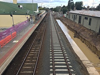
Clyde was a railway station on the South Gippsland railway line in South Gippsland, Victoria, Australia, the station operated until the closure of the line between Cranbourne Station and Leongatha Station in 1993. All that remains of this station now is the platform mound, however the track is still in reasonable condition.
Lang Lang was a railway station on the South Gippsland railway line in South Gippsland, Victoria, Australia. The station operated until the closure of the line between Cranbourne Station and Leongatha Station in 1993. This station remains partially intact with its platform and signals still in reasonable condition, the track along this section is still in reasonable condition.
Nyora is a railway station on the former South Gippsland line in South Gippsland, Victoria, Australia.

Loch is a railway station on the former South Gippsland line in South Gippsland, Victoria, Australia, located in the town of Loch. The station was then part of the South Gippsland Tourist railway, after passenger operations on the line ceased after Cranbourne station in 1993, until 2016, when the railway shut down. It is located on the Great Southern Rail Trail.

Korumburra is a heritage listed railway station on the former South Gippsland line in South Gippsland, Victoria, Australia. Passenger operations on the line ceased beyond Cranbourne station in July 1993. The station was part of the South Gippsland tourist railway between 1994 and 2015 but is no longer in use.

Leongatha is a railway station in the town of Leongatha, Victoria on the former South Gippsland railway line in South Gippsland, Victoria, Australia.

Yarram was a railway station on the Woodside railway line in the Australian state of Victoria. The railway opened to the town of Yarram on 8 February 1921. In the mid-1950s, it was the only station on the Woodside line to remain open, effectively making it the terminus of the South Gippsland line or Great Southern Railway. The station was closed in October 1987, along with Alberton and Welshpool stations.

Nyora is a town in South Gippsland, Victoria, Australia, approximately 84 kilometres (52 mi) south-east of Melbourne's Central Business District, located within the Shires of Baw Baw, Cardinia and South Gippsland local government areas. Nyora recorded a population of 1,644 at the 2021 census.

Koo Wee Rup is a town and satellite suburb in Victoria, Australia, 63 km south-east of Melbourne's Central Business District, located within the Shire of Cardinia local government area. Built on former marshland now converted to market gardens, Koo Wee Rup recorded a population of 4,047 at the 2021 census.


