Locust, North Carolina

Last updated

Locust, North Carolina
Locust, NC City Flag.gif
Locust, NC City Seal.jpeg
Motto: 
"The City with a Soul"
NCMap-doton-Locust.PNG
Location of Locust, North Carolina
Coordinates: 35°16′07″N80°26′12″W / 35.26861°N 80.43667°W / 35.26861; -80.43667
Country United States
State North Carolina
Counties Stanly, Cabarrus
Area
[1]
  Total8.19 sq mi (21.21 km2)
  Land8.19 sq mi (21.21 km2)
  Water0.00 sq mi (0.00 km2)
Elevation
[2]
627 ft (191 m)
Population
 (2020)
  Total4,537
  Density553.97/sq mi (213.89/km2)
Time zone UTC-5 (Eastern (EST))
  Summer (DST) UTC-4 (EDT)
ZIP code
28097
Area code 704
FIPS code 37-38860 [3]
GNIS feature ID2404946 [2]
Website www.locustnc.com

Locust is a small rural city in Stanly and Cabarrus counties in the U.S. state of North Carolina. The population was 2,930 at the 2010 census. [4]

Contents

Geography

Locust is located in southwestern Stanly County. Through annexations, the city limits now extend west into Cabarrus County. Locust is bordered by the town of Stanfield to the south.

The center of Locust is at the intersection of combined North Carolina Highway 24/27 with North Carolina Highway 200. NC 24/27 leads east 15 miles (24 km) to Albemarle and west to the Charlotte area. Via NC 27 it is 25 miles (40 km) to the Charlotte center city. NC 200 leads northwest to US 601 and provides a route to Concord, 15 miles (24 km) away, and leads southwest 22 miles (35 km) to Monroe.

According to the United States Census Bureau, the city of Locust has a total area of 8.1 square miles (21.1 km2), with no significant water bodies. [4]

Demographics

Historical population
CensusPop.Note
1880 35
1920 95
1930 1038.4%
1940 15146.6%
1950 21643.0%
1960 211−2.3%
1980 1,590
1990 1,94022.0%
2000 2,41624.5%
2010 2,93021.3%
2020 4,53754.8%
2023 (est.)5,854 [5] 29.0%
U.S. Decennial Census [6]

2020 census

Locust racial composition [7]
RaceNumberPercentage
White (non-Hispanic)3,70381.62%
Black or African American (non-Hispanic)2495.49%
Native American 80.18%
Asian 440.97%
Pacific Islander 40.09%
Other/Mixed 2164.76%
Hispanic or Latino 3136.9%

As of the 2020 United States census, there were 4,537 people, 1,397 households, and 956 families residing in the city.

2000 census

As of the census [3] of 2000, there were 2,416 people, 922 households, and 712 families residing in the city. The population density was 470.5 inhabitants per square mile (181.7/km2). There were 981 housing units at an average density of 191.0 per square mile (73.7/km2). The racial makeup of the city was 94.91% White, 1.53% African American, 0.46% Native American, 0.17% Asian, 2.03% from other races, and 0.91% from two or more races. Hispanic or Latino of any race were 3.39% of the population.

There were 922 households, out of which 35.2% had children under the age of 18 living with them, 65.9% were married couples living together, 7.9% had a female householder with no husband present, and 22.7% were non-families. 20.4% of all households were made up of individuals, and 8.2% had someone living alone who was 65 years of age or older. The average household size was 2.62 and the average family size was 3.02.

In the city, the population was spread out, with 26.2% under the age of 18, 6.7% from 18 to 24, 32.8% from 25 to 44, 22.8% from 45 to 64, and 11.5% who were 65 years of age or older. The median age was 36 years. For every 100 females, there were 100.3 males. For every 100 females age 18 and over, there were 97.3 males.

The median income for a household in the city was $44,556, and the median income for a family was $50,987. Males had a median income of $35,614 versus $21,375 for females. The per capita income for the city was $19,250. About 3.2% of families and 4.1% of the population were below the poverty line, including 6.9% of those under age 18 and 2.5% of those age 65 or over.

Notable person

Related Research Articles

<span class="mw-page-title-main">Kannapolis, North Carolina</span> City in North Carolina, United States

Kannapolis is a city in Cabarrus and Rowan counties, in the U.S. state of North Carolina, northwest of Concord and northeast of Charlotte and is a suburb in the Charlotte metropolitan area. The city of Kannapolis was incorporated in 1984. The population was 53,114 at the 2020 census, which makes Kannapolis the 19th-most populous city in North Carolina. It is the home of the Kannapolis Cannon Ballers, the Low-A baseball affiliate of the Chicago White Sox, and it is the hometown of the Earnhardt racing family. It is also the headquarters for the Haas F1 racing team. The center of the city is home to the North Carolina Research Campus, a public-private venture that focuses on food, nutrition, and biotech research.

<span class="mw-page-title-main">Stanly County, North Carolina</span> County in North Carolina, United States

Stanly County is a county in the U.S. state of North Carolina. As of the 2020 census, the population was 62,504. Its county seat is Albemarle.

<span class="mw-page-title-main">Cabarrus County, North Carolina</span> County in North Carolina, United States

Cabarrus County is a county located in the south-central part of the U.S. state of North Carolina. As of the 2020 census, the population was 225,804, making it the 9th-most populous county in North Carolina. The county seat is Concord, which was incorporated in 1803. Cabarrus County is included in the Charlotte-Concord-Gastonia, NC-SC Metropolitan Statistical Area.
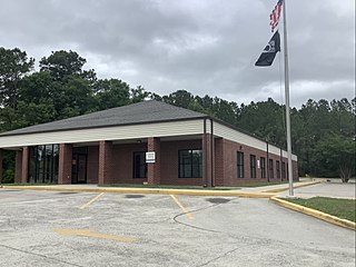
<span class="mw-page-title-main">Shallotte, North Carolina</span> Town in North Carolina, United States

Shallotte is a town in Brunswick County, North Carolina, United States. The population was 3,675 at the 2010 census. The Shallotte River passes through the town.
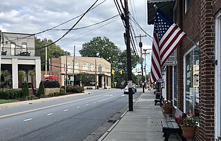
<span class="mw-page-title-main">Mount Pleasant, North Carolina</span> Town in North Carolina, United States

Mount Pleasant is a town located in eastern Cabarrus County, North Carolina, United States. As of the 2010 census, the town population was 1,652. The town center is located at the crossroads of Mount Pleasant Road and North Carolina Highway 73. NC Highway 49 skirts the town to the north on its way from Charlotte to Asheboro.
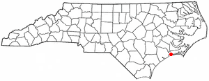
<span class="mw-page-title-main">Cape Carteret, North Carolina</span> Town in North Carolina, United States

Cape Carteret is a town in Carteret County, on the southern coast of North Carolina, United States. It was incorporated in 1959 and had a population of 2,224 as of the 2020 census.

<span class="mw-page-title-main">Polkville, North Carolina</span> Town in North Carolina, United States

Polkville is a small town in Cleveland County, North Carolina, United States. The population was 545 at the 2010 census.

<span class="mw-page-title-main">Kenansville, North Carolina</span> Town in North Carolina, United States

Kenansville is a town in Duplin County, North Carolina, United States. Its population was 770 at the 2020 census. It is the county seat of Duplin County. The town was named for James Kenan, a member of the North Carolina Senate. Liberty Hall, his early 1800s era historic home, is located within Kenansville.

<span class="mw-page-title-main">Warsaw, North Carolina</span> Town in North Carolina, United States

Warsaw is a town in Duplin County, North Carolina, United States. The population was 3,054 at the 2010 census.

<span class="mw-page-title-main">Clemmons, North Carolina</span> Village in North Carolina

Clemmons is a village in Forsyth County, North Carolina, United States and a suburb of Winston-Salem. The population was 21,177 at the 2020 census, with an estimated population of 21,517 in 2021.
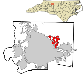
<span class="mw-page-title-main">Walkertown, North Carolina</span> Town in North Carolina, United States

Walkertown is a town in Forsyth County, North Carolina, United States and a rural area outside of Winston-Salem. It is part of the Piedmont Triad. The population was 5,695 at the 2020 census.
<span class="mw-page-title-main">Bunn, North Carolina</span> Town in North Carolina, United States

Bunn is a town in Franklin County, North Carolina, United States. The population was 327 at the 2020 census.
<span class="mw-page-title-main">Walstonburg, North Carolina</span> Town in North Carolina, United States

Walstonburg is a town in Greene County, North Carolina, United States. The population was 219 at the 2010 census. It is located north of Snow Hill on North Carolina Highway 91. The town is part of the Greenville Metropolitan Area.

<span class="mw-page-title-main">Oak Ridge, North Carolina</span> Town in North Carolina, United States

Oak Ridge is a town in northwestern Guilford County, North Carolina, United States. As of the census of 2020, the town had a population of 7,474. Oak Ridge is 15 miles (24 km) northwest of the center of Greensboro, North Carolina's third-most populous city. Oak Ridge is a part of the Piedmont Triad urban area.
<span class="mw-page-title-main">Weldon, North Carolina</span> Town in North Carolina, United States

Weldon is a town in Halifax County, North Carolina, United States. The population was 1,655 at the 2010 census. It is part of the Roanoke Rapids, North Carolina Micropolitan Statistical Area.

<span class="mw-page-title-main">Mint Hill, North Carolina</span> Town in North Carolina, United States

Mint Hill is a suburban town in southeastern Mecklenburg and northwestern Union counties in the U.S. state of North Carolina, it is a major suburb on the outskirts of Charlotte and near the Cabarrus County line. The population was 22,722 at the 2010 census.
<span class="mw-page-title-main">Walnut Cove, North Carolina</span> Town in North Carolina, United States

Walnut Cove is a town in Stokes County, North Carolina, United States. The population was 1,536 at the 2020 census.

<span class="mw-page-title-main">Virgilina, Virginia</span> Town in Virginia, United States

Virgilina is a town in Halifax County, Virginia, United States. The population was 154 at the 2010 census. Virgilina was once a copper mining town. It was a stop on the Atlantic and Danville Railway as recently as the 1950s. It is named "Virgilina" because it is located on the Virginia and North Carolina border.

<span class="mw-page-title-main">Archdale, North Carolina</span> City in North Carolina, United States

Archdale is a city in Guilford and Randolph counties in the U.S. state of North Carolina. Located 15 miles southwest of Greensboro, it is part of the Greensboro-High Point Metropolitan Statistical Area of the Piedmont Triad metro region. The population of the city was 11,907 at the 2020 census.

<span class="mw-page-title-main">Locust Grove, Georgia</span> City in the United States

Locust Grove is a city in Henry County, Georgia, United States. The population was 5,402 at the 2010 census, up from 2,322 in 2000. Some unincorporated communities such as Luella and many rural areas surround Locust Grove, and those communities have Locust Grove postal addresses.

References

  1. "ArcGIS REST Services Directory". United States Census Bureau. Retrieved September 20, 2022.
  2. 1 2 U.S. Geological Survey Geographic Names Information System: Locust, North Carolina
  3. 1 2 "U.S. Census website". United States Census Bureau . Retrieved January 31, 2008.
  4. 1 2 "Geographic Identifiers: 2010 Demographic Profile Data (G001): Locust city, North Carolina". U.S. Census Bureau, American Factfinder. Archived from the original on February 12, 2020. Retrieved December 18, 2014.
  5. "City and Town Population Totals: 2020-2023". United States Census Bureau. May 16, 2024. Retrieved May 16, 2024.
  6. "Census of Population and Housing". Census.gov. Retrieved June 4, 2015.
  7. "Explore Census Data". data.census.gov. Retrieved December 20, 2021.