Lowesville, North Carolina

Last updated

Lowesville, North Carolina
NCMap-doton-Lowesville.PNG
Location of Lowesville, North Carolina
Coordinates: 35°25′09″N81°0′0″W / 35.41917°N 81.00000°W / 35.41917; -81.00000
Country United States
State North Carolina
County Lincoln
Area
[1]
  Total6.80 sq mi (17.62 km2)
  Land6.79 sq mi (17.60 km2)
  Water0.01 sq mi (0.02 km2)
Elevation
[2]
761 ft (232 m)
Population
 (2020)
  Total3,281
  Density482.86/sq mi (186.43/km2)
Time zone UTC-5 (Eastern (EST))
  Summer (DST) UTC-4 (EDT)
FIPS code 37-39520 [3]
GNIS feature ID2403244 [2]

Lowesville is a census-designated place (CDP) in Lincoln County, North Carolina, United States. The population was 2,945 at the 2010 census, [4] up from 1,440 in 2000.

Contents

History

Mount Welcome was listed on the National Register of Historic Places in 1991. [5]

Geography

Lowesville is located in the southeast corner of Lincoln County. It is bordered to the south by Gaston County. North Carolina Highway 16, a four-lane freeway, passes through the east side of the community, leading northwest 24 miles (39 km) to Newton and southeast 17 miles (27 km) to Charlotte. It is paralleled by old Highway 16 (NC-16 Business), a two-lane road that runs through the center of Lowesville. Access to new Highway 16 is only from North Carolina Highway 73 at the northern end of the CDP or from NC-16 Business in Lucia, 2 miles (3 km) south of the center of Lowesville. NC 73 forms the northern edge of the CDP; it leads east 9 miles (14 km) to Interstate 77 in northern Huntersville and west 15 miles (24 km) to Lincolnton, the Lincoln county seat.

According to the United States Census Bureau, the Lowesville CDP has a total area of 6.8 square miles (17.6 km2), of which 0.01 square miles (0.02 km2), or 0.10%, are water. [6] Killian Creek forms the western edge of the CDP, and Johnson Creek drains the eastern side of the community. The entire community is in the Catawba River watershed.

Lowesville uses the Stanley, North Carolina, 28164 ZIP code.

Demographics

Historical population
CensusPop.Note
2020 3,281
U.S. Decennial Census [7]

As of the census [3] of 2000, there were 1,440 people, 552 households, and 422 families residing in the CDP. The population density was 211.4 inhabitants per square mile (81.6/km2). There were 589 housing units at an average density of 86.5 per square mile (33.4/km2). The racial makeup of the CDP was 92.29% White, 6.53% African American, 0.21% Native American, 0.83% Asian, and 0.14% from two or more races. Hispanic or Latino of any race were 1.60% of the population.

There were 552 households, out of which 34.8% had children under the age of 18 living with them, 64.5% were married couples living together, 8.9% had a female householder with no husband present, and 23.4% were non-families. 19.7% of all households were made up of individuals, and 8.2% had someone living alone who was 65 years of age or older. The average household size was 2.61 and the average family size was 2.99.

In the CDP, the population was spread out, with 24.3% under the age of 18, 7.5% from 18 to 24, 33.3% from 25 to 44, 25.3% from 45 to 64, and 9.6% who were 65 years of age or older. The median age was 36 years. For every 100 females, there were 99.7 males. For every 100 females age 18 and over, there were 99.3 males.

The median income for a household in the CDP was $51,333, and the median income for a family was $53,000. Males had a median income of $36,316 versus $24,280 for females. The per capita income for the CDP was $28,072. About 5.9% of families and 7.3% of the population were below the poverty line, including 8.8% of those under age 18 and 10.7% of those age 65 or over.

Related Research Articles

<span class="mw-page-title-main">Lincoln County, North Carolina</span> County in North Carolina, United States

Lincoln County is a county located in the U.S. state of North Carolina. As of the 2020 census, the population was 86,810. Its county seat is Lincolnton.

<span class="mw-page-title-main">Escatawpa, Mississippi</span> Census-designated place in Mississippi, United States

Escatawpa is an unincorporated community and census-designated place (CDP) in Jackson County, Mississippi, United States. It is part of the Pascagoula Metropolitan Statistical Area. The population was 3,254 at the 2020 census.

<span class="mw-page-title-main">Altamahaw, North Carolina</span> Census-designated place in North Carolina, United States

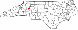
Altamahaw is a census-designated place (CDP) in Alamance County, North Carolina, United States. It is part of the Burlington, North Carolina Metropolitan Statistical Area. As of the 2010 census it had a population of 347. The community was listed as Altamahaw-Ossipee at the 2000 census, at which time the population was 996. The town of Ossipee incorporated in 2002 and currently has a population of 543. The remainder of the territory was reassigned as the Altamahaw CDP.

<span class="mw-page-title-main">Woodlawn, North Carolina</span> Census-designated place in North Carolina, United States

Woodlawn is a census-designated place in Alamance County, North Carolina, United States.

<span class="mw-page-title-main">Avery Creek, North Carolina</span> Census-designated place in North Carolina, United States

Avery Creek is a census-designated place (CDP) in Buncombe County, North Carolina, United States. The population was 1,950 at the 2010 census. It is part of the Asheville Metropolitan Statistical Area.

<span class="mw-page-title-main">Bent Creek, Buncombe County, North Carolina</span> Census-designated place in North Carolina, United States

Bent Creek is a census-designated place (CDP) in Buncombe County, North Carolina, United States. The population was 1,287 at the 2010 census. The Bent Creek area has mountain bike trails within the Pisgah National Forest.

Lake Norman of Catawba is a census-designated place (CDP) in Catawba County, North Carolina, United States. The population was 11,395 at the 2020 census up from 7,411 at the 2010 census. It is part of the Hickory-Lenoir-Morganton Metropolitan Statistical Area.

<span class="mw-page-title-main">Mountain View, North Carolina</span> Census-designated place in North Carolina, United States

Mountain View is a census-designated place (CDP) in Catawba County, North Carolina, United States. The population was 3,552 at the 2010 census. It is part of the Hickory–Lenoir–Morganton Metropolitan Statistical Area.

<span class="mw-page-title-main">Ashley Heights, North Carolina</span> Census-designated place in North Carolina, United States

Ashley Heights is an unincorporated community and census-designated place (CDP) in Hoke County, North Carolina, United States. The population was 380 at the 2010 census.

<span class="mw-page-title-main">Five Points, North Carolina</span> Census-designated place in North Carolina, United States

Five Points is a census-designated place (CDP) in Hoke County, North Carolina, United States. The population was 689 at the 2010 census.

<span class="mw-page-title-main">Westport, North Carolina</span> Census-designated place in North Carolina, United States

Westport is an unincorporated community and census-designated place (CDP) located in Lincoln County, North Carolina, United States. The population of the CDP was 4,026 at the 2010 census, up from 2,006 at the 2000 census. The community's name comes from its location on the west side of Lake Norman.

<span class="mw-page-title-main">Castle Hayne, North Carolina</span> CDP in North Carolina, United States

Castle Hayne is a census-designated place (CDP) in New Hanover County, North Carolina, United States. The population was 1,202 at the 2010 census, up from 1,116 in 2000. It is part of the Wilmington Metropolitan Statistical Area.

Elrod is a census-designated place (CDP) in Robeson County, North Carolina, United States. The population was 441 at the 2000 census.

Flat Rock is a census-designated place (CDP) in Surry County, North Carolina, United States. The name "Flat Rock" stems from the community's granite quarry. The granite quarry is the largest open-face granite quarry in the world, and has been mined continuously since 1889 by the North Carolina Granite Corporation.

Elroy is a town in Wayne County, North Carolina, United States. In 2007, the estimated population was 3,905. It is included in the Goldsboro, North Carolina Metropolitan Statistical Area.

Duncan is a census-designated place (CDP) in Greenville County, South Carolina, United States. The population was 3,671 at the 2010 census, down from 4,158 in 2000. It is part of the Greenville–Mauldin–Easley Metropolitan Statistical Area.

Springdale is an unincorporated community and census-designated place (CDP) in Lancaster County, South Carolina, United States. The population was 2,574 at the 2010 census, down from 2,864 at the 2000 census.

<span class="mw-page-title-main">Red Bank, South Carolina</span> Census-designated place in South Carolina, United States

Red Bank is an unincorporated community and census-designated place (CDP) in Lexington County, South Carolina, United States. The population was 9,617 at the 2010 census, up from 8,811 at the 2000 census. It is part of the Columbia, South Carolina Metropolitan Statistical Area.

<span class="mw-page-title-main">Stony Point, North Carolina</span> Census-designated place in North Carolina, United States

Stony Point is a census-designated place (CDP) in Alexander and Iredell counties in the U.S. state of North Carolina. The population was 1,317 at the 2010 census. It is part of the Hickory–Lenoir–Morganton Metropolitan Statistical Area.

Lincoln is a census-designated place (CDP) and the main village in the town of Lincoln in Grafton County, New Hampshire, United States. The population of the CDP was 969 at the 2020 census, out of 1,631 in the entire town.

References

  1. "ArcGIS REST Services Directory". United States Census Bureau. Retrieved September 20, 2022.
  2. 1 2 U.S. Geological Survey Geographic Names Information System: Lowesville, North Carolina
  3. 1 2 "U.S. Census website". United States Census Bureau . Retrieved January 31, 2008.
  4. "Total Population: 2010 Census DEC Summary File 1 (P1), Lowesville CDP, North Carolina". data.census.gov. U.S. Census Bureau. Retrieved June 30, 2020.
  5. "National Register Information System". National Register of Historic Places . National Park Service. July 9, 2010.
  6. "U.S. Gazetteer Files: 2019: Places: North Carolina". U.S. Census Bureau Geography Division. Retrieved June 30, 2020.
  7. "Census of Population and Housing". Census.gov. Retrieved June 4, 2016.