Loxbeare

Last updated

Loxbeare
Loxbeare, St Michael and All Angels Church - geograph.org.uk - 1257310.jpg
Loxbeare, St Michael and All Angels Church
Devon UK location map.svg
Red pog.svg
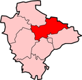
Loxbeare
Location within Devon
Population162 (2011 UK Census)
District
Shire county
Region
Country England
Sovereign state United Kingdom
Police Devon and Cornwall
Fire Devon and Somerset
Ambulance South Western
UK Parliament
List of places
UK
England
Devon
50°56′02″N3°33′00″W / 50.933941°N 3.55003°W / 50.933941; -3.55003

Loxbeare is a village and civil parish in Devon, England. The church is from the twelfth century and the tower is probably Norman. [1] It is dedicated to St Michael and All Angels [2] and is a grade II* listed building. [3]

In Domesday Book Loxbeare is recorded as Lochesbera. [4]

Related Research Articles

<span class="mw-page-title-main">Stewkley</span> Human settlement in England

Stewkley is a village and civil parish in Buckinghamshire, England. The village is about 5 miles (8 km) east of Winslow and about 4 miles (6 km) west of Leighton Buzzard. The civil parish includes the hamlets of North End and Stewkley Dean.

<span class="mw-page-title-main">Little Torrington</span> Village in Devon, England

Little Torrington is a village and a civil parish near Great Torrington, in the Torridge district, north Devon, England. In 2001 the population of the civil parish of Little Torrington was 420 and in 2011 it was 376, according to census data. Little Torrington has the Church of St Giles and the Chapel of St Mary Magdalene.

<span class="mw-page-title-main">Badminton, Gloucestershire</span> Human settlement in England

Badminton is a village and civil parish in South Gloucestershire, England. The only settlement in the parish is Badminton village, sometimes called Great Badminton to distinguish it from the hamlet of Little Badminton, about one mile to the north in Hawkesbury parish. The large country house called Badminton House is close to the north end of the village, and its surrounding deer park lies to the north and west.

<span class="mw-page-title-main">West Overton</span> Human settlement in England

West Overton is a village and civil parish in the English county of Wiltshire, about 3.5 miles (5.6 km) west of Marlborough. The river Kennet runs immediately north of the village, separating it from the A4 road. The parish includes the village of Lockeridge, also near the river, further east (downstream).

<span class="mw-page-title-main">Belstone</span> Village in Devon, England

Belstone is a small village and civil parish in the West Devon District of Devon, England.

<span class="mw-page-title-main">Awliscombe</span> Village in Devon, England

Awliscombe is a village and civil parish in the East Devon district of Devon, England. The village is about two miles west of Honiton. The 2011 census showed a population of 500 for the parish, which is surrounded clockwise from the north by the parishes of Dunkeswell, Combe Raleigh, Honiton, Gittisham, Buckerell, Payhembury and Broadhembury.

<span class="mw-page-title-main">Bassingham</span> Village and civil parish in the North Kesteven district of Lincolnshire, England

Bassingham is a village and civil parish in the North Kesteven district of Lincolnshire, England. The population of the civil parish at the 2011 census was 1,425. The village is situated approximately 8 miles (13 km) south-west of Lincoln.

<span class="mw-page-title-main">Bawdrip</span> Human settlement in England

Bawdrip is a village and civil parish in Somerset, England. The village is on the south side of the Polden Hills about 4 miles (6.4 km) north-east of Bridgwater. At the 2011 census the parish had a population of 506. The parish includes the hamlets of Bradney, Horsey and Knowle.

<span class="mw-page-title-main">Buckland Monachorum</span> Village & civil parish in South West England

Buckland Monachorum is a village and civil parish in the West Devon district of Devon, England, situated on the River Tavy, about 10 miles north of Plymouth.

<span class="mw-page-title-main">Edenham</span> Village and civil parish in the South Kesteven district of Lincolnshire, England

Edenham is a village and civil parish in the South Kesteven district of Lincolnshire, England. It is approximately 3 miles (5 km) north-west of Bourne, and on the A151 road. While the civil parish is called 'Edenham', the parish council is called Edenham, Grimsthorpe, Elsthorpe & Scottlethorpe Parish Council. The population of the civil parish at the 2011 census was 291.

<span class="mw-page-title-main">Hilperton</span> Human settlement in England

Hilperton is a village and civil parish in Wiltshire, England. The village is separated by a few fields from the northeastern edge of the town of Trowbridge and is approximately 1.3 miles (2.1 km) from Trowbridge town centre.

<span class="mw-page-title-main">Bricklehampton</span> Village in Worcestershire, England

Bricklehampton is a village and civil parish in Worcestershire, England. In the 2021 census the population of the parish was recorded as 236. Its area is 369.7 hectares (1.427 sq mi). The village shares a parish council with Elmley Castle and Netherton.

<span class="mw-page-title-main">Bradworthy</span> Village in Devon, England

Bradworthy is a village and civil parish in Devon, England, situated 3 miles (4.8 km) north-east of the border with Cornwall. This location has led to it being called the "last village in North Devon" – traveling further west leads to the Cornish village of Kilkhampton. The village is close to the site of the first wind turbines in Devon, erected in 2005. Bradworthy has the largest village square in England. The civil parish is bordered by the Devon parishes Hartland, Woolfardisworthy, West Putford, Sutcombe, Holsworthy Hamlets, and Pancrasweek and the Cornish civil parishes Kilkhampton and Morwenstow. As well as a number of shops, Bradworthy village has a pub, a primary school, and an industrial estate.

<span class="mw-page-title-main">Iddesleigh</span> Village in Devon, England

Iddesleigh is a village and civil parish in the county of Devon, England. The settlement has ancient origins and is listed in the Domesday Book. The village lies on the B3217 road, roughly central in its parish of around 2,900 acres (1,200 ha), about 8 miles (13 km) north of the town of Okehampton.

<span class="mw-page-title-main">Onibury</span> Human settlement in England

Onibury is a village and civil parish on the River Onny in southern Shropshire, about 4 miles (6.4 km) northwest of the market town of Ludlow.

<span class="mw-page-title-main">Frithelstock</span> Village in Devon, England

Frithelstock is a village, civil parish and former manor in Devon, England. It is located within Torridge local authority area and formed part of the historic Shebbear hundred. The parish is surrounded, clockwise from the north, by the parishes of Monkleigh, Great Torrington, Little Torrington, Langtree and Buckland Brewer. In 2001 its population was 366, down from 429 in 1901.

<span class="mw-page-title-main">Loddiswell</span> Village in Devon, England

Loddiswell is a parish and village in the South Hams district of Devon, England. It lies on the west side of the River Avon or Aune and is three miles NNW from Kingsbridge. There is evidence of occupation going back to Roman times. The villages most famous son and benefactor was Richard Peek who retired here after being one of the Sheriffs of London. The name Loddiswell is a corruption of Saint Loda's well, named after one of the many saints that occurred all over the westcountry, especially in Cornwall.

<span class="mw-page-title-main">Huntshaw</span> Village in Devon, England

Huntshaw is a village and civil parish located 2.5 north north east of Great Torrington, in the Torridge district, in the county of Devon, England.

<span class="mw-page-title-main">Chivelstone</span> Village in Devon, England

Chivelstone is a village and civil parish in Devon, England. The parish contains the villages of East Prawle and South Allington as well as the hamlets of Ford and Lannacombe. The population of the parish taken at the 2011 census was 280.

<span class="mw-page-title-main">South Huish</span> Village in Devon, England

South Huish is a village and civil parish about 4 miles south west of Kingsbridge, in the South Hams district, in the county of Devon, England. The parish includes Galmpton and Hope Cove. According to the 2011 census the parish had a population of 473, the parish had an estimated population of 436 in 2017. The parish touches West Alvington, South Milton and Malborough. The parish is in the South Devon Area of Outstanding Natural Beauty.

References

  1. "Loxbeare". Devon County Council. Retrieved 4 November 2016.
  2. "St Michael and All Angels, Loxbeare" . Retrieved 4 November 2016.
  3. "PARISH CHURCH (DEDICATION UNKNOWN)". Historic England. Retrieved 4 November 2016.
  4. "Devonshire I-L". The Domesday Book Online. Retrieved 4 November 2016.