Puerto Boyacá is a Colombian river-port town and municipality by the Magdalena River in the Boyacá Department, where is also considered a Special Trade Zone due to its port status. Its main industries are oil exploration and processing. In the 1980s and early 1990s, Puerto Boyacá was affected intensively by the Colombian Armed Conflict.

Santa Catarina Barahona is a municipality in the Guatemalan department of Sacatepéquez.

Santa Fe de Antioquia is a municipality in the Antioquia Department, Colombia. The city is located approximately 58 kilometres (36 mi) north of Medellín, the department capital. The population was 23,216 at the 2018 census.

Caracolí is a town and municipality in Antioquia Department, Colombia, It has an extension of 260 km². It has unique woodlands, with many species of animals and plants.

Frontino is a municipality in the Colombian department of Antioquia. The population was 20,156 at the 2018 census.

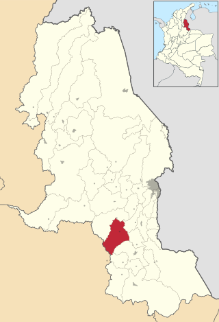
Jericó is a town, municipality and Catholic bishopric in the Colombian department of Antioquia. It is part of the subregion of Southwestern Antioquia. The distance reference from Medellín city, the capital of the department, is 104 km. It lies 1,910 m above sea level.

Marinilla is a town and municipality in the Colombian department of Antioquia. The population was estimated to be 67,893 in 2020. Marinilla is part of the subregion of Eastern Antioquia.

Necoclí is a town and municipality in Antioquia Department, Colombia. Located on the eastern shore of the Gulf of Urabá, it is part of the Urabá Antioquia sub-region. The population is predominantly Afro-Colombian.

Puerto Berrío is a municipality and town in the Colombian department of Antioquia. It is part of the Magdalena Medio Antioquia sub-region.

Puerto Triunfo is a town and municipality in Antioquia Department, Colombia. It is part of the Magdalena Medio Antioquia sub-region.

Puerto Nare is a town and municipality in the Colombian department of Antioquia. It is part of the Magdalena Medio Antioquia sub-region.

San Carlos is a town and municipality in the Colombian department of Antioquia, part of the subregion of Eastern Antioquia. It is called the hydro-electrical capital of Colombia, because it has many dams and it produces much energy. The population was 14,480 at the 2018 census.
German submarine U-551 was a Type VIIC U-boat of Nazi Germany's Kriegsmarine during World War II. The submarine was laid down on 21 November 1939 at the Blohm & Voss yard in Hamburg as yard number 527, launched on 14 September 1940, and commissioned on 7 November 1940 under the command of Kapitänleutnant Karl Schrott.

The Republic of New Granada was a 1831–1858 centralist unitary republic consisting primarily of present-day Colombia and Panama with smaller portions of today's Costa Rica, Ecuador, Venezuela, Peru and Brazil. On 9 May 1834, the national flag was adopted and was used until 26 November 1861, with the Gran Colombian colours in Veles' arrangement. The merchant ensign had the eight-pointed star in white.
Cucutilla is a Colombian municipality and town located in the department of North Santander.

Moradillo de Roa is a municipality and town located in the province of Burgos, Castile and León, Spain. According to the 2004 census (INE), the municipality has a population of 209 inhabitants.
German submarine U-665 was a Type VIIC U-boat built for Nazi Germany's Kriegsmarine for service during World War II. She was laid down on 10 June 1941 by Deutsche Werft, Hamburg as yard number 814, launched on 9 June 1942 and commissioned on 22 July 1942 under Leutnant zur See Hans-Jürgen Haupt.

German submarine U-1279 was a Type VIIC/41 U-boat of Nazi Germany's Kriegsmarine during World War II.
La Grange Township is a township in Harrison County, Iowa, USA.
This page is based on this
Wikipedia article Text is available under the
CC BY-SA 4.0 license; additional terms may apply.
Images, videos and audio are available under their respective licenses.