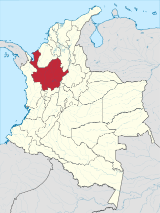
Antioquia is one of the 32 departments of Colombia, located in the central northwestern part of Colombia with a narrow section that borders the Caribbean Sea. Most of its territory is mountainous with some valleys, much of which is part of the Andes mountain range. Antioquia has been part of many territorial divisions of former countries created within the present-day territory of Colombia. Prior to adoption of the Colombian Constitution of 1886, Antioquia State had its own sovereign government.

Medellín, officially the Special District of Science, Technology and Innovation of Medellín, is the second-largest city in Colombia after Bogotá, and the capital of the department of Antioquia. It is located in the Aburrá Valley, a central region of the Andes Mountains, in northwestern South America. The city's population was 2,508,452 at the 2018 census. The metro area of Medellín is the second-largest urban agglomeration in Colombia in terms of population and economy, with more than 4 million people.

Sucre is a department in the Caribbean Region of Colombia. The department ranks 27th by area, 10,670 km2 (4,120 sq mi) and it has a population of 904,863, ranking 20th of all the 32 departments of Colombia. Sucre is bordered by the Caribbean on the northwest; by Bolívar Department on the east and by Córdoba Department on the west.

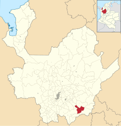
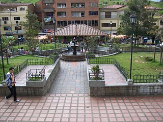
Alejandría is a town and municipality in the Antioquia Department, Colombia. It is part of the sub-region of Eastern Antioquia and is bordered to the north by the municipalities of Concepción, Santo Domingo and San Roque, on the east by the municipality of San Rafael, on the south by the municipalities of San Rafael and Guatapé, and on the west by the municipalities of El Penol and Concepción. Its capital is 90 kilometers from the city of Medellin, the capital of Antioquia department. The municipality has an area of 149 km2.

Bello is a city and municipality in Antioquia Department, Colombia and a suburb of Medellín, the department capital. Bello is part of the Metropolitan Area of the Aburrá Valley in the department of Antioquia. It is bordered on the north by the municipality of San Pedro de los Milagros, on the east by the municipality of Copacabana, on the south by the municipality of Medellín and on the west by the municipalities of Medellín and San Jerónimo.

Cocorná is a town and municipality in the Colombian department of Antioquia. The population was 14,743 at the 2018 census. It is part of the subregion of Eastern Antioquia.
Don Matías is a municipality in Antioquia Department, Colombia. Part of the subregion of Northern Antioquia. Bordered to the north by the municipality of Santa Rosa de Osos, to the east by the municipalities of Santa Rosa de Osos and Santo Domingo, to the south by the municipality of Barbosa, and to the west by the municipality of San Pedro de los Milagros.

Guatapé is a town and municipality in the Department of Antioquia, Colombia. It is a part of the subregion of Eastern Antioquia and is located 79 kilometres (49 mi) from Medellín, the capital of the department. Guatapé is bordered on the north by Alejandría, San Rafael to the east, and Granada and El Peñol to the south. This town is the gathering place for Las Vegas, referring to the small farms of the area.
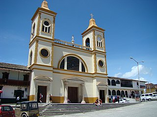
La Unión is a municipality in Colombia, located in the Eastern subregion of the department of Antioquia. It is bordered to the north by the municipalities of La Ceja and El Carmen de Viboral, to the east by El Carmen de Viboral, to the south by the municipality of Abejorral, and to the west by the municipality of La Ceja. Its capital is 57 kilometers away from Medellín, the capital of the department of Antioquia. The municipality covers an area of 198 square kilometers.

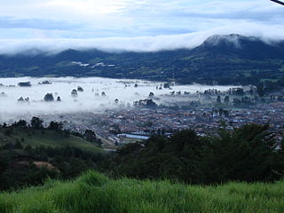
Santa Rosa de Osos is a middle city and municipality of Colombia located in the northern of the department of Antioquia. Bounded on the north with the municipalities of Yarumal and Angostura, on the east with Guadalupe and Carolina del Principe, on the south with the municipalities of Donmatías, San Pedro de los Milagros and Entrerríos, and on the west with Belmira and San José de la Montaña.

Yolombó is a town and municipality in the Colombian department of Antioquia. It is part of the subregion of Northeastern Antioquia, located 108 km from Medellín.

Necoclí is a town and municipality in Antioquia Department, Colombia. Located on the eastern shore of the Gulf of Urabá, it is part of the Urabá Antioquia sub-region. The population is predominantly Afro-Colombian.

Pueblorrico is a municipality in Colombia, located in the southwest subregion of the Department of Antioquia. It borders the municipalities of Salgar and Tarso to the north, Jericó to the east, Andes to the south, and Ciudad Bolívar and Hispania to the west.

Puerto Nare is a town and municipality in the Colombian department of Antioquia. It is part of the Magdalena Medio Antioquia sub-region.

Rionegro is a city and municipality in Antioquia Department, Colombia, located in the subregion of Eastern Antioquia. The official name of the city is Ciudad Santiago de Arma de Rionegro. Rio Negro means "Black River" in Spanish, as the city received its name after a river that looks black because of the shadows cast by trees. The river traverses the city and it is the most prominent geographical feature of the municipality. Rionegro is also sometimes called the Cuna de la democracia as it was one of the most important cities during the era of the Colombia's struggle for independence and the 1863 constitution was written in the city.

San Carlos is a town and municipality in the Colombian department of Antioquia, part of the subregion of Eastern Antioquia. It is called the hydro-electrical capital of Colombia, because it has many dams and it produces much energy. The population was 14,480 at the 2018 census.
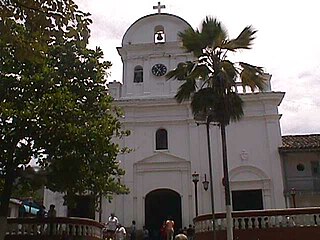
San Jerónimo is a municipality in Colombia, located in the Western subregion of the Department of Antioquia. Its main town is 35 kilometers from the city of Medellín, the capital of the department of Antioquia. The municipality has an area of 155 square kilometers.

San Luis is a municipality in Colombia, located in the department of Antioquia. It is limited in the north by the municipalities of San Carlos and Puerto Nare, in the east by the municipality of Puerto Triunfo, in the south by the municipality of San Francisco and in the west by the municipalities of Cocorná and Granada.
Race and ethnicity in Colombia descend mainly from three racial groups—Europeans, Amerindians, and Africans—that have mixed throughout the last 500 years of the country's history. Some demographers describe Colombia as one of the most ethnically diverse countries in the Western Hemisphere and in the World, with 900 different ethnic groups. Most Colombians identify themselves and others according to ancestry, physical appearance, and sociocultural status. Social relations reflect the importance attached to certain characteristics associated with a given racial group. Although these characteristics no longer accurately differentiate social categories, they still contribute to one's rank in the social hierarchy. A study from Rojas et al involving 15 departments determined that the average Colombian has a mixture of 47% Amerindian, 42% European, and 11% African. These proportions also vary widely among ethnicities.
La Ceja del Tambo, known as La Ceja, is a town and municipality in the Antioquia Department of Colombia. It is part of the subregion of Eastern Antioquia. La Ceja borders the Rionegro and Carmen de Viboral municipalities to the north, La Unión to the east, and Montebello and Retiro to the west. It is located approximately 41 kilometers from Medellín, the department capital.