Malaysian Federal Roads System

Last updated
Malaysian Federal Roads System
Sistem Jalan Persekutuan Malaysia (Malay)
Jkr-ft1.png
Highway shield of the Malaysian Federal Roads
System information
Maintained by Federal Public Works Department (JKR); numbers and routings assigned by Malaysian Ministry of Works. [1]
Formed1957 (Peninsular Malaysia)
1986 (Sabah and Sarawak) [2]
Highway names
Federal RoadsFederal Route nn (FT nn)
System links
Tun Razak Highway (Federal route FT 12) runs from Segamat, Johor to Gambang, Pahang. Kuantan-highway.JPG
Tun Razak Highway (Federal route MYS Jkr-ft12.svg FT 12) runs from Segamat, Johor to Gambang, Pahang.
A direction signboard on Federal Route 3 in Terengganu. Terengganusign.png
A direction signboard on Federal Route 3 in Terengganu.
A Federal Route code sign Federal Route 226 Sign.jpg
A Federal Route code sign

Malaysian Federal Roads System (Malay : Sistem Jalan Persekutuan Malaysia), is the main national road network in Malaysia. All Federal Roads in Malaysia are under the purview of the Ministry of Works (MOW). According to the Ministerial Functions Act 1969, the MOW is responsible to plan, build and maintain all Federal Roads gazetted under the Federal Roads Act 1959. [3] However, most of the Federal roads' projects were built and maintained by the Malaysian Public Works Department (JKR), which is also one of the implementing agencies under the MOW (with the exception of Sabah and Sarawak, whereby JKR in these two states is under respective state government).

Contents

History

Most of the federal roads in Peninsular Malaysia were built during the British colonial era before 1957. At that time, the British government built the roads in order to enable them to transport goods and commodities easier.

In Sabah, most of the federal roads were built during the occupation of British North Borneo under North Borneo Chartered Company administration, and unlike most federal roads in Peninsular Malaysia which uses only numbers to label federal roads, Sabah federal road codes begin with the letter A followed by route number.

However, in Sarawak, no road network system was developed during the rule of White Rajah Brooke dynasty. As a result, right after Sarawak joined the federation of Malaysia on 16 September 1963, the federal government of Malaysia began to build a road network system connecting Sarawak to Sabah, known as Pan Borneo Highway.

Federal road standards

Overview

According to Malaysian Road Statistics 2021 by Public Works Department (JKR) Malaysia. The total length of federal roads is 20,017.97 km (12,438.59 mi) and state roads is 247,027.61 km (153,495.84 mi) (Grand total for federal/state roads is 290,099.38 km (180,259.40 mi) as of December 2021, not included local road and rural road under local government authority). (Source: Malaysian Road Statistics 2021)

Federal routes are labeled with only numbers, for example Federal Route 1, while state routes are labeled with the state code letter followed by assigned numbers; for example
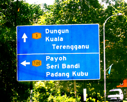
 Route (J)32 is a Johor state road. However, federal route numbers can also be added with the FT- prefix, which is normally used by JKR and Malaysian police. For example, Federal Route 1 can also be written as Federal Route FT1. Both federal and state roads have blue road signs and the text colour is white.

Most of the federal roads in Malaysia are two-lane roads. Malaysia implements a right-hand driving system where drivers drive on the left side of the road. However, there are in certain places where additional lanes are available. In town areas, federal roads may become four-lane roads to increase traffic capacity. In hilly areas, additional third climbing lane is available for slower vehicles such as buses and lorries.

Some federal roads may have motorcycle lanes. On Malaysian federal roads, the motorcycle lanes are placed at the extreme left side of each direction and only separated from the main lanes by black-and-white stripes to enable motorcyclists to overtake slower motorcycles and to turn right to exit the road.

Some expressways in Malaysia such as Federal Highway and Skudai Highway are federally funded, therefore all federally funded expressways are also classified as federal roads.

Nearly all federal roads are paved with typical tarmac except Skudai-Pontian Highway which is paved with concrete from Universiti Teknologi Malaysia interchange to Taman Sri Pulai junction and Sitiawan–Batak Rabit road (Federal route 5) from Sitiawan to Kota Setia. Meanwhile, at Federal Highway linking Klang to Kuala Lumpur, the section of the highway from Subang Jaya to Kota Darul Ehsan near Petaling Jaya are paved with asphalt.

Sarawak has some of the most extensive federal road network in Malaysia. All federal roads in Sarawak is connecting main divisions with exception of Mukah division. As for Kapit division, the only federal road serving this division is Jalan Bakun (starting from KM 95–KM 120). Coastal road of Bintulu–Miri is a still in dispute between federal government and state government right of maintenance. It is due to the construction is federal funded, but the compensation and acquisition of land are from Sarawak state government. No federal roads are isolated from the network unlike state roads. Uniquely in Sarawak, federal road network is adjoined internationally to Brunei highway at Sungai Tujuh (Miri) with Kuala Belait (Brunei), Tedungan (Limbang) with Kuala Lurah (Brunei), Limbang with Puni (Brunei), Lawas with Labu (Brunei) and also to Indonesian road network at Tebedu (Serian district) with Entikong (Kalimantan Barat, Indonesia).

Malaysian federal roads are subject to the rural highway standard adopted by Malaysian Public Works Department (JKR), ranging from R1 and R1a (minor roads at villages and FELDA settlements with no access control and low speed limits) to R5 (federal roads or highways with limited access control and speed limits up to 90 km/h). R6 standard is exclusive for high-speed (up to 110 km/h) expressways with full access control.

Type of federal roads and route number categories

ExamplesInformationNumber digits
MYS Jkr-ft5.svg FT 5
MYS Jkr-ft24.svg FT 24
MYS Jkr-ft247.svg FT 247
Main federal route numbers001–249
MYS Jkr-ft276.svg FT 276
MYS Jkr-ft345.svg FT 345
Institutional facilities federal roads250–479
1
226
Federal road exit numbersEXIT 1–EXIT 99
EXIT 201–EXIT 299
MYS Jkr-ft1.svg FT 1
MYS Jkr-ft1-15.svg FT 1-15
Main federal route numbers
(Sarawak)
1-1–1-59
3-1–3-99
Jkr-ftA1.png A1
A6
Main federal route numbers
(Sabah; old numbering system)
A01–A99
MYS Jkr-ft700.svg FT 700
MYS Jkr-ft701.svg FT 701
MYS Jkr-ft704.svg FT 704
Main federal route numbers
(Labuan)
700–799

FELDA/FELCRA federal route numbers1000–1999
2000–2999

Industrial federal route numbers3000–3999

Main federal roads

Mostly found at Peninsula Malaysia, Sabah and Sarawak.

FELDA/FELCRA federal roads

Mostly found at FELDA and FELCRA settlements in Peninsula Malaysia only. The road was built by FELDA or FELCRA and JKR.

In Sarawak, federal roads for FELDA is in Lundu and for SALCRA is in Sarikei.

Industrial federal roads

Mostly found at the industrial areas in Peninsula Malaysia only.

In Sarawak, there are two industrial federal roads, which are located at Pending Industrial Estate in Kuching and Kidurong Industrial Estate in Bintulu.

Institutional facilities federal roads

Mostly found at the entrance to the federal institutional facilities such as university, institute, military bases, satellite earth stations, airports, TV and radio frequency stations, telecom exchange stations, hospitals and tourist attractions.

Road design

Rural

StandardMax design
speed limit
(km/h)
Minimum
lane width
(m)
Access controlApplication
JKR R61103.5Full Expressways under the administration of Malaysian Highway Authority (MHA)
JKR R51003.5PartialPrimary roads and partial access highways for the Federal JKR
JKR R4903.25PartialMain / secondary roads
JKR R3703.0PartialSecondary roads
JKR R2602.75NoneMinor roads

Note: JKR R2 is the minimum geometrical standard for 2-lane roads
JKR R140(5.0)*None Single-lane minor roads (country lane)
JKR R1a40(4.5)*NoneSingle-lane roads (roads to restricted areas such as quarries)

Urban

StandardMax design
speed limit
(km/h)
Minimum
lane width
(m)
Access controlApplication
JKR U6903.5Full Expressways under the administration of Malaysian Highway Authority (MHA)
JKR U5803.5PartialArterial roads and partial access municipal highways
JKR U4703.25PartialArterial / collector roads
JKR U3603.0PartialCollector roads / Local streets
JKR U2502.75NoneLocal streets

Note: JKR U2 is the minimum geometrical standard for 2-lane roads
JKR U140(5.0)*NoneSingle-lane street (in towns)
JKR U1a40(4.5)*NoneSingle-lane street (as in low-cost housing areas)

* - Total width of 2-way road

(Source: Arahan Teknik (Jalan) 8/86 - A Guide on Geometric Design of Roads, Jabatan Kerja Raya Malaysia)

Asian Highway Network

Asian Highway route shield. Asian Highway 18 (route shield).jpg
Asian Highway route shield.
Federal Roads distance sign with Asian Highway route shield. FT3 AH18.jpg
Federal Roads distance sign with Asian Highway route shield.

Asian Highway Network is an international project between Asian nations to develop their highway systems which will form the main routes in the Asian Highway network. There are 7 Asian Highway routes passing through Malaysia - AH2, AH18, AH140, AH141, AH142, AH143, and AH150.

The Malaysian section of Route AH2 consists of:-

The Malaysian section of Route AH18 consists of:-

The Malaysian section of Route AH140 consists of:-

The Malaysian section of Route AH141 consists of:-

The Malaysian section of Route AH142 consists of:-

The Malaysian section of Route AH143 consists of:-

The Malaysian section of Route AH150 consists of:-

Federal road maintenances

Malaysian federal roads were previously maintained by the Public Works Department itself; since 2000, several private contractors were appointed by the JKR to provide maintenance to the federal roads by region. [4] [5]

RegionsCompany
Flag of Perlis.svg  Perlis
Flag of Kedah.svg  Kedah
Flag of Penang (Malaysia).svg  Penang
THB Maintenance Sdn. Bhd.
Flag of Perak.svg  Perak Belati Wangsa (M) Sdn Bhd
Flag of Selangor.svg  Selangor
Flag of the Federal Territories of Malaysia.svg Federal Territory of Kuala Lumpur
Flag of the Federal Territories of Malaysia.svg Federal Territory of Putrajaya
Flag of Pahang.svg  Pahang
Flag of Terengganu.svg  Terengganu
Flag of Kelantan.svg  Kelantan
Roadcare (M) Sdn Bhd
Flag of Negeri Sembilan.svg  Negeri Sembilan
Flag of Malacca.svg  Malacca
Flag of Johor.svg  Johor
Selia Selenggara Selatan (M) Sdn Bhd
Flag of Sabah.svg  Sabah
Flag of the Federal Territories of Malaysia.svg Federal Territory of Labuan
Lintasan Resources Sdn Bhd
Flag of Sarawak.svg  Sarawak DAL HCM Sdn. Bhd.

Safety

Speed limits

The default speed limit and National Speed Limits is 90 km/h (56 mph); however, a lower speed limit of 80 km/h (50 mph) has been implemented during festive seasons starting from the 2006 Hari Raya Aidilfitri as a preventive measure to reduce accidents during festive seasons. In town areas, the speed limit is reduced to 60 km/h (37 mph). Speed traps are also deployed by the Malaysian police at many places along the federal roads.

Accidents

Malaysian federal roads are always sites of most of the road accidents in Malaysia, especially during festive seasons.

During festive seasons

During festive seasons such as Chinese New Year, Deepavali, Christmas and Hari Raya Aidilfitri, activities such as construction, road repairs and maintenance works have been stopped. Meanwhile, a heavy goods vehicles such as logging truck, cement truck, intermodal container truck, construction materials truck and other heavy goods vehicles (except tanker lorry, provision goods truck, road crane crane, tow truck, fire engine, ambulance, etc.) are banned from using roads, highways and expressways during festive seasons. A massive nationwide operation known as Ops Selamat (Previously named as Ops Sikap) are held annually by the Malaysian police to ensure safety on all roads in Malaysia during festive seasons.

Automated Enforcement System

The Automated Enforcement System (AES) is the road safety enforcement system to monitor all federal roads, highways and expressways in Malaysia. This system came into effect on 22 September 2012.

Type of AES

  • Speed light camera
  • Red light camera

Natural hazards

The Public Works Department has monitored all federal roads in Malaysia and make sure that no landslides, flash floods and other natural hazards may happen again.

Facilities on the Malaysian federal roads

Other facts

List of federal roads

See also

Related Research Articles

<span class="mw-page-title-main">Transport in Malaysia</span>

Transportation in Malaysia started to develop during British colonial rule, and the country's transport network is now diverse and developed. Malaysia's road network is extensive, covering 290,099.38 kilometres, including 2,016.05 km of expressways. The main highway of the country extends over 800 km, reaching the Thai border from Singapore. Peninsular Malaysia has an extensive road network, whilst the road system in East Malaysia is not as well-developed. The main modes of transport in Peninsular Malaysia include buses, trains, cars and to an extent, commercial travel on airplanes.

<span class="mw-page-title-main">Malaysian State Roads system</span>

Malaysian State Roads System are the secondary roads in Malaysia with a total length of 247,027.61 km. The construction and maintenance works of state roads in Malaysia is managed by Malaysian Public Works Department (JKR) of each state and funded by state governments. The standard of the state roads is similar with the federal roads except for the coding system, where the codes for state roads begin with state codes followed by route number, for example Johor State Route J32 is labeled as J32. If a state road crosses the state border, the state code will change, for example route B20 in Salak Tinggi, Selangor will change to N20 after crossing the border of Negeri Sembilan to Nilai.

<span class="mw-page-title-main">KLIA Expressway</span> Road in Malaysia

KLIA Expressway, E6 and Federal Route 26, is an expressway in Sepang, Selangor, Malaysia. It serves as the main access road to Kuala Lumpur International Airport (KLIA), as well as the nearby Sepang International Circuit and Bandar Enstek.

North Klang Straits Bypass, Federal Route 20, AH 141, is the main highway bypass to Port Klang in Klang, Selangor, Malaysia. Federal Route 20 became the backbone of the road system linking Sungai Rasau to Port Klang before being surpassed by the New North Klang Straits Bypass 30. Many cargo trucks travel along the highway daily.

Putrajaya–Cyberjaya Expressway, Federal Route 29, is a major expressway in Klang Valley, Malaysia. The 21.2 km (13.2 mi) expressway connects Serdang interchange on Damansara–Puchong Expressway to Kuala Lumpur International Airport (KLIA) in Sepang. It was named after the two sides of the MSC cities, Putrajaya and Cyberjaya.

The Federal Route 2 is a major east–west oriented federal highway in Malaysia. The 276.9 kilometres (172 mi) road connects Port Klang in Selangor to Kuantan Port in Pahang. The Federal Route 2 became the backbone of the road system linking the east and west coasts of Peninsula Malaysia before being surpassed by the East Coast Expressway E8.

<span class="mw-page-title-main">KLIA Outer Ring Road</span> Road in Malaysia

KLIA Outer Ring Road(KLIAORR), or Jalan Pekeliling, Federal Route 27, is the second highway and ring road along Kuala Lumpur International Airport (KLIA) after KLIA Expressway (Federal Route 26) in Malaysia. During Formula One Petronas Malaysian Grand Prix championship every year it becomes the main route to Sepang F1 Circuit. From 1 March 2006 until 9 May 2014 it became a main road to Low Cost Carrier Terminal (LCCT).

Federal Route 92, also known as Pengerang Highway, is a federal highway that runs from Kota Tinggi to Sungai Rengit in Johor, Malaysia. The 66.8 km (41.5 mi) highway is also a main route to Desaru beach. Federal Route 92 became the backbone of the road system linking the southeastern Johor before being surpassed by the Senai–Desaru Expressway E22.

Malaysian National Projects are major national and giant projects which are important in the development of Malaysia.

<span class="mw-page-title-main">Pan-Borneo Highway</span> International road route on the island of Borneo

Pan Borneo Highway, also known as Trans-Borneo Highway or Trans-Kalimantan Highway, is a road network on Borneo Island connecting two Malaysian states, Sabah and Sarawak, with Brunei and Kalimantan region in Indonesia. The highway is numbered AH150 in the Asian Highway Network and as Federal Route 1 in Sarawak. In Sabah, the route numbers given are 1, 13 and 22. The highway is a joint project between both governments which started as soon as the formation of Malaysia in 1963 which comprised Malaya, Sabah, Sarawak and Singapore. The lack of a road network system in Sarawak was the main factor of the construction.

<span class="mw-page-title-main">Second East–West Highway</span> Road in Malaysia

Second East–West Highway, also known as Simpang Pulai–Kuala Berang Highway, Federal Route 185 and Federal Route 36, is a highway in Peninsular Malaysia which connects Simpang Pulai in Perak to Kuala Jeneris in Terengganu. It overlaps with Federal Route 8 Federal Route 8 between Gua Musang and Sungai Relau. It is notorious for its many sharp corners which increase the risk of road accidents.

<span class="mw-page-title-main">Rail transport in Malaysia</span>

Rail transport in Malaysia consists of heavy rail, light rapid transit (LRT), mass rapid transit (MRT), monorails, airport rail links and a funicular railway line. Heavy rail is mostly used for intercity services and freight transport as well as some urban public transport, while rapid transit rails are used for intracity urban public transport in the capital city of Kuala Lumpur and the surrounding Klang Valley region. There are two airport rail link systems linking Kuala Lumpur with the Kuala Lumpur International Airport and Sultan Abdul Aziz Shah Airport. The longest monorail line in the country is also used for public transport in Kuala Lumpur, while the only funicular railway line is available in Penang.

<span class="mw-page-title-main">KLIA East Road</span> Road in Malaysia

The KLIA East Road, or Jalan Kuarters KLIA, Federal Route 344, is a fourth highway in Kuala Lumpur International Airport (KLIA) in Malaysia that connects the KLIA Outer Ring Road junctions near Sepang International Circuit in Selangor to KLIA Quarters in Negeri Sembilan. It is also a main route to Sepang and Labu town.

North–South Port Link, or Jalan Kem and Jalan Pelabuhan Utara-Barat, Federal Route 180, is an expressway in Klang District, Selangor, Malaysia. It connects Northport Highway in Port Klang to Teluk Gedong near Pandamaran. The Kilometre Zero of the Federal Route 180 starts at Port Klang.

Transport in Greater Kuala Lumpur includes a road network, a railway network, airports, and other modes of public transport. The Klang Valley is an urban conglomeration consisting of the city of Kuala Lumpur, as well as surrounding towns and cities in the state of Selangor. The Klang Valley has the country's largest airport, the Kuala Lumpur International Airport (KLIA), as well as the country's largest intermodal transport hub and railway station, Kuala Lumpur Sentral.

Northport Highway, alternately Jalan Pelabuhan Utara, Federal Route 103 or Jalan Parang is an expressway in Port Klang, Selangor, Malaysia. It connects Port Klang in the south to Northport in the north.

Jalan KLIA 1, Federal Route 182, is the third highway in Kuala Lumpur International Airport (KLIA), Malaysia. It is a main route to KLIA Charter Field Town or KLIA Town Centre. The Kilometre Zero is located at Nilai-KLIA Highway junctions.

<span class="mw-page-title-main">Malaysian Expressway System</span> System of expressways in Malaysia

The Malaysian Expressway System is a network of national controlled-access expressways in Malaysia that forms the primary backbone network of Malaysian national highways. The network begins with the Tanjung Malim–Slim River tolled road which was opened to traffic on 16 March 1966, later North–South Expressway (NSE), and is being substantially developed. Malaysian expressways are built by private companies under the supervision of the government highway authority, Malaysian Highway Authority.

The Sarawak section of the Federal Route 1, Asian Highway Route AH 150, also known as Pan Borneo Highway Sarawak or Sarawak First Trunk Road, is a 1077-km federal highway in Sarawak, Malaysia, making the highway as the longest component of the Malaysian portion of the larger Pan Borneo Highway network. Construction of the highway began in 1965 after Sarawak became a member of the federation of Malaysia in 1963.

Jalan Lapangan Terbang Baru Bintulu, or New Bintulu Airport Road, Federal Route 920, is a federal road in Bintulu Division, Sarawak, Malaysia.

References

  1. Malaysian Ministry of Works (2013-04-11). "Know Federal Roads". Malaysian Ministry of Works. Retrieved 2015-11-08.
  2. Federal Roads Act 1959 (Act 376). Accessed on 2015-11-08.
  3. "FEDERAL ROADS ACT 1959" (PDF).
  4. "PEMBERITAHUAN PERTANYAAN BERTULIS DEWAN RAKYAT MESYUARAT KETIGA, PENGGAL KETIGA PARLIMEN KEEMPAT BELAS" (PDF). Retrieved 26 August 2023.
  5. "EDUCATIVE MATERIAL CSFJ - Tajuk: Penyenggaraan Jalan Persekutuan" . Retrieved 26 August 2023.