Meadow Bluff, West Virginia

Last updated
Meadow Bluff, West Virginia
Unincorporated community
USA West Virginia location map.svg
Red pog.svg
Meadow
Bluff
Usa edcp location map.svg
Red pog.svg
Meadow
Bluff
Coordinates: 37°54′13″N80°39′05″W / 37.90361°N 80.65139°W / 37.90361; -80.65139 Coordinates: 37°54′13″N80°39′05″W / 37.90361°N 80.65139°W / 37.90361; -80.65139
Country United States
State West Virginia
County Greenbrier
Elevation 2,457 ft (749 m)
Time zone Eastern (EST) (UTC-5)
  Summer (DST) EDT (UTC-4)
Area code(s) 304 & 681
GNIS feature ID 1543049 [1]

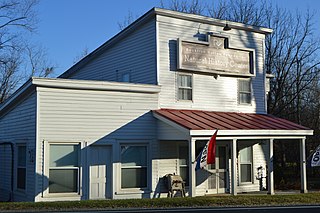
Meadow Bluff is an unincorporated community in Greenbrier County, West Virginia, United States. Meadow Bluff is 4.5 miles (7.2 km) southeast of Rupert.

Unincorporated area Region of land not governed by own local government

In law, an unincorporated area is a region of land that is not governed by a local municipal corporation; similarly an unincorporated community is a settlement that is not governed by its own local municipal corporation, but rather is administered as part of larger administrative divisions, such as a township, parish, borough, county, city, canton, state, province or country. Occasionally, municipalities dissolve or disincorporate, which may happen if they become fiscally insolvent, and services become the responsibility of a higher administration. Widespread unincorporated communities and areas are a distinguishing feature of the United States and Canada. In most other countries of the world, there are either no unincorporated areas at all, or these are very rare; typically remote, outlying, sparsely populated or uninhabited areas.

Greenbrier County, West Virginia County in the United States

Greenbrier County is a county in the U.S. state of West Virginia. As of the 2010 census, the population was 35,480. Its county seat is Lewisburg. The county was formed in 1778 from Botetourt and Montgomery counties in Virginia.

West Virginia State of the United States of America

West Virginia is a state located in the Appalachian region in the Southern United States that is also considered to be a part of the Middle Atlantic States. It is bordered by Pennsylvania to the north, Maryland to the east and northeast, Virginia to the southeast, Kentucky to the southwest, and Ohio to the northwest. West Virginia is the 41st largest state by area, and is ranked 38th in population. The capital and largest city is Charleston.

The community was named after the meadows and bluffs near the original town site. [2] Located near Meadow Bluff is the Deitz Farm, listed on the National Register of Historic Places in 1992. [3]

Deitz Farm building in West Virginia, United States

Deitz Farm, also known as General Robert E. Lee Headquarters, is a national historic district located near Meadow Bluff, Greenbrier County, West Virginia. The house was built about 1840, and is a two-story side gabled red brick residence in the Greek Revival style. It features a three bay, one-story wooden porch across the front of the house. Also on the property are two contributing wooden outbuildings and earthworks associated with the property's role as General Robert E. Lee Headquarters during the American Civil War.

National Register of Historic Places federal list of historic sites in the United States

The National Register of Historic Places (NRHP) is the United States federal government's official list of districts, sites, buildings, structures, and objects deemed worthy of preservation for their historical significance. A property listed in the National Register, or located within a National Register Historic District, may qualify for tax incentives derived from the total value of expenses incurred preserving the property.

Related Research Articles

Pliny, West Virginia Unincorporated community in West Virginia, United States

Pliny is an unincorporated community in Putnam County, West Virginia, United States. It was named for M. Pliny Brown, an early settler. The ZIP code is 25158.

Files Crossroad, West Virginia Unincorporated community in West Virginia, United States

Files Crossroad is an unincorporated community in Berkeley County, West Virginia. The community is located east of Martinsburg on West Virginia Route 45 at its crossroads with County Route 45/4. The community was originally known as Smoketown, hence the name of its historic Smoketown Cemetery.

Nollville, West Virginia Unincorporated community in West Virginia, United States

Nollville is an unincorporated community on Tuscarora Creek in Berkeley County, West Virginia. It lies west of Martinsburg on the Tuscarora Pike.

Ridgeway, West Virginia Unincorporated community in West Virginia, United States

Ridgeway is an unincorporated community in Berkeley County, West Virginia. It lies off U.S. Route 11 on Specks Run Road near the Virginia state line.

Institute, West Virginia Unincorporated community in West Virginia, United States

Institute is an unincorporated community on the Kanawha River in Kanawha County, West Virginia, United States. Interstate 64 and West Virginia Route 25 pass by the community, which has grown to intermingle with nearby Dunbar. Institute is home to West Virginia State University and the West Virginia State Police Academy. In August 2008 a chemical plant explosion here killed two and injured eight at the Bayer CropScience facility.

Sky Meadows State Park

Sky Meadows State Park is a 1,862-acre (754 ha) park in the Virginia state park system. It is located in extreme northwest Fauquier County, Virginia in the Blue Ridge Mountains, near Paris, Virginia. It is about an hour outside of the Washington, D.C. metro region.

Bloomfield, Virginia Unincorporated community in Virginia

Bloomfield is an unincorporated community in Loudoun County, Virginia. It is situated at the intersection of Airmont and Bloomfield Roads.

Meadows of Dan, Virginia Unincorporated community in Virginia, United States

Meadows of Dan is an unincorporated community in Patrick County, Virginia, United States, where the Blue Ridge Parkway crosses U.S. Route 58. There are numerous country shops, classic houses, and restaurants in the community. It is located near the Patrick/Floyd county line about 20 miles east of Hillsville and about 14 miles northwest of Stuart, Virginia. The community's name is credited to one of its earliest English settlers, James Steptoe Langhorne, and comes from the beautiful meadows that abound near the Dan River which flows through the area. The community's motto as posted on the welcoming sign is "A simpler place in time". Meadows of Dan is located along the Crooked Road, Virginia and the Crooked Road, Virginia's heritage music trail and in the Rocky Knob American Viticultural Area.

Millstone Bluff

Millstone Bluff is a natural bluff in Pope County, Illinois, United States, located near the community of Glendale. Listed on the National Register of Historic Places because of its archaeological significance, Millstone Bluff is one of three National Register sites in Pope County, along with the Golconda Historic District and part of the Kincaid Mounds State Historic Site.

Greenville, Monroe County, West Virginia Unincorporated community in West Virginia, United States

Greenville is an unincorporated community in Monroe County, West Virginia, United States. Greenville is located on West Virginia Route 122 west of Union. The community was formerly called Centreville.

Wintergreen, Virginia human settlement in Virginia, United States of America

Wintergreen is a census-designated place (CDP) in Augusta and Nelson counties, Virginia, United States, located near Wintergreen Resort. The population as of the 2010 Census was 165.

Frankford, West Virginia Unincorporated community in West Virginia, United States

Frankford is an unincorporated community in Greenbrier County, West Virginia, United States. Frankford is located on U.S. Route 219 south of Falling Spring and north of Maxwelton. Frankford has a post office with ZIP code 24938.

Tesla, West Virginia Unincorporated community in West Virginia, United States

Tesla is an unincorporated community in Braxton County, West Virginia, United States. Tesla is 4.5 miles (7.2 km) south of Sutton.

Drennen, West Virginia Unincorporated community in West Virginia, United States

Drennen is an unincorporated community in Nicholas County, West Virginia, United States. Drennen is located on West Virginia Route 39 8 miles (13 km) west of Summersville. Drennen has a post office with ZIP code 26667.

Wheeler, West Virginia Unincorporated community in West Virginia, United States

Wheeler is an unincorporated community in Webster County, West Virginia, United States. Wheeler is 14.5 miles (23.3 km) north of Webster Springs.

Cranesville, West Virginia Unincorporated community in West Virginia, United States

Cranesville is an unincorporated community in Preston County, West Virginia, United States. Cranesville is located along County Route 47 7.9 miles (12.7 km) north-northeast of Terra Alta.

Chalk Bluff, Arkansas place in Arkansas listed on National Register of Historic Places

Chalk Bluff was an unincorporated community in Clay County, Arkansas, United States, approximately 2 mi (3 km) northwest of St. Francis. The town was formed in the 1820s at the point where the St. Francis River cuts through Crowley's Ridge from west to east. The name of the community was derived from the white clay bluff created by this crossing. The founder of the community was Abraham Seitz, who established and operated a ferry crossing and general store in the area from the 1830 until it was destroyed during the Civil War. The community occupied a strategic location and was often referred to in the reports of Union and Confederate forces vying for control of Northeast Arkansas during the war. Several skirmishes occurred near the ferry crossing, one of which was significant it enough to become known as the Battle of Chalk Bluff, which occurred in early May 1863. The town was abandoned following the Civil War and most residents moved to the new railroad town, St. Francis, Arkansas. The location was listed on the National Register of Historic Places in 1974.

Mossy Creek, Virginia Unincorporated community in Virginia, United States

Mossy Creek is an unincorporated community in Augusta County, Virginia, United States. Mossy Creek is located on Virginia State Route 42 3.3 miles (5.3 km) west-southwest of Bridgewater. The Hannah Miller House and the Henry Miller House, which are listed on the National Register of Historic Places, are both located near Mossy Creek.

References