Menominee, Illinois

Last updated

Menominee
Jo Daviess County Illinois Incorporated and Unincorporated areas Menominee Highlighted.svg
Location of Menominee in Jo Daviess County, Illinois.
Illinois in United States (US48).svg
Location of Illinois in the United States
Coordinates: 42°28′29″N90°32′32″W / 42.47472°N 90.54222°W / 42.47472; -90.54222
CountryUnited States
StateIllinois
County Jo Daviess
Township Menominee
Area
[1]
  Total1.91 sq mi (4.96 km2)
  Land1.91 sq mi (4.96 km2)
  Water0.00 sq mi (0.00 km2)
Elevation
[2]
761 ft (232 m)
Population
 (2020)
  Total211
  Density110.24/sq mi (42.57/km2)
Time zone UTC-6 (CST)
  Summer (DST) UTC-5 (CDT)
ZIP Code(s)
61025
Area code 815
FIPS code 17-48359
Wikimedia CommonsMenominee, Illinois

Menominee is a village in Jo Daviess County, Illinois, United States. The population was 248 at the 2010 census, up from 237 in 2000. The village is located on the Little Menominee River near East Dubuque and Galena.

Contents

The village derives its name from the Menominee indigenous peoples. [3]

Geography

Menominee is located at 42°28′29″N90°32′32″W / 42.47472°N 90.54222°W / 42.47472; -90.54222 (42.474652, -90.542114). [4]

According to the 2010 census, Menominee has a total area of 1.82 square miles (4.71 km2), all land. [5]

Demographics

Historical population
CensusPop.Note
1940 138
1950 132−4.3%
1960 19144.7%
1970 21713.6%
1980 2316.5%
1990 187−19.0%
2000 23726.7%
2010 2484.6%
2020 211−14.9%
U.S. Decennial Census [6]

As of the census [7] of 2000, there were 237 people, 78 households, and 59 families residing in the village. Also according to the census [7] of 2000 there were over 800 cows located in Menominee, almost four times the population. The population density was 123.1 inhabitants per square mile (47.5/km2). There were 81 housing units at an average density of 42.1 per square mile (16.3/km2). The racial makeup of the village was 97.89% White, 0.84% African American, 0.84% from other races, and 0.42% from two or more races. Hispanic or Latino of any race were 4.22% of the population.

There were 78 households, out of which 35.9% had children under the age of 18 living with them, 65.4% were married couples living together, 7.7% had a female householder with no husband present, and 23.1% were non-families. 19.2% of all households were made up of individuals, and 5.1% had someone living alone who was 65 years of age or older. The average household size was 3.04 and the average family size was 3.53.

In the village, the population was spread out, with 33.8% under the age of 18, 6.8% from 18 to 24, 28.3% from 25 to 44, 21.5% from 45 to 64, and 9.7% who were 65 years of age or older. The median age was 35 years. For every 100 females, there were 111.6 males. For every 100 females age 18 and over, there were 106.6 males.

The median income for a household in the village was $45,972, and the median income for a family was $47,500. Males had a median income of $33,036 versus $20,000 for females. The per capita income for the village was $14,518. About 6.7% of families and 18.2% of the population were below the poverty line, including 30.6% of those under the age of eighteen and 3.8% of those 65 or over.

Related Research Articles

<span class="mw-page-title-main">Jo Daviess County, Illinois</span> County in Illinois, United States

Jo Daviess County is the northwesternmost county in the U.S. state of Illinois. According to the 2020 census, it had a population of 22,035. Its county seat is Galena.

<span class="mw-page-title-main">Oak Ridge, Florida</span> Census-designated place in Florida, United States

Oak Ridge is a census-designated place and unincorporated area in Orange County, Florida, United States. The population was 22,685 at the 2010 census. It is part of the Orlando–Kissimmee–Sanford, Florida Metropolitan Statistical Area.
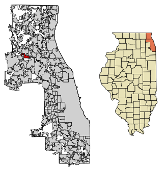
<span class="mw-page-title-main">Deer Park, Illinois</span> Village in Illinois, United States

Deer Park is a village in Lake and Cook Counties, Illinois. Per the 2020 census, the population was 3,681. The village is one of the few left in the Chicago area that enjoy a green belt which is bordered by two large natural areas providing outdoor recreation and open space. The village is home to popular shopping and dining destinations: Deer Park Town Center and the Town Center Promenade. The town is also home to the Vehe Farm, an Illinois Centennial Farm.

<span class="mw-page-title-main">Apple River, Illinois</span> Village in Illinois, United States

Apple River is a village in Jo Daviess County, Illinois, United States. The population was 366 at the 2010 census, down from 379 in 2000.

<span class="mw-page-title-main">East Dubuque, Illinois</span> City in Illinois, United States

East Dubuque is a city in Jo Daviess County, Illinois, United States. The population was 1,505 at the 2020 census, down from 1,704 in 2010. East Dubuque is located alongside the Mississippi River. Across the river is the city of Dubuque, Iowa. The city limits extend along the river to the Illinois – Wisconsin border.

<span class="mw-page-title-main">Elizabeth, Illinois</span> Village in Illinois, United States

Elizabeth is a village in Jo Daviess County, Illinois, United States. The population was 761 at the 2010 census.

<span class="mw-page-title-main">Hanover, Illinois</span> Village in Illinois, United States

Hanover is a village in Jo Daviess County, Illinois, United States, along the Apple River. The town was previously named Wapello, in honor of Chief Wapello of the Meskwaki tribe. The population was 844 at the 2010 census, up from 836 in 2000.

<span class="mw-page-title-main">Nora, Illinois</span> Village in Illinois, United States

Nora is a village in Jo Daviess County, Illinois, United States. In 2020, the population was 107, down from 121 according to the 2010 census, which was up from 118 in 2000.

<span class="mw-page-title-main">Scales Mound, Illinois</span> Village in Illinois, United States

Scales Mound is a village in Jo Daviess County, Illinois, United States. The population was 436 at the 2020 census.

<span class="mw-page-title-main">Stockton, Illinois</span> Village in Illinois, United States

Stockton is a village in Jo Daviess County, Illinois, United States. The population was 1,862 at the 2010 census, down from 1,926 at the 2000 census.

<span class="mw-page-title-main">Warren, Illinois</span> Village in Illinois, United States

Warren is a village in Jo Daviess County, Illinois, United States. The population was 1,323 at the 2020 census, down from 1,428 at the 2010 census.

<span class="mw-page-title-main">Channel Lake, Illinois</span> Census-designated place in Illinois, United States

Channel Lake is an unincorporated community and census-designated place (CDP) in Antioch Township, Lake County, Illinois, United States. Per the 2020 census, the population was 1,581.

<span class="mw-page-title-main">Medora, Illinois</span> Village in Illinois, United States

Medora is a village in Macoupin County, Illinois, United States. The population was 379 at the 2020 census, down from 419 in 2010.
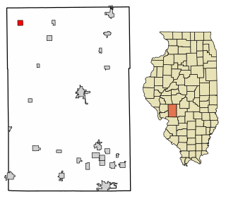
<span class="mw-page-title-main">Scottville, Illinois</span> Village in Illinois, United States

Scottville is a village in Macoupin County, Illinois, United States. The population was 93 at the 2020 census.

<span class="mw-page-title-main">Shipman, Illinois</span> Village in Illinois, United States

Shipman is a village in Macoupin County, Illinois, United States. The population was 511 at the 2020 census, down from 624 in 2010.

<span class="mw-page-title-main">Cincinnatus, New York</span> Town in New York, United States

Cincinnatus is a small town in Cortland County, New York, United States. The population was 910 at the 2020 census. The town is named after the Roman general Lucius Quinctius Cincinnatus. It is in the eastern part of the county and is east of the city of Cortland.
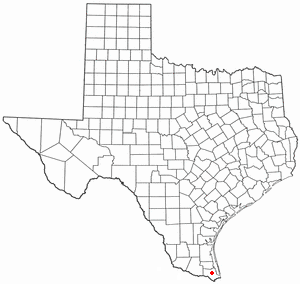
<span class="mw-page-title-main">Lozano, Texas</span> Census-designated place in Texas, United States

Lozano is a census-designated place (CDP) in Cameron County, Texas, United States. The population was 404 at the 2010 census, up from 324 at the 2000 census. It is part of the Brownsville–Harlingen Metropolitan Statistical Area.

<span class="mw-page-title-main">Suring, Wisconsin</span> Village in Wisconsin, United States

Suring is a village in Oconto County, Wisconsin, United States, along the 45th parallel. The population was 544 at the 2010 census. It is part of the Green Bay Metropolitan Statistical Area.

<span class="mw-page-title-main">Middle Village, Wisconsin</span> CDP in Wisconsin, United States

Middle Village is a census-designated place (CDP), in the towns of Menominee and Red Springs, in Menominee and Shawano counties in the U.S. state of Wisconsin. It does not have any legal status as an incorporated municipality. The population was 290 at the 2020 census.

Gratiot is a town in Lafayette County, Wisconsin, United States. The population was 550 at the 2010 census, down from 653 at the 2000 census. The village of Gratiot is located within the town. The unincorporated community of Riverside and part of the unincorporated community of Dunbarton are also in the town.

References

  1. "2020 U.S. Gazetteer Files". United States Census Bureau. Retrieved March 15, 2022.
  2. "USGS detail on Newtown" . Retrieved October 21, 2007.
  3. Illinois Central Magazine. Illinois Central Railroad Company. 1922. p. 42.
  4. "US Gazetteer files: 2010, 2000, and 1990". United States Census Bureau. February 12, 2011. Retrieved April 23, 2011.
  5. "G001 - Geographic Identifiers - 2010 Census Summary File 1". United States Census Bureau. Archived from the original on February 13, 2020. Retrieved October 26, 2015.
  6. "Census of Population and Housing". Census.gov. Retrieved June 4, 2015.
  7. 1 2 "U.S. Census website". United States Census Bureau . Retrieved January 31, 2008.