Merton Park | |
|---|---|
 | |
| General information | |
| Location | Merton Park, London Borough of Merton England |
| Operated by | Tramlink |
| Platforms | 2 |
| Construction | |
| Accessible | Yes |
| Other information | |
| Fare zone | London fare zones 3, 4, 5 and 6 |
| History | |
| Opened | 30 May 2000 |
| Passengers | |
| 2009–10 | 0.327 million total boardings and alightings [1] |
| 2010–11 | |
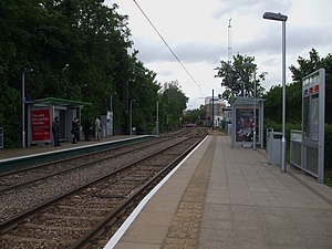
Merton Park tram stop is a stop on the Tramlink service in the London Borough of Merton.
Contents
It overlaps part of the site of the former Merton Park railway station which was served by passenger trains on the West Croydon to Wimbledon Line until 1997,and by trains via Tooting Junction on the Merton Abbey Branch until 1929. The station building of the original station (about 200 yards south) has been converted to a private house.
Access is provided by footpath from Kingston Road at the site of the old level crossing and signal box. A footpath also comes from the nearby nature preserve at Nursery Road playing fields and another level crossing from a footpath from Dorset Road (B285).