This article needs additional citations for verification .(October 2016) |
Mitcham | |
|---|---|
 | |
| General information | |
| Location | Mitcham, London Borough of Merton England |
| Operated by | Tramlink |
| Platforms | 2 |
| Construction | |
| Accessible | Yes |
| Other information | |
| Fare zone | London fare zones 3, 4, 5 and 6 |
| History | |
| Opened | 30 May 2000 (Tramlink) |
| Passengers | |
| 2009–10 | 0.858 million total boardings and alightings [1] |
| 2010–11 | |
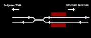
Mitcham tram stop is a Tramlink stop in Mitcham in the London Borough of Merton. It is located between Belgrave Walk and Mitcham Junction,just east of the former Mitcham railway station,which closed in 1997. The stop consists of twin platforms accessible by ramps at either end.