Mid North Coast

Last updated

Mid North Coast
New South Wales
McBrides Beach - panoramio.jpg
McBrides Beach, Forster, New South Wales
Australia New South Wales relief location map.png
Red pog.svg
Mid North Coast
Coordinates 31°16′S152°54′E / 31.267°S 152.900°E / -31.267; 152.900
Population308,372 (30 June 2016) [1]
 • Density14.4187/km2 (37.3442/sq mi)
Area21,387 km2 (8,257.6 sq mi)
Time zone AEST (UTC+10)
 • Summer (DST) AEDT (UTC+11)
LGA(s)
State electorate(s)
Federal division(s)
Localities around Mid North Coast:
Northern Tablelands Northern Rivers Tasman Sea
New England Mid North Coast Tasman Sea
Upper Hunter Hunter Tasman Sea

The Mid North Coast is a country region in the north-east of the state of New South Wales, Australia. The region, situated 416km north of Sydney, covers the mid northern coast of the state, beginning from Port Stephens at Hawks Nest to as far north as Woolgoolga, near Coffs Harbour. The region has many beaches and subtropical national parks and forests as well as rural farmland and logging. Major coastal towns include Coffs Harbour, Forster and Port Macquarie. The Mid North Coast is a popular destination for camping or resorts and surfing, with coastal and hinterland tracks, with the unique heritage-listed mountain village of Bellbrook popular for day trips inland or 4wd campers and keen bass fishers.

Contents

Heading northwards beyond Newcastle, the Mid North Coast region's main towns include the towns of Bulahdelah, Forster, Tuncurry, Wingham, Taree, Port Macquarie, Kempsey, South West Rocks, Macksville, Nambucca Heads, Bellingen and Coffs Harbour. Of these Taree, Port Macquarie and Coffs Harbour are the major commercial centres, all with large shopping centres, public facilities and attractions. Kempsey and Forster-Tuncurry are considered semi-major commercial centres. Smaller towns that are popular tourist spots are Bellbrook, North Haven, South West Rocks, Urunga, Gloucester, Crescent Head, Hawks Nest, Woolgoolga, Old Bar, Lake Cathie and Pacific Palms.

The region has a subtropical climate and is known for its waterways, beaches and hinterland of forests and farms. Major industries are farming, logging and tourism.

Demography and area

The following local government areas are contained within the region:

Population by Local Government Area
Mid North Coast rankLocal Government AreaPopulation 30 June 2016 [2] 10-year growth ratePopulation density (people/km2)
1 Mid Coast Council 91,9588.79.1
2 Port Macquarie-Hastings Council 79,90514.221.7
3 Coffs Harbour City Council 74,64112.063.6
4 Kempsey Shire Council 29,4545.18.7
5 Nambucca Shire Council 19,5216.713.1
6 Bellingen Shire Council 12,8931.48.1
Mid North Coast308,37210.014.4

Public transport

Bus

Many bus services run throughout the region. Providers include Buslines, Busways, Eggins, Ryans and Sawtell Coaches.

Rail

There are several railway stations on the Mid North Coast serviced by three trains; the Grafton, the Casino and the Brisbane XPT trains. Each run north and south once a day. Heading north from Sydney Central, the first station on the mid north coast is Gloucester followed by Wingham and Taree. Further north are Kendall, Wauchope (for Port Macquarie), Kempsey, Eungai, Macksville, Nambucca Heads, Urunga, Sawtell and Coffs Harbour. There is no station for Forster–Tuncurry.

Politics

The Mid North Coast includes six local government areas: the City of Coffs Harbour, the Bellingen Shire, the Kempsey Shire, the Mid-Coast Council, the Nambucca Shire and the Port Macquarie-Hastings Council. It also includes four state electorates (Coffs Harbour, Myall Lakes, Oxley and Port Macquarie) and two federal electorates (Cowper and Lyne).

The region is conservative and is dominated by the Coalition in state and federal politics, particularly the National Party. Of the two federal electorates, Cowper has only been held by Labor once (for one term) and Lyne has never been held by Labor (although was held by an independent for five years). In state politics, the Coalition safely holds all Mid North Coast electorates (the Nationals hold Coffs Harbour, Myall Lakes and Oxley while the Liberal Party holds Port Macquarie).

In the Australian Marriage Law Postal Survey, a 2018 plebiscite eventually legalising same-sex marriage in Australia, both of the federal Mid North Coast electorates recorded majorities for the "yes" vote, while in the 1999 Australian republic referendum and the 2023 Australian Indigenous Voice referendum, they both recorded majorities for the "no" vote.

See also

Related Research Articles

<span class="mw-page-title-main">Coffs Harbour</span> City in New South Wales, Australia

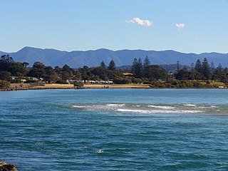
Coffs Harbour, locally nicknamed Coffs, is a coastal city on the Mid North Coast of New South Wales, Australia, 540 km (340 mi) north of Sydney, and 390 km (240 mi) south of Brisbane. It is one of the largest urban centres on the North Coast, with a population of 78,759 as per 2021 census. The Gumbaynggirr are the original people of the Coffs Harbour region.

<span class="mw-page-title-main">Pacific Highway (Australia)</span> Highway in New South Wales and Queensland

Pacific Highway is a 790-kilometre-long (491 mi) national highway and major transport route along the central east coast of Australia, with the majority of it being part of Australia's Highway 1. The highway and its adjoining Pacific Motorway between Brisbane and Brunswick Heads and Pacific Motorway between Sydney and Newcastle links the state capitals of Sydney in New South Wales with Brisbane in Queensland, approximately paralleling the Tasman Sea and the Coral Sea of the South Pacific Ocean coast, via regional cities and towns like Gosford, Newcastle, Taree, Port Macquarie, Kempsey, Coffs Harbour, Grafton, Ballina, Byron Bay, Tweed Heads and the Gold Coast, which is part of Queensland. Additionally, between Brunswick Heads and Port Macquarie, the road is also signed as Pacific Motorway, but has not been legally gazetted as such.

<span class="mw-page-title-main">North Coast railway line, New South Wales</span> Railway line in New South Wales, Australia

The North Coast Line is the primary rail route in the Mid North Coast and Northern Rivers regions of New South Wales, Australia, and forms a major part of the Sydney–Brisbane rail corridor.

<span class="mw-page-title-main">Urunga, New South Wales</span> Town in New South Wales, Australia

Urunga is a small town located within the Mid North Coast region of New South Wales, Australia, in Bellingen Shire. It is famous for its surf spots. At the 2021 census, Urunga had a population of 3,185. The town is south of Coffs Harbour and Sawtell and north of Nambucca Heads. The place name is derived from the Gumbaynggir word Yurūnga, which is derived from the word for long yurūn in reference to "long white sands".

<span class="mw-page-title-main">Eungai, New South Wales</span> Town in New South Wales, Australia

Eungai is a town on the mid-North Coast of New South Wales, Australia. It is made up of two localities, Eungai Creek and Eungai Rail, although both have the same postcode. The Eungai district is midway between Sydney (500 km) and Brisbane, midway between Port Macquarie (90 km) and Coffs Harbour, and midway between Kempsey (20 km) and Macksville. It is in the Nambucca Valley. It has a population of 605 in the 2021 census.

<span class="mw-page-title-main">AFL North Coast</span>

The AFL North Coast is a park Australian rules football competition in the Mid North Coast region of New South Wales. Founded in 1982 as The North Coast Australian Football League it merged with the junior league in its area in 2008 and was renamed AFL North Coast.

Group 2 is a rugby league competition on the north coast of New South Wales Since 1966, run under the auspices of the Country Rugby League. The Group 2 area runs from Grafton in the north to Macksville in the south. Group 2 teams played for many decades before 1966 when some redistribution, amalgamation or control mechanism presumably changed. Teams on the Nambucca River, namely Bowraville, Macksville and Nambucca Heads played in a southern division against Kempsey, Smithtown, Port Macquarie and Wauchope before 1966.

Group 3 is a rugby league competition on the north coast of New South Wales, run under the auspices of the Country Rugby League. The Group 3 area runs from Kempsey in the north to Forster in the south.

Raw FM is an Australian narrowcast radio network, consisting of stations in New South Wales, Australian Capital Territory, Victoria and Queensland.

Raleigh is a small town in the Mid North Coast region of New South Wales, Australia, in Bellingen Shire. At the 2011 census, Raleigh had a population of 550. The town is south of Coffs Harbour and Sawtell and north of Nambucca Heads. It is located in Raleigh County and is perhaps named after it. It has one school, Raleigh Public School, which is located opposite a Norco dairy factory. A railway station on the North Coast line opened in 1915, but was subsequently closed and demolished.

ABC Mid North Coast is an ABC Local Radio station based in Port Macquarie and broadcasting to the Mid North Coast region in New South Wales. This includes the towns and cities of Grafton, Coffs Harbour, Kempsey and Taree.

<span class="mw-page-title-main">King Brothers (bus operator)</span> Australian bus company operating scheduled and school services

King Brothers was an Australian bus company operating route and school services in the Mid North Coast region of New South Wales. It collapsed in April 2003 with debts of $220 million, after owners Peter and Tony King were charged with and later convicted of fraud.

The 2015 NNSW FFA Cup qualifying rounds and finals series was a knockout competition run in Northern New South Wales, by Northern NSW Football, used to determine the two Northern NSW entrants to the national 2015 FFA Cup. For the Preliminary rounds, Football Far North Coast kicked off the overall competition with matches on 13 February.

Oxley is an electoral district of the Legislative Assembly in the Australian state of New South Wales.

Dorrigo Shire was a local government area in the Mid North Coast region of New South Wales, Australia.

Giinagay Way is a road in the Mid North Coast region of New South Wales linking the towns of Warrell Creek, Macksville, Nambucca Heads and Urunga to Pacific Highway. It runs along a former section of the highway between Eungai Creek and Raleigh that was bypassed by a new parallel alignment between 2016 and 2018.

Solitary Islands Way is a road in the Mid North Coast region of New South Wales, located north of the city of Coffs Harbour. It links the towns of Woolgoolga and Corindi Beach to the Pacific Highway. It consists of a mix of newly constructed roads, pre-existing Council-owned roads and former sections of the highway that were bypassed by new alignments in 2013 and 2017.

References

  1. Statistics, c=AU; o=Commonwealth of Australia; ou=Australian Bureau of. "Main Features - Main Features". abs.gov.au. Archived from the original on 10 October 2017. Retrieved 3 May 2018.{{cite web}}: CS1 maint: multiple names: authors list (link)
  2. "3218.0 – Regional Population Growth, Australia, 2016". Australian Bureau of Statistics. Archived from the original on 29 July 2017.