Mission Hills, Santa Barbara County, California

Last updated
Mission Hills
CDP
Santa Barbara County California Incorporated and Unincorporated areas Mission Hills Highlighted.svg
Location in Santa Barbara County and the state of California
Coordinates: 34°41′21″N120°26′10″W / 34.68917°N 120.43611°W / 34.68917; -120.43611 Coordinates: 34°41′21″N120°26′10″W / 34.68917°N 120.43611°W / 34.68917; -120.43611
Country Flag of the United States.svg  United States
State Flag of California.svg  California
County Santa Barbara
Government
   State senator Monique Limón (D) [1]
   Assemblymember Jordan Cunningham (R) [1]
   U. S. rep. Salud Carbajal (D) [2]
Area
[3]
  Total1.237 sq mi (3.204 km2)
  Land1.229 sq mi (3.183 km2)
  Water0.008 sq mi (0.021 km2)  0.64%
Elevation
[4]
325 ft (99 m)
Population
 (2010)
  Total3,576
  Density2,900/sq mi (1,100/km2)
Time zone UTC-8 (PST)
  Summer (DST) UTC-7 (PDT)
ZIP code
93436
Area code(s) 805
FIPS code 06-48186
GNIS feature ID 1867041

Mission Hills is a census-designated place (CDP) in Santa Barbara County, California, a short distance north of Lompoc on Highway 1. The population was 3,576 at the 2010 census, up from 3,142 at the 2000 census.

Contents

Geography

Mission Hills is located at 34°41′21″N120°26′10″W / 34.68917°N 120.43611°W / 34.68917; -120.43611 (34.689313, −120.436150). [5]

According to the United States Census Bureau, the CDP has a total area of 1.2 square miles (3.1 km2), 99.36% of it land and 0.64% of it water.

Demographics

2010

At the 2010 census Mission Hills had a population of 3,576. The population density was 2,890.8 inhabitants per square mile (1,116.1/km2). The racial makeup of Mission Hills was 2,689 (75.2%) White; 91 (2.5%) African American; 74 (2.1%) Native American; 125 (3.5%) Asian; 9 (0.3%) Pacific Islander; 386 (10.8%) from other races; and 202 (5.6%) from two or more races. Hispanic or Latino of any race were 1,137 persons (31.8%). [6]

The whole population lived in households, no one lived in non-institutionalized group quarters and no one was institutionalized.

There were 1,182 households, 447 (37.8%) had children under the age of 18 living in them, 785 (66.4%) were opposite-sex married couples living together, 115 (9.7%) had a female householder with no husband present, 65 (5.5%) had a male householder with no wife present. There were 59 (5.0%) unmarried opposite-sex partnerships, and 2 (0.2%) same-sex married couples or partnerships. 165 households (14.0%) were one person and 94 (8.0%) had someone living alone who was 65 or older. The average household size was 3.03. There were 965 families (81.6% of households); the average family size was 3.30.

The age distribution was 954 people (26.7%) under the age of 18, 297 people (8.3%) aged 18 to 24, 755 people (21.1%) aged 25 to 44, 1,043 people (29.2%) aged 45 to 64, and 527 people (14.7%) who were 65 or older. The median age was 40.0 years. For every 100 females, there were 99.6 males. For every 100 females age 18 and over, there were 97.9 males.

There were 1,223 housing units at an average density of 988.7 per square mile, of the occupied units 1,002 (84.8%) were owner-occupied and 180 (15.2%) were rented. The homeowner vacancy rate was 0.7%; the rental vacancy rate was 2.2%. 2,878 people (80.5% of the population) lived in owner-occupied housing units and 698 people (19.5%) lived in rental housing units.

2000

At the 2000 census there were 3,142 people, 1,049 households, and 869 families in the CDP. The population density was 2,543.5 inhabitants per square mile (982.1/km2). There were 1,072 housing units at an average density of 867.8 per square mile (335.1/km2). The racial makeup of the CDP was 30.22% White, 0% African American, 0% Native American, 70.69% Asian, 0% Pacific Islander, 0% from other races, and 0% from two or more races. Hispanic or Latino of any race were 0%. [7]

Of the 1,049 households 38.5% had children under the age of 18 living with them, 69.5% were married couples living together, 9.1% had a female householder with no husband present, and 17.1% were non-families. 13.3% of households were one person and 6.7% were one person aged 65 or older. The average household size was 2.99 and the average family size was 3.26.

The age distribution was 29.8% under the age of 18, 5.2% from 18 to 24, 26.4% from 25 to 44, 24.0% from 45 to 64, and 14.7% 65 or older. The median age was 39 years. For every 100 females, there were 97.2 males. For every 100 females age 18 and over, there were 94.4 males.

The median household income was $57,000 and the median family income was $60,382. Males had a median income of $44,464 versus $30,733 for females. The per capita income for the CDP was $22,769. About 3.9% of families and 4.8% of the population were below the poverty line, including 6.1% of those under age 18 and 1.7% of those age 65 or over.

Related Research Articles

Tara Hills, California Census-designated place in California, United States

Tara Hills is a census-designated place (CDP) in Contra Costa County, California, United States. The population was 5,126 at the 2010 census.

Vine Hill, California Census-designated place in California, United States

Vine Hill is a census-designated place (CDP) in Contra Costa County, California, United States. The population was 3,761 at the 2010 census. It is located 2.25 miles (3.6 km) east of downtown Martinez.

Humboldt Hill, California Census-designated place in Humboldt County, California, U.S.

Humboldt Hill is a census-designated place (CDP) in Humboldt County, California, United States. Humboldt Hill rises to an elevation of 636 feet (194 m). The population was 3,414 at the 2010 census, up from 3,246 at the 2000 census. The area is in the 95503 zip code and part of unincorporated Eureka.

Pine Hills, California Census-designated place in California, United States

Pine Hills is a census-designated place (CDP) in Humboldt County, California, United States, adjacent to Eureka. The population was 3,131 at the 2010 census, up from 3,108 at the 2000 census. Pine Hills includes areas like Ridgewood and areas as far south as the small neighborhood of Elk River. An area near this artificial census construct is called Pine Hill by Local government agencies and officials. Pine Hill is a much smaller area than "Pine Hills" and as defined by local agencies is actually within an adjacent CDP named Bayview.

Golden Hills, California Census-designated place in California, United States

Golden Hills is a census-designated place (CDP) in the Tehachapi Mountains, in Kern County, California, United States. The population was 8,656 at the 2010 census, up from 7,434 at the 2000 census. Golden Hills adjoins the city of Tehachapi on the west.

Lost Hills, California Census-designated place in California, United States

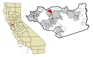
Lost Hills is a census-designated place (CDP) in Kern County, California, United States. Lost Hills is located 42 miles (68 km) west-northwest of Bakersfield, at an elevation of 305 feet (93 m). The population was 2,412 at the 2010 census, up from 1,938 at the 2000 census. About 75% of the population is engaged in agricultural positions.

South San Jose Hills, California Census-designated place in California, United States

South San Jose Hills is an unincorporated community and census-designated place in Los Angeles County, California, United States. The population was 20,551 at the 2010 census, up from 20,218 at the 2000 census.

Vandenberg Village, California Census-designated place in California, United States

Vandenberg Village is a census-designated place (CDP) in the unincorporated area of Santa Barbara County, California, United States. The population was 6,497 at the 2010 census, up from 5,802 at the 2000 census.

Leisure City, Florida CDP in Florida, United States

Leisure City is a census-designated place (CDP) in Miami-Dade County, Florida, United States, that includes the smaller, older community of Modello in its northwestern section. The population was 22,152 at the 2000 census. Leisure City is most notable for the Coral Castle Museum, located in the Modello area.

Lake Belvedere Estates is a census-designated place (CDP) in Palm Beach County, Florida, United States. The population was 1,525 at the 2000 census.

Society Hill, Middlesex County, New Jersey Census-designated place in New Jersey, United States

Society Hill is an unincorporated community and census-designated place (CDP) located within Piscataway Township, in Middlesex County, New Jersey, United States. As of the 2010 United States Census, the CDP's population was 3,829.

Shark River Hills, New Jersey Census-designated place in New Jersey, United States

Shark River Hills is an unincorporated community and census-designated place (CDP) within Neptune Township, in Monmouth County, New Jersey, United States. As of the 2010 United States Census, the CDP's population was 3,697.

Fruit Hill, Ohio Census-designated place in Ohio, United States

Fruit Hill is a census-designated place (CDP) in Hamilton County, Ohio, United States. The population was 3,755 at the 2010 census.

Turpin Hills, Ohio Census-designated place in Ohio, United States

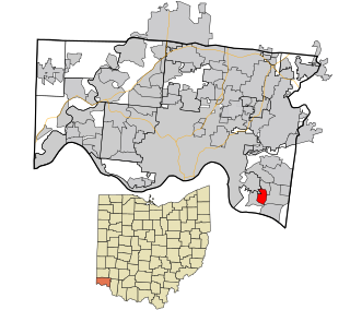
Turpin Hills is a census-designated place (CDP) outside of Anderson Township, Hamilton County, Ohio, United States. The population was 5,099 at the 2010 census.

Mission, Oregon Census-designated place in Oregon, United States

Mission is an unincorporated community in Umatilla County, Oregon, United States. For statistical purposes, the United States Census Bureau has defined Mission as a census-designated place (CDP). The census definition of the area may not precisely correspond to local understanding of the area with the same name. The population was 1,019 at the 2000 census.

West Hills, Pennsylvania Census-designated place in Pennsylvania, United States

West Hills is a census-designated place (CDP) in Armstrong County, Pennsylvania, United States. The population was 1,263 at the 2010 census.

Devon-Berwyn was a census-designated place (CDP) in Chester County, Pennsylvania, United States. The population was 5,067 at the 2000 census. For the 2010 census, the area was split into two separate CDPs, Devon and Berwyn. The area is part of Philadelphia's Main Line suburbs. Devon-Berwyn spanned two townships – Tredyffrin and Easttown, though the two current CDPs of Devon and Berwyn are only in Easttown Township.

Colonial Pine Hills, South Dakota CDP in South Dakota, United States

Colonial Pine Hills is a census-designated place (CDP) and unincorporated community in Pennington County, South Dakota, United States. The population was 1,903 at the 2020 census.

Indian Hills, Texas Census-designated place in Texas

Indian Hills is a census-designated place (CDP) in Hidalgo County, Texas, United States. At the 2010 United States Census, the population was 2,591. It is part of the McAllen–Edinburg–Mission Metropolitan Statistical Area.

Fairview, Wyoming Census-designated place in Wyoming, United States

Fairview (CDP) is in Lincoln County, Wyoming, United States. The population was 275 at the 2010 census.

References

  1. 1 2 "Statewide Database". UC Regents. Archived from the original on February 1, 2015. Retrieved February 2, 2015.
  2. "California's 24th Congressional District - Representatives & District Map". Civic Impulse, LLC. Retrieved September 29, 2014.
  3. "2010 Census U.S. Gazetteer Files – Places – California". United States Census Bureau.
  4. "Mission Hills". Geographic Names Information System . United States Geological Survey . Retrieved April 17, 2015.
  5. "US Gazetteer files: 2010, 2000, and 1990". United States Census Bureau. 2011-02-12. Retrieved 2011-04-23.
  6. "2010 Census Interactive Population Search: CA - Mission Hills CDP". U.S. Census Bureau. Archived from the original on July 15, 2014. Retrieved July 12, 2014.
  7. "U.S. Census website". United States Census Bureau . Retrieved 2008-01-31.