Morse Bluff, Nebraska

Last updated

Morse Bluff, Nebraska
Morse Bluff, Nebraska downtown 1.jpg
Looking south at downtown Morse Bluff,
October 2011
Saunders County Nebraska Incorporated and Unincorporated areas Morse Bluff Highlighted.svg
Location of Morse Bluff, Nebraska
Coordinates: 41°25′51″N96°45′59″W / 41.43083°N 96.76639°W / 41.43083; -96.76639
Country United States
State Nebraska
County Saunders
Area
[1]
  Total0.18 sq mi (0.46 km2)
  Land0.18 sq mi (0.46 km2)
  Water0.00 sq mi (0.00 km2)
Elevation
[2]
1,289 ft (393 m)
Population
 (2020)
  Total117
  Density661.02/sq mi (254.80/km2)
Time zone UTC-6 (Central (CST))
  Summer (DST) UTC-5 (CDT)
ZIP code
68648
Area code 402
FIPS code 31-32865 [3]
GNIS feature ID2399401 [2]

Morse Bluff is a village in Saunders County, Nebraska, United States. The population was 117 at the 2020 census.

Contents

History

Morse Bluff was platted in 1887 when the Chicago & North Western Railroad was extended to that point. [4] [5] It was named for Chester Morse, the original owner of the town site. [4] [6]

Geography

According to the United States Census Bureau, the village has a total area of 0.18 square miles (0.47 km2), all land. [7]

Demographics

Historical population
CensusPop.Note
1900 177
1910 19610.7%
1920 2159.7%
1930 179−16.7%
1940 170−5.0%
1950 142−16.5%
1960 119−16.2%
1970 16236.1%
1980 132−18.5%
1990 128−3.0%
2000 1344.7%
2010 1350.7%
2020 117−13.3%
U.S. Decennial Census [8]

2010 census

As of the census [9] of 2010, there were 135 people, 58 households, and 39 families living in the village. The population density was 750.0 inhabitants per square mile (289.6/km2). There were 60 housing units at an average density of 333.3 per square mile (128.7/km2). The racial makeup of the village was 99.3% White and 0.7% Asian. Hispanic or Latino of any race were 2.2% of the population.

There were 58 households, of which 31.0% had children under the age of 18 living with them, 51.7% were married couples living together, 8.6% had a female householder with no husband present, 6.9% had a male householder with no wife present, and 32.8% were non-families. 31.0% of all households were made up of individuals, and 10.3% had someone living alone who was 65 years of age or older. The average household size was 2.33 and the average family size was 2.92.

The median age in the village was 39.3 years. 25.9% of residents were under the age of 18; 11.1% were between the ages of 18 and 24; 18.4% were from 25 to 44; 30.3% were from 45 to 64; and 14.1% were 65 years of age or older. The gender makeup of the village was 47.4% male and 52.6% female.

2000 census

As of the census [3] of 2000, there were 134 people, 58 households, and 40 families living in the village. The population density was 746.4 inhabitants per square mile (288.2/km2). There were 59 housing units at an average density of 328.6 per square mile (126.9/km2). The racial makeup of the village was 100.00% White. Hispanic or Latino of any race were 1.49% of the population.

There were 58 households, out of which 41.4% had children under the age of 18 living with them, 55.2% were married couples living together, 8.6% had a female householder with no husband present, and 31.0% were non-families. 31.0% of all households were made up of individuals, and 13.8% had someone living alone who was 65 years of age or older. The average household size was 2.31 and the average family size was 2.88.

In the village, the population was spread out, with 28.4% under the age of 18, 6.7% from 18 to 24, 26.9% from 25 to 44, 17.2% from 45 to 64, and 20.9% who were 65 years of age or older. The median age was 37 years. For every 100 females, there were 100.0 males. For every 100 females age 18 and over, there were 100.0 males.

As of 2000 the median income for a household in the village was $30,625, and the median income for a family was $41,875. Males had a median income of $25,625 versus $16,750 for females. The per capita income for the village was $14,051. There were no families and 3.0% of the population living below the poverty line, including no under eighteens and 6.9% of those over 64.

See also

Related Research Articles

<span class="mw-page-title-main">Saunders County, Nebraska</span> County in Nebraska, United States

Saunders County is a county in the U.S. state of Nebraska. As of the 2020 United States Census, the population was 22,278. Its county seat is Wahoo.

<span class="mw-page-title-main">Cass County, Nebraska</span> County in Nebraska, United States

Cass County is a county in the U.S. state of Nebraska. As of the 2020 United States Census, the population was 26,598. Its county seat and largest city is Plattsmouth. The county was formed in 1855, and was named for General Lewis Cass, an American military officer, politician, and statesman.

<span class="mw-page-title-main">Homer, Nebraska</span> Villages in Dakota County, Nebraska, United States

Homer is a village in Dakota County, Nebraska, United States. It is part of the Sioux City, IA–NE–SD Metropolitan Statistical Area. The population was 549 at the 2010 census.
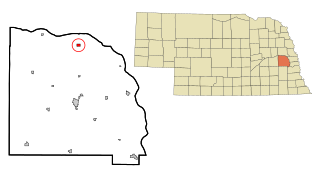
<span class="mw-page-title-main">Cedar Bluffs, Nebraska</span> Village in Saunders County, Nebraska, United States

Cedar Bluffs is a village in Saunders County, Nebraska, United States. The population was 615 at the 2020 census. Cedar Bluffs was a point on the Mormon, Oregon, and California Trails.

<span class="mw-page-title-main">Ceresco, Nebraska</span> Village in Saunders County, Nebraska, United States

Ceresco is a farming village in Saunders County, Nebraska, United States. The population was 919 at the 2020 census. It is located near U.S. Highway 77, just north of Lincoln, just south of Wahoo, and a short distance southwest of Omaha.

<span class="mw-page-title-main">Colon, Nebraska</span> Village in Saunders County, Nebraska, United States

Colon is a village in Saunders County, Nebraska, United States. The population was 107 at the 2020 census. Amenities include a post office and bank branch. Colon is seven miles north of the county seat Wahoo.

<span class="mw-page-title-main">Ithaca, Nebraska</span> Village in Saunders County, Nebraska, United States

Ithaca is a village in Saunders County, Nebraska, United States. The population was 160 at the 2020 census.

<span class="mw-page-title-main">Leshara, Nebraska</span> Village in Saunders County, Nebraska, United States

Leshara is a village in Saunders County, Nebraska, United States. The population was 108 at the 2020 census.
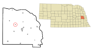
<span class="mw-page-title-main">Malmo, Nebraska</span> Village in Saunders County, Nebraska, United States

Malmo is a village in Saunders County, Nebraska, United States. The population was 94 at the 2020 census.
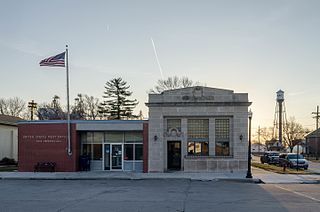
<span class="mw-page-title-main">Mead, Nebraska</span> Village in Saunders County, Nebraska, United States

Mead is a village in Saunders County, Nebraska, United States. The population was 617 at the 2020 census.

<span class="mw-page-title-main">Memphis, Nebraska</span> Village in Nebraska, United States

Memphis is a village in Saunders County, Nebraska, United States. The population was 109 at the 2020 census.

<span class="mw-page-title-main">Prague, Nebraska</span> Village in Saunders County, Nebraska, United States

Prague is a village in Saunders County, Nebraska, United States. The population was 291 at the 2020 census. It was named after Prague, capital of Bohemia.

<span class="mw-page-title-main">Valparaiso, Nebraska</span> Village in Saunders County, Nebraska, United States

Valparaiso is a village in Saunders County, Nebraska, United States. The population was 595 at the 2020 census.
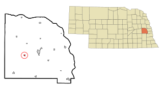
<span class="mw-page-title-main">Weston, Nebraska</span> Village in Saunder County, Nebraska, United States

Weston is a village in Saunders County, Nebraska, United States. The population was 250 at the 2020 census.

<span class="mw-page-title-main">Yutan, Nebraska</span> City in Saunders County, Nebraska, United States

Yutan is a city in Saunders County, Nebraska, United States.
<span class="mw-page-title-main">Henry, Nebraska</span> Village in Nebraska, United States

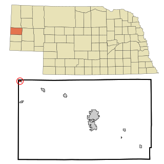
Henry is a village in Scotts Bluff County, Nebraska, United States. It is part of the Scottsbluff, Nebraska Micropolitan Statistical Area. The population was 106 at the 2010 census.
<span class="mw-page-title-main">Lyman, Nebraska</span> Village in Scotts Bluff County, Nebraska, United States

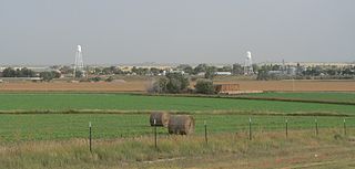
Lyman is a village in Scotts Bluff County, Nebraska, United States. It is part of the Scottsbluff, Nebraska Micropolitan Statistical Area. The population was 341 at the 2010 census.

<span class="mw-page-title-main">McGrew, Nebraska</span> Village in Scotts Bluff County, Nebraska, United States

McGrew is a village in Scotts Bluff County, Nebraska, United States. It is part of the Scottsbluff, Nebraska Micropolitan Statistical Area. The population was 105 at the 2010 census.

<span class="mw-page-title-main">Melbeta, Nebraska</span> Village in Scotts Bluff County, Nebraska, United States

Melbeta is a village in Scotts Bluff County, Nebraska, United States. It is part of the Scottsbluff, Nebraska Micropolitan Statistical Area. The population was 112 at the 2010 census.

<span class="mw-page-title-main">Morrill, Nebraska</span> Village in Scotts Bluff County, Nebraska, United States

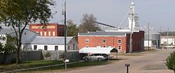
Morrill is a village located in Scotts Bluff County, Nebraska, United States, in the western Panhandle of the state. Morrill is part of the Scottsbluff, Nebraska Micropolitan Statistical Area. The population was 921 at the 2010 census.
References

  1. "ArcGIS REST Services Directory". United States Census Bureau. Retrieved September 18, 2022.
  2. 1 2 U.S. Geological Survey Geographic Names Information System: Morse Bluff, Nebraska
  3. 1 2 "U.S. Census website". United States Census Bureau . Retrieved January 31, 2008.
  4. 1 2 "Morse Bluff, Saunders County". Center for Advanced Land Management Information Technologies. University of Nebraska. Retrieved August 23, 2014.
  5. Chicago and North Western Railway Company (1908). A History of the Origin of the Place Names Connected with the Chicago & North Western and Chicago, St. Paul, Minneapolis & Omaha Railways. p. 105.
  6. Perky, Charles (1915). Past and Present of Saunders County, Nebraska: A Record of Settlement, Organization, Progress and Achievement. S.J. Clarke publishing Company. p. 130.
  7. "US Gazetteer files 2010". United States Census Bureau. Archived from the original on January 25, 2012. Retrieved June 24, 2012.
  8. "Census of Population and Housing". Census.gov. Retrieved June 4, 2015.
  9. "U.S. Census website". United States Census Bureau . Retrieved June 24, 2012.

Commons-logo.svg Media related to Morse Bluff, Nebraska at Wikimedia Commons