Yutan, Nebraska

Last updated

Yutan, Nebraska
Rusty Rooster Bar Yutan, NE.jpg
Rusty Rooster Bar in downtown Yutan,
March 2017
Saunders County Nebraska Incorporated and Unincorporated areas Yutan Highlighted.svg
Location of Yutan, Nebraska
USA Nebraska relief location map.svg
Red pog.svg
Yutan
Location within Nebraska
Usa edcp relief location map.png
Red pog.svg
Yutan
Location within the United States
Coordinates: 41°14′40″N96°23′54″W / 41.24444°N 96.39833°W / 41.24444; -96.39833
Country United States
State Nebraska
County Saunders
Township Union
Area
[1]
  Total0.57 sq mi (1.49 km2)
  Land0.57 sq mi (1.49 km2)
  Water0.00 sq mi (0.00 km2)
Elevation
[2]
1,155 ft (352 m)
Population
 (2020)
  Total1,347
  Density2,346.69/sq mi (906.30/km2)
Time zone UTC-6 (Central (CST))
  Summer (DST) UTC-5 (CDT)
ZIP code
68073
Area code 402
FIPS code 31-54115
GNIS feature ID2397396 [2]
Website www.cityofyutan.com

Yutan is a city in Saunders County, Nebraska, United States.

Contents

History

Yutan was originally called Clear Creek, and under the latter name was platted in 1876 when the Omaha and Republican Valley Railroad was extended to that point. It was renamed in 1884 after Ietan, an Otoe Indian chief. [3] [4] [5]

Geography

According to the United States Census Bureau, the city has a total area of 0.53 square miles (1.37 km2), all land. [6]

Demographics

Historical population
CensusPop.Note
1890 168
1900 26356.5%
1910 35334.2%
1920 300−15.0%
1930 3134.3%
1940 268−14.4%
1950 2877.1%
1960 33516.7%
1970 50751.3%
1980 63124.5%
1990 626−0.8%
2000 1,21694.2%
2010 1,174−3.5%
2020 1,34714.7%
U.S. Decennial Census [7]
Yutan Rail Yard, June 2006 Yutan, Nebraska.JPG
Yutan Rail Yard, June 2006

2010 census

As of the census [8] of 2010, there were 1,174 people, 432 households, and 324 families living in the city. The population density was 2,215.1 inhabitants per square mile (855.3/km2). There were 449 housing units at an average density of 847.2 per square mile (327.1/km2). The racial makeup of the city was 98.0% White, 0.9% African American, 0.1% Native American, 0.1% Asian, 0.4% from other races, and 0.5% from two or more races. Hispanic or Latino of any race were 1.9% of the population.

There were 432 households, of which 41.7% had children under the age of 18 living with them, 56.5% were married couples living together, 12.0% had a female householder with no husband present, 6.5% had a male householder with no wife present, and 25.0% were non-families. 20.4% of all households were made up of individuals, and 8.4% had someone living alone who was 65 years of age or older. The average household size was 2.72 and the average family size was 3.12.

The median age in the city was 35.4 years. 30.9% of residents were under the age of 18; 7.3% were between the ages of 18 and 24; 25% were from 25 to 44; 26.8% were from 45 to 64; and 10% were 65 years of age or older. The gender makeup of the city was 50.1% male and 49.9% female.

2000 census

As of the census of 2000, there were 1,216 people, 406 households, and 319 families living in the city. The population density was 2,561.3 inhabitants per square mile (988.9/km2). There were 423 housing units at an average density of 891.0 per square mile (344.0/km2). The racial makeup of the city was 96.71% White, 0.16% African American, 0.82% Native American, 0.49% Asian, 0.25% from other races, and 1.56% from two or more races. Hispanic or Latino of any race were 1.15% of the population.

There were 406 households, out of which 45.1% had children under the age of 18 living with them, 63.1% were married couples living together, 11.8% had a female householder with no husband present, and 21.4% were non-families. 17.7% of all households were made up of individuals, and 7.1% had someone living alone who was 65 years of age or older. The average household size was 3.00 and the average family size was 3.43.

In the city, the population was spread out, with 35.0% under the age of 18, 8.1% from 18 to 24, 31.8% from 25 to 44, 17.8% from 45 to 64, and 7.3% who were 65 years of age or older. The median age was 32 years. For every 100 females, there were 103.0 males. For every 100 females age 18 and over, there were 92.7 males.

As of 2000 the median income for a household in the city was $44,844, and the median income for a family was $52,273. Males had a median income of $36,310 versus $25,850 for females. The per capita income for the city was $16,675. About 1.9% of families and 2.6% of the population were below the poverty line, including 3.5% of those under age 18 and 9.3% of those age 65 or over.

Education

Yutan's schools are administered by Yutan Public Schools. Yutan Elementary School and Yutan High School are located in the city.

See also

Related Research Articles

<span class="mw-page-title-main">Ainsworth, Nebraska</span> City in and county seat of Brown County, Nebraska, United States

Ainsworth is a city and county seat of Brown County, Nebraska, United States. The population was 1,728 at the 2010 census.

<span class="mw-page-title-main">Edgar, Nebraska</span> City in Nebraska, United States

Edgar is a city in Clay County, Nebraska, United States. The population was 498 at the 2010 census. It is part of the Hastings, Nebraska Micropolitan Statistical Area.

<span class="mw-page-title-main">Mason City, Nebraska</span> Village in Nebraska, United States

Mason City is a village in Custer County, Nebraska, United States. The population was 171 at the 2010 census.

<span class="mw-page-title-main">Bennington, Nebraska</span> City in Douglas County, Nebraska, United States

Bennington is a city in Douglas County, Nebraska, United States. The population was 2,026 at the 2020 U.S. Census.

<span class="mw-page-title-main">Valley, Nebraska</span> City in Douglas County, Nebraska, United States

Valley is a city in Douglas County, Nebraska, United States. The population was 3,037 at the 2020 census.

<span class="mw-page-title-main">Franklin, Nebraska</span> City in Nebraska, United States

Franklin is a city in Franklin County, Nebraska, United States. The population was 1,000 at the 2010 census. It is the county seat of Franklin County.

<span class="mw-page-title-main">Blue Springs, Nebraska</span> City in Nebraska, United States

Blue Springs is a city in Gage County, Nebraska, United States. The population was 282 at the 2020 census.

<span class="mw-page-title-main">Creighton, Nebraska</span> City in Nebraska, United States

Creighton is a city in Knox County, Nebraska, United States. The population was 1,154 at the 2010 census.

<span class="mw-page-title-main">Fullerton, Nebraska</span> City in and county seat of Nance County, Nebraska, United States

Fullerton is a city in, and the county seat of, Nance County, Nebraska, United States. The population was 1,307 as of the 2010 Census.

<span class="mw-page-title-main">Osmond, Nebraska</span> City in Nebraska, United States

Osmond is a city in Pierce County, Nebraska, United States. It is part of the Norfolk, Nebraska Micropolitan Statistical Area. The population was 791 at the 2020 census.

<span class="mw-page-title-main">Wilber, Nebraska</span> City in Nebraska, United States

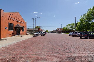
Wilber is a city in Saline County, Nebraska, United States. The population was 1,855 at the 2010 census. It is the county seat of Saline County. Wilber is the official "Czech Capital of the USA" and hosts an annual Czech festival in August. Wilber's school is the Wilber-Clatonia High School.

<span class="mw-page-title-main">Gretna, Nebraska</span> City in Nebraska, United States

Gretna is a city in Sarpy County, Nebraska, United States. The population was 5,083 at the 2020 census.

<span class="mw-page-title-main">Springfield, Nebraska</span> City in Nebraska, United States

Springfield is a city in Sarpy County, Nebraska, United States. The population was 1,501 at the 2020 census.

<span class="mw-page-title-main">Leshara, Nebraska</span> Village in Saunders County, Nebraska, United States

Leshara is a village in Saunders County, Nebraska, United States. The population was 108 at the 2020 census.

<span class="mw-page-title-main">Valparaiso, Nebraska</span> Village in Saunders County, Nebraska, United States

Valparaiso is a village in Saunders County, Nebraska, United States. The population was 595 at the 2020 census.

<span class="mw-page-title-main">Rushville, Nebraska</span> City in and county seat of Sheridan Count, Nebraska, United States

Rushville is a city in Sheridan County, Nebraska, United States, in the remote Sandhills Region. Its population was 890 at the 2010 census. It is the county seat of Sheridan County.

<span class="mw-page-title-main">Fort Calhoun, Nebraska</span> City in Washington County, Nebraska, United States

Fort Calhoun is a city in Washington County, Nebraska, United States. The population was 908 at the 2010 census. The city includes Fort Atkinson, the first fort built west of the Missouri River.

<span class="mw-page-title-main">Wayne, Nebraska</span> City in Wayne County, Nebraska, United States

Wayne is a city in Wayne County, Nebraska, United States. The population was 5,660 at the 2010 census. It is the county seat of Wayne County and the home of Wayne State College.

<span class="mw-page-title-main">Wakefield, Nebraska</span> City in Dixon and Wayne counties in Nebraska, United States

Wakefield is a city in Dixon and Wayne Counties in the State of Nebraska. The population was 1,451 at the 2010 census.

<span class="mw-page-title-main">Newman Grove, Nebraska</span> City in Nebraska, United States

Newman Grove is a city in Madison and Platte Counties in the U.S. state of Nebraska. The population was 721 at the 2010 census.

References

  1. "ArcGIS REST Services Directory". United States Census Bureau. Retrieved September 18, 2022.
  2. 1 2 U.S. Geological Survey Geographic Names Information System: Yutan, Nebraska
  3. "Yutan, Saunders County". Center for Advanced Land Management Information Technologies. University of Nebraska. Retrieved August 23, 2014.
  4. Fitzpatrick, Lillian L. (1960). Nebraska Place-Names. University of Nebraska Press. p. 128. ISBN   0-8032-5060-6. A 1925 edition is available for download at University of Nebraska—Lincoln Digital Commons.
  5. "Profile for Yutan, NE". ePodunk . Retrieved August 23, 2014.
  6. "US Gazetteer files 2010". United States Census Bureau. Archived from the original on February 20, 2011. Retrieved June 24, 2012.
  7. United States Census Bureau. "Census of Population and Housing" . Retrieved October 19, 2013.
  8. "U.S. Census website". United States Census Bureau . Retrieved June 24, 2012.