Pisgah, Iowa

Last updated
Pisgah, Iowa
Pisgah, IA.jpg
Harrison County Iowa Incorporated and Unincorporated areas Pisgah Highlighted.svg
USA Iowa relief location map.svg
Red pog.svg
Pisgah
Location within Iowa
Usa edcp relief location map.png
Red pog.svg
Pisgah
Location within the United States
Coordinates: 41°49′47″N95°55′34″W / 41.82972°N 95.92611°W / 41.82972; -95.92611
Country United States
State Iowa
County Harrison
Township Jackson
Area
[1]
  Total0.50 sq mi (1.30 km2)
  Land0.50 sq mi (1.30 km2)
  Water0.00 sq mi (0.00 km2)
Elevation
[2]
1,063 ft (324 m)
Population
 (2020)
  Total249
  Density498.00/sq mi (192.12/km2)
Time zone UTC-6 (Central (CST))
  Summer (DST) UTC-5 (CDT)
ZIP code
51564
Area code 712
FIPS code 19-63075
GNIS feature ID2396216 [2]

Pisgah is a city in Harrison County, Iowa, United States, along the Soldier River. The community is located in the midst of the Loess Hills. The population was 249 at the time of the 2020 census. [3]

Contents

History

Pisgah was laid out in 1899. [4] The town's name is a biblical one chosen by members of the Church of Jesus Christ of Latter-day Saints (Mormons), who established a temporary settlement in central Iowa near a hill they christened Mount Pisgah. A post office called Pisgah has been in operation since 1902. [5]

Geography

According to the United States Census Bureau, the city has a total area of 1.01 square miles (2.62 km2), all of it land. [6]

Demographics

Historical populations
YearPop.±%
1910 212    
1920 421+98.6%
1930 400−5.0%
1940 397−0.7%
1950 327−17.6%
1960 343+4.9%
1970 286−16.6%
1980 307+7.3%
1990 268−12.7%
2000 316+17.9%
2010 251−20.6%
2020 249−0.8%
Source: "U.S. Census website". United States Census Bureau . Retrieved 2020-03-29. and Iowa Data Center
Source:
U.S. Decennial Census [7] [3]

2010 census

At the 2010 census there were 251 people, 121 households, and 66 families living in the city. The population density was 248.5 inhabitants per square mile (95.9/km2). There were 143 housing units at an average density of 141.6 per square mile (54.7/km2). The racial makeup of the city was 97.6% White, 0.8% Native American, and 1.6% from two or more races. Hispanic or Latino people of any race were 3.2%. [8]

Of the 121 households 21.5% had children under the age of 18 living with them, 37.2% were married couples living together, 14.0% had a female householder with no husband present, 3.3% had a male householder with no wife present, and 45.5% were non-families. 43.8% of households were one person and 24% were one person aged 65 or older. The average household size was 2.07 and the average family size was 2.83.

The median age was 48.2 years. 23.1% of residents were under the age of 18; 5.3% were between the ages of 18 and 24; 16.8% were from 25 to 44; 30% were from 45 to 64; and 25.1% were 65 or older. The gender makeup of the city was 46.2% male and 53.8% female.

2000 census

At the 2000 census there were 316 people, 143 households, and 84 families living in the city. The population density was 314.4 inhabitants per square mile (121.4/km2). There were 147 housing units at an average density of 146.2 per square mile (56.4/km2). The racial makeup of the city was 99.05% White, 0.32% Native American, 0.32% Asian, and 0.32% from two or more races. Hispanic or Latino people of any race were 0.63%. [9]

Of the 143 households 24.5% had children under the age of 18 living with them, 51.0% were married couples living together, 7.0% had a female householder with no husband present, and 40.6% were non-families. 36.4% of households were one person and 25.2% were one person aged 65 or older. The average household size was 2.21 and the average family size was 2.89.

26.6% of the people are under the age of 18, 1.9% from 18 to 24, 21.2% from 25 to 44, 21.2% from 45 to 64, and 29.1% 65 or older. The median age was 45 years. For every 100 females, there were 83.7 males. For every 100 females age 18 and over, there were 88.6 males.

The median household income was $26,125 and the median family income was $37,292. Males had a median income of $27,250 versus $17,500 for females. The per capita income for the city was $13,837. About 10.8% of families and 15.5% of the population were below the poverty line, including 16.4% of those under age 18 and 18.0% of those age 65 or over.

Education

It is within the West Harrison Community School District. [10]

Notable people


Related Research Articles

<span class="mw-page-title-main">Harrison County, Iowa</span> County in Iowa, United States

Harrison County is a county located in the U.S. state of Iowa. As of the 2020 census, the population was 14,582. The county seat is Logan. The county was formed in 1851. It was named for ninth US President William Henry Harrison.

<span class="mw-page-title-main">Lawler, Iowa</span> City in Iowa, United States

Lawler is a city in Chickasaw County, Iowa, United States. The population was 406 at the time of the 2020 census.

<span class="mw-page-title-main">Pulaski, Iowa</span> City in Iowa, United States

Pulaski is a city in Davis County, Iowa, United States. The population was 264 at the time of the 2020 census.

<span class="mw-page-title-main">Garden Grove, Iowa</span> City in Iowa, United States

Garden Grove is a small town in Decatur County, Iowa, United States. The population was 174 at the time of the 2020 census.

<span class="mw-page-title-main">Little Sioux, Iowa</span> City in Iowa, United States

Little Sioux is a city in Harrison County, Iowa, United States. The population was 166 at the time of the 2020 census. The city is most known for Little Sioux Scout Ranch of the Boy Scouts of America.

<span class="mw-page-title-main">Logan, Iowa</span> City in Iowa, United States

Logan is a city and county seat of Harrison County, Iowa, United States, along the Boyer River. The population was 1,397 at the time of the 2020 census.

<span class="mw-page-title-main">Magnolia, Iowa</span> City in Iowa, United States

Magnolia is a city in Harrison County, Iowa, United States. The population was 190 at the time of the 2020 census.

<span class="mw-page-title-main">Modale, Iowa</span> City in Iowa, United States

Modale is a city in Harrison County, Iowa, United States. The population was 273 at the time of the 2020 census.

<span class="mw-page-title-main">Mondamin, Iowa</span> City in Iowa, United States

Mondamin is a city in Harrison County, Iowa, United States. The population was 339 at the time of the 2020 census.

<span class="mw-page-title-main">Persia, Iowa</span> City in Iowa, United States

Persia is a city in Harrison County, Iowa, United States. The population was 297 in the 2020 census, a decline from 363 in the 2000 census.
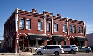
<span class="mw-page-title-main">Woodbine, Iowa</span> City in Iowa, United States

Woodbine is a city in Harrison County, Iowa, United States, along the Boyer River. The population was 1,625 at the time of the 2020 census.

<span class="mw-page-title-main">Ottosen, Iowa</span> City in Iowa, United States

Ottosen is a city in Humboldt County, Iowa, United States. The population was 40 in the 2020 census, a decline from 61 in 2000.

<span class="mw-page-title-main">Wapello, Iowa</span> City in Iowa, United States

Wapello is a city in and the county seat of Louisa County, Iowa, United States. The population was 2,084 at the time of the 2020 census.

<span class="mw-page-title-main">Emerson, Iowa</span> City in Iowa, United States

Emerson is a city in Mills County, Iowa, United States. The population was 403 at the time of the 2020 census.

<span class="mw-page-title-main">Moorhead, Iowa</span> City in Iowa, United States

Moorhead is a city in Monona County, Iowa, United States. Moorhead stands along the Soldier River. The population was 199 at the time of the 2020 census.

<span class="mw-page-title-main">Tingley, Iowa</span> City in Iowa, United States

Tingley is a city in northern Ringgold County, Iowa, United States. The population was 136 at the time of the 2020 census.

<span class="mw-page-title-main">Donahue, Iowa</span> City in Iowa, United States

Donahue is a city in Scott County, Iowa, United States. The population was 335 at the 2020 census. The city has a mayor-council form of government.

<span class="mw-page-title-main">Thayer, Iowa</span> City in Iowa, United States

Thayer is a city in Union County, Iowa, United States. The population was 51 at the time of the 2020 census.
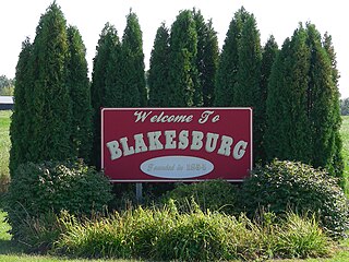
<span class="mw-page-title-main">Blakesburg, Iowa</span> City in Iowa, United States

Blakesburg is a city in Wapello County, Iowa, United States. The population was 274 at the 2020 census.

<span class="mw-page-title-main">Humeston, Iowa</span> City in Iowa, United States

Humeston is a city in Wayne County, Iowa, United States. The population was 465 in the 2020 census, a decline from 542 in 2000.

References

  1. "2020 U.S. Gazetteer Files". United States Census Bureau. Retrieved March 16, 2022.
  2. 1 2 U.S. Geological Survey Geographic Names Information System: Pisgah, Iowa
  3. 1 2 "2020 Census State Redistricting Data". census.gov. United states Census Bureau. Retrieved 12 August 2021.
  4. Chicago and North Western Railway Company (1908). A History of the Origin of the Place Names Connected with the Chicago & North Western and Chicago, St. Paul, Minneapolis & Omaha Railways. p. 114.
  5. "Harrison County". Jim Forte Postal History. Retrieved 21 March 2015.
  6. "US Gazetteer files 2010". United States Census Bureau. Archived from the original on January 12, 2012. Retrieved 2012-05-11.
  7. "Census of Population and Housing". Census.gov. Retrieved June 4, 2015.
  8. "U.S. Census website". United States Census Bureau . Retrieved 2012-05-11.
  9. "U.S. Census website". United States Census Bureau . Retrieved 2008-01-31.
  10. "West Harrison Archived 2018-04-27 at the Wayback Machine ." Iowa Department of Education. Retrieved on July 16, 2018.