Mukim Tamoi

Last updated

Mukim Tamoi
Bandar Seri Begawan 9 September 2023 36.jpg
Stilt houses in Mukim Tamoi, with Istana Nurul Iman in the background
Brunei and Muara mukims.png
Tamoi is in light green.
Country Brunei
District Brunei–Muara
Area
  Total51.76 ha (127.90 acres)
Population
 (2018) [1]
  Total1,603
  Density3,100/km2 (8,000/sq mi)
Time zone UTC+8 (BNT)
Postcode
BLxx12

Mukim Tamoi is a mukim in Brunei-Muara District, Brunei. It is part of Kampong Ayer, the traditional stilt settlements on the Brunei River in the country's capital Bandar Seri Begawan. The population was 1,389 in 2016. [2]

Contents

Name

The origin of Kampong Tamoi whether it is related to Kampung Tamoi Tengah or Kampung Tamoi Ujong in the past cannot be accurately confirmed. Even though its existence was once spoken orally through generations but what has been recorded in history books is that Kampong Tamoi is one of the oldest villages in the history of Kampong Ayer together with Kampong Saba, Kampong Burung Pingai and Kampong Sungai Kedayan. In the 18th century, the existence of Kampong Tamoi was once recorded on the map of Kampong Ayer, known as Kampong Tamoi Menengah only. [1]

According to folk tale, Kampong Tamoi got its name from the event of defending the village from the fury of outsiders. As a result of the rampage of those outsiders who might intend to seize or create chaos, many villagers were killed and became victims. There was a man named Liau Haris where when the mobsters were not at home, he was looking for wood in Lumadan, which is now the location of Istana Nurul Iman, when he was told about the rioters Liau Haris returned home. At the time of the battle, Liau Haris who according to the story was a 'cleaner and fuller' tried to fight the rampaging enemy. Because both were reliable when fighting, the water started to rise and reached his back and Liau Haris stabbed his dagger into the ground and the enemy collapsed. Seeing the reliability that Liau Haris has, the villagers call him 'Tamamur Liau Haris atu eh' which means that really brave Liau Haris. The meaning of the word Tamamur is taken and becomes Tamoi. That is how the origin of the name was obtained but there are also different stories about the origin of the name Kampong Tamoi. [3]

However, in the research carried out by the Brunei History Centre, it was recorded that Kampong Tamoi originated from the leadership of a person named Haji Tarif. His leadership was distinguished when he managed to lead the villagers to prevent and break the attack of the invaders who came from Limbang to control the village. Fortified with calico cloth and praying to Allah, the attack was repelled and the villagers succeeded in expelling the intruders. Above the authority and leadership of Haji Tarif and his obedience to the King, the word Tamoi appeared. Taking good sense from the name, a primary school was established to replace the old school and was named Sekolah Rendah Haji Tarif. [1]

The mukim could be named after the village it encompasses.

Geography

Mukim Tamoi is located in the waters of the Brunei River, starting from the intersection of the Kedayan River towards the upstream of the Brunei River is close to the Istana Darul Hana area which is on the mainland side.

Demographics

As of 2016 census, [2] the population was 1,389 with

Administration

In 2018, the mukim comprised the following census villages: [1]

Village Population
(2018)
Kampong Limbongan 54
Kampong Pengiran Bendahara Lama305
Kampong Pengiran Kerma Indera Lama169
Kampong Pengiran Tajuddin Hitam194
Kampong Tamoi Tengah429
Kampong Tamoi Ujong261
Kampong Ujong Bukit181
Total1,603

Kampong Limbongan and Kampong Ujong Bukit have since ceased to exist due to the redevelopment project to the Kedayan River and the construction of the public park Taman Mahkota Jubli Emas. [4] The mukim has also been subsumed under the municipal area of Bandar Seri Begawan. [5]

Villages

Kampung Tamoi Ujong

Kampong Tamoi Ujong or formerly known as Penganan Kingkin is located at the most extreme end of Mukim Tamoi, upstream of the Brunei River and borders Kampong Tamoi Tengah. It was previously named Kampung Penganan Kingkin because in this village there is a family whose job is only to make kuih cincin. The majority of the village population at this time is made up of Muslim Malay natives of the village who have lived there for generations. Until 2018, the village recorded a decreasing population with an estimated number of less than 200 people. The decline in the number of residents is caused by several factors such as the government's facilities in providing housing plans for the people, as well as some residents being involved in several disasters such as fires and house collapses. In recent years, this village has become a highlight for tourists and foreign dignitaries to visit here to see up close the traditions and life in Kampong Ayer. [6]

Kampong Tamoi Tengah Kampong Ayer 27 May 2023 17.jpg
Kampong Tamoi Tengah

Kampong Tamoi Tengah

Kampong Tamoi Tengah is the largest village in Mukim Tamoi, since this village has a wide area, there used to be several names in it including: Pencalap, Tendar, Pedaun, Barang Sungai and others. The population is currently estimated at 320 people. The reduction of population in this village is the same as the one in Kampong Tamoi Ujong and other villages in Kampong Ayer. Currently, most of the residents in this village work with the government in addition to the private sector and no less are self-employed. While in the past, most of them only worked on their own whether it was catching fish such as fishing, peeling tree barks, collecting stones and so on. While the women are only housewives in addition to doing side jobs such as roofing, making baskets, making tray covers and so on. [7]

Kampong Pengiran Pekerma Indera Lama

Kampong Pengiran Pekerma Indera Lama is located between Kampong Pengiran Tajuddin Hitam and Kampong Pengiran Bandahara Lama. As of 2018, the population is currently estimated at 115 people. According to information passed down by generations, the origin of the village was the residence of the children of Sultan Omar Ali Saifuddin I along with his followers and men. The village was initially called Pengiran Pekerma Indera Lama Pengiran Anak Apong and it was because of the name of a cheteria nobleman. In the past, the average male population in the village worked as a sweeper, collecting stones and collecting wood, while the female population's work was only making kajang (things woven from nipah leaves), weaving nyiru, roofing and so on. While currently most of the villagers work in the government, private sector in addition to being self-employed. [8]

Kampong Pengiran Tajuddin Hitam

Kampong Pengiran Tajuddin Hitam is located between Kampong Pengiran Pekerma Indera Lama and Kampong Tamoi Tengah in the ulu (inner) section. As of 2018, it is inhabited by about 200 residents. The history of the existence of the village is the same as the existence of Kampong Pengiran Pekerma Indera Lama and Kampong Pengiran Bendahara Lama. According to the residents, the name of the village is taken from the name of a person who is from the descendants of Pengiran-Pengiran according to whom his tombstone was turned into stone and is located in the area of the royal tomb. Entering the 1960s and early 1970s the condition of the houses in the village and some in Kampong Ayer began to change where the houses began to be built with concrete pillars and zinc roofs and board walls. [9]

Kampong Pengiran Bendahara Lama

Pengiran Bendahara Lama Primary School Kampong Ayer 27 May 2023 54.jpg
Pengiran Bendahara Lama Primary School

The position of this village is bordered by Kampong Pengiran Pekerma Indera Lama and faces Kampong Ujong Tanjong towards the city center separated by Kedayan River. The existence of the village is the same as Kampong Pengiran Pekerma Indera and Kampong Pengiran Tajuddin Hitam. According to the residents, it used to be known as Kampong Lama Masjid. He said the name Pengiran Bendahara is taken from the name of the first vizier of the sultanate in this country who is believed to have lived in the village in the 19th century. Lama Masjid is connected to Kampong Bendahara Lama, and is one of the oldest mosques ever built in this country and is located in the village. The mosque (with thatched roof and brick walls) has been destroyed for a long time but the remnants of the remains of the building can still be seen to this day and it is located near Bakut Syeikh Haji Ibrahim. Not far from Bakut Syeikh Haji Ibrahim according to Awang Haji Hamid again, there is another bamboo named Bakut Jambu. On the bakut there used to be many fragments of old ceramics, pieces of pitis, kuit, old coins as well as former large pillars which are believed to be the former site of Istana Pengiran Bendahara Lama. [10]

Folklore holds that the location of Sultan Abdul Momin's Istana Lama (Old Palace) is adjacent to Kampong Pengiran Bendahara Lama's waters. Back then, the region was surrounded by stones acting as a city wall to hold the land down and prevent the wall stones from falling. Since both large and small boats that traverse the path to the inner Gadong River are eroding the stone walls and slopes of the area of the palace, the historic site is no longer discernible and may eventually vanish. [11]

Kampong Ujong Bukit

The villages of Ujong Bukit and Limbongan are located on the banks of the Kedayan River. Its position faces Kampong Bukit Salat and leads to Gadong River bordering Kampong Sumbiling Baharu. The village currently no longer exists when the area is involved in the Bandar Seri Begawan reclamation project. All the residents had to be moved to several Government Housing Plans such as the National Housing Plan in Kampong Panchor since July 2017. The origin of Kampong Ujong Bukit started from the occupation of its residents who at that time worked as forger of copper items. The village had several names before becoming Kampung Ujong Bukit, such as Pulau Pandaian and Pandai Kawat, the latter meant good at making copper items. People of the village originally built houses in the water area near Pulau Pandaian (Pandaian Island). The work of copper is done on Pandaian Island which is now used as a burial place for Muslims. Difficulties are encountered when the water is shallow, which is why the craftsman's place had to move from Pandaian Island to Ujong Bukit. Ujong Bukit was chosen because it was so easy to get water. [12]

Kampong Limbungan was not the name of a village at first but the name of a place for the port of merchant ships. Trading ships would often anchor there and would clean their ships before continuing their voyage. Due to the frequent anchoring there are merchants who began living there with the number increasing over time. [12]

Economy

Although Mukim Tamoi is not too prominent with its products, it still produces some products produced by the villagers such as crackers, cookies, dried fish and so on. However, it is clear from the Ketua Kampong Tamoi Tengah and Tamoi Ujong, Awang Tarip bin Haji Asgar, that the people of Tamoi Village are famous for their prowess in boat racing, which has been proven since time immemorial. According to him, this excellence is the result of the nature of agreement and seriousness as well as the spirit of cooperation practiced by the residents. Apart from that, the techniques and experience they gained especially in 'working' on the boat helped them win. The unity of the spirit of the participants and the rowing techniques and the boats produced make the people of Kampung Tamoi always excel in the competition. [3]

In generating a self-sustaining economy, some people in this village are very active in trading food such as cakes, cooking, and also catching fish on a small scale. Residents in this village also put a lot of emphasis on living a united and harmonious life by holding a village meal, participating in mukim events and participating in the Majlis Ibadah Korban Jabatan Daerah Brunei Muara. The villagers are also active in the field of sports such as organizing a nine-player football team and managed to get saved financial results as much as BND$500 in 2012. [13]

Infrastructure

Duli Pengiran Muda Mahkota Pengiran Muda Haji Al-Muhtadee Billah Mosque Local mosque in Bandar Seri Begawan; 2009.jpg
Duli Pengiran Muda Mahkota Pengiran Muda Haji Al-Muhtadee Billah Mosque

The local primary schools include Bendahara Lama Primary School and Haji Tarif Primary School, with the latter replacing Tamoi Tengah Malay School (SMTT). Each school also houses a sekolah ugama ("religious school") i.e. school for the country's Islamic religious primary education in Brunei. [lower-alpha 1]

Duli Pengiran Muda Mahkota Pengiran Muda Haji Al-Muhtadee Billah Mosque [lower-alpha 2] is the sole local mosque. The construction began in August 1995; it was opened on 16 January 1999. [14] It can accommodate 1,500 worshippers. [14] The mosque is named after the Crown Prince Al-Muhtadee Billah.

Notes

  1. The religious schools are Bendahara Lama Religious School and Haji Tarif Religious School.
  2. Commonly abbreviated as DPMMPMHAMB Mosque

Related Research Articles

<span class="mw-page-title-main">Brunei–Muara district</span> District of Brunei

The Brunei–Muara District or simply Brunei-Muara is one of the four districts of Brunei. It has the smallest area among the four districts, with 571 square kilometres (220 sq mi), yet is the most populous, with 289,630 people as of 2016. Bandar Seri Begawan, the country's capital, is located in this district, which is also de facto the district's capital. It is also home to Brunei International Airport, the country's only international airport, as well as Muara Port, the main and only deep-water port in the country. The Brunei River flows within this district and is home to Kampong Ayer, the traditional historic settlement on stilts above the river.

<span class="mw-page-title-main">Kampong Ayer</span> Traditional settlement in Brunei

Kampung Ayer is a prominent traditional settlement in Bandar Seri Begawan, the capital of Brunei. It comprises neighbourhoods of traditional houses, schools and mosques built on stilts above the Brunei River near the capital's city centre. It has an area of about 10 square kilometres (3.9 sq mi); the total population was 10,250 in 2016. It has been historically nicknamed 'Venice of the East'. Kampung Ayer has been historically the principal settlement of Brunei; it was the de facto capital, in particular social and economic centre, of the Bruneian Empire for a few centuries, but also extending into the early period during British imperialism in Brunei.

<span class="mw-page-title-main">Mukim Bukit Sawat</span> Mukim of Brunei

Mukim Bukit Sawat is a mukim in Belait District, Brunei. It had a population of 794 in 2016.

<span class="mw-page-title-main">Mukim Sungai Kebun</span> Mukim of Brunei

Mukim Sungai Kebun is a mukim in Brunei–Muara district, Brunei. It is part of Kampong Ayer, the traditional stilt settlements on the Brunei River in the capital Bandar Seri Begawan. The population was 4,750 in 2016.

<span class="mw-page-title-main">Mukim Sungai Kedayan</span> Mukim of Brunei

Mukim Sungai Kedayan was a mukim in Brunei-Muara District, Brunei. It was located within Kampong Ayer, the historical stilt settlements on the Brunei River in the capital Bandar Seri Begawan. The population was 230 in 2016.

<span class="mw-page-title-main">Mukim Bangar</span> Mukim of Brunei

Mukim Bangar is a mukim in Temburong District, Brunei. It has a total area of 113 square kilometres (44 sq mi); the population was 2,112 in 2021. The mukim encompasses Bangar, the district's sole town and administrative centre.

<span class="mw-page-title-main">Lumut, Brunei</span> Settlement in Brunei

Kampong Lumut or commonly known as Lumut, is a coastal settlement in Belait District, Brunei Daurssalam, about 30 kilometres from the district town Kuala Belait. The total population was 11,273 in 2016.

<span class="mw-page-title-main">Kampong Bukit Beruang, Brunei</span> Public housing estate in Tutong, Brunei

Kampong Bukit Beruang, also simply known as Bukit Beruang, is a village in Tutong District, Brunei, about 13 kilometres (8.1 mi) from the district town Pekan Tutong. The population was 6,157 in 2016. It is one of the villages within Mukim Telisai, a mukim subdivision in the district. It comprises the original village settlement as well as the public housing estate Bukit Beruang National Housing Scheme.

<span class="mw-page-title-main">Kampong Beribi</span> Village in Brunei-Muara, Brunei

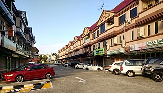
Kampong Beribi or commonly known as Beribi, is a village in Brunei-Muara District, Brunei, as well as a neighbourhood in the capital Bandar Seri Begawan. The population was 5,679 in 2016. It is one of the villages within Mukim Gadong 'B'. The postcode is BE1118.

<span class="mw-page-title-main">Kampong Mata-Mata</span> Village in Brunei-Muara, Brunei

Kampong Mata-Mata or commonly known as Mata-Mata, is a village in Brunei-Muara District, Brunei, and a neighbourhood in the capital Bandar Seri Begawan. The population was 6,126 in 2016. It is one of the villages within Mukim Gadong 'B'. The postcode is BE1718.

<span class="mw-page-title-main">Kampong Kiulap</span> Village in Brunei-Muara, Brunei

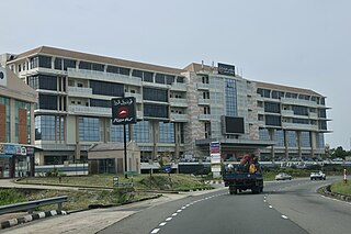
Kampong Kiulap or commonly known as Kiulap, is a village in Brunei-Muara District, Brunei, as well as a neighbourhood and commercial area in the capital Bandar Seri Begawan. It has an area of 176.53 hectares ; the population was 3,400 in 2016. It is one of the villages within Mukim Gadong 'B'. The postcode is BE1518.

<span class="mw-page-title-main">Kampong Kiarong</span> Village in Brunei

Kampong Kiarong or commonly known as Kiarong, is a village in Brunei-Muara District, Brunei, as well as a neighbourhood in the country's capital Bandar Seri Begawan. It has an area of 383.43 hectares ; the population was 4,530 in 2016.

Kampong Perpindahan Mata-Mata or simply known as Perpindahan Mata-Mata, is a public housing estate and designated village in Brunei-Muara District, Brunei, on the outskirts of the capital Bandar Seri Begawan. The population was 2,385 in 2016. It is one of the villages within Mukim Gadong 'B'. The postcode is BE1918.

<span class="mw-page-title-main">Kampong Jaya Setia</span> Village in Brunei-Muara, Brunei

Kampong Jaya Setia is a village in Brunei-Muara District, Brunei, and a neighbourhood in the capital Bandar Seri Begawan. The population was 855 in 2016. It is one of the villages within Mukim Berakas 'A'. The postcode is BB2713.

<span class="mw-page-title-main">Kampong Bunut Perpindahan</span> Village of Brunei

Kampong Bunut Perpindahan or also known as Kampong Perpindahan Bunut, is a village in Brunei-Muara District, Brunei, as well as a neighbourhood in the capital Bandar Seri Begawan. The population was 1,707 in 2016. It is one of the villages within Mukim Kilanas. The postcode is BF1220.

<span class="mw-page-title-main">Kampong Menglait</span> Village in Brunei-Muara, Brunei

Kampong Menglait or simply known as Menglait, is a village in Brunei-Muara District, Brunei, as well as a neighbourhood and commercial area in the capital Bandar Seri Begawan. The population was 2,262 in 2016. It is one of the villages within Mukim Gadong 'B'. The postcode is BE3919.

<span class="mw-page-title-main">Kampong Tumasek</span> Neighbourhood in Bandar Seri Begawan, Brunei

Kampong Tumasek or simply known as Tumasek, is an area in Bandar Seri Begawan, the capital of Brunei, as well as a village within Mukim Kianggeh in Brunei-Muara District. The population was 673 in 2016. It has the postcode BA2112.

<span class="mw-page-title-main">Kampong Bolkiah</span> Neighbourhood in Kampong Ayer, Brunei

Kampong Bolkiah is a village and housing estate in Kampong Ayer, the traditional riverine settlement in Bandar Seri Begawan, the capital of Brunei. The total population was 2,143 in 2016.

<span class="mw-page-title-main">Ali Mohamed Daud</span> Bruneian politician (1916–2005)

Pengiran Mohamed Ali bin Pengiran Mohamed Daud, simply known as Pengiran Ali, was a Bruneian nobleman, teacher and politician whom formerly held the position of Deputy Menteri Besar from 1962 to 1965, Legislative, Executive, and Privy Councils. He emphasized the significant impact he played in Brunei's history, notably from the 1950s to 1960s, and was also the first of the "three M's" that the British government dreaded.

References

  1. 1 2 3 4 Mukim Tamoi (PDF) (in Malay). Unit Penerbitan Melayu, Bahagian Penerbitan dan Seni Grafik, Jabatan Penerangan, Jabatan Perdana Menteri. 2018. pp. 11–13.
  2. 1 2 "Population and Housing Census Update Final Report 2016" (PDF). www.deps.gov.bn. Statistics Department. December 2018. Retrieved 27 June 2021.
  3. 1 2 3 KOMPILASI RENCANA KNK 2015 (PDF) (in Malay). Kenali Negera Kitani. 2015. pp. 177–182.
  4. "A beacon of Bandar's revitalisation – Borneo Bulletin Online". Borneo Bulletin Online. 23 October 2017. Archived from the original on 18 May 2019. Retrieved 9 August 2018.
  5. Za'im Zaini; Sonia K (23 July 2007). "Brunei capital to become nearly ten times bigger". Archived from the original on 1 November 2021. Retrieved 5 November 2021 via bn.china-embassy.org.
  6. Kampung Tamoi Ujong (PDF) (in Malay). Unit Penerbitan Melayu, Bahagian Penerbitan dan Seni Grafik, Jabatan Penerangan, Jabatan Perdana Menteri. 2018. pp. 16–18.
  7. Kampung Tamoi Tengah (PDF) (in Malay). Unit Penerbitan Melayu, Bahagian Penerbitan dan Seni Grafik, Jabatan Penerangan, Jabatan Perdana Menteri. 2018. pp. 19–21.
  8. Kampung Pengiran Pekerma Indera Lama (PDF) (in Malay). Unit Penerbitan Melayu, Bahagian Penerbitan dan Seni Grafik, Jabatan Penerangan, Jabatan Perdana Menteri. 2018. pp. 22–23.
  9. Kampung Pengiran Tajuddin Hitam (PDF) (in Malay). Unit Penerbitan Melayu, Bahagian Penerbitan dan Seni Grafik, Jabatan Penerangan, Jabatan Perdana Menteri. 2018. pp. 24–25.
  10. Kampung Pengiran Bendahara Lama (PDF) (in Malay). Unit Penerbitan Melayu, Bahagian Penerbitan dan Seni Grafik, Jabatan Penerangan, Jabatan Perdana Menteri. 2018. pp. 26–29.
  11. "Tapak Istana Lama Kampung Pengiran Bendahara Lama". Tapak Istana Lama Kampung Pengiran Bendahara Lama. Retrieved 13 October 2023.
  12. 1 2 Kampung Ujong Bukit (PDF) (in Malay). Unit Penerbitan Melayu, Bahagian Penerbitan dan Seni Grafik, Jabatan Penerangan, Jabatan Perdana Menteri. 2018. pp. 30–35.
  13. KOMPILASI RENCANA KNK 2016 (PDF) (in Malay). Kenali Negera Kitani. 2016. pp. 11–14.
  14. 1 2 "SenaraiMasjid – Masjid Duli Pengiran Muda Mahkota Pengiran Muda Haji Al-Muhtadee Billah, Kampong Tamoi". www.kheu.gov.bn (in Malay). Archived from the original on 13 August 2021. Retrieved 5 November 2021.

4°53′2″N114°56′9″E / 4.88389°N 114.93583°E / 4.88389; 114.93583