
Oxfordshire is a historic, ceremonial and non-metropolitan county in South East England. It is a mainly rural county, with its largest settlement being the city of Oxford. The county is a centre of research and development, primarily due to the work of the University of Oxford. Oxfordshire is locally governed by Oxfordshire County Council, together with the lower tier councils of its five non-metropolitan districts: City of Oxford, Cherwell, South Oxfordshire, Vale of White Horse, and West Oxfordshire. The ceremonial county is landlocked and bordered by Northamptonshire to the north-east, Warwickshire to the north-west, Buckinghamshire to the east, Berkshire to the south, Wiltshire to the south-west, and Gloucestershire to the west. The areas of Oxfordshire south of the River Thames were part of the historic county of Berkshire, including the county's highest point, the 261-metre (856 ft) White Horse Hill.

The Arctic Archipelago, also known as the Canadian Arctic Archipelago, is an archipelago lying to the north of the Canadian continental mainland, excluding Greenland.
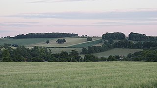
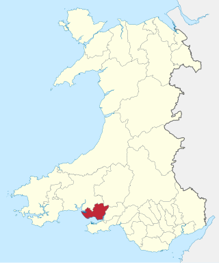
The Vale of White Horse is a local government district of Oxfordshire in England. It was historically a north-west projection of Berkshire. The area is commonly referred to as the 'Vale of the White Horse'. It is crossed by the Ridgeway National Trail in its far south, across the North Wessex Downs AONB at the junction of four counties. The northern boundary is defined by the River Thames. The name refers to Uffington White Horse, a prehistoric hill figure.

South Oxfordshire is a local government district in the ceremonial county of Oxfordshire, England. Its council is temporarily based outside the district at Abingdon-on-Thames pending a planned move to Didcot, the district's largest town. The areas located south of the River Thames are within the historic county of Berkshire.

Oxford West and Abingdon is a constituency represented in the House of Commons of the UK Parliament since 2017 by Layla Moran, a Liberal Democrat.

Abingdon Town Football Club is a football club based in Abingdon, Oxfordshire, England. Affiliated to the Berks & Bucks Football Association, they were members of the Hellenic League and played at Culham Road.

Monmouth District was one of five local government districts in the county of Gwent in Wales between 1974 and 1996. In 1988 the district was granted a charter conferring borough status, becoming the Borough of Monmouth.
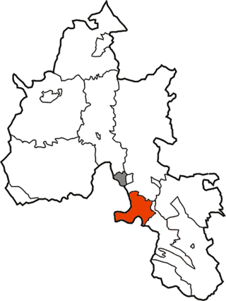
The Borough of Llanelli was one of six local government districts of the county of Dyfed, Wales from 1974 to 1996.
Culham was a rural district in Oxfordshire, England from 1894 to 1932. It was formed under the Local Government Act 1894 from the part of the Abingdon Rural Sanitary District in the administrative county of Oxfordshire. The remainder of the sanitary district, in the administrative county of Berkshire, became Abingdon Rural District. The rural district council continued to be based at Abingdon, holding meetings in the workhouse of the poor law union.
Abingdon was a rural district in the administrative county of Berkshire from 1894 to 1974.
St Helen Without is a civil parish in the Vale of White Horse district in the English county of Oxfordshire. In 1974 it was transferred from Berkshire. It is immediately west of Abingdon and includes the villages of Dry Sandford and Shippon. A large part of the parish is occupied by Dalton Barracks and its associated airfield. According to the 2001 census the parish had a population of 2,623. The parish was created by the Local Government Act 1894, by the division of the parish of Abingdon St. Helen. The part inside Abingdon Municipal Borough became part of Abingdon parish, whilst that part outside became St. Helen Without. It became part of the Abingdon Rural District of Berkshire in 1894, and then part of the Vale of White Horse in Oxfordshire under the Local Government Act 1972.
The River Ock is a small English river which is a tributary of the River Thames. It has as its catchment area the Vale of White Horse, a low-lying and wide valley in south Oxfordshire, and flows into the River Thames, at Abingdon on the reach above Culham Lock.

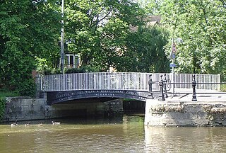
Andersey Island is a 273-acre (110.5 ha) area of flood-meadow and former flood-meadow south-east of Abingdon Bridge, Abingdon, Oxfordshire on the reach above Culham Lock in which parish it lies however maintaining close links with Abingdon by virtue of its current amenities. It is the second-largest island of the non-tidal course of the River Thames in England upstream of the Tideway — if disqualifying the villages of Dorney and Eton, Berkshire enclosed by the engineered Jubilee River. Andersey means Andrew's island after its chapel to St Andrew, demolished, built about 1050 CE.
Turka is a village in the administrative district of Gmina Wólka, within Lublin County, Lublin Voivodeship, in eastern Poland. It lies approximately 8 km (5 mi) north-east of the regional capital Lublin.
Charlejów is a village in the administrative district of Gmina Serokomla, within Łuków County, Lublin Voivodeship, in eastern Poland. It lies approximately 6 kilometres (4 mi) south-west of Serokomla, 29 km (18 mi) south of Łuków, and 51 km (32 mi) north-west of the regional capital Lublin.
Bryzgów is a village in the administrative district of Gmina Borkowice, within Przysucha County, Masovian Voivodeship, in east-central Poland. It lies approximately 5 kilometres (3 mi) south of Borkowice, 10 km (6 mi) south of Przysucha, and 107 km (66 mi) south of Warsaw.
Bestwin is a village in the administrative district of Gmina Zduny, within Krotoszyn County, Greater Poland Voivodeship, in west-central Poland. It lies approximately 7 kilometres (4 mi) west of Zduny, 11 km (7 mi) west of Krotoszyn, and 86 km (53 mi) south of the regional capital Poznań.
Empire Bruce was a prototype 7,459 GRT cargo ship which was built in 1941 by Sir J Laing & Sons for the Ministry of War Transport (MoWT). She was torpedoed and sunk by U-123 on 18 April 1943.
Fyfield and Tubney is a civil parish in The Vale of White Horse district of Oxfordshire, England. It includes the village of Fyfield which is about 4.5 miles (7 km) west of Abingdon and Tubney, which is about 4 miles (6 km) west of Abingdon. The parish was formed in 1952 when the parish of Fyfield was merged with the parish of Tubney. It was part of Berkshire until the 1974 boundary changes transferred it to Oxfordshire.
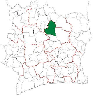
Niakaramandougou Department is a department of Hambol Region in Vallée du Bandama District, Ivory Coast. In 2021, its population was 195,127 and its seat is the settlement of Niakaramandougou. The sub-prefectures of the department are Arikokaha, Badikaha, Niakaramandougou, Niédiékaha, Tafiré, and Tortiya.


