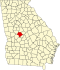
Musella, Georgia

Last updated
Musella
USA Georgia location map.svg
Red pog.svg
Musella
Location within the state of Georgia
Usa edcp location map.svg
Red pog.svg
Musella
Musella (the United States)
Coordinates: 32°47′52″N84°01′56″W / 32.79778°N 84.03222°W / 32.79778; -84.03222
Country United States
State Georgia
County Crawford
Elevation
591 ft (180 m)
Population
 (2020)
  Total104
Time zone UTC-5 (Eastern (EST))
  Summer (DST) UTC-4 (EDT)
ZIP code
31066 [1]
Area code 478
GNIS ID 319174 [2]

Musella is an unincorporated community and census-designated place (CDP) in Crawford County, Georgia, United States. [2]

Contents

The 2020 U.S. Census listed a population of 104. [3]

History

A post office called Musella was established in 1889. [4] According to tradition, the community's name is an amalgamation Mose and Ella, the names of two first settlers. [5] C.F. Hays & Son general store, a small and traditional country store, was built in the year 1900.

Demographics

Historical population
CensusPop.Note
2020 104
U.S. Decennial Census [6]
2020 [7]

Musella was first listed as a census designated place in the 2020 U.S. Census. [7]

2020 census

Musella CDP, Georgia – Racial and ethnic composition
Note: the US Census treats Hispanic/Latino as an ethnic category. This table excludes Latinos from the racial categories and assigns them to a separate category. Hispanics/Latinos may be of any race.
Race / Ethnicity (NH = Non-Hispanic)Pop 2020 [7] % 2020
White alone (NH)3432.69%
Black or African American alone (NH)7067.31%
Native American or Alaska Native alone (NH)00.00%
Asian alone (NH)00.00%
Pacific Islander alone (NH)00.00%
Some Other Race alone (NH)00.00%
Mixed Race or Multi-Racial (NH)00.00%
Hispanic or Latino (any race)00.00%
Total104100.00%

Related Research Articles

<span class="mw-page-title-main">Boykin, Georgia</span> Place in Georgia, United States

Boykin is an unincorporated community and census-designated place (CDP) in Miller County, Georgia, United States. The 2020 census listed a population of 151.

Millwood is an unincorporated community and census-designated place (CDP) in Ware County, Georgia, United States, located west of Waycross. The community is part of the Waycross Micropolitan Statistical Area.

Waverly is an unincorporated community and census designated place in Camden County, in the U.S. state of Georgia.

Smarr is an unincorporated community and census-designated place (CDP) in Monroe County, in the U.S. state of Georgia. The 2020 census listed a population of 218.

Crescent is an unincorporated community and census-designated place (CDP) in McIntosh County, Georgia, United States. It lies along State Route 99, 12 miles (19 km) north of the city of Darien, the county seat of McIntosh County. Its elevation is 30 feet (9.1 m) above sea level. It has a post office with the ZIP code 31304.

<span class="mw-page-title-main">Ellerslie, Georgia</span> Place in Georgia, United States

Ellerslie is an unincorporated community and census-designated place (CDP) in Harris County, Georgia, United States. Ellerslie is a part of the Columbus, Georgia metropolitan area.

Mershon is an unincorporated community and census-designated place (CDP) in Pierce County, Georgia, United States.

Dacusville is a small unincorporated community and census-designated place (CDP) in Pickens County, South Carolina, United States. It is best known for its tractor show once a year in the month of September. The community also has an elementary school and a middle school. It was first listed as a CDP in the 2020 census with a population of 399.

Epworth is an unincorporated community and census-designated place (CDP) in Fannin County, Georgia, United States. As of the 2010 census it had a population of 480. It lies at an elevation of 1,703 feet (519 m) in the north-central part of the county. A former name was Atalla. The ZIP code is 30541.

Faceville is an unincorporated community and census-designated place in Decatur County, Georgia, United States. Faceville is located at the junction of Georgia State Route 97 and Georgia State Route 302 Spur, 11 miles (18 km) south-southwest of Bainbridge.

Cedar Springs is an unincorporated community and census-designated place (CDP) in Early County, Georgia, United States. At the time of the 2020 census, the population was 75. Cedar Springs has a post office with ZIP code 39832. Georgia State Route 273 passes through the community. Georgia Pacific is 2 miles southwest from it.

<span class="mw-page-title-main">Cherry Log, Georgia</span> Place in Georgia, United States

Cherry Log is an unincorporated community and census-designated place (CDP) in Gilmer County, Georgia, United States. Its population was 99 as of the 2020 census. Cherry Log has a post office with ZIP code 30522. U.S. Route 76 passes through the community. Through the heart of Cherry Log runs Cherry Log Street, on which is found the Post Office, Cornerstone Baptist Church, Cherry Log Christian Church, and the Pink Pig, a restaurant in operation since 1950.

Dewy Rose is an unincorporated community and census-designated place (CDP) in Elbert County, Georgia, United States. Its population was 161 as of the 2020 census. Dewy Rose has a post office with ZIP code 30634. Georgia State Route 17 passes through the community.

Norristown is an unincorporated community and census-designated place (CDP) in Emanuel County, Georgia, United States. Its population was 54 as of the 2020 census.

Mendes is a census-designated place and unincorporated community in Tattnall County, Georgia, United States. Its population was 124 as of the 2020 census. Georgia State Route 169 passes through the community.

Gough is an unincorporated community and census-designated place (CDP) in Burke County, Georgia, United States. The community is located along Georgia State Route 305, 12.2 miles (19.6 km) west of Waynesboro.

Axson is an unincorporated community and census designated place (CDP) in Atkinson County, Georgia, United States. The community is located on U.S. Route 82, 7.1 miles (11.4 km) east of Pearson. Axson has a post office with ZIP code 31624. Per the 2020 census, the population was 360.

New England is an unincorporated community and census-designated place (CDP) in Dade County, in the U.S. state of Georgia. The 2020 census listed a population of 546.

Ohoopee is an unincorporated community and census-designated place (CDP) in Toombs County, in the U.S. state of Georgia.

<span class="mw-page-title-main">Tazewell, Georgia</span> Place in Georgia, United States

Tazewell is an unincorporated community and census-designated place (CDP) in Marion County, in the U.S. state of Georgia.

References

  1. "Musella ZIP Code". zipdatamaps.com. 2023. Retrieved January 12, 2023.
  2. 1 2 "Musella, Georgia". Geographic Names Information System . United States Geological Survey, United States Department of the Interior.
  3. "Musella CDP, Georgia". United States Census Bureau . Retrieved March 13, 2022.
  4. "Post Offices". Jim Forte Postal History. Retrieved 24 March 2019.
  5. Krakow, Kenneth K. (1975). Georgia Place-Names: Their History and Origins (PDF). Macon, GA: Winship Press. p. 155. ISBN   0-915430-00-2.
  6. "Decennial Census of Population and Housing by Decades". US Census Bureau.
  7. 1 2 3 "P2 Hispanic or Latino, and Not Hispanic or Latino by Race – 2020: DEC Redistricting Data (PL 94-171) – Musella CDP, Georgia". United States Census Bureau .