Bibb County, Georgia

Last updated

Bibb County
Maconbibbcourthouse.jpg
Bibb County courthouse in Macon
Map of Georgia highlighting Bibb County.svg
Location within the U.S. state of Georgia
Georgia in United States.svg
Georgia's location within the U.S.
Coordinates: 32°48′N83°42′W / 32.8°N 83.7°W / 32.8; -83.7
CountryFlag of the United States.svg United States
StateFlag of Georgia (U.S. state).svg  Georgia
FoundedDecember 9, 1822;202 years ago (1822)
Named for William Wyatt Bibb
Seat Macon
Largest cityMacon
Area
  Total255 sq mi (660 km2)
  Land250 sq mi (600 km2)
  Water5.6 sq mi (15 km2)  2.2%
Population
 (2020)
  Total157,346
  Density629/sq mi (243/km2)
Time zone UTC−5 (Eastern)
  Summer (DST) UTC−4 (EDT)
Congressional districts 2nd, 8th
Website www.co.bibb.ga.us

Bibb County is located in the U.S. state of Georgia. As of the 2020 census, its population was 157,346. [1] Bibb County is geographically located in the Central Georgia (Middle Georgia) region, and is the largest county in the Macon metropolitan area (metropolitan statistical area).

Contents

Bibb County has a consolidated city-county government following a merger of the county with its county seat and largest city, Macon, in 2014. They were later joined in this consolidated government in 2015 by the county's only other municipality, Payne City. [2]

History

This area was inhabited for thousands of years by successive indigenous peoples. The Ocmulgee National Monument is a national park and historic site incorporating two major mound and town complexes: Lamar Mounds and Village Site and Ocmulgee Mound Site, both located along the Ocmulgee River. They were built by indigenous peoples during the Mississippian culture era. The detailed chronicles of the Hernando de Soto expedition recorded visiting Ichisi, a major village, in 1539. Historians and archeologists have theorized it may have been located at the Lamar Mounds complex. [3]

For centuries, the historic Native Americans Muscogee tribe, descendants of this culture, was the predominant one in a large area of Georgia, including that later organized as Bibb County. During the colonial period, Anglo colonists carried on a brisk trade with them and allied with them in certain wars in the Southeast. With European-American land hunger to extend cotton cultivation in the Georgia uplands, the Muscogee and other four Civilized Tribes of the Southeast were forcibly relocated to Indian Territory west of the Mississippi River, in the Indian Removal of the 1830s, during the administration of President Andrew Jackson. The Indian tribes affected refer to their journey is as the "Trail of Tears", since many died during the march west.

In the late 18th century, the cotton gin was invented, making profitable the processing of short-staple cotton. This could be grown across the uplands of the South, in contrast to the long-staple cotton of the Low Country. Bibb is considered one of the counties of the "Black Belt", which originally referred to the fertile dark soil in these uplands. The area was developed by European-American planters, who used enslaved African Americans as workers to clear land and develop large cotton plantations during the antebellum years. Cotton generated high profits, since it was in demand in the textile mills of the northern states and England. By the 1860 census, shortly before the American Civil War, more than a million enslaved African Americans lived in Georgia, and they constituted a majority of the population in much of the Black Belt.

Bibb County was created by act of the Georgia Legislature on December 9, 1822, with Macon to be incorporated as a town/city in December 1823; designated the county seat. It was carved from the earlier territories of the counties of Jones, Monroe, Houston, and Twiggs Counties. The county seat has not been changed since, and no other subsequent county in the state has ever been created ("erected") out of land from Bibb County.

The county was named for Dr. William Wyatt Bibb, a physician from Elbert County, who served in the U.S. House of Representatives and United States Senate from Georgia. After he moved to the new Alabama Territory, he was later elected as the first governor of the new State of Alabama upon its admission.

Civil War to present

During the Civil War, an estimated 10% of the white males in the county lost their lives while serving in the Confederate States Army. [4] The war gained the emancipation of slaves across the South. Georgia had been a battleground, and Atlanta and many other areas were left in ruins.

Well into the 20th century, the county depended on cotton and other agriculture as its economic base. It was subject to related vagaries of weather, financial markets, and the devastation of the invasive boll weevil in the early 20th century, which destroyed cotton crops across the South.

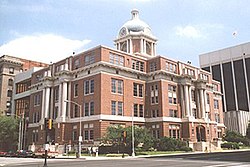
After the Civil War and during the 20th century, the county seat of Macon continued to serve as the county's principal population center, site of the most significant landmarks, and the location of major historical events.

On July 31, 2012, voters in the City of Macon (57.8% approval) and Bibb County (56.7% approval) passed a referendum to merge the governments of the city and the county, based on the authorization of House Bill 1171 passed by the Georgia General Assembly earlier in the year. [5] Four previous consolidation attempts (in 1933, 1960, 1972, and 1976) had failed. [6] [7] [8] The consolidation took effect on January 1, 2014, along with the deannexation from the city of a small portion of land in Jones County.

In addition to Macon, Bibb County contained one other municipality, Payne City (or Payne), an enclave of around 200 people that was surrounded entirely by the preconsolidation City of Macon. In the 2012 referendum, Payne City voters rejected consolidation by a vote of 9 to 7, so it was not merged into the consolidated government. In early 2015, at the request of the small city's government, the Georgia General Assembly passed a bill dissolving Payne City, merging it with the rest of Macon-Bibb County. [2]

Geography

According to the U.S. Census Bureau, the county has a total area of 255 square miles (660 km2), of which 250 square miles (650 km2) is land and 5.6 square miles (15 km2) (2.2%) is water. [9] The entirety of Bibb County is located in the Upper Ocmulgee River sub-basin of the Altamaha River basin. [10]

Adjacent counties

National protected areas

Communities

Cities

Unincorporated communities

Demographics

Historical population
CensusPop.Note
1830 7,154
1840 9,80237.0%
1850 12,69929.6%
1860 16,29128.3%
1870 21,25530.5%
1880 27,14727.7%
1890 42,37056.1%
1900 50,47319.1%
1910 56,64612.2%
1920 71,30425.9%
1930 77,0428.0%
1940 83,7838.7%
1950 114,07936.2%
1960 141,24923.8%
1970 143,4181.5%
1980 150,2564.8%
1990 149,967−0.2%
2000 153,8872.6%
2010 155,5471.1%
2020 157,3461.2%
2023 (est.)156,512 [11] −0.5%
U.S. Decennial Census [12]
1790-1880 [13] 1890-1910 [14]
1920-1930 [15] 1930-1940 [16]
1940-1950 [17] 1960-1980 [18]
1980-2000 [19] 2010 [20] 2020 [21]
Bibb County, Georgia – Racial and ethnic composition
(NH = Non-Hispanic)
Note: the US Census treats Hispanic/Latino as an ethnic category. This table excludes Latinos from the racial categories and assigns them to a separate category. Hispanics/Latinos may be of any race.
Race / EthnicityPop 2000 [22] Pop 2010 [20] Pop 2020 [21] % 2000% 2010% 2020
White alone (NH)76,26265,49456,78749.56%42.11%36.09%
Black or African American alone (NH)72,50380,74485,23447.11%51.91%54.17%
Native American or Alaska Native alone (NH)2552872810.17%0.18%0.18%
Asian alone (NH)1,6322,4923,2091.06%1.60%2.04%
Pacific Islander alone (NH)3574420.02%0.05%0.03%
Other race alone (NH)922156020.06%0.14%0.38%
Mixed race or Multiracial (NH)1,0851,8524,4540.71%1.19%2.83%
Hispanic or Latino (any race)2,0234,3896,7371.31%2.82%4.28%
Total153,887155,547157,346100.00%100.00%100.00%

As of the 2020 United States census, there were 157,346 people, 56,726 households, and 33,573 families residing in the county.

Crime

In 2022, Bibb County had the highest crime rate in Georgia. Bibb County had a rate of 52.6 crimes per 1,000 residents. The most common was larceny theft, of which there were 3,694 incidents, while the second most common crime was aggravated assault, with 1,911 committed. Overall, Bibb had the highest crime rate for seven of the ten crime categories, including murder, robbery, motor vehicle theft and arson. [23]

Government and politics

Since the 2014 consolidation, Macon-Bibb has been governed by a mayor, elected at-large (county-wide), along with a nine-member county commission with members elected from single-member districts. [24] [25] [26]

Like all other Georgia counties, Bibb has an elected sheriff responsible for maintaining the jail. Bibb's sheriff also manages the county's law enforcement duties, with their deputies acting as the city and county police force. As of 2019, the current sheriff is David Davis. [27]

Elections

Bibb County Courthouse, circa 1876 Bibb County Courthouse, base of Confederate monument, circa 1876 - DPLA - 54681e1bd3e6d3f9e7328362443594da.jpeg
Bibb County Courthouse, circa 1876

In 2013, the consolidated city-county held its first elections. Macon's incumbent mayor Robert Reichert received 49% of the vote in the general election on September 17 over the other five mayoral candidates, but a winner had to take a majority of the vote. Reichert subsequently won 63% of the vote in a runoff election against former Macon mayor C. Jack Ellis. [28] Reichert was unopposed for re-election in 2016, following the death of his only opponent before the election. Under the city-county charter, the mayor is subject to term limits and may serve only two consecutive terms. Reichert had to leave office in December 2020. [29]

As an urban county with a majority African-American population, voters in Bibb County today consistently vote at high rates for Democratic candidates counties in presidential elections. During the late 19th century and into the late 1960s, when most African Americans were disenfranchised by the state constitution and practices under Jim Crow, white conservatives dominated the Democratic Party and voting. The combination of these two contrasting affiliations resulted in the majority of county voters having supported for a Republican presidential candidate only three times in its history. Bibb was the only county in the 2004 flag referendum to vote to keep the 2001 flag. [30]

United States presidential election results for Bibb County, Georgia [31] [32]
Year Republican Democratic Third party
No.%No.%No.%
2020 26,55937.53%43,40861.34%7961.12%
2016 24,04338.24%36,78758.50%2,0503.26%
2012 25,62339.54%38,58559.54%5950.92%
2008 27,03740.69%38,98758.67%4240.64%
2004 28,10748.64%29,32250.74%3590.62%
2000 24,07148.36%24,99650.22%7091.42%
1996 20,77841.61%26,72753.53%2,4274.86%
1992 19,84736.72%28,07051.93%6,13211.35%
1988 22,17949.96%22,08449.74%1330.30%
1984 24,17047.77%26,42752.23%00.00%
1980 15,17531.53%31,77066.01%1,1852.46%
1976 12,81928.66%31,90271.34%00.00%
1972 27,40272.87%10,20127.13%00.00%
1968 13,49032.59%10,57925.55%17,32841.86%
1964 25,64158.98%17,83141.02%00.00%
1960 10,52342.24%14,38757.76%00.00%
1956 7,24232.61%14,96667.39%00.00%
1952 6,12129.42%14,68770.58%00.00%
1948 3,83727.26%7,01149.80%3,22922.94%
1944 1,88426.04%5,35273.96%00.00%
1940 1,37116.85%6,72982.70%370.45%
1936 4527.29%5,72292.34%230.37%
1932 4058.42%4,37290.93%310.64%
1928 2,07847.58%2,28952.42%00.00%
1924 45510.38%3,64783.17%2836.45%
1920 45818.41%2,03081.59%00.00%
1916 582.51%2,04888.77%2018.71%
1912 713.70%1,74190.82%1055.48%
1908 56521.91%1,94675.46%682.64%
1904 2369.86%2,11788.47%401.67%
1900 25011.42%1,89786.66%421.92%
1896 67018.36%1,85450.81%1,12530.83%
1892 64114.67%3,62783.00%1022.33%
1888 1,12132.45%2,21564.11%1193.44%
1884 85733.17%1,72766.83%00.00%
1880 90836.38%1,58863.62%00.00%

United States Congress

SenatorsNamePartyAssumed OfficeLevel
 Senate Class 2 Raphael Warnock Democratic 2021
 Senate Class 3 Jon Ossoff Democratic 2021
RepresentativesNamePartyAssumed Office
 District 2 Sanford Bishop Democratic 1993
 District 8 Austin Scott Republican 2011

Georgia General Assembly

Georgia State Senate

DistrictNamePartyAssumed office
 18 John F. Kennedy Republican 2015
 25 Burt Jones Republican 2013
 51 David Lucas Democratic 2011

Georgia House of Representatives

DistrictNamePartyAssumed office
 140 Robert Dickey Republican 2011
 141 Allen Peake Republican 2011
 142 Miriam Paris Democratic 2017
 143 James Beverly Democratic 2011
 144 Bubber Epps Republican 2008

[33] [34] [35]

Recreation

Lake Tobesofkee in the Wintertime Lake Tobesofkee near Lizella, Georgia.JPG
Lake Tobesofkee in the Wintertime

Lake Tobesofkee, about 10 miles (16 km) west of Macon, has three parks. Claystone, Sandy Beach, and Arrowhead Parks, each with a beach, and children's playgrounds. Sandy Beach has lighted tennis courts, a water park with many attractions, and a softball field. [36]

Transportation

Major highways

Pedestrians and cycling

  • Heritage Trail
  • Ocmulgee Heritage Trail

See also

Related Research Articles

<span class="mw-page-title-main">Twiggs County, Georgia</span> County in Georgia, United States

Twiggs County is a county located in the central portion of the U.S. state of Georgia. As of the 2020 census, the population was 8,022. The county seat is Jeffersonville. The county was created on December 14, 1809, and named for American Revolutionary War general John Twiggs.

<span class="mw-page-title-main">Sumter County, Georgia</span> County in Georgia, United States

Sumter County is a county located in the west-central portion of the U.S. state of Georgia. As of the 2020 census, its population was 29,616. The county seat is Americus. The county was created on December 26, 1831.

<span class="mw-page-title-main">Richmond County, Georgia</span> Consolidated city-county in Georgia, United States

Richmond County is located in the state of Georgia in the U.S. As of the 2020 census, the population was 206,607. It is one of the original counties of Georgia, created on February 5, 1777. Following an election in 1995, Augusta consolidated governments with Richmond County. The consolidated entity is known as Augusta-Richmond County, or simply Augusta. Exempt are the cities of Hephzibah and Blythe, in southern Richmond County, which voted to remain separate. Richmond County is included in the Augusta-Richmond County, GA-SC metropolitan statistical area.

<span class="mw-page-title-main">Peach County, Georgia</span> County in Georgia, United States

Peach County is a county located in the central portion of the U.S. state of Georgia. As of the 2020 census, the population was 27,981. Its county seat is Fort Valley. Founded in 1924, it is the state's newest county, taken from Houston and Macon counties on July 18 of that year. Its namesake is the peach on account of it being located in a peach-growing district.

<span class="mw-page-title-main">Newton County, Georgia</span> County in Georgia, United States

Newton County is a county located in the north central portion of the U.S. state of Georgia. As of the 2020 census, the population was 112,483. The county seat is Covington.

<span class="mw-page-title-main">Monroe County, Georgia</span> County in Georgia, United States

Monroe County is a county located in the central portion of the U.S. state of Georgia. As of the 2020 census, the population was 27,957. The county seat is Forsyth. The county was created on May 15, 1821. The county was named for James Monroe. Monroe County is included in the Macon, GA metropolitan statistical area.

<span class="mw-page-title-main">Macon County, Georgia</span> County in Georgia, United States

Macon County is a county located in the west central portion of the U.S. state of Georgia. As of the 2020 census, the population was 12,082. The county seat is Oglethorpe.

<span class="mw-page-title-main">Laurens County, Georgia</span> County in Georgia, United States

Laurens County is a county located in the central part of the U.S. state of Georgia. As of the 2020 census, the population was 49,570, up from 48,434 in 2010. The county seat is Dublin. The county was founded on December 10, 1807, and named after Lieutenant Colonel John Laurens, an American soldier and statesman from South Carolina during the American Revolutionary War.

<span class="mw-page-title-main">Lamar County, Georgia</span> County in Georgia, United States

Lamar County is a county located in the west central portion of the U.S. state of Georgia. As of the 2020 census, the population was 18,500. The county seat is Barnesville.

<span class="mw-page-title-main">Jones County, Georgia</span> County in Georgia, United States

Jones County is a county in the central portion of the U.S. state of Georgia. As of the 2020 census, the population was 28,347. The county seat is Gray. The county was created on December 10, 1807, and named after U.S. Representative James Jones.

<span class="mw-page-title-main">Houston County, Georgia</span> County in Georgia, United States

Houston County is a county located in the central portion of the U.S. state of Georgia. The population was 163,633 at the 2020 census. Its county seat is Perry; the city of Warner Robins is substantially larger in both area and population.

<span class="mw-page-title-main">Dooly County, Georgia</span> County in Georgia, United States

Dooly County is a county located in the central portion of the U.S. state of Georgia. As of the 2020 census, the population was 11,208. The county seat is Vienna. The county was created by an act of the Georgia General Assembly on May 15, 1821, and named for Colonel John Dooly, a Georgia American Revolutionary War fighter. It was one of the original landlot counties created from land ceded from the Creek Nation.

<span class="mw-page-title-main">Dodge County, Georgia</span> County in Georgia, United States

Dodge County is a county located in the central portion of the U.S. state of Georgia. As of 2020, the population was 19,925. The county seat is Eastman. Dodge County lies in the Historic South and Black Belt region of Georgia, an area that was devoted to cotton production in the antebellum years. It has significant historic buildings and plantations, has a substantial African-American population, and shows cultural aspects of the South.

<span class="mw-page-title-main">Clarke County, Georgia</span> County in Georgia, United States

Clarke County is located in the northeastern part of the U.S. state of Georgia. As of the 2020 census, the population was 128,671. Its county seat is Athens, with which it is a consolidated city-county.

<span class="mw-page-title-main">Burke County, Georgia</span> County in Georgia, United States

Burke County is a county located along the eastern border of the U.S. state of Georgia in the Piedmont. As of the 2020 census, the population was 24,596. The county seat is Waynesboro. Burke County is part of the Augusta-Richmond County, GA-SC metropolitan statistical area.

<span class="mw-page-title-main">Macon, Georgia</span> Consolidated city-county in Georgia, United States

Macon, officially Macon–Bibb County, is a consolidated city-county in Georgia, United States. Situated near the fall line of the Ocmulgee River, it is 85 miles (137 km) southeast of Atlanta and near the state's geographic center—hence its nickname "The Heart of Georgia."

<span class="mw-page-title-main">Payne, Georgia</span> Neighborhood in Bibb, Georgia, United States

Payne, more commonly known as Payne City, was a city in Bibb County, Georgia, United States. Payne was an enclave completely surrounded by the city of Macon, and was the only other incorporated area in the county. The population was 218 at the 2010 census.

<span class="mw-page-title-main">Oglethorpe, Georgia</span> City in Georgia, United States

Oglethorpe is a city in Macon County, Georgia, United States. The population was 995 at the 2020 census, down from 1,328 in 2010. The city is the county seat of Macon County. It was named for Georgia's founder, James Oglethorpe.

<span class="mw-page-title-main">Macon metropolitan area, Georgia</span> Metropolitan Statistical Area in Georgia, United States

The Macon metropolitan area is a metropolitan statistical area consisting of five counties in Central Georgia, anchored by the principal city of Macon. At the 2010 U.S. census, the five-county area had a population of 232,293. A July 2017 estimate placed the population at 228,914. In 2022, its estimated population was 235,805.

References

  1. "Census - Geography Profile: Bibb County, Georgia". United States Census Bureau . Retrieved December 26, 2022.
  2. 1 2 Lee, Maggie (April 1, 2015). "Payne City officially dissolved". The Telegraph | Macon.com. Retrieved June 17, 2019.
  3. Charles M. Hudson, Knights of Spain, Warriors of the Sun , University of Georgia Press, 1997, pp. 157-162
  4. Davis, Robert Scott (1998). Cotton, Fire, and Dreams. Mercer University Press. ISBN   9780865545984.
  5. "HB 1171 - Macon-Bibb County; create and incorporate new political body corporate". Archived from the original on October 30, 2012.
  6. City-County Consolidation Proposals, 1921 - Present Archived July 19, 2012, at the Wayback Machine , National Association of Counties. Retrieved February 11, 2011.
  7. "The Effects on City-County Consolidation" (PDF). Archived from the original (PDF) on July 21, 2014. Retrieved August 28, 2012.
  8. Consolidation pass for Macon and Bibb county in the 2012 vote.CONSOLIDATION OF CITY AND COUNTY GOVERNMENTS: ATTEMPTS IN FIVE CITIES Archived January 20, 2013, at the Wayback Machine . Retrieved September 14, 2010.
  9. "US Gazetteer files: 2010, 2000, and 1990". United States Census Bureau. February 12, 2011. Retrieved April 23, 2011.
  10. "Georgia Soil and Water Conservation Commission Interactive Mapping Experience". Georgia Soil and Water Conservation Commission. Archived from the original on October 3, 2018. Retrieved November 22, 2015.
  11. "Annual Estimates of the Resident Population for Counties: April 1, 2020 to July 1, 2023". United States Census Bureau. Retrieved March 31, 2024.
  12. "Decennial Census of Population and Housing by Decades". United States Census Bureau.
  13. "1880 Census Population by Counties 1790-1800" (PDF). United States Census Bureau. 1880.
  14. "1910 Census of Population - Georgia" (PDF). United States Census Bureau. 1910.
  15. "1930 Census of Population - Georgia" (PDF). United States Census Bureau. 1930.
  16. "1940 Census of Population - Georgia" (PDF). United States Census Bureau. 1940.
  17. "1950 Census of Population - Georgia -" (PDF). United States Census Bureau. 1950.
  18. "1980 Census of Population - Number of Inhabitants - Georgia" (PDF). United States Census Bureau. 1980.
  19. "2000 Census of Population - Population and Housing Unit Counts - Georgia" (PDF). United States Census Bureau. 2000.
  20. 1 2 "P2: Hispanic or Latino, and Not Hispanic or Latino by Race – 2010: DEC Redistricting Data (PL 94-171) – Bibb County, Georgia". United States Census Bureau.
  21. 1 2 "P2: Hispanic or Latino, and Not Hispanic or Latino by Race – 2020: DEC Redistricting Data (PL 94-171) – Bibb County, Georgia". United States Census Bureau.
  22. "P004 Hispanic or Latino, and Not Hispanic or Latino by Race – 2000: DEC Summary File 1 – Bibb County, Alabama". United States Census Bureau.
  23. https://metroatlantaceo.com/news/2023/12/georgia-counties-highest-crime-rates/#:~:text=The%20Georgia%20county%20with%20the%20second%20highest,robbery%20and%20motor%20vehicle%20theft%2C%20as%20well
  24. Jim Gaines (July 28, 2012). "Last details of Macon-Bibb consolidation debate aired". The Telegraph.[ permanent dead link ]
  25. Mike Stucka (July 31, 2012). "Macon-Bibb County consolidation wins with strong majorities". The Telegraph. Archived from the original on July 19, 2014. Retrieved August 28, 2012.
  26. Erica Lockwood (July 13, 2012). "Consolidation: 3 Areas of Macon and Bibb Affected Differently". 13 WMAZ. Archived from the original on January 16, 2013.
  27. "Sheriff David Davis | bibbsheriff.us" . Retrieved June 17, 2019.
  28. "Election Race Results | Macon, GA - Warner Robins, GA | 13WMAZ.com". Archived from the original on October 16, 2013. Retrieved October 16, 2013.
  29. Dunlap, Stanley (May 25, 2016). "Reichert reveals plans for final term, reflects on past". The Telegraph | Macon.com. Retrieved June 17, 2019.
  30. "Statewide Advisory Flag Referendum". Georgia Secretary of State. July 7, 2004. Archived from the original on July 3, 2014. Retrieved February 11, 2022.
  31. Leip, David. "Dave Leip's Atlas of U.S. Presidential Elections". uselectionatlas.org. Retrieved March 18, 2018.
  32. https://web.archive.org/web/20051118120032/http://geoelections.free.fr/. Archived from the original on November 18, 2005. Retrieved January 13, 2021.{{cite web}}: Missing or empty |title= (help)
  33. "House Members List" . Retrieved June 2, 2016.
  34. "Senate Members List" . Retrieved June 2, 2016.
  35. "Georgia Counties by 2012 Legislative and Congressional District" (PDF). Archived (PDF) from the original on May 30, 2013. Retrieved June 2, 2016.
  36. "Tobesofkee parks and beaches" . Retrieved June 2, 2012.

32°48′N83°42′W / 32.80°N 83.70°W / 32.80; -83.70