Nakhon Si Thammarat Airport

Last updated
Nakhon Si Thammarat International Airport

ท่าอากาศยานนานาชาตินครศรีธรรมราช
NSTAIRPORT.jpg
Summary
Airport typePublic
Operator Department of Airports
Serves Nakhon Si Thammarat
Location Pak Phun, Mueang, Nakhon Si Thammarat, Thailand
Opened1 December 1998;25 years ago (1998-12-01)
Elevation  AMSL 13 ft / 4 m
Coordinates 8°32′24″N99°56′25.3″E / 8.54000°N 99.940361°E / 8.54000; 99.940361
Maps
Nakhon Si Thammarat Airport
Thailand adm location map.svg
Airplane silhouette.svg
NST/VTSF
Location of airport in Thailand
Nakhon Si Thammarat Airport
Runways
Direction LengthSurface
mft
01/192,1006,890 Asphalt
Statistics (2023)
Passengers1,195,381 Decrease2.svg8.39%
Aircraft movements9,114 Decrease2.svg17.74%
Freight (tonnes)383.93 Increase2.svg1.93%
Source: DAFIF [1] [2]

Nakhon Si Thammarat International Airport( IATA : NST, ICAO : VTSF) is in Pak Phun subdistrict, Mueang Nakhon Si Thammarat district, Nakhon Si Thammarat province in southern Thailand.

Contents

History

Passengers boarding Nok Air flight at Nakhon Si Thammarat Airport NokAir Get Passenger on NST.jpg
Passengers boarding Nok Air flight at Nakhon Si Thammarat Airport
Nok Air and Thai AirAsia parking at Nakhon Si Thammarat Airport and preparing departure Nokair and ThaiAirAsia.JPG
Nok Air and Thai AirAsia parking at Nakhon Si Thammarat Airport and preparing departure

The airport's first landing was on 1 December 1998 by Thai Airways International and PBair from Bangkok.

Beginning in 1985, Nakhon Si Thammarat used Cha-ian Airport (Army Region 4) temporarily. Thai Airways flew from Surat Thani to Nakhon Si Thammarat on Short 360 aircraft. Nakhon Si Thammarat Airport then had Nok Air, Thai AirAsia, One-Two-Go as airlines. Thai Airways and PBair later suspended service.

In July 2008, the Department of Civil Aviation (Thailand) suspended the certificate of One Two Go (operated by Orient Thai Airlines) from 22 July to 15 September. One Two Go was then re-certified and their service was suspended to Nakhon Si Thammarat Airport.

Nakhon Si Thammarat Airport offers direct routes from Bangkok–Don Mueang with Nok Air, Thai AirAsia, and Thai Lion Air. The average number of flights is 7 per day.

As a result of the airport's growth, the Nakhon Si Thammarat Provincial Governor and Nakhon Si Thammarat Airport Director are working on including international flights, due to the potential for increased tourism and economic growth for the Nakhon Si Thammarat province. The initiative planned to extend the runway to 2,600 meters (8,530 feet).

On 12 July 2013 Nakhon Si Thammarat Airport was published in Royal Thai Government Gazette to customs airport, No. 10/1 of Ministerial Regulation prescribed port or place, customs airport, border approval way, and customs ACT 2553. Dated 1 July 2013 by Kittiratt Na-Ranong, the Minister of Finance, which resulted in Nakhon Si Thammarat Airport qualifying to import and export international flights and goods.

Capacity

The airport is 14 km (8.69 miles) from the city center. It has an arrival terminal capacity of 188 people per hour and a departure terminal capacity of 215 people per hour. It has two Boeing 737 parking spaces, two ATR 72 parking spaces, and two helipad spaces. The airport spans 2,902,400 square meters (1,803 square miles).

The terminal building covers 7,985 square meters (26,197 square feet). The arrival terminal covers 375 square meters (1,230 square feet), while the departure terminal covers 375 square meters (1,230 square feet). [3]

The flight capacity is 32/day. The passenger capacity is 2,504 passengers/day. Aircraft parking space is 17,000 square meters (85 x 200 meters). The runway covers 45 x 2,100 meters (147.6 x 6,889 feet).

Airlines and destinations

Passenger

AirlinesDestinations
Nok Air Bangkok–Don Mueang
Thai AirAsia Bangkok–Don Mueang
Thai Lion Air Bangkok–Don Mueang

Statistics

Activity [4]
year
Flights
(Flight/Year)
Passengers
(Person/Year)
Cargo
(Kilograms/Year)
Mail
(Kilograms/Year)
Passenger Change
(%)
199579630,07993,6560Steady2.svg 0.0
199689839,80575,2280Increase2.svg 32.33
19971,07062,755134,2650Increase2.svg 57.66
19981,24069,979140,1770Increase2.svg 11.22
199972674,712271,8910Increase2.svg 6.76
200078882,687373,336115Increase2.svg 10.67
20011,35292,583425,7230Increase2.svg 11.97
20021,26290,921546,4620Decrease2.svg 1.80
20031,705104,340820,9980Increase2.svg 14.76
20042,048131,9571,105,2370Increase2.svg 26.47
20052,160146,4351,369,8760Increase2.svg 10.97
20062,275193,231983,8370Increase2.svg 31.96
20073,488396,7371,587,8480Increase2.svg 105.32
20082,636299,0751,205,4420Decrease2.svg 24.62
20092,458297,2571,108,6710Decrease2.svg 0.61
20103,365406,792811,3270Increase2.svg 36.85
20114,610555,015684,2140Increase2.svg 36.44

Notes

    Related Research Articles

    <span class="mw-page-title-main">Nakhon Si Thammarat province</span> Province of Thailand

    Nakhon Si Thammarat province is a province (changwat) of Thailand, on the western shore of the Gulf of Thailand. As of 2018, it was the most populous province of Southern Thailand, with a population of approximately 1.5 million. Neighboring provinces are Songkhla, Phatthalung, Trang, Krabi and Surat Thani.

    <span class="mw-page-title-main">Don Mueang International Airport</span> Secondary civilian airport serving Bangkok, Thailand

    Don Mueang International Airport, known as Bangkok International Airport before 2006, is one of two international airports serving Bangkok, the capital of Thailand, the other one being Suvarnabhumi Airport (BKK).

    <span class="mw-page-title-main">Phuket International Airport</span> Airport in southern Thailand

    Phuket International Airport is in Mai Khao subdistrict, Thalang district, Phuket province in southern Thailand. It is in the north of Phuket Island, 32 kilometres (20 mi) from downtown Phuket. The airport plays a major role in Thailand's tourism industry, as Phuket is a popular resort destination. It is the third-busiest airport in Thailand in terms of passengers, after Suvarnabhumi Airport and Don Mueang International Airport in the Bangkok Metropolitan Region. The airport set a record 15.1 million arrivals and departures in 2016, up 17.8 percent from 2015.

    Thai Airways Company or Thai Airways was the domestic flag carrier of Thailand. Its main base was the domestic terminal at Don Mueang International Airport. Its head office was located in Pom Prap Sattru Phai, Bangkok. In 1988, Thai Airways merged to become Thai Airways International.

    <span class="mw-page-title-main">Suvarnabhumi Airport</span> Main airport serving Bangkok, Thailand

    Suvarnabhumi Airport is the main international airport serving Bangkok, the capital of Thailand. Located mostly in Racha Thewa subdistrict, Bang Phli district, Samut Prakan province, it covers an area of 3,240 ha, making it one of the biggest international airports in Southeast Asia and a regional hub for aviation. The airport is also a major Cargo Air Freight Hub, which has a designated Airport Free Zone, as well as road links to the Eastern Economic Corridor (EEC) on Motorway 7.

    <span class="mw-page-title-main">Kuwait International Airport</span> International airport in Farwaniya, Kuwait

    Kuwait International Airport is an international airport located in the Farwaniya Governorate, Kuwait, 15.5 kilometers (9.6 mi) south of the centre of Kuwait City, spread over an area of 37.7 square kilometres (14.6 sq mi). It serves as the primary hub for Kuwait Airways and Jazeera Airways. A portion of the airport complex is designated as Abdullah Al-Mubarak Air Base, which contains the headquarters of the Kuwait Air Force, as well as the Kuwait Air Force Museum.

    Nok Air is a low-cost airline in Thailand operating mostly domestic services out of Bangkok's Don Mueang International Airport. Thai Airways International owns the fourth-largest stake in the airline.

    <span class="mw-page-title-main">Surat Thani International Airport</span> Airport in southern Thailand

    Surat Thani International Airport is in Hua Toei subdistrict, Phunphin district, Surat Thani province in southern Thailand. The airport, 21 kilometres west of downtown Surat Thani, is also home to the Royal Thai Air Force (RTAF) squadrons. It has a single paved runway, and is the tenth-busiest airport in Thailand in terms of passengers, handling more than two million passengers annually.

    <span class="mw-page-title-main">U-Tapao International Airport</span> Commercial airport serving Pattaya, Thailand

    U-Tapao–Rayong–Pattaya International Airport, also spelled Utapao and U-Taphao, is a joint civil–military public international airport serving the cities of Rayong and Pattaya in eastern Thailand. It is in Ban Chang district of Rayong province.

    <span class="mw-page-title-main">Lokpriya Gopinath Bordoloi International Airport</span> International airport serving Guwahati, Assam, India

    Lokpriya Gopinath Bordoloi International Airport is an international airport serving Guwahati, the largest city of North-East India in Assam, India. It is the primary airport of North-East India, and the 12th busiest airport in India. It is located at Borjhar, 26 km (16 mi) from Dispur, the capital city of Assam and 28 km (18 mi) from Guwahati. It is named after Gopinath Bordoloi, a freedom fighter and the first Chief Minister of Assam after India's independence. The airport is managed by Airports Authority of India and serves as an Indian Air Force base.

    Mae Sot Airport is in Tha Sai Luat subdistrict, Mae Sot district, Tak province in northern Thailand. Currently, it is connected to two domestic destinations. Nok Air started the first international commercial operation from Mae Sot to Yangon in October 2017, but service to Yangon stopped in January 2018. Wisdom Airways started with a 12-seater Cessna Grand Caravan a bi-weekly return flight to Chiang Mai International Airport from Mae Sot.

    Nan Nakhon Airport is in Pha Sing subdistrict, Mueang Nan district, Nan province in northern Thailand. Flights are available only one destination: Bangkok (DMK).

    <span class="mw-page-title-main">Roi Et Airport</span> Airport in northeastern Thailand

    Roi Et Airport is in Nong Phok subdistrict, Thawat Buri district, Roi Et province in northeastern Thailand, and is approximately 11 kilometres from downtown Roi Et.

    <span class="mw-page-title-main">Richard Pearse Airport</span> Airport in Timaru, New Zealand

    Richard Pearse Airport, also known as Timaru Airport, is located off the Pleasant Point Highway, 4 km north of the suburb Washdyke in Timaru, New Zealand.

    <span class="mw-page-title-main">Phrae Airport</span> Airport in northern Thailand

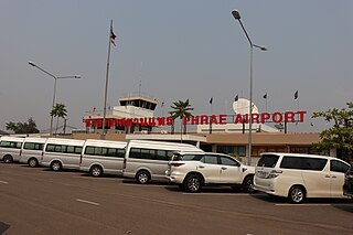
    Phrae Airport is in Na Chak subdistrict, Mueang Phrae district, Phrae province in northern Thailand.

    Cha-ian Airport is a Thai military airport operated by the Fourth Army, Royal Thai Army in the Pak Phun sub-district of Nakhon Si Thammarat Province, in southern Thailand. The Thai Airways Company formerly used Cha-ian Airport for passenger flights between Nakhon Si Thammarat-Surat Thani-Bangkok. Today, the airport is used by the military to transport the royal family.

    <span class="mw-page-title-main">Soekarno–Hatta International Airport Terminal 3</span> International terminal in Banten, Indonesia

    Soekarno–Hatta International Airport Terminal 3 is an international terminal of Soekarno–Hatta International Airport serving Greater Jakarta, Indonesia. It is located on northeast side of the airport. Terminal 3 has a different style than other terminals of the airport. Terminal 1 and 2 were built with incorporation of the local architecture into the design, but Terminal 3 is built in contemporary modern design with environmental friendly and traditional sense. The terminal was first named as Terminal 3 Ultimate but later it was decided to integrate with the old Terminal 3.

    <span class="mw-page-title-main">Betong Airport</span> Airport in southern Thailand

    Betong International Airport is in Yarom subdistrict, Betong district, Yala province in southern Thailand. The airport is 12 km (7.5 mi) east of Betong, 85 km (53 mi) southeast from Yala city and 20 km (12 mi) via the Malaysian border. The airport covers an area of 1.47 million sq.m.

    References

    1. "Airport information for VTSF". World Aero Data. Archived from the original on 2019-03-05.{{cite web}}: CS1 maint: unfit URL (link) Data current as of October 2006. Source: DAFIF.
    2. Airport information for NST at Great Circle Mapper. Source: DAFIF  (effective October 2006).
    3. "Physical data of Nakhon Si Thammarat Airport(Thai Language)". Archived from the original on 2013-03-03. Retrieved 2012-06-17.
    4. "statistics used of Nakhon Si Thammarat People". Archived from the original on 2010-03-05. Retrieved 2020-04-12.