List of airports in Thailand

Last updated

Map of Thailand Un-thailand.png
Map of Thailand

This is a list of airports in Thailand . There are 39 commercial service airports in Thailand, 10 of which are international airports. [1] The Department of Airports (DOA) managed 29 airports, while 7 airports are managed by Airports of Thailand (AOT), 3 airports are managed by Bangkok Airways (BA), and 1 airport is managed by the Royal Thai Navy (RTNV). [2] The six major international airports managed by AOT are the main gateways to Thailand for international travelers, while smaller commercial airports may be operated by the DOA or individual airlines. Thailand also has military and private airports that serve various purposes, such as supporting military operations, private aircraft operations, and general aviation.

Contents

Classification of airports

Flight accommodation

Airports can be classified according to the types of flights they accommodate. There are two main categories: [3]

  1. International airports: Serve regular international flights and operate 24/7. Have ICAO-standard customs and immigration services, as well as ground facilities for handling passengers, cargo, and mail. Can be classified into two types based on their capacity:
    1. Primary international airports: Provide regular facilities and services for international flights.
    2. Secondary international airports: Provide limited facilities and services for international flights.
  2. Domestic/National airports: Cater exclusively to domestic flights, without international flights.

CAAT classification

The Civil Aviation Authority of Thailand (CAAT) has classified Thailand airports into four categories based on their location in large cities and passenger traffic. The four categories are as follows: [4]

  1. Primary hub airports: These airports have a passenger traffic of over 25 million per year and are located in Bangkok. They are the main hubs of transport and connectivity in Thailand and offer a wide range of facilities and services for both domestic and international flights.
  2. Secondary hub airports: These airports have a passenger traffic between 5 and 25 million per year and are located in popular tourist destinations. They offer a range of facilities and services for both domestic and international flights, but with fewer options than primary hub airports.
  3. Regional airports: These airports have a passenger traffic between 1 and 5 million per year and are located in smaller cities or popular tourist destinations. They offer limited facilities and services for both domestic and international flights.
  4. Local airports: These airports have a passenger traffic of less than 1 million per year and are located in small towns or remote areas. They offer very limited facilities and services for domestic flights only.

List of airports

Airport name City served Location IATA ICAO ClassificationOperator Coordinates
Province District Flight accommodation CAAT
International airports
Don Mueang International Airport Bangkok Metropolitan Region Bangkok Don Mueang DMKVTBDInternationalPrimary AOT 13°54′44.59″N100°36′14.57″E / 13.9123861°N 100.6040472°E / 13.9123861; 100.6040472 (Don Mueang International Airport)
Suvarnabhumi International Airport [5] Bangkok Metropolitan Region Samut Prakan Bang Phli BKKVTBSInternationalPrimary AOT 13°41′32.71″N100°45′1.79″E / 13.6924194°N 100.7504972°E / 13.6924194; 100.7504972 (Suvarnabhumi International Airport)
Chiang Mai International Airport Chiang Mai
Lamphun
Lampang
Chiang Mai Mueang Chiang Mai CNXVTCCInternationalSecondary AOT 18°46′8.38″N98°58′4.57″E / 18.7689944°N 98.9679361°E / 18.7689944; 98.9679361 (Chiang Mai International Airport)
Chiang Rai International Airport Chiang Rai Chiang Rai Mueang Chiang Rai CEIVTCTInternationalRegional AOT 19°57′15.43″N99°52′44.92″E / 19.9542861°N 99.8791444°E / 19.9542861; 99.8791444 (Chiang Rai International Airport)
Krabi International Airport Krabi Krabi Nuea Khlong KBVVTSGInternationalRegional DOA 8°5′55.52″N98°58′57.92″E / 8.0987556°N 98.9827556°E / 8.0987556; 98.9827556 (Krabi International Airport)
Phuket International Airport Phuket Phuket Thalang HKTVTSPInternationalSecondary AOT 8°6′19.23″N98°18′20.2″E / 8.1053417°N 98.305611°E / 8.1053417; 98.305611 (Phuket International Airport)
U-Tapao International Airport [6] Chonburi
Pattaya
Rayong
Rayong Ban Chang UTPVTBUInternationalLocal RTNV 12°40′47″N101°0′18″E / 12.67972°N 101.00500°E / 12.67972; 101.00500 (U-Tapao International Airport)
Hat Yai International Airport Hat Yai Songkhla Khlong Hoi Khong HDYVTSSInternationalRegional AOT 6°56′11.3″N100°23′37.4″E / 6.936472°N 100.393722°E / 6.936472; 100.393722 (Hat Yai International Airport)
Samui International Airport Koh Samui Surat Thani Koh SamuiUSMVTSMInternationalRegional BA 9°32′52″N100°3′44″E / 9.54778°N 100.06222°E / 9.54778; 100.06222 (Samui International Airport)
Surat Thani International Airport Surat Thani Surat Thani Phunphin URTVTSBInternationalRegional DOA 9°8′3.75″N99°8′32.94″E / 9.1343750°N 99.1424833°E / 9.1343750; 99.1424833 (Surat Thani International Airport)
Udon Thani International Airport Udon Thani Udon Thani Mueang Udon Thani UTHVTUDInternationalRegional DOA 17°23′12.79″N102°46′32.63″E / 17.3868861°N 102.7757306°E / 17.3868861; 102.7757306 (Udon Thani Airport)
Domestic airports
Betong Airport [7] Betong
Yala
Yala Betong BTZVTSYDomesticLocal DOA 5°47′11.31″N101°8′50.24″E / 5.7864750°N 101.1472889°E / 5.7864750; 101.1472889 (Betong Airport)
Buriram Airport Buriram
Surin
Buriram Satuek BFVVTUODomesticLocal DOA 15°13′40.43″N103°14′55.08″E / 15.2278972°N 103.2486333°E / 15.2278972; 103.2486333 (Buriram Airport)
Chumphon Airport Chumphon Chumphon Pathio CJMVTSEDomesticLocal DOA 10°42′52.17″N99°21′32.19″E / 10.7144917°N 99.3589417°E / 10.7144917; 99.3589417 (Chumphon Airport)
Hua Hin Airport Hua Hin Prachuap Khiri Khan Hua Hin HHQVTPHDomesticLocal DOA 12°37′41.59″N99°57′9.94″E / 12.6282194°N 99.9527611°E / 12.6282194; 99.9527611 (Hua Hin Airport)
Khon Kaen Airport Khon Kaen Khon Kaen Mueang Khon Kaen KKCVTUKDomesticRegional DOA 16°27′51.95″N102°47′11.78″E / 16.4644306°N 102.7866056°E / 16.4644306; 102.7866056 (Khon Kaen Airport)
Lampang Airport Lampang Lampang Mueang Lampang LPTVTCLDomesticLocal DOA 18°16′39.25″N99°30′20.2″E / 18.2775694°N 99.505611°E / 18.2775694; 99.505611 (Lampang Airport)
Loei Airport Loei Loei Mueang Loei LOEVTULDomesticLocal DOA 17°26′44.6″N101°43′35.45″E / 17.445722°N 101.7265139°E / 17.445722; 101.7265139 (Loei Airport)
Mae Hong Son Airport Mae Hong Son Mae Hong Son Mueang Mae Hong Son HGNVTCHDomesticLocal DOA 19°18′1.92″N97°58′30.69″E / 19.3005333°N 97.9751917°E / 19.3005333; 97.9751917 (Mae Hong Son Airport)
Mae Sariang Airport [8] Mae Sariang Mae Hong Son Mae Sariang VTCSDomesticLocal DOA 18°10′40.47″N97°55′49.86″E / 18.1779083°N 97.9305167°E / 18.1779083; 97.9305167 (Mae Sariang Airport)
Mae Sot Airport Mae Sot
Tak
Tak Mae Sot MAQVTPMDomesticLocal DOA 16°42′8.83″N98°32′44.16″E / 16.7024528°N 98.5456000°E / 16.7024528; 98.5456000 (Mae Sot Airport)
Nakhon Phanom Airport Nakhon Phanom Nakhon Phanom Mueang Nakhon Phanom KOPVTUWDomesticLocal DOA 17°23′11.63″N104°39′37.82″E / 17.3865639°N 104.6605056°E / 17.3865639; 104.6605056 (Nakhon Phanom Airport)
Nakhon Ratchasima Airport Nakhon Ratchasima Nakhon Ratchasima Chaloem Phra Kiat NAKVTUQDomesticLocal DOA 14°57′13.3″N102°18′41.33″E / 14.953694°N 102.3114806°E / 14.953694; 102.3114806 (Nakhon Ratchasima Airport)
Nakhon Si Thammarat Airport Nakhon Si Thammarat Nakhon Si Thammarat Mueang Nakhon Si Thammarat NSTVTSFDomesticRegional DOA 8°32′23.8″N99°56′25.11″E / 8.539944°N 99.9403083°E / 8.539944; 99.9403083 (Nakhon Si Thammarat Airport)
Nan Nakhon Airport Nan Nan Mueang Nan NNTVTCNDomesticLocal DOA 18°48′9.8″N100°47′5.32″E / 18.802722°N 100.7848111°E / 18.802722; 100.7848111 (Nan Nakhon Airport)
Narathiwat Airport Narathiwat Narathiwat Mueang Narathiwat NAWVTSCDomesticLocal DOA 6°31′22.99″N101°44′55.17″E / 6.5230528°N 101.7486583°E / 6.5230528; 101.7486583 (Narathiwat Airport)
Pai Airport Pai Mae Hong Son Pai PYYVTCIDomesticLocal DOA 19°22′13.55″N98°26′9.41″E / 19.3704306°N 98.4359472°E / 19.3704306; 98.4359472 (Pai Airport)
Pattani Airport Pattani Pattani Nong Chik PANVTSKDomesticLocal DOA 6°47′6.16″N101°8′51.53″E / 6.7850444°N 101.1476472°E / 6.7850444; 101.1476472 (Pattani Airport)
Phetchabun Airport Phetchabun Phetchabun Lom Sak PHYVTPBDomesticLocal DOA 16°40′33.36″N101°11′26.16″E / 16.6759333°N 101.1906000°E / 16.6759333; 101.1906000 (Phetchabun Airport)
Phitsanulok Airport Phitsanulok Phitsanulok Mueang Phitsanulok PHSVTPPDomesticLocal DOA 16°46′17.97″N100°16′53.86″E / 16.7716583°N 100.2816278°E / 16.7716583; 100.2816278 (Phitsanulok Airport)
Phrae Airport Phrae Phrae Mueang Phrae PRHVTCPDomesticLocal DOA 18°7′54.2″N100°9′44.47″E / 18.131722°N 100.1623528°E / 18.131722; 100.1623528 (Phrae Airport)
Ranong Airport Ranong Ranong Mueang Ranong UNNVTSRDomesticLocal DOA 9°46′25.74″N98°35′14.3″E / 9.7738167°N 98.587306°E / 9.7738167; 98.587306 (Ranong Airport)
Roi Et Airport Roi Et Roi Et Thawat Buri ROIVTUVDomesticLocal DOA 16°6′33.84″N103°46′57.05″E / 16.1094000°N 103.7825139°E / 16.1094000; 103.7825139 (Roi Et Airport)
Sakon Nakhon Airport Sakon Nakhon Sakon Nakhon Mueang Sakon Nakhon SNOVTUIDomesticLocal DOA 17°11′48.02″N104°6′59.51″E / 17.1966722°N 104.1165306°E / 17.1966722; 104.1165306 (Sakon Nakhon Airport)
Sukhothai Airport Sukhothai Sukhothai Sawankhalok THSVTPODomesticLocal BA 17°13′56.88″N99°49′13.66″E / 17.2324667°N 99.8204611°E / 17.2324667; 99.8204611 (Sukhothai Airport)
Tak Airport Tak Tak Mueang Tak TKTVTPTDomesticLocal DOA 16°53′53.48″N99°15′13.5″E / 16.8981889°N 99.253750°E / 16.8981889; 99.253750 (Tak Airport)
Trang Airport Trang Trang Mueang Trang TSTVTSTDomesticLocal DOA 7°30′40.75″N99°36′55.14″E / 7.5113194°N 99.6153167°E / 7.5113194; 99.6153167 (Trang Airport)
Trat Airport Trat Trat Khao Saming TDXVTBODomesticLocal BA 12°16′51.95″N102°19′27.74″E / 12.2810972°N 102.3243722°E / 12.2810972; 102.3243722 (Trat Airport)
Ubon Ratchathani Airport Ubon Ratchathani Ubon Ratchathani Mueang Ubon Ratchathani UBPVTUUDomesticRegional DOA 15°14′49.5″N104°52′13.56″E / 15.247083°N 104.8704333°E / 15.247083; 104.8704333 (Ubon Ratchathani Airport)

Other airports

This list includes airports other than the 39 airports listed above, without scheduled services, military airports, as well as airports and airstrips used solely for general aviation.

Airport nameLocation ICAO IATA Operator Coordinates
Province District
Bang Phra Airport [9] Chonburi Si Racha VTBTThai Flying Club 13°13′59.77″N100°57′28.29″E / 13.2332694°N 100.9578583°E / 13.2332694; 100.9578583 (Bang Phra Airport)
Ban Thi Airport [10] Lamphun Ban Thi VTCM 18°40′35.45″N99°6′9.75″E / 18.6765139°N 99.1027083°E / 18.6765139; 99.1027083 (Ban Thi Airport)
Bhumibol Dam Airport [11] Tak Sam Ngao VTPY EGAT 17°14′0.87″N99°3′24.9″E / 17.2335750°N 99.056917°E / 17.2335750; 99.056917 (Bhumibol Dam Airport)
Cha-ian Airport Nakhon Si Thammarat Pak PhunVTSN RTA 8°28′9.74″N99°57′20.94″E / 8.4693722°N 99.9558167°E / 8.4693722; 99.9558167 (Cha-ian Airport)
Chanthaburi Airstrip [12] Chanthaburi Tha Mai VTBC RTNV 12°37′49.07″N102°1′33.55″E / 12.6302972°N 102.0259861°E / 12.6302972; 102.0259861 (Chanthaburi Airstrip)
Chiang Kham Airport [13] Phayao Chiang Kham VTCB RTA 19°29′59.28″N100°17′2.97″E / 19.4998000°N 100.2841583°E / 19.4998000; 100.2841583 (Chanthaburi Airstrip)
Kabinburi Airport [14] Prachinburi Kabinburi VTZ3Sahapat 14°1′11.62″N101°42′8.37″E / 14.0198944°N 101.7023250°E / 14.0198944; 101.7023250 (Kabinburi Airport)
Kamphaeng Saen Airport [15] Nakhon Pathom Kamphaeng Saen VTBKKDT RTAF 14°5′50.2″N99°55′16.91″E / 14.097278°N 99.9213639°E / 14.097278; 99.9213639 (Kamphaeng Saen Airport)
Khok Kathiam Air Force Base [16] Lopburi Mueang Lopburi VTBLKKM RTAF 14°52′29″N100°39′47″E / 14.87472°N 100.66306°E / 14.87472; 100.66306 (Khok Kathiam Air Force Base)
Korat Royal Thai Air Force Base [17] Nakhon Ratchasima Nakhon Ratchasima VTUN RTAF 14°55′51.5″N102°4′34.48″E / 14.930972°N 102.0762444°E / 14.930972; 102.0762444 (Korat Royal Thai Air Force Base)
Koh Mai Si Airport [18] Trat Koh Kut Soneva Kiri 11°43′2.84″N102°31′13.64″E / 11.7174556°N 102.5204556°E / 11.7174556; 102.5204556 (Koh Mai Si Airport)
Koh Takian Airport Trat Mueang Trat VTBV RTAF 12°15′15.29″N102°31′6.44″E / 12.2542472°N 102.5184556°E / 12.2542472; 102.5184556 (Koh Takian Airport)
Lamphun Airport [19] Lamphun Lamphun VTCOSahaphat 18°32′50.16″N99°0′43.78″E / 18.5472667°N 99.0121611°E / 18.5472667; 99.0121611 (Lamphun Airport)
Loeng Nok Tha Airport [20] Yasothon Loeng Nok Tha 16°9′21.9″N104°35′22.9″E / 16.156083°N 104.589694°E / 16.156083; 104.589694 (Loeng Nok Tha Airport)
Lom Sak Airport [21] Phetchabun Lom Sak 16°49′26.92″N101°15′4.85″E / 16.8241444°N 101.2513472°E / 16.8241444; 101.2513472 (Lom Sak Airport)
Nakhon Sawan Airport Nakhon Sawan Mueang Nakhon Sawan VTPN DRRAA 15°40′19.13″N100°8′7.67″E / 15.6719806°N 100.1354639°E / 15.6719806; 100.1354639 (Nakhon Sawan Airport)
Namphong Airstrip Khon Kaen Nam Phong RTAF 16°39′6″N102°57′56″E / 16.65167°N 102.96556°E / 16.65167; 102.96556 (Namphong Airstrip)
Nok Airfield [22] Chiang Mai Ban Thi VTCYNok Aviation Flying Club [note 1] 18°40′36.13″N99°6′41.36″E / 18.6767028°N 99.1114889°E / 18.6767028; 99.1114889 (Nok Airfield)
Nong Khor Airfield Chonburi Si Racha Paramotor Thailand 13°8′24.16″N101°2′45.89″E / 13.1400444°N 101.0460806°E / 13.1400444; 101.0460806 (Nong Khor Airfield)
Old Chiang Rai Airport Chiang Rai Mueang Chiang Rai VTCR RTAF 19°53′0.32″N99°49′35.81″E / 19.8834222°N 99.8266139°E / 19.8834222; 99.8266139 (Old Chiang Rai Airport)
Pak Phreaw Airport Saraburi Mueang Saraburi VTBE RTA 14°30′48.38″N100°55′4.65″E / 14.5134389°N 100.9179583°E / 14.5134389; 100.9179583 (Pak Phreaw Airport)
Pattaya Airpark [23] Chonburi Bang Lamung VTBF 12°49′57.39″N100°56′56.98″E / 12.8326083°N 100.9491611°E / 12.8326083; 100.9491611 (Pattaya Airpark)
Photharam Airport [24] Ratchaburi Photharam VTPRThai Aerospace Services 13°40′12.61″N99°44′2.13″E / 13.6701694°N 99.7339250°E / 13.6701694; 99.7339250 (Photharam Airport)
Phuket Airpark [25] [26] Phuket Thalang VTSW 8°1′11.08″N98°24′5.39″E / 8.0197444°N 98.4014972°E / 8.0197444; 98.4014972 (Phuket Airpark)
Prachin Buri Airport [27] Prachin Buri Mueang Prachin Buri VTBI RTA 14°4′39.95″N101°22′47.59″E / 14.0777639°N 101.3798861°E / 14.0777639; 101.3798861 (Prachin Buri Airport)
Prachuap Khiri Khan Air Force Base [28] Prachuap Khiri Khan Mueang Prachuap Khiri Khan VTBP RTAF 11°47′18.3″N99°48′16.65″E / 11.788417°N 99.8046250°E / 11.788417; 99.8046250 (Prachuap Khiri Khan Air Force Base)
Rob Muang Airport [29] Roi Et Mueang Roi Et VTUR RTA 16°4′13.26″N103°38′45.25″E / 16.0703500°N 103.6459028°E / 16.0703500; 103.6459028 (Rob Muang Airport)
Songkhla Airport Songkhla Mueang Songkhla VTSHSGZ RTNV 7°11′11.4″N100°36′29.08″E / 7.186500°N 100.6080778°E / 7.186500; 100.6080778 (Songkhla Airport)
Surin Airport [30] Surin Mueang Surin VTUJPXR DOA 14°52′5.75″N103°29′53.72″E / 14.8682639°N 103.4982556°E / 14.8682639; 103.4982556 (Surin Airport)
Takhli Air Force Base [31] Nakhon Sawan Takhli VTPITKH RTAF 15°16′38.29″N100°17′45.06″E / 15.2773028°N 100.2958500°E / 15.2773028; 100.2958500 (Takhli Air Force Base)
Uttaradit Airport [32] Uttaradit Mueang Uttaradit VTPUUTR DOA 17°40′25.01″N100°14′4.98″E / 17.6736139°N 100.2347167°E / 17.6736139; 100.2347167 (Uttaradit Airport)
Watthana Nakhon Airport [33] Sa Kaeo Watthana Nakhon VTBW RTAF 13°46′7.68″N102°18′55.77″E / 13.7688000°N 102.3154917°E / 13.7688000; 102.3154917 (Watthana Nakhon Airport)

Under construction, approved and proposed

This list includes airports that are currently under construction, as well as those that have been approved and are in the planning stages.

Airport nameLocationClassificationOperator Coordinates StartCompletionStatus
Flight accommodation CAAT
U-Tapao International Airport
New Terminal
Phase 1
[34]
Rayong InternationalPrimaryUTA 12°40′43.34″N101°1′15.03″E / 12.6787056°N 101.0208417°E / 12.6787056; 101.0208417 (U-Tapao International Airport) 2024 [35] 2027Prepared for construction
Suvarnabhumi International Airport
Expansion: Phase 2
Samut Prakan InternationalPrimary AOT 13°40′56.13″N100°44′52.64″E / 13.6822583°N 100.7479556°E / 13.6822583; 100.7479556 (Suvarnabhumi International Airport) 20162023 [36] Under construction [37]
Trang Airport
New Terminal
Trang InternationalRegional DOA 7°30′15.72″N99°37′4.97″E / 7.5043667°N 99.6180472°E / 7.5043667; 99.6180472 (Trang Airport) 2020 [38] 2023 [39] Under construction
Nakhon Si Thammarat Airport
New Terminal
Nakhon Si Thammarat InternationalRegional DOA 8°32′18.41″N99°56′24.92″E / 8.5384472°N 99.9402556°E / 8.5384472; 99.9402556 (Nakhon Si Thammarat Airport) 2019 [40] 2023 [41] Under construction
Khon Kaen International Airport
New Terminal
Khon Kaen InternationalRegional DOA 16°27′51.95″N102°47′11.78″E / 16.4644306°N 102.7866056°E / 16.4644306; 102.7866056 (Khon Kaen International Airport) 2018 [42] 2023 [43] Under construction
Buriram International Airport
New Terminal
Buriram InternationalRegional DOA 15°13′40.43″N103°14′55.08″E / 15.2278972°N 103.2486333°E / 15.2278972; 103.2486333 (Buriram International Airport) 20212024Under construction [44]
Don Mueang International Airport
Expansion: Phase 3
Bangkok InternationalPrimary AOT 13°54′22.83″N100°35′43.82″E / 13.9063417°N 100.5955056°E / 13.9063417; 100.5955056 (Don Mueang International Airport) 20232029Approved [45]
Nakhon Pathom Airport Nakhon Pathom InternationalRegional DOA Proposed [46]
Phang Nga - Andaman International Airport Phang Nga InternationalRegional DOA Proposed [47]
New Chiang Mai International Airport Chiang Mai InternationalSecondary AOT Proposed [48]
Bueng Kan Airport Bueng Kan Proposed [49]
Mukdahan Airport Mukdahan Proposed [49]
Satun Airport Satun Proposed [49]
Mukdahan Airport Mukdahan Proposed [49]
Phatthalung Airport Phatthalung Proposed [49]
Phayao Airport Phayao Proposed [49]
Kalasin Airport Kalasin Proposed [49]

See also

Map this section's coordinates using: OpenStreetMap

Notes

  1. Not related to Nok Air or Nok Mini.

Related Research Articles

<span class="mw-page-title-main">Transport in Thailand</span> Overview of transport in Thailand

Transport in Thailand is varied, with no one dominant means of transport. For long distance travel, bus transport dominates. Low-speed rail travel has long been a rural long-distance transport mechanism, though plans are underway to expand services with high-speed rail lines extending to several major regions of Thailand. Road transportation is the primary form of freight transport across the country.

<span class="mw-page-title-main">Don Mueang International Airport</span> Secondary airport serving Bangkok, Thailand

Don Mueang International Airport is one of two international airports serving the Bangkok Metropolitan Region, the other one being Suvarnabhumi Airport (BKK). Before Suvarnabhumi opened in 2006, Don Mueang was previously known as Bangkok International Airport.

<span class="mw-page-title-main">Phuket International Airport</span> Airport in southern Thailand

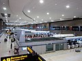
Phuket International Airport is an international airport in Mai Khao subdistrict, Thalang district, Phuket province in southern Thailand. It is in the north of Phuket Island, 32 kilometres (20 mi) from downtown Phuket. The airport plays a major role in Thailand's tourism industry, as Phuket is a popular resort destination. It is the third-busiest airport in Thailand in terms of passengers, after Suvarnabhumi Airport and Don Mueang International Airport in the Bangkok Metropolitan Region. The airport set a record 15.1 million arrivals and departures in 2016, up 17.8 percent from 2015.

Thai Airways International Public Company Limited, trading as THAI is the flag carrier airline of Thailand. Formed in 1961, the airline has its corporate headquarters in Vibhavadi Rangsit Road, Chatuchak district, Bangkok, and primarily operates from Suvarnabhumi Airport. THAI is a founding member of the Star Alliance. The airline is the second-largest shareholder of the low-cost carrier Nok Air with a 15.94 per cent stake (2020), and it launched a regional carrier under the name Thai Smile in the middle of 2012 using new Airbus A320 aircraft. In 2023, it was announced that Thai Smile would be merged back into Thai Airways.

Thai Airways Company or Thai Airways was the domestic flag carrier of Thailand. Its main base was the domestic terminal at Don Mueang International Airport. Its head office was located in Pom Prap Sattru Phai, Bangkok. In 1988, Thai Airways merged to become Thai Airways International.

<span class="mw-page-title-main">Suvarnabhumi Airport</span> Main airport serving Bangkok, Thailand

Suvarnabhumi Airport, also known unofficially as Bangkok International Airport, is the main international airport serving Bangkok, Thailand. Located mostly in Racha Thewa subdistrict, Bang Phli district, Samut Prakan province, it covers an area of 3,240 ha, making it one of the biggest international airports in Southeast Asia and a regional hub for aviation. The airport is also a major Cargo Air Freight Hub, which has a designated Airport Free Zone, as well as road links to the Eastern Economic Corridor (EEC) on Motorway 7.

Nok Air is a low-cost airline in Thailand operating mostly domestic services out of Bangkok's Don Mueang International Airport. Thai Airways International owns the fourth-largest stake in the airline.

<span class="mw-page-title-main">Bangkok Airways</span> Regional airline of Thailand

Bangkok Airways Public Company Limited is a regional airline based in Bangkok, Thailand. It operates scheduled services to destinations in Thailand, Cambodia, Hong Kong, Laos, Maldives, Myanmar, Singapore, and Vietnam. Its main base is Suvarnabhumi Airport.

<span class="mw-page-title-main">Surat Thani International Airport</span> Airport in southern Thailand

Surat Thani International Airport is in Hua Toei subdistrict, Phunphin district, Surat Thani province in southern Thailand. The airport, 21 kilometres west of downtown Surat Thani, is also home to the Royal Thai Air Force (RTAF) squadrons. Surat Thani International Airport has a single paved runway. It is the tenth-busiest airport in Thailand in terms of passengers, handling more than two million passengers annually.

Thai AirAsia is a Thai low-cost airline. It is a joint venture of the Malaysian AirAsia and Thailand's Asia Aviation. It serves AirAsia's regularly scheduled domestic and international flights from Bangkok and other cities in Thailand.

<span class="mw-page-title-main">U-Tapao International Airport</span> Commercial airport serving Pattaya, Thailand

U-Tapao–Rayong–Pattaya International Airport also spelled Utapao and U-Taphao, is a joint civil–military public international airport serving Rayong and Pattaya cities in Thailand. It is in Ban Chang District of Rayong Province.

<span class="mw-page-title-main">Phuket Air</span>

Phuket Air was an airline based in Bangkok, Thailand. The airline specialised in leasing its fleet of Boeing 747 and 737 aircraft on an ACMI as well as wet lease basis to airlines worldwide needing extra passenger capacity. Other services provided included international charter services, ad hoc wet leasing services, religious pilgrimage charters (Hajj/Umrah) and dry lease services. Saudi Arabian Airlines was a major long term client of Phuket Air. In the past, the airline provided scheduled domestic and international air services. Its main base was at Suvarnabhumi Airport, Bangkok, with a hub at Phuket International Airport, Phuket. The airline was an international scheduled carrier before it shifted its focus to the ACMI/wet lease market.

<span class="mw-page-title-main">Penang International Airport</span> Airport serving Penang, Malaysia

Penang International Airport (PIA) (IATA: PEN, ICAO: WMKP) is an international airport in George Town, the capital city of the Malaysian state of Penang. The airport is located at the southeastern tip of Penang Island, 16 km (9.9 mi) south of the city centre, and serves the country's second largest conurbation.

<span class="mw-page-title-main">Udon Thani International Airport</span> Airport in northeastern Thailand

Udon Thani International Airport is in Nong Khon Kwang subdistrict, Mueang Udon Thani district, Udon Thani province in northeastern Thailand. It is approximately 450 kilometres (280 mi) northeast of Bangkok. It currently has domestic flights to and from Bangkok, Chiang Mai, Hat Yai, Phuket, Rayong, and Ubon Ratchathani. In 2006, the airport had 677,411 passengers movements and 1,558 MT cargo movements. In 2013, the airport handled 1,325,305 passengers. In 2015, it handled 2,213,689 passengers and 3,678 tonnes of freight. It has been managed by the Department of Airports (DOA).

<span class="mw-page-title-main">Lokpriya Gopinath Bordoloi International Airport</span> International airport serving Guwahati, Assam, India

Lokpriya Gopinath Bordoloi International Airport is an international airport serving Guwahati, the largest city of North-East India in Assam, India. It is the primary airport of North-East India, and the 12th busiest airport in India. It is located at Borjhar, 26 km (16 mi) from Dispur, the capital city of Assam and 28 km (18 mi) from Guwahati. It is named after Gopinath Bordoloi, a freedom fighter and the first Chief Minister of Assam after India's independence. The airport is managed by Airports Authority of India and serves as an Indian Air Force base.

<span class="mw-page-title-main">Airports of Thailand</span> Government Owned Public Company

Airports of Thailand Public Company Limited (AOT) is a public company that manages ten international airports in Thailand.

<span class="mw-page-title-main">Thai AirAsia X</span> Low-cost airline of Thailand, operating long-haul flights

Thai AirAsia X is a Thai long-haul budget airline based at Suvarnabhumi Airport in Bangkok. It is a joint venture of AirAsia X from Malaysia and Thai AirAsia.

<span class="mw-page-title-main">Thai VietJet Air</span> Low-cost airline of Thailand

Thai Vietjet Air JSC Limited, operating as Thai VietJet Air or Vietjet Air Thailand, is a low-cost airline from Thailand and an associate company of Vietnamese airline VietJet Air.

<span class="mw-page-title-main">Betong Airport</span> Airport in southern Thailand

Betong International Airport is a domestic airport serving the town of Betong and Yala province in Thailand. The airport is 12 km (7.5 mi) east of Betong, 85 km (53 mi) southeast from Yala city and 20 km (12 mi) via the Malaysian border. The airport covers an area of 1.47 million sq.m.

References

  1. Civil Aviation Authority of Thailand (January 17, 2023), ประกาศเรื่องรายชื่อสนามบินที่ให้บริการเที่ยวบินระหว่างประเทศ [Announcement of the list of airports providing international flight services](PDF) (in Thai)
  2. OTP 2018, p. 157–159.
  3. OTP 2018, p. 331.
  4. OTP 2018, p. 333.
  5. Bangkok Suvarnabhumi International Airport, CAPA - Centre for Aviation, retrieved March 28, 2023
  6. Utapao Rayong-Pattaya International Airport, CAPA - Centre for Aviation, retrieved March 28, 2023
  7. Betong Airport, Centre For Aviation, retrieved March 28, 2023
  8. "VTCS Mae Sariang (STOL)". airportnavfinder.com. Retrieved March 29, 2023.
  9. "Bang Phra Airport". thaiflyingclub.com. Retrieved March 28, 2023.
  10. "BAN THI "LANNA" AIRPORT". thaiflyingclub.com.
  11. "PHUMIPOL DAM AIRPORT". thaiflyingclub.com.
  12. "CHANTABURI AIRPORT". thaiflyingclub.com.
  13. "Chiang Kham Airport". thaiflyingclub.com. Retrieved March 28, 2023.
  14. "Kabinburi Airport". thaiflyingclub.com. Retrieved March 28, 2023.
  15. "KAMPHAENG SAEN AIRPORT". thaiflyingclub.com.
  16. "AIRPORT". thaiflyingclub.com.
  17. "KHORAT AIRFORCE AIRPORT". thaiflyingclub.com.
  18. "Koh Mai Si Airport". thaiflyingclub.com.
  19. "LAMPOON AIRPORT". www.thaiflyingclub.com. Retrieved 2016-12-04.
  20. "Loeng Nok Tha Airport". www.thaiflyingclub.com. Retrieved March 28, 2023.
  21. "Lom Sak Airport". www.thaiflyingclub.com. Retrieved March 28, 2023.
  22. "NOK Aviation home page". nokaviation.com.
  23. "PATTAYA AIRPORT". thaiflyingclub.com.
  24. "RATCHABURI AIRPORT". thaiflyingclub.com.
  25. "PHUKET AIRPARK". thaiflyingclub.com.
  26. "PHUKET AIRPARK -- Home and Flying Club in Thailand -- www.phuketairpark.c0m". phuketairpark.com.
  27. "VTBIPrachin Buri RTA". airportnavfinder.com. Retrieved March 29, 2023.
  28. VTBP — PRACHUAP KHIRI KHAN, Civil Aviation Authority of Thailand, retrieved March 29, 2023
  29. "VTUR Rob Muang RTA". airportnavfinder.com.
  30. "VTUJ Surin". airportnavfinder.com.
  31. "VTPI Nakhon Sawan Takhli RTAF". airportnavfinder.com.
  32. "VTPU Uttaradit". airportnavfinder.com.
  33. "WATTANA NAKORN AIRPORT". thaiflyingclub.com.
  34. Bangkok's 3rd Major Airport, capable of handling 60 million passengers a year in the ultimate phase , retrieved March 28, 2023
  35. ""อู่ตะเภา" สตาร์ทช้าแต่มาแน่ ปักหมุดตอกเข็มปี 67 เคาะประมูลรันเวย์ พ.ค.นี้-UTA เร่งปรับแผนพัฒนา" (in Thai). May 2, 2023.
  36. "ส่องอาคารใหม่ "สุวรรณภูมิ" ทอท.เปิดใช้พร้อมรถไฟฟ้าไร้คนขับ". Bangkokbiznews (in Thai).
  37. Suvarnabhumi Airport Development Project Phase 2 , retrieved March 28, 2023
  38. "ปลื้มขยายสนามบินตรังฉลุยเปิดใช้ปี65" (in Thai). June 23, 2020.
  39. "อาคารผู้โดยสารใหม่ สนามบินตรัง เลื่อนเปิดปลายปี 2566". thelist (in Thai). Dec 28, 2022.
  40. "อาคารผู้โดยสารใหม่ "สนามบินนานาชาติ นครศรีธรรมราช" เตรียมเปิดใช้ ก.ย. 65 นี้ !" (in Thai). July 22, 2022.
  41. "สวยตาแตก! โฉมใหม่ สนามบินนครศรีธรรมราช คาดเปิดให้บริการ มี.ค.66" (in Thai). January 12, 2023.
  42. "อัพเดต!!! ความคืบหน้าสนามบินขอนแก่น คาดเปิด 2565 นี้" (in Thai). October 16, 2018.
  43. "โกอินเตอร์! สนามบิน "ขอนแก่น" เร่งรีโนเวท "เทอร์มินอล" หลังเก่าเสร็จ มี.ค.66" (in Thai). November 21, 2022.
  44. รักษาราชการแทนผู้อำนวยการท่าอากาศยานบุรีรัมย์ เผยความคืบหน้าโครงการพัฒนาท่าอากาศยานบุรีรัมย์ คาดว่าจะแล้วเสร็จภายในเดือนมีนาคม 2567 (in Thai), March 21, 2023
  45. แผนปรับเปลี่ยนครั้งใหญ่!! สนามบินดอนเมือง ระยะ 3, January 12, 2023
  46. สนามบินนครปฐม - สนามบินที่ 3 ใกล้กรุงเทพฯ สุด, January 3, 2020
  47. Phang Nga - Andaman International Airport, CAPA - Centre for Aviation, retrieved March 28, 2023
  48. New Chiang Mai Airport , retrieved March 28, 2023
  49. 1 2 3 4 5 6 7 เช็กสถานะว่าที่7สนามบินแห่งใหม่ แจ้งเกิดไว้ลุ้นรัฐบาลหน้าสร้าง-ล้ม , retrieved March 28, 2023