
Trang, also called Mueang Thap Thiang, is one of the southern provinces (changwat) of Thailand, on the west side of the Malay Peninsula facing the Strait of Malacca. Neighboring provinces are Krabi, Nakhon Si Thammarat, Phatthalung, and Satun.
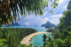
Ranong is one of Thailand's southern provinces (changwat), on the west coast along the Andaman Sea. It has the fewest inhabitants of all Thai provinces. provinces neighboring Ranong are (clockwise) Chumphon, Surat Thani, and Phang Nga. To the west, it borders Kawthaung, Tanintharyi, Myanmar.

Phang Nga is one of the southern provinces (Changwat) of Thailand, on the shore of the Andaman Sea to the west and Phang Nga Bay to the south. Neighbouring provinces, from north and moving clockwise, are Ranong, Surat Thani, and Krabi. Towards the south of Phang Nga is the Phuket province, connected by the Sarasin Bridge.
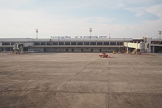
Hat Yai International Airport is an international airport in Khlong La subdistrict, Khlong Hoi Khong district, Songkhla province in southern Thailand, near the city of Hat Yai. It is under the management of Airports of Thailand, PLC (AOT). It serves more than 1.5 million passengers per year, 9,500 flights and 12,000 tons of cargo.

Hat Yai is a city in southern Thailand near the Malaysian border and the fifth largest city in Thailand. It is 946 km (588 mi) south of Bangkok, has a population of 156,802 (2019) in the city municipality itself and an urban population of 404,044 (2021) in the entire district of Amphoe Hat Yai.

Thesaban nakhon Trang, City of Trang, or Trang, also called Mueang Thap Thiang (เมืองทับเที่ยง), is a thesaban nakhon and the capital of Trang Province, Thailand. The city has a population of 59,637 (2005) and covers the whole tambon Thap Thiang of Mueang Trang district. Trang is 839 km south of Bangkok.

Prachuap Khiri Khan is a town in western Thailand. It is the capital of Prachuap Khiri Khan Province and is on the coast at one of the narrowest stretches in Thailand, only 10 kilometres (6.2 mi) from the border with Myanmar at Dan Sing Khon in the Tenasserim Hills. The area has large pineapple and coconut industries, in addition to being popular with Thai tourists. The town is 291 km south of Bangkok by road.

Ranong is a town in southern Thailand, capital of the Ranong Province and the Mueang Ranong District. The town covers completely the area of the tambon Khao Niwet (เขานิเวศน์). As of 2005, it had a population of 16,163. Ranong lies 586 kilometres (364 mi) south-southwest of Bangkok by road.

Chumphon is a town in southern Thailand, capital of the Chumphon Province and Mueang Chumphon District. The city is about 463 kilometers from Bangkok. As of 2005 it had a population of 33,522. The town covers the commune (tambon) Tha Taphao completely and parts of tambons Bang Mak, Wang Phai, Na Thung, Tak Daet, and Khun Krathing. Its main economic activity is agriculture.

Southern Thailand, Southern Siam or Tambralinga is a southernmost cultural region of Thailand, separated from Central Thailand region by the Kra Isthmus.
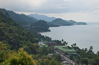
Ko Chang is an amphoe (district) in Trat province, Thailand. It is on the Gulf of Thailand's eastern seaboard, 300 km (190 mi) from Bangkok, near the border with Cambodia.

Kawthaung is a border town located in the southernmost part of Myanmar, in the Tanintharyi Region. During British rule in Burma between 1824 and 1948, it was known as Victoria Point. As of 2021, it has a population of 57,949. Facing Ranong in Thailand, Kawthaung is one of 7 official border trade posts with Thailand.

Kra Buri is the northernmost district (amphoe) of Ranong province, southern Thailand.

Nakhon Si Thammarat International Airport is in Pak Phun subdistrict, Mueang Nakhon Si Thammarat district, Nakhon Si Thammarat province in southern Thailand.
Khlong Nakha is a wildlife sanctuary in southern Thailand, located in the southeast of Ranong Province. It is located within the hills of the Phuket mountain range.
The Port Authority of Thailand (PAT) is a government agency of Thailand, responsible for the regulation and governance of the ports of Thailand, primarily the ports of Laem Chabang and Bangkok Port, the country's two largest. PAT operates Thai ports in conjunction with public companies including Hutchison Ports Thailand and PSA International.
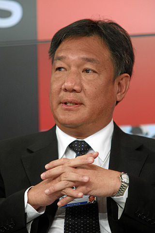
Kittiratt Na-Ranong is a Thai business executive and politician. He was a deputy prime minister in Yingluck Shinawatra's cabinet. He also served as the Minister of Commerce until January 2012 and then as Minister of Finance until May 2014.
Moklen is an Austronesian language spoken on the western coast of southern Thailand. It is related to but distinct from the Moken language of Myanmar and southern Thailand. Unlike Moken, it is not spoken in Myanmar.
The Southern Economic Corridor is a special economic zone on the upper south of Thailand. It consists of four provinces, including Chumphon, Ranong, Surat Thani and Nakhon Si Thammarat. The SEC is part of a larger plan to link up the Andaman Sea with the Gulf of Thailand by land, air, and water, connecting the SEC with the Eastern Economic Corridor (EEC). The project aims to promote sustainable development, increase competitiveness, and connectivity with neighboring countries, including members of BIMSTEC.

Betong International Airport is a domestic airport serving the town of Betong and Yala province in Thailand. The airport is 12 km (7.5 mi) east of Betong, 85 km (53 mi) southeast from Yala city and 20 km (12 mi) via the Malaysian border. The airport covers an area of 1.47 million sq.m.


