Northolt is a town in West London, England, spread across both sides of the A40 trunk road. It is 11 miles (17.7 km) west-northwest of Charing Cross and is one of the seven major towns that make up the London Borough of Ealing. It had a population of 30,304 at the 2011 UK census.

Perivale is an area of Greater London, 9.5 miles (15.3 km) west of Charing Cross. It is the smallest of the seven towns which make up the London Borough of Ealing.

The London and Birmingham Railway (L&BR) was an early railway company in the United Kingdom, existing from 1833 to 1846, when it became part of the London and North Western Railway (L&NWR).
Tipton is an industrial town in the West Midlands in England with a population of around 38,777 at the 2011 UK Census. It is located 16 kilometres (9.9 mi) northwest of Birmingham.

Smethwick is an industrial town in Sandwell, West Midlands, historically in Staffordshire. It is 4 miles west of Birmingham city centre and borders West Bromwich and Oldbury to the north and west. Formerly a Staffordshire county borough, Smethwick is situated near the edge of Sandwell metropolitan borough and borders the Birmingham districts of Handsworth, Winson Green, Harborne, Edgbaston and Quinton to the south and east, as well as the Black Country towns of West Bromwich and Oldbury in the north and west.

Watford is a town and borough in Hertfordshire, England, 17.5 miles northwest of Charing Cross.

Watford tube station is the terminus of a Metropolitan line branch line in the north-western part of London Underground in Zone 7. The station opened in 1925.

Watford Gap is a low-lying area between two hills, close to the village of Watford, Northamptonshire, England. Engineers from Roman times onwards have found it to be an ideal route for connecting the Midlands with South East England. The A5 road, the West Coast Main Line railway, the M1 motorway and a branch of the Grand Union Canal traverse in parallel a space about 400 metres (1,300 ft) wide. It has been written and spoken of as marking the divide between Northern England and Southern England.

The Cassiobury Estate is a suburban residential area of Watford in Hertfordshire, England. It is bounded to the south by Cassiobury Park, the main public park in the town, to the west by playing fields next to the River Gade, and to the northeast by Hempstead Road. It is mostly characterised by 1930s Mock Tudor houses.

South Wigston is a large village to the south of Leicester, England. It is outside the city boundary, forming part of the Oadby and Wigston district of Leicestershire. The population of the ward rose slightly from 7,471 at the 2001 census to 7,490 at the 2011 census.

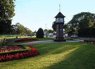
Cassiobury Park is the principal public park in Watford, Hertfordshire, in England. It was created in 1909 from the purchase by Watford Borough Council of part of the estate of the Earls of Essex around Cassiobury House which was subsequently demolished in 1927. It comprises over 190 acres (0.77 km2) and extends from the A412 Rickmansworth Road in the east to the Grand Union Canal in the west, and lies to the south of the Watford suburb of Cassiobury, which was also created from the estate. The western part is a 25.1 hectare Local Nature Reserve managed by the Herts and Middlesex Wildlife Trust. The park hosts the free, weekly timed parkrun 5km event every Saturday morning at 9am, starting at the Rickmansworth Road entrance to the park.

Cassiobury House was a country house in Cassiobury Park, Watford, England. It was the ancestral seat of the Earls of Essex. Originally a Tudor building, dating from 1546 for Sir Richard Morrison, it was substantially remodelled in the 17th and 19th centuries and ultimately demolished in 1927. The surrounding Cassiobury Park was turned into the main public open space for Watford.

Cassiobridge was a proposed London Underground station in Watford, Hertfordshire, England. The station would have been part of the Croxley Rail Link project, a scheme to extend the Metropolitan line to Watford Junction railway station. It would have been served by Metropolitan line trains between Watford Junction and Central London via Baker Street. The railway line would run over Ascot Road via a viaduct and the platforms would have been situated on the east side of the road. Entrance to the station would have been from the west side of the road, with a ticket hall and other facilities at street level. Passengers would gain access to the platforms via stairs and lifts and a short footbridge over the road.

Storeton is a small village on the Wirral Peninsula, England. It is situated to the west of the town of Bebington and is made up of Great Storeton and Little Storeton, which is classified as a hamlet. At the 2001 Census the population of Storeton was recorded as 150.

How Wood is a residential village, south of Park Street village between the towns of Watford and St Albans in St Stephen civil parish, Hertfordshire, England.
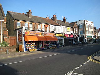
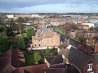
North Watford is an area in the town of Watford, Hertfordshire, in the United Kingdom. It is primarily a residential area which developed as a result of expansion from the town during the 19th century.

Thackley is a small suburb near Bradford, West Yorkshire in England. The village is loosely bordered by the village of Idle to the south, to the west by the West Royd area of Shipley and elsewhere by the Leeds and Liverpool Canal. Thackley is the northernmost part of Bradford south of the River Aire.
Carpenders Park is a suburb of Watford in the Watford Rural parish of the Three Rivers district of Hertfordshire, England. It is located in the south western corner of Hertfordshire and close to the boundary with Greater London. It is bounded to the West by a railway line that separates it from South Oxhey, to the East by the A4008 Watford to Harrow Road, to the South by the B4542, Green Belt and the boundary with the London Borough of Harrow and to the North by woodland.
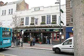
Watford Central, a planned London Underground station in the centre of Watford, Hertfordshire, was to be the terminus of a proposed extension of the Metropolitan line from the present-day Watford tube station to the High Street opposite Clarendon Road. The proposed station booking hall has long gone, however, the facade was retained and a new building constructed behind it. It is now The Moon Under Water public house.

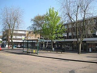
Watford Museum is a local museum in Watford, Hertfordshire, in the United Kingdom. It is owned by Watford Borough Council and is located on the Lower High Street in Watford.