National Register of Historic Places listings in Madison County, North Carolina

Last updated

Map all coordinates using: OpenStreetMap  
Download coordinates as: KML
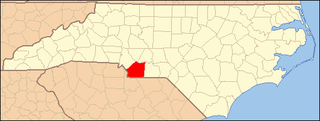
North Carolina Map Highlighting Madison County.PNG

This list includes properties and districts listed on the National Register of Historic Places in Madison County, North Carolina. Click the "Map of all coordinates" link to the right to view an online map of all properties and districts with latitude and longitude coordinates in the table below. [1]

Contents

Current listings


    This National Park Service list is complete through NPS recent listings posted April 22, 2022. [2]

[3] Name on the Register [4] ImageDate listed [5] Location City or townDescription
1 Bank of French Broad
Bank of French Broad Bank of French Broad Building, Marshall, NC (46636426172).jpg
Bank of French Broad
June 10, 2004
(#04000584)
100 Main St.
35°47′51″N82°41′01″W / 35.797567°N 82.683664°W / 35.797567; -82.683664 (Bank of French Broad)
Marshall
2 California Creek Missionary Baptist Church
California Creek Missionary Baptist Church California Creek Missionary Baptist Church, California Creek, NC.jpg
California Creek Missionary Baptist Church
July 12, 1984
(#84002342)
US 23
35°52′25″N82°30′50″W / 35.873611°N 82.513889°W / 35.873611; -82.513889 (California Creek Missionary Baptist Church)
Mars Hill
3 Capitola Manufacturing Company Cotton Yarn Mill
Capitola Manufacturing Company Cotton Yarn Mill Capitola Manufacturing Company Cotton Yarn Mill.jpg
Capitola Manufacturing Company Cotton Yarn Mill
August 28, 2012
(#12000577)
Southeast end of Bridge No. 328 over French Broad River
35°47′42″N82°40′59″W / 35.794973°N 82.68309°W / 35.794973; -82.68309 (Capitola Manufacturing Company Cotton Yarn Mill)
Marshall
4 Dorland Memorial Presbyterian Church
Dorland Memorial Presbyterian Church Dorland Memorial Presbyterian Church, Hot Springs, NC (39706781173).jpg
Dorland Memorial Presbyterian Church
July 24, 1986
(#86001907)
Bridge St. at Meadow Ln.
35°53′32″N82°49′43″W / 35.892222°N 82.828611°W / 35.892222; -82.828611 (Dorland Memorial Presbyterian Church)
Hot Springs
5 William R. Ellerson House September 11, 2018
(#100002929)
320 Gahagans Rd.
35°53′37″N82°49′12″W / 35.8935°N 82.8200°W / 35.8935; -82.8200 (William R. Ellerson House)
Hot Springs
6 Hot Springs Historic District
Hot Springs Historic District Andrews Avenue, Hot Springs, NC (32796871858).jpg
Hot Springs Historic District
February 5, 2009
(#08001413)
Roughly bounded by Bridge St., Andrews Ave. S. and Meadow Ln.
35°53′32″N82°49′41″W / 35.892222°N 82.828008°W / 35.892222; -82.828008 (Hot Springs Historic District)
Hot Springs
7 Madison County Courthouse
Madison County Courthouse Madison County North Carolina Courthouse.jpg
Madison County Courthouse
May 10, 1979
(#79001732)
Main St.
35°47′52″N82°41′02″W / 35.797675°N 82.683928°W / 35.797675; -82.683928 (Madison County Courthouse)
Marshall
8 Mars Hill Anderson Rosenwald School
Mars Hill Anderson Rosenwald School Mars Hill Anderson Rosenwald School, Mars Hill, NC.jpg
Mars Hill Anderson Rosenwald School
May 31, 2018
(#100002519)
225 Mount Olive Dr.
35°48′23″N82°32′29″W / 35.806389°N 82.541389°W / 35.806389; -82.541389 (Mars Hill Anderson Rosenwald School)
Mars Hill
9 Mars Hill College Historic District
Mars Hill College Historic District Montague Hall (Rural Heritage Museum), Mars Hill University, Mars Hill, NC (45956973694).jpg
Mars Hill College Historic District
September 12, 2006
(#06000865)
Bet. Bailey and Cascade Sts. N and S
35°49′36″N82°33′02″W / 35.826756°N 82.550672°W / 35.826756; -82.550672 (Mars Hill College Historic District)
Mars Hill
10 Mars Hill Commercial Historic District
Mars Hill Commercial Historic District Main Street, Mars Hill, NC (46628943712).jpg
Mars Hill Commercial Historic District
September 8, 2015
(#15000575)
15 College, 2-14, 18, 24-26, 28-30, 32-34, 9, and 15-25 S. Main, and 10, 14, and 16-20 N. Main Sts.
35°49′38″N82°32′55″W / 35.827222°N 82.548611°W / 35.827222; -82.548611 (Mars Hill Commercial Historic District)
Mars Hill
11 Mars Hill High School
Mars Hill High School Old Mars Hill High School, Mars Hill, NC (39716791883).jpg
Mars Hill High School
September 7, 2005
(#05000962)
734 Bailey St.
35°50′06″N82°33′09″W / 35.835°N 82.5525°W / 35.835; -82.5525 (Mars Hill High School)
Mars Hill
12 Marshall High School
Marshall High School Old Marshall High School, Marshall, NC (45964067304).jpg
Marshall High School
August 13, 2008
(#08000779)
Blannahassett Island. W. side Bridge St.
35°47′46″N82°41′12″W / 35.796103°N 82.686664°W / 35.796103; -82.686664 (Marshall High School)
Marshall
13 Marshall Main Street Historic District
Marshall Main Street Historic District Main Street, Marshall, NC (39724136513).jpg
Marshall Main Street Historic District
August 16, 2007
(#07000819)
101 N. Main St.- 165 S. Main St., Bridge St. and 33 Bailey's Branch Rd.
35°47′50″N82°40′59″W / 35.797183°N 82.683189°W / 35.797183; -82.683189 (Marshall Main Street Historic District)
Marshall
14 Thomas J. Murray House
Thomas J. Murray House Thomas J. Murray House, Mars Hill, NC.jpg
Thomas J. Murray House
June 1, 2005
(#05000514)
Address Restricted
Mars Hill
15 Henry Ottinger House March 6, 1986
(#86000410)
391 Boys Home Rd.
35°54′35″N82°51′13″W / 35.909722°N 82.853611°W / 35.909722; -82.853611 (Henry Ottinger House)
Hot Springs
16 Sunnybank
Sunnybank Sunnybank (The Inn at Hot Springs), Hot Springs, NC (31729996117).jpg
Sunnybank
May 23, 1980
(#80002883)
NC 209 and Walnut St.
35°53′29″N82°49′47″W / 35.891389°N 82.829722°W / 35.891389; -82.829722 (Sunnybank)
Hot Springs
17 James H. White House
James H. White House James H. White House, Marshall, NC (45773762935).jpg
James H. White House
December 21, 1989
(#89002136)
5 Hill St.
35°47′53″N82°41′00″W / 35.798064°N 82.68345°W / 35.798064; -82.68345 (James H. White House)
Marshall
18 Jeff White House
Jeff White House Jeff White House, Petersburg, NC.jpg
Jeff White House
June 5, 1975
(#75001279)
Northeast of Marshall on NC 213
35°49′09″N82°38′48″W / 35.819167°N 82.646667°W / 35.819167; -82.646667 (Jeff White House)
Marshall

See also

Related Research Articles

National Register of Historic Places listings in Alamance County, North Carolina

This list includes properties and districts listed on the National Register of Historic Places in Alamance County, North Carolina. Click the "Map of all coordinates" link to the right to view an online map of all properties and districts with latitude and longitude coordinates in the table below.

National Register of Historic Places listings in Orange County, North Carolina

This list includes properties and districts listed on the National Register of Historic Places in Orange County, North Carolina. Click the "Map of all coordinates" link to the right to view an online map of all properties and districts with latitude and longitude coordinates in the table below.

National Register of Historic Places listings in Halifax County, North Carolina Wikimedia list article

This list includes properties and districts listed on the National Register of Historic Places in Halifax County, North Carolina. Click the "Map of all coordinates" link to the right to view an online map of all properties and districts with latitude and longitude coordinates in the table below.

National Register of Historic Places listings in Burke County, North Carolina

This list includes properties and districts listed on the National Register of Historic Places in Burke County, North Carolina. Click the "Map of all coordinates" link to the right to view an online map of all properties and districts with latitude and longitude coordinates in the table below.

National Register of Historic Places listings in Franklin County, North Carolina Wikimedia list article

This list includes properties and districts listed on the National Register of Historic Places in Franklin County, North Carolina. Click the "Map of all coordinates" link to the right to view an online map of all properties and districts with latitude and longitude coordinates in the table below.

National Register of Historic Places listings in Moore County, North Carolina

This list includes properties and districts listed on the National Register of Historic Places in Moore County, North Carolina. Click the "Map of all coordinates" link to the right to view a Google map of all properties and districts with latitude and longitude coordinates in the table below.

National Register of Historic Places listings in Cabarrus County, North Carolina

This list includes properties and districts listed on the National Register of Historic Places in Cabarrus County, North Carolina. Click the "Map of all coordinates" link to the right to view an online map of all properties and districts with latitude and longitude coordinates in the table below.

National Register of Historic Places listings in Warren County, North Carolina

This list includes properties and districts listed on the National Register of Historic Places in Warren County, North Carolina. Click the "Map of all coordinates" link to the right to view a Google map of all properties and districts with latitude and longitude coordinates in the table below.

National Register of Historic Places listings in Nash County, North Carolina

This list includes properties and districts listed on the National Register of Historic Places in Nash County, North Carolina. Click the "Map of all coordinates" link to the right to view an online map of all properties and districts with latitude and longitude coordinates in the table below.

National Register of Historic Places listings in Martin County, North Carolina

This list includes properties and districts listed on the National Register of Historic Places in Martin County, North Carolina. Click the "Map of all coordinates" link to the right to view an online map of all properties and districts with latitude and longitude coordinates in the table below.

National Register of Historic Places listings in Haywood County, North Carolina

This list includes properties and districts listed on the National Register of Historic Places in Haywood County, North Carolina. Click the "Map of all coordinates" link to the right to view an online map of all properties and districts with latitude and longitude coordinates in the table below.

National Register of Historic Places listings in Bertie County, North Carolina

This list includes properties and districts listed on the National Register of Historic Places in Bertie County, North Carolina. Click the "Map of all coordinates" link to the right to view an online map of all properties and districts with latitude and longitude coordinates in the table below.

National Register of Historic Places listings in Vance County, North Carolina

This list includes properties and districts listed on the National Register of Historic Places in Vance County, North Carolina. Click the "Map of all coordinates" link to the right to view an online map of all properties and districts with latitude and longitude coordinates in the table below.

National Register of Historic Places listings in Cleveland County, North Carolina

This list includes properties and districts listed on the National Register of Historic Places in Cleveland County, North Carolina. Click the "Map of all coordinates" link to the right to view an online map of all properties and districts with latitude and longitude coordinates in the table below.

National Register of Historic Places listings in Stokes County, North Carolina

This list includes properties and districts listed on the National Register of Historic Places in Stokes County, North Carolina. Click the "Map of all coordinates" link to the right to view a Google map of all properties and districts with latitude and longitude coordinates in the table below.

National Register of Historic Places listings in Harnett County, North Carolina

This list includes properties and districts listed on the National Register of Historic Places in Harnett County, North Carolina, United States. Click the "Map of all coordinates" link to the right to view a Google map of all properties and districts with latitude and longitude coordinates in the table below.

National Register of Historic Places listings in Pender County, North Carolina

This list includes properties and districts listed on the National Register of Historic Places in Pender County, North Carolina. Click the "Map of all coordinates" link to the right to view an online map of all properties and districts with latitude and longitude coordinates in the table below.
National Register of Historic Places listings in Union County, North Carolina

This list includes properties and districts listed on the National Register of Historic Places in Union County, North Carolina. Click the "Map of all coordinates" link to the right to view a Google map of all properties and districts with latitude and longitude coordinates in the table below.

National Register of Historic Places listings in Person County, North Carolina

This list includes properties and districts listed on the National Register of Historic Places in Person County, North Carolina. Click the "Map of all coordinates" link to the right to view a Google map of all properties and districts with latitude and longitude coordinates in the table below.

This list includes properties and districts listed on the National Register of Historic Places in Avery County, North Carolina. Click the "Map of all coordinates" link to the right to view an online map of all properties and districts with latitude and longitude coordinates in the table below.

References

  1. The latitude and longitude information provided in this table was derived originally from the National Register Information System, which has been found to be fairly accurate for about 99% of listings. Some locations in this table may have been corrected to current GPS standards.
  2. National Park Service, United States Department of the Interior, "National Register of Historic Places: Weekly List Actions", retrieved April 22, 2022.
  3. Numbers represent an alphabetical ordering by significant words. Various colorings, defined here, differentiate National Historic Landmarks and historic districts from other NRHP buildings, structures, sites or objects.
  4. "National Register Information System". National Register of Historic Places . National Park Service. April 24, 2008.
  5. The eight-digit number below each date is the number assigned to each location in the National Register Information System database, which can be viewed by clicking the number.