National Register of Historic Places listings in Okmulgee County, Oklahoma

Last updated

Location of Okmulgee County in Oklahoma Map of Oklahoma highlighting Okmulgee County.svg
Location of Okmulgee County in Oklahoma

This is a list of the National Register of Historic Places listings in Okmulgee County, Oklahoma.

Contents

This is intended to be a complete list of the properties and districts on the National Register of Historic Places in Okmulgee County, Oklahoma, United States. The locations of National Register properties and districts for which the latitude and longitude coordinates are included below, may be seen in a map. [1]

There are 20 properties and districts listed on the National Register in the county, including 1 National Historic Landmark.


    This National Park Service list is complete through NPS recent listings posted April 12, 2024. [2]

Current listings

[3] Name on the Register [4] ImageDate listed [5] Location City or townDescription
1 Creek National Capitol
Creek National Capitol Muscogee (Creek) Nation Council House.jpg
Creek National Capitol
October 15, 1966
(#66000632)
6th St. and Grand Ave.
35°37′21″N95°58′18″W / 35.6225°N 95.971667°W / 35.6225; -95.971667 (Creek National Capitol)
Okmulgee
2 Eastside Baptist Church
Eastside Baptist Church Eastside Baptist Church, Okmulgee, OK.jpg
Eastside Baptist Church
November 23, 1984
(#84000306)
219 N. Osage Ave.
35°37′33″N95°57′30″W / 35.625833°N 95.958333°W / 35.625833; -95.958333 (Eastside Baptist Church)
Okmulgee
3 First Baptist Central Church
First Baptist Central Church First Baptist Central Church, Okmulgee, OK.jpg
First Baptist Central Church
November 23, 1984
(#84000307)
521 N. Central Ave.
35°37′39″N95°58′11″W / 35.6275°N 95.969722°W / 35.6275; -95.969722 (First Baptist Central Church)
Okmulgee
4 Harmon Athletic Field
Harmon Athletic Field Harmon Athletic Field, Okmulgee, OK.jpg
Harmon Athletic Field
January 25, 1999
(#98001588)
North of the junction of 12th St. and Creek Ave.
35°37′05″N95°57′51″W / 35.618056°N 95.964167°W / 35.618056; -95.964167 (Harmon Athletic Field)
Okmulgee
5 Hugh Henry House
Hugh Henry House Hugh Henry House, Henryetta, OK.jpg
Hugh Henry House
August 18, 1983
(#83002110)
N. 3rd St.
35°27′02″N95°59′00″W / 35.450556°N 95.983333°W / 35.450556; -95.983333 (Hugh Henry House)
Henryetta
6 Isparhecher House and Grave July 12, 1976
(#76001573)
About 4 miles west of Beggs off State Highway 16
35°44′15″N96°07′50″W / 35.7375°N 96.130556°W / 35.7375; -96.130556 (Isparhecher House and Grave)
Beggs
7 Kennedy Mansion
Kennedy Mansion Kennedy Mansion, Okmulgee, OK.jpg
Kennedy Mansion
December 10, 2014
(#14001032)
502 S. Okmulgee Ave.
35°37′07″N95°58′31″W / 35.6187°N 95.9753°W / 35.6187; -95.9753 (Kennedy Mansion)
Okmulgee
8 Lake Okmulgee Dam Spillway Cascade
Lake Okmulgee Dam Spillway Cascade Lake Okmulgee Dam Spillway Cascade.jpg
Lake Okmulgee Dam Spillway Cascade
January 25, 1999
(#98001591)
State Highway 56, 10 miles west of U.S. Route 62
35°37′19″N96°03′32″W / 35.621944°N 96.058889°W / 35.621944; -96.058889 (Lake Okmulgee Dam Spillway Cascade)
Okmulgee See mention Okmulgee Park
9 Nichols Park
Nichols Park Nichols Park Shelter.jpg
Nichols Park
December 6, 2006
(#06001115)
1.9 miles south of the junction of Lake Rd. and Main St.
35°24′23″N95°58′35″W / 35.406389°N 95.976389°W / 35.406389; -95.976389 (Nichols Park)
Henryetta
10 Nuyaka Mission
Nuyaka Mission Nuyaka Mission 10-2022.jpg
Nuyaka Mission
April 13, 1972
(#72001075)
9 miles west of Okmulgee
35°38′59″N96°09′46″W / 35.649722°N 96.162778°W / 35.649722; -96.162778 (Nuyaka Mission)
Okmulgee
11 Okmulgee Armory
Okmulgee Armory Okmulgee Armory 2, Okmulgee, OK.jpg
Okmulgee Armory
January 25, 1999
(#98001589)
Junction of 2nd and Alabama Sts.
35°37′37″N95°58′35″W / 35.626944°N 95.976389°W / 35.626944; -95.976389 (Okmulgee Armory)
Okmulgee
12 Okmulgee Colored Hospital
Okmulgee Colored Hospital Okmulgee Colored Hospital, Okmulgee, OK.jpg
Okmulgee Colored Hospital
June 22, 1984
(#84003387)
320 N. Wood Dr.
35°38′03″N95°57′39″W / 35.634167°N 95.960833°W / 35.634167; -95.960833 (Okmulgee Colored Hospital)
Okmulgee
13 Okmulgee Country Club and Golf Course
Okmulgee Country Club and Golf Course Okmulgee Country Club Back View 10-2022.jpg
Okmulgee Country Club and Golf Course
March 15, 2018
(#100002219)
1400 S. Mission Ln.
35°36′38″N95°56′39″W / 35.610623°N 95.944086°W / 35.610623; -95.944086 (Okmulgee Country Club and Golf Course)
Okmulgee See also Okmulgee, Oklahoma#Historic buildings
14 Okmulgee County Courthouse
Okmulgee County Courthouse Okmulgee Court House.JPG
Okmulgee County Courthouse
August 23, 1984
(#84003390)
300 W. 7th St.
35°37′20″N95°58′27″W / 35.622222°N 95.974167°W / 35.622222; -95.974167 (Okmulgee County Courthouse)
Okmulgee
15 Okmulgee Downtown Historic District
Okmulgee Downtown Historic District Parkinson Building in Okmulgee.jpg
Okmulgee Downtown Historic District
December 17, 1992
(#92001693)
Roughly bounded by 4th St., Frisco Ave., 8th St., and Okmulgee Ave.
35°37′22″N95°58′12″W / 35.622778°N 95.97°W / 35.622778; -95.97 (Okmulgee Downtown Historic District)
Okmulgee
16 Okmulgee Public Library
Okmulgee Public Library Okmulgee Public Library, Okmulgee, OK.jpg
Okmulgee Public Library
July 28, 1983
(#83002111)
218 S. Okmulgee Ave.
35°37′17″N95°58′31″W / 35.621389°N 95.975278°W / 35.621389; -95.975278 (Okmulgee Public Library)
Okmulgee
17 Okmulgee Stock Pavilion
Okmulgee Stock Pavilion Okmulgee Stock Pavilion, Okmulgee, OK.jpg
Okmulgee Stock Pavilion
January 25, 1999
(#98001590)
Junction of Lagonda and Okmulgee Sts.
35°38′14″N95°58′29″W / 35.637222°N 95.974722°W / 35.637222; -95.974722 (Okmulgee Stock Pavilion)
Okmulgee
18 St. Anthony's Catholic Church
St. Anthony's Catholic Church St. Anthony's Catholic Church (Okmulgee, Oklahoma).jpg
St. Anthony's Catholic Church
July 14, 1983
(#83002112)
515 S. Morton St.
35°37′06″N95°58′20″W / 35.618333°N 95.972222°W / 35.618333; -95.972222 (St. Anthony's Catholic Church)
Okmulgee
19 Severs Block
Severs Block Severs Block Bank.JPG
Severs Block
March 22, 1991
(#91000311)
101 E. 6th St.
35°37′24″N95°58′16″W / 35.623333°N 95.971111°W / 35.623333; -95.971111 (Severs Block)
Okmulgee
20 Wilson School January 28, 1981
(#81000465)
Northwest of Henryetta
35°30′28″N96°02′06″W / 35.507778°N 96.035°W / 35.507778; -96.035 (Wilson School)
Henryetta Demolished [6]

See also

Related Research Articles

<span class="mw-page-title-main">National Register of Historic Places listings in Bryan County, Oklahoma</span>

This is a list of the National Register of Historic Places listings in Bryan County, Oklahoma.

<span class="mw-page-title-main">National Register of Historic Places listings in Carter County, Oklahoma</span>

This is a list of the National Register of Historic Places listings in Carter County, Oklahoma.

<span class="mw-page-title-main">National Register of Historic Places listings in Cherokee County, Oklahoma</span>

This is a list of the National Register of Historic Places listings in Cherokee County, Oklahoma.

<span class="mw-page-title-main">National Register of Historic Places listings in Cimarron County, Oklahoma</span>

This is a list of the National Register of Historic Places listings in Cimarron County, Oklahoma.

<span class="mw-page-title-main">National Register of Historic Places listings in Tulsa County, Oklahoma</span>

This is a list of the National Register of Historic Places listings in Tulsa County, Oklahoma.

<span class="mw-page-title-main">National Register of Historic Places listings in Muskogee County, Oklahoma</span>

This is a list of the National Register of Historic Places listings in Muskogee County, Oklahoma.

<span class="mw-page-title-main">National Register of Historic Places listings in Custer County, Oklahoma</span>

This is a list of the National Register of Historic Places listings in Custer County, Oklahoma.

<span class="mw-page-title-main">National Register of Historic Places listings in Kay County, Oklahoma</span>

This is a list of the National Register of Historic Places listings in Kay County, Oklahoma.

<span class="mw-page-title-main">National Register of Historic Places listings in LeFlore County, Oklahoma</span>

This is a list of the National Register of Historic Places listings in LeFlore County, Oklahoma.

<span class="mw-page-title-main">National Register of Historic Places listings in Latimer County, Oklahoma</span>

This is a list of the National Register of Historic Places listings in Latimer County, Oklahoma.

<span class="mw-page-title-main">National Register of Historic Places listings in Logan County, Oklahoma</span>

This is a list of the National Register of Historic Places listings in Logan County, Oklahoma.

<span class="mw-page-title-main">National Register of Historic Places listings in Mayes County, Oklahoma</span>

This is a list of the National Register of Historic Places listings in Mayes County, Oklahoma.

<span class="mw-page-title-main">National Register of Historic Places listings in McCurtain County, Oklahoma</span>

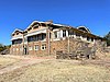
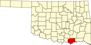
This is a list of the National Register of Historic Places listings in McCurtain County, Oklahoma.

<span class="mw-page-title-main">National Register of Historic Places listings in Murray County, Oklahoma</span>

This is a list of the National Register of Historic Places listings in Murray County, Oklahoma.

<span class="mw-page-title-main">National Register of Historic Places listings in Okfuskee County, Oklahoma</span>

This is a list of the National Register of Historic Places listings in Okfuskee County, Oklahoma.

<span class="mw-page-title-main">National Register of Historic Places listings in Ottawa County, Oklahoma</span>

This is a list of the National Register of Historic Places listings in Ottawa County, Oklahoma.

<span class="mw-page-title-main">National Register of Historic Places listings in Rogers County, Oklahoma</span>

This is a list of the National Register of Historic Places listings in Rogers County, Oklahoma.

<span class="mw-page-title-main">National Register of Historic Places listings in Sequoyah County, Oklahoma</span>

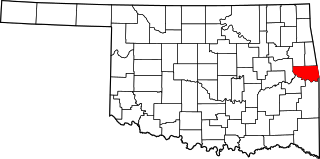
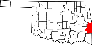
This is a list of the National Register of Historic Places listings in Sequoyah County, Oklahoma.

<span class="mw-page-title-main">National Register of Historic Places listings in Tillman County, Oklahoma</span>

This is a list of the National Register of Historic Places listings in Tillman County, Oklahoma.

<span class="mw-page-title-main">National Register of Historic Places listings in Woodward County, Oklahoma</span>

This is a list of the National Register of Historic Places listings in Woodward County, Oklahoma.

References

  1. The latitude and longitude information provided in this table was derived originally from the National Register Information System, which has been found to be fairly accurate for about 99% of listings. Some locations in this table may have been corrected to current GPS standards.
  2. National Park Service, United States Department of the Interior, "National Register of Historic Places: Weekly List Actions", retrieved April 12, 2024.
  3. Numbers represent an alphabetical ordering by significant words. Various colorings, defined here, differentiate National Historic Landmarks and historic districts from other NRHP buildings, structures, sites or objects.
  4. "National Register Information System". National Register of Historic Places . National Park Service. March 13, 2009.
  5. The eight-digit number below each date is the number assigned to each location in the National Register Information System database, which can be viewed by clicking the number.
  6. "Oklahoma's National Register of Historic Places (Wilson School)". Department of Geography at Oklahoma State University for the State Historic Preservation Office of Oklahoma. Retrieved June 4, 2021.