National Register of Historic Places listings in Sherman County, Oregon

Last updated
Location of Sherman County in Oregon Map of Oregon highlighting Sherman County.svg
Location of Sherman County in Oregon

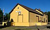
This list presents the full set of buildings, structures, objects, sites, or districts designated on the National Register of Historic Places in Sherman County, Oregon, and offers brief descriptive information about each of them. The National Register recognizes places of national, state, or local historic significance across the United States. [1] Out of over 90,000 National Register sites nationwide, [2] Oregon is home to over 2,000, [3] and 5 of those are found in Sherman County.

National Register of Historic Places federal list of historic sites in the United States

The National Register of Historic Places (NRHP) is the United States federal government's official list of districts, sites, buildings, structures, and objects deemed worthy of preservation for their historical significance. A property listed in the National Register, or located within a National Register Historic District, may qualify for tax incentives derived from the total value of expenses incurred preserving the property.

Sherman County, Oregon County in the United States

Sherman County is a county in the U.S. state of Oregon. As of the 2010 census, the population was 1,765, making it the second-least populous county in Oregon. The county seat is Moro, and the largest city is Wasco. The county is named for William Tecumseh Sherman, a Union general in the American Civil War.

United States Federal republic in North America

The United States of America (USA), commonly known as the United States or America, is a country comprising 50 states, a federal district, five major self-governing territories, and various possessions. At 3.8 million square miles, the United States is the world's third or fourth largest country by total area and is slightly smaller than the entire continent of Europe's 3.9 million square miles. With a population of over 327 million people, the U.S. is the third most populous country. The capital is Washington, D.C., and the largest city by population is New York City. Forty-eight states and the capital's federal district are contiguous in North America between Canada and Mexico. The State of Alaska is in the northwest corner of North America, bordered by Canada to the east and across the Bering Strait from Russia to the west. The State of Hawaii is an archipelago in the mid-Pacific Ocean. The U.S. territories are scattered about the Pacific Ocean and the Caribbean Sea, stretching across nine official time zones. The extremely diverse geography, climate, and wildlife of the United States make it one of the world's 17 megadiverse countries.

Contents

This National Park Service list is complete through NPS recent listings posted May 18, 2018. [4]

Current listings

[5] Name on the Register Image Date listed [6] Location City or town Description
1 Columbia Southern Railway Passenger Station and Freight Warehouse
Columbia Southern Railway Passenger Station and Freight Warehouse Columbia Southern Railroad depot - Wasco Oregon.jpg
Columbia Southern Railway Passenger Station and Freight Warehouse
February 19, 1991
(#91000059)
SW Clark and Fulton Streets
45°35′27″N120°41′53″W / 45.590713°N 120.698077°W / 45.590713; -120.698077 (Columbia Southern Railway Passenger Station and Freight Warehouse)
Wasco
2 DeMoss Springs Park
DeMoss Springs Park DeMoss Park - Moro Oregon.jpg
DeMoss Springs Park
April 12, 2007
(#07000366)
De Moss Springs, off Highway 97 approximately 3 miles (4.8 km) north of Moro
45°30′44″N120°40′58″W / 45.512246°N 120.682801°W / 45.512246; -120.682801 (DeMoss Springs Park)
Moro vicinity
3 Mack Canyon Archeological Site
Mack Canyon Archeological Site Pithouse depression.jpg
Mack Canyon Archeological Site
August 22, 1975
(#75001600)
Address restricted [7]
Grass Valley vicinity This extensive series of pit houses was occupied seasonally in winter by Columbia River tribes for about 7,000 years from after 5000 BCE to the early 19th century CE. [8]
4 John and Helen Moore House
John and Helen Moore House Moore House - Moro Oregon.jpg
John and Helen Moore House
August 5, 1994
(#94000806)
66432 Highway 97
45°26′44″N120°45′16″W / 45.445655°N 120.754550°W / 45.445655; -120.754550 (John and Helen Moore House)
Moro vicinity This house is an excellent example of the rural expression of the Italianate style. Built in 1882, around the time of Sherman County's first large-scale settlement, it is one of the oldest houses in the county, and the only Italianate house in the region. [9]
5 Sherman County Courthouse
Sherman County Courthouse Sherman County Courthouse (Sherman County, Oregon scenic images) (sheD0059).jpg
Sherman County Courthouse
August 28, 1998
(#98001122)
500 Court Street
45°29′14″N120°43′53″W / 45.487317°N 120.731362°W / 45.487317; -120.731362 (Sherman County Courthouse)
Moro

See also

National Register of Historic Places listings in Oregon Wikimedia list article

This is a list of properties and historic districts in Oregon that are listed on the National Register of Historic Places. There are listings in all of Oregon's 36 counties.

Related Research Articles

Mack Canyon Archeological Site archaeological site in Oregon, USA

The Mack Canyon Archeological Site is a prehistoric archeological site in Sherman County, Oregon, United States. Consisting of an extensive series of pit houses in a sheltered canyon, the site was occupied seasonally in winter by Columbia River tribes for about 7,000 years from after 5000 BCE to the early 19th century CE.

References

  1. Andrus, Patrick W.; Shrimpton, Rebecca H.; et al. (2002), How to Apply the National Register Criteria for Evaluation, National Register Bulletin (15), National Park Service, U.S. Department of the Interior, OCLC   39493977, archived from the original on April 6, 2014, retrieved June 20, 2014.
  2. National Park Service, National Register of Historic Places Program: Research, archived from the original on February 1, 2015, retrieved January 28, 2015.
  3. Oregon Parks and Recreation Department, Oregon Historic Sites Database , retrieved August 6, 2015. Note that a simple count of National Register records in this database returns a slightly higher total than actual listings, due to duplicate records. A close reading of detailed query results is necessary to arrive at the precise count.
  4. "National Register of Historic Places: Weekly List Actions". National Park Service, United States Department of the Interior. Retrieved on May 18, 2018.
  5. Numbers represent an ordering by significant words. Various colorings, defined here, differentiate National Historic Landmarks and historic districts from other NRHP buildings, structures, sites or objects.
  6. The eight-digit number below each date is the number assigned to each location in the National Register Information System database, which can be viewed by clicking the number.
  7. Federal and state laws and practices restrict general public access to information regarding the specific location of sensitive archeological sites in many instances. The main reasons for such restrictions include the potential for looting, vandalism, or trampling. See: Knoerl, John; Miller, Diane; Shrimpton, Rebecca H. (1990), Guidelines for Restricting Information about Historic and Prehistoric Resources, National Register Bulletin (29), National Park Service, U.S. Department of the Interior, OCLC   20706997 .
  8. Cunninghame, Brian (June 7, 1973), National Register of Historic Places Inventory — Nomination Form for Federal Properties: The Mack Canyon Archeological Site (redacted PDF), retrieved March 8, 2016.
  9. Donovan, Sally (November 10, 1993), National Register of Historic Places Registration Form: Moore, John and Helen, House (PDF), retrieved November 18, 2014.
Map all coordinates using: OpenStreetMap  ·  Google Maps
Download coordinates as: KML  ·  GPX