National scenic area (Scotland)

Last updated

A map of the National Scenic Areas of Scotland NSA scotland map opengov.png
A map of the National Scenic Areas of Scotland

National scenic area (NSA) is a conservation designation used in Scotland, and administered by NatureScot on behalf of the Scottish Government. The designation's purpose is to identify areas of exceptional scenery and to protect them from inappropriate development. There are currently 40 national scenic areas (NSAs) in Scotland, covering 13% of the land area of Scotland. [1] The areas protected by the designation are considered to represent the type of scenic beauty "popularly associated with Scotland and for which it is renowned". [2] As such they tend to be mainly found in remote and mountainous areas, [1] with a review in 1997 noting a potential weakness of national scenic areas was that the original selection placed undue emphasis on mountainous parts of the country. [3] National scenic areas do however also cover seascapes, with approximately 26% of the total area protected by the designation being marine. [4] The designation is primarily concerned with scenic qualities, although designated national scenic areas may well have other special qualities, for example related to culture, history, archaeology, geology or wildlife. Areas with such qualities may be protected by other designations (e.g. national nature reserve) that overlap with the NSA designation. [5]

Contents

National scenic areas are designated by the IUCN as Category V Protected Landscapes, the same international category as Scotland's two national parks. [1] Within the United Kingdom the NSA designation is regarded as equivalent to the Areas of Outstanding Natural Beauty (AONBs) of England, Wales and Northern Ireland. [1]

The national scenic area designation does not have a high profile when compared to other conservation designations used in Scotland: in 2018 a survey by the National Trust for Scotland found that only 20% of Scots were "definitely aware" of national scenic areas, compared to 80% for National Parks. [6]

History

The Cuillin Hills national scenic area. Main ridge of the cuillin in skye arp.jpg
The Cuillin Hills national scenic area.

After the Second World War, the Labour government passed the National Parks and Access to the Countryside Act 1949, which led to the creation of ten national parks in England and Wales between 1951 and 1957, although no parks were created in Scotland. A committee, chaired by Sir Douglas Ramsay, was however established to consider preservation of the landscape in Scotland. The report, published in 1945, proposed that five areas (Loch Lomond & the Trossachs, the Cairngorms, Glen Coe-Ben Nevis-Black Mount, Wester Ross and Glen Strathfarrar-Glen Affric-Glen Cannich) should receive a level of protection. [7] Accordingly, the government designated these areas as "national park direction areas", giving powers for planning decisions taken by local authorities to be reviewed by central government. After a further review of landscape protection in 1978, additional areas were identified for protection, and in 1981 the direction areas were replaced by national scenic areas, which were based on the 1978 recommendations. [3]

Following the passage of the National Parks (Scotland) Act 2000, two national parks were established: Loch Lomond and The Trossachs National Park and the Cairngorms National Park. [8] Both of these parks included areas that were already designated as national scenic areas, and the NSA designation remains in place alongside national park status for the areas in question.

Scottish Natural Heritage reviewed the national scenic areas between November 2007 and March 2009 to try to identify what makes the scenery of each NSA special; [5] however no formal review into the number and extent has been undertaken since the original report. The current national scenic areas, which therefore remain as originally mapped in 1978, were legally redesignated in 2010. [9] Despite calls from bodies such as the John Muir Trust for the protection to be extended to other areas to protect landscape and support tourism, the Scottish Government has stated that it has no plans to designate further areas. In September 2017 the Scottish Parliament's Public Petitions Committee asked the government to explain why it is not reviewing the NSAs. [10]

Operation

The Kyles of Bute national scenic area in Argyll and Bute. Kyles-of-bute-2013-10-12.jpg
The Kyles of Bute national scenic area in Argyll and Bute.

NSAs are currently designated under the Planning etc. (Scotland) Act 2006: all 40 current NSAs were redesignated under this act via a single order in 2010. [9] Designation provides an additional level of protection to specified areas. For developments that would ordinarily require only local authority planning permission the Scottish Government must be informed if advice from NatureScot is ignored. [11] Additionally, there are some classes of development that would not normally require planning permission to proceed when located outwith a national scenic area, but which are subject to controls within them. These developments include the erection of agricultural and forestry buildings over 12 m high, the construction of vehicle tracks for agriculture or forestry purposes (unless forming part of an approved scheme), and local authority roadworks outside present road boundaries costing more than £100,000. [11]

There is no equivalent to a national park authority for national scenic areas, as controls on development are exercised through the planning system. Local authorities can produce a management strategy for each of the NSA within its territory. This strategy defines the area's special qualities and identifies the actions needed to safeguard them. As of 2018, only the three national scenic areas within Dumfries and Galloway have current management strategies . [12]

Public access to all land in Scotland is governed by the Land Reform (Scotland) Act 2003, which grants the public a right of responsible access to most land (and water) for activities such as walking, camping, cycling, canoeing, swimming and climbing; this right applies to land regardless of ownership or whether or not it is in a designated or protected area such as an NSA, providing it is exercised responsibly (as defined by the Scottish Outdoor Access Code). [13]

List of national scenic areas

As of 2020 there were 40 national scenic areas: [1]

NamePhotoLand
area (ha) [4]
Marine
area (ha) [4]
Total
area (ha) [4]
Local Authorities with areas inside NSA [4]
Assynt-Coigach Suilven from the North West1.JPG 86,53943,285129,824 Highland
Ben Nevis and Glen Coe BenNevis2005.jpg 90,3341,94492,278Highland/Argyll and Bute/Perth and Kinross
Cairngorm Mountains Cairn gorm.jpg 65,541065,541Highland/Aberdeenshire/Moray (also within Cairngorms National Park )
Cuillin Hills Main ridge of the cuillin in skye arp.jpg 22,7264,59427,320Highland
Deeside and Lochnagar Ancient Caledonian Forest, Glen Tanar - geograph.org.uk - 6992.jpg 39,787039,787Aberdeenshire/Angus (also within Cairngorms National Park)
Dornoch Firth Dornoch Firth - geograph.org.uk - 52109.jpg 11,5424,24015,782Highland
East Stewartry Coast Rough Firth - geograph.org.uk - 1806562.jpg 8,4471,1739,620 Dumfries and Galloway
Eildon and Leaderfoot EildonScottsView.jpg 3,87703,877 Scottish Borders
Fleet Valley Water of Fleet - geograph.org.uk - 652202.jpg 5,3734815,854Dumfries and Galloway
Glen Affric Islands - panoramio (2).jpg 18,837018,837Highland
Glen Strathfarrar Loch Beannacharan - geograph.org.uk - 446641.jpg 4,02704,027Highland
Hoy and West Mainland Old man of hoy2.jpg 16,4797,92824,407 Orkney Islands
Jura Sheep on the beach. - geograph.org.uk - 320351.jpg 21,0729,24530,317Argyll and Bute
Kintail Five Sisters of Kintail.jpg 16,0701,07917,149Highland
Knapdale Rugged Knapdale moorland - geograph.org.uk - 825981.jpg 20,82112,01132,832Argyll and Bute
Knoydart The path south from Barrisdale - geograph.org.uk - 503138.jpg 40,20110,49550,696Highland
Kyle of Tongue Ben Loyal and the Kyle of Tongue, Sutherland (3-06-2011, 19-25-02).jpg 21,0933,39624,488Highland
Kyles of Bute Kyles-of-bute-2013-10-12.jpg 4,7231,0165,739Argyll and Bute
Loch Lomond Loch Lomond, looking south from Ben Lomond.jpg 28,077028,077Argyll and Bute/Stirling/West Dunbartonshire (also within Loch Lomond and the Trossachs National Park )
Loch na Keal, Isle of Mull Boat Cave.JPG 13,50730,74244,250Argyll and Bute
Loch Rannoch and Glen Lyon Glen Lyon - geograph.org.uk - 12596.jpg 48,625048,625Perth and Kinross/Stirling
Loch Shiel Glenfinnan monument and Loch Shiel.jpg 13,045013,045Highland
Loch Tummel Schotland Queen's View 8-05-2010 10-39-44.JPG 9,01309,013Perth and Kinross
Lynn of Lorn CastleCoeffinLismore-ARuinedMacDougallStronghold(ColinSmith)Aug1995.jpg 5,63810,08815,726Argyll and Bute
Morar, Moidart and Ardnamurchan Ardnamurchan Lighthouse Pasture.jpg 17,22019,73636,956Highland
North Arran Sunset on goatfell.jpg 20,3606,94327,304 North Ayrshire
Nith Estuary River Nith at Ellisland.JPG 14,3102814,337Dumfries and Galloway
North West Sutherland Ben Stack - geograph.org.uk - 820662.jpg 23,4153,15126,565Highland
River Earn (Comrie to St. Fillans) Placid stretch of the River Earn near St Fillans Hill, Perthshire - geograph.org.uk - 1584715.jpg 3,10803,108Perth and Kinross
River Tay (Dunkeld) Perth and Kinross Dunkeld Tay.jpg 5,70805,708Perth and Kinross
Scarba, Lunga and the Garvellachs The Corryvreckan Whirlpool - geograph-2404815-by-Walter-Baxter.jpg 2,1394,4026,542Argyll and Bute
Shetland Puffin Party IMG 3348 (19674441423).jpg 15,48626,34741,833 Shetland Islands
Small Isles Eigg-and-Rum-from-mainland.jpg 16,27130,96447,235Highland
South Lewis, Harris and North Uist Scotland Harris 1.jpg 112,30190,087202,388Western Isles
South Uist Machair South Uist machair (timniblett).jpg 6,2897,02513,314 Western Isles
St Kilda The Street.jpg 8656,1016,966Western Isles
The Trossachs Wooded area of the Trossachs and Loch Katrine.jpg 4,85004,850Stirling (also within Loch Lomond and the Trossachs National Park)
Trotternish The Storr by Grinner.jpg 6,1281,7897,916Highland
Upper Tweeddale Farmland, Manor Valley - geograph.org.uk - 198958.jpg 12,770012,770Scottish Borders
Wester Ross Liathach from Beinn Eighe.jpg 143,88119,574163,456Highland

See also

Related Research Articles

<span class="mw-page-title-main">National parks of Scotland</span> Area of landscape in Scotland

The national parks of Scotland are managed areas of outstanding landscape where some forms of development are restricted to preserve the landscape and natural environment. At present, Scotland has two national parks: Loch Lomond and The Trossachs National Park, created in 2002, and the Cairngorms National Park, created in 2003.

<span class="mw-page-title-main">NatureScot</span> Scottish government agency for natural heritage conservation

NatureScot is the operating name for the body formally called Scottish Natural Heritage. It is an executive non-departmental public body of the Scottish Government responsible for the country's natural heritage, especially its natural, genetic and scenic diversity. It advises the Scottish Government on nature conservation, and acts as a government agent in the delivery of conservation designations, i.e. national nature reserves, local nature reserves, national parks, Sites of Special Scientific Interest (SSSIs), Special Areas of Conservation, Special Protection Areas and the national scenic areas. It receives annual funding from the Government in the form of Grant in Aid to deliver Government priorities for the natural heritage.

<span class="mw-page-title-main">River Dee, Aberdeenshire</span> River in Aberdeenshire, Scotland

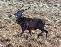
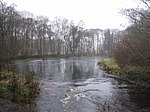
The River Dee is a river in Aberdeenshire, Scotland. It rises in the Cairngorms and flows through southern Aberdeenshire to reach the North Sea at Aberdeen. The area it passes through is known as Deeside, or Royal Deeside in the region between Braemar and Banchory because Queen Victoria came for a visit there in 1848 and greatly enjoyed herself. She and her husband, Prince Albert, built Balmoral Castle there which replaced an older castle.

<span class="mw-page-title-main">Cairngorms</span> Mountain range in the eastern Highlands of Scotland

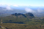
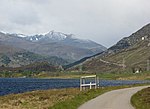
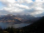
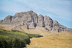
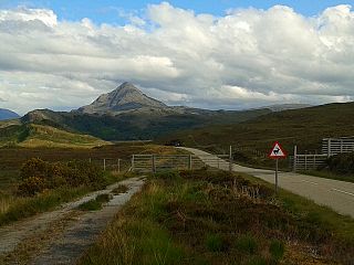
The Cairngorms are a mountain range in the eastern Highlands of Scotland closely associated with the mountain Cairn Gorm. The Cairngorms became part of Scotland's second national park on 1 September 2003. Although the Cairngorms give their name to, and are at the heart of, the Cairngorms National Park, they only form one part of the national park, alongside other hill ranges such as the Angus Glens and the Monadhliath, and lower areas like Strathspey.

<span class="mw-page-title-main">Loch Lomond and The Trossachs National Park</span> National park in Scotland

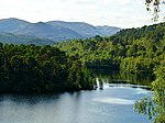
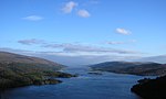
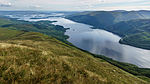
Loch Lomond and The Trossachs National Park is a national park in Scotland centred on Loch Lomond and the hills and glens of the Trossachs, along with several other ranges of hills. It was the first of the two national parks established by the Scottish Parliament in 2002, the second being the Cairngorms National Park. The park extends to cover much of the western part of the southern highlands, lying to the north of the Glasgow conurbation, and contains many mountains and lochs. It is the fourth-largest national park in the British Isles, with a total area of 1,865 km2 (720 sq mi) and a boundary of some 350 km (220 mi) in length. It features 21 Munros and 20 Corbetts.

<span class="mw-page-title-main">Cairngorms National Park</span> National park in Scotland

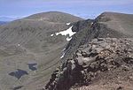
Cairngorms National Park is a national park in northeast Scotland, established in 2003. It was the second of two national parks established by the Scottish Parliament, after Loch Lomond and The Trossachs National Park, which was set up in 2002. The park covers the Cairngorms range of mountains, and surrounding hills. Already the largest national park in the United Kingdom, in 2010 it was expanded into Perth and Kinross.

<span class="mw-page-title-main">National parks of the United Kingdom</span> Areas of landscape in the United Kingdom

National parks of the United Kingdom are areas of relatively undeveloped and scenic landscape across the country. Despite their name, they are quite different from national parks in many other countries, which are usually owned and managed by governments as protected community resources, and which do not usually include permanent human communities. In the United Kingdom, an area designated as a national park may include substantial settlements and human land uses that are often integral parts of the landscape. Land within national parks remains largely in private ownership. These parks are therefore not "national parks" according to the internationally accepted standard of the IUCN but they are areas of outstanding landscape where planning controls are a little more restrictive than elsewhere.

<span class="mw-page-title-main">Trossachs</span> Area of wooded hills and lochs in the southern part of the Scottish Highlands

The Trossachs generally refers to an area of wooded glens, braes, and lochs lying to the east of Ben Lomond in the Stirling council area of Scotland. The name is taken from that of a small woodland glen that lies at the centre of the area, but is now generally applied to the wider region.

<span class="mw-page-title-main">Corrie Fee</span> Corrie and nature reserve in Angus, Scotland

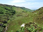
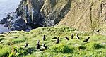
Corrie Fee is a glacier-carved corrie situated at the head of Glen Clova in the Angus Glens of Scotland. It forms part of Corrie Fee National Nature Reserve (NNR), which is managed by NatureScot and lies within the Cairngorms National Park. The adjoining Corrie Sharroch and the slopes of Craig Rennet are also included in the NNR.

<span class="mw-page-title-main">Rough Firth</span> Fjord in Dumfries and Galloway, Scotland, UK

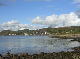
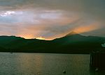
Rough Firth is an inlet on the northern coast of the Solway Firth in the Stewartry area of Dumfries and Galloway, Scotland. The firth lies between Almorness Point and Castlehill Point, and contains Rough Island. The village of Kippford stands near the head of the firth where the Urr Water reaches the sea; the only other coastal settlement of any size is Rockcliffe. The area is designated as the East Stewartry Coast National Scenic Area, one of the forty national scenic areas (NSAs) in Scotland.

<span class="mw-page-title-main">South Lewis, Harris and North Uist National Scenic Area</span>

South Lewis, Harris and North Uist is a large national scenic area (NSA) in the Western Isles of Scotland. It is one of 40 such areas in Scotland, which are defined so as to identify areas of exceptional scenery and to ensure its protection from inappropriate development. The designated area covers 202,388 ha in total, of which 112,301 ha is on land, with a further 90,087 ha being marine, making it the largest of the NSAs in both total and marine area. The designated area includes the mountainous south west of Lewis, all of Harris, the Sound of Harris and the northern part of North Uist.

<span class="mw-page-title-main">Protected areas of Scotland</span> Designated area for protection in Scotland

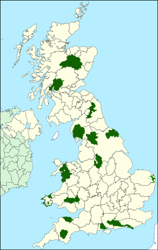
Many parts of Scotland are protected in accordance with a number of national and international designations because of their environmental, historical or cultural value. Protected areas can be divided according to the type of resource which each seeks to protect. NatureScot has various roles in the delivery of many environmental designations in Scotland, i.e. those aimed at protecting flora and fauna, scenic qualities and geological features. Historic Environment Scotland is responsible for designations that protect sites of historic and cultural importance. Some international designations, such as World Heritage Sites, can cover both categories of site.

<span class="mw-page-title-main">Ben Nevis and Glen Coe National Scenic Area</span>

Ben Nevis and Glen Coe is a national scenic area (NSA) covering part of the Highlands of Scotland surrounding Ben Nevis and Glen Coe, in which certain forms of development are restricted. It is one of 40 such areas in Scotland, which are defined so as to identify areas of exceptional scenery and to ensure its protection from inappropriate development. The Ben Nevis and Glen Coe NSA covers 903 km2 (349 sq mi) of land, lying within the Highland, Argyll and Bute and Perth and Kinross council areas. A further 19 km2 (7.3 sq mi) of the NSA are marine, covering the sea loch of Loch Leven.

<span class="mw-page-title-main">Hoy and West Mainland National Scenic Area</span>

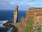
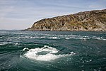
Hoy and West Mainland is a national scenic area (NSA) covering parts of the islands of Hoy and Mainland in the Orkney Islands of Scotland, as well as parts of the surrounding sea. It is one of 40 such areas in Scotland, which are defined so as to identify areas of exceptional scenery and to ensure its protection by restricting certain forms of development. The Hoy and West Mainland NSA covers 24,407 ha in total, consisting of 16,479 ha of land with a further 7928 ha being marine.

<span class="mw-page-title-main">Loch Rannoch and Glen Lyon National Scenic Area</span>

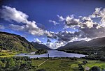
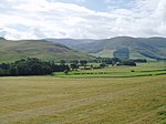
The Loch Rannoch and Glen Lyon National Scenic Area is a national scenic area (NSA) covering the area surrounding Loch Rannoch, Glen Lyon, and the Ben Lawers ranges of mountains in Scotland. It is one of 40 such areas in Scotland, which are defined so as to identify areas of exceptional scenery and to ensure its protection from inappropriate development by restricting certain forms of development. The Loch Rannoch and Glen Lyon NSA covers 48,625 ha, most of which lies in the council area of Perth and Kinross, with a small portion lying in Stirling.

<span class="mw-page-title-main">Morar, Moidart and Ardnamurchan National Scenic Area</span> National scenic area in Scotland

Morar, Moidart and Ardnamurchan is a national scenic area (NSA) covering the coastal scenery of three peninsulas in the western Highlands of Scotland: Ardnamurchan, Moidart and Morar. It is one of 40 such areas in Scotland, which are defined so as to identify areas of exceptional scenery and to ensure its protection from inappropriate development by restricting certain forms of development. The Morar, Moidart and Ardnamurchan NSA covers 36,956 ha in total, consisting of 17,220 ha of land with a further 19,736 ha being marine.

<span class="mw-page-title-main">North West Sutherland National Scenic Area</span>

North West Sutherland is a national scenic area (NSA) covering the mountains and coastal scenery of the northwestern part of the county of Sutherland in the highlands of Scotland. The designated area covers the mountains of Foinaven, Arkle and Ben Stack as well as the coastal scenery surrounding Loch Laxford and Handa Island. It is one of 40 such areas in Scotland, which are defined so as to identify areas of exceptional scenery and to ensure its protection by restricting certain forms of development. The North West Sutherland NSA covers 26,565 ha in total, consisting of 23,415 ha of land with a further 3,151 ha being marine.

<span class="mw-page-title-main">Scarba, Lunga and the Garvellachs National Scenic Area</span>

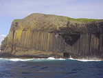
Scarba, Lunga and the Garvellachs is the name of one of the 40 national scenic areas of Scotland. The designated area covers the islands of Scarba, Lunga, and the Garvellachs, all of which lie in the Firth of Lorn, along with much of the surrounding seascape. The national scenic areas are defined so as to identify areas of exceptional scenery and to ensure its protection by restricting certain forms of development, and are considered to represent the type of scenic beauty "popularly associated with Scotland and for which it is renowned". The Scarba, Lunga and the Garvellachs NSA covers 6,542 ha in total, consisting of 2,139 ha of land with a further 4,402 ha being marine.

<span class="mw-page-title-main">Upper Tweeddale National Scenic Area</span>

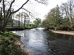
The Upper Tweeddale National Scenic Area lies in the Borders region of Scotland. It is one of 40 national scenic areas (NSA) in Scotland, which are defined so as to identify areas of exceptional scenery and to ensure their protection from inappropriate development. The designated area covers 12,770 ha of countryside surrounding the upper reaches of the River Tweed between Broughton and Peebles.

<span class="mw-page-title-main">Conservation in Scotland</span>

This article gives an overview of the structure of environmental and cultural conservation in Scotland, a constituent country of the United Kingdom.

References

  1. 1 2 3 4 5 "National Scenic Areas". NatureScot. Retrieved 3 September 2020.
  2. "Countryside and Landscape in Scotland - National Scenic Areas". Scottish Government. 4 July 2017. Archived from the original on 31 January 2018. Retrieved 31 January 2018.
  3. 1 2 "National Scenic Areas Review" (PDF). Scottish Natural Heritage. 1997. Archived from the original (PDF) on 6 February 2018. Retrieved 5 February 2018.
  4. 1 2 3 4 5 "National Scenic Areas - Maps". SNH. 20 December 2010. Archived from the original on 12 June 2018. Retrieved 24 January 2018.
  5. 1 2 "The special qualities of the national scenic areas" (PDF). Scottish Natural Heritage. 2010. Retrieved 28 April 2021.
  6. "Scots want their scenic landscapes better protected". National Trust for Scotland. 7 November 2018. Retrieved 28 April 2021.
  7. "History Leading to the Cairngorms National Park". Cairngorms National Park Authority. Archived from the original on 15 January 2018. Retrieved 15 January 2018.
  8. "National Park". NatureScot. Retrieved 28 April 2021.
  9. 1 2 "National Scenic Areas: background, guidance and policy". NatureScot. Retrieved 28 April 2021.
  10. "Public Petitions Committee: Official Report". Scottish Parliament. 14 September 2017. pp. 1–13. Retrieved 28 April 2021.
  11. 1 2 "Development management and National Scenic Areas". NatureScot. Retrieved 3 September 2020.
  12. "National Scenic Areas (NSAs)". Dumfries and Galloway council. 8 December 2017. Retrieved 24 January 2018.
  13. "Scottish Outdoor Access Code" (PDF). www.outdooraccess-scotland.scot. Scottish Natural Heritage. 2005. Retrieved 28 April 2021.