Tyrrell County is a county located in the U.S. state of North Carolina. As of the 2020 census, the population was 3,245, making it the least populous county in North Carolina. Its county seat is Columbia. The county was created in 1729 as Tyrrell Precinct and gained county status in 1739. Tyrrell County is included in the Kill Devil Hills, NC, Micropolitan Statistical Area, which is also included in the Virginia Beach-Norfolk, VA-NC Combined Statistical Area.

Perquimans County is a county located in the U.S. state of North Carolina. As of the 2020 census, the population was 13,005. Its county seat is Hertford. The county was originally created as Berkeley Precinct. It was renamed Perquimans Precinct around 1684 and gained county status in 1739. Perquimans County is part of the Elizabeth City, NC Micropolitan Statistical Area, which is also included in the Virginia Beach-Norfolk, VA-NC Combined Statistical Area. The Harvey Point Defense Testing Activity facility is located in Perquimans County.

Pasquotank County is a county located in the U.S. state of North Carolina. As of the 2020 census, the population was 40,568. Its county seat is Elizabeth City. The county was originally created as Pasquotank Precinct and gained county status in 1739. Pasquotank County is part of the Elizabeth City, NC Micropolitan Statistical Area, which is also included in the Virginia Beach-Norfolk, VA-NC Combined Statistical Area.

Gates County is a county located in the northeastern portion of the U.S. state of North Carolina, on the border with Virginia. As of the 2020 census, the population was 10,478. Its county seat is Gatesville. Gates County is included in the Virginia Beach-Norfolk-Newport News, VA-NC Metropolitan Statistical Area. It is part of the Albemarle Sound area of the Inner Banks.

Camden County is a consolidated city-county located in the U.S. State of North Carolina. As of the 2020 census, the population was 10,335, making it the fourth-least populous county in North Carolina. Its county seat is Camden. Camden County is part of the Elizabeth City, NC Micropolitan Statistical Area, which is also included in the Virginia Beach-Norfolk, VA-NC Combined Statistical Area.

Hertford is a town and the county seat of Perquimans County, North Carolina, United States. The current population of Hertford, North Carolina is 1,912 based on the 2020 census. The US Census estimates the 2021 population at 1,925. The last official US Census in 2010 recorded the population at 2,143. Hertford is located in North Carolina's Inner Banks region and is part of both the Elizabeth City Micropolitan Statistical Area and the Hampton Roads region. It is named after the county town of Hertford, England.

Elizabeth City is a city in Pasquotank County, North Carolina, United States. As of the 2020 census, it had a population of 18,629. Elizabeth City is the county seat and largest city of Pasquotank County. It is the cultural, economic and educational hub of the sixteen-county Historic Albemarle region of northeastern North Carolina.
A township in some states of the United States is a small geographic area.

The Province of Georgia was one of the Southern colonies in British America. It was the last of the thirteen original American colonies established by Great Britain in what later became the United States. In the original grant, a narrow strip of the province extended to the Pacific Ocean.

South Hampton Roads is a region located in the extreme southeastern portion of Virginia's Tidewater region in the United States with a total population of 1,191,937. It is part of the Virginia Beach-Norfolk-Newport News, VA-NC MSA, which itself has a population of 1,724,876.

Wachovia was the area settled by Moravians in what is now Forsyth County, North Carolina, United States. Of the six 18th-century Moravian "villages of the Lord" established in Wachovia, today the town of Bethania and city of Winston-Salem exist within the historic Wachovia tract. The historical tract was somewhat larger than present-day Winston-Salem and somewhat smaller than present-day Forsyth County.

The Eno River, named for the Eno Native Americans who once lived along its banks, is the initial tributary of the Neuse River in North Carolina, United States. Descendants of European immigrants settled along the Eno River in the latter 1740s and early 1750s, including many Quakers from Pennsylvania. Several years after the 1752 creation of Orange County, the Orange County Court of Common Pleas & Quarter Sessions selected a site along the Eno River near the homes of James Watson and William Reed as the county seat, originally naming it Corbin Town, or Corbinton, after Francis Corbin, agent and attorney to John, Earl Granville. The Court met at James Watson's home along the Eno River from 1754 through 1756, when the courthouse at Corbinton was completed. In 1759, officials changed the county seat's name from Corbinton to Childsburg, after another of Earl Granville's agents, Thomas Child. Finally, in 1766, officials changed the name to Hillsborough.
George Durant was an attorney, Attorney General and Speaker of the House of Burgesses in the Province of Carolina. He is sometimes called the "father of North Carolina".

The Pasquotank River is a coastal water-body in Northeastern North Carolina in the United States. Located between Camden and Pasquotank counties, the Pasquotank connects directly to Albemarle Sound and is part of the Intracoastal Waterway via Elizabeth City.

North Carolina's 1st congressional district is located in the northeastern part of the state. It consists of many Black Belt counties that border Virginia and it extends southward into several counties of the Inner Banks and the Research Triangle. It covers many rural areas of northeastern North Carolina, among the state's most economically poor, as well as outer exurbs of urbanized Research Triangle. It contains towns and cities such as Greenville, Rocky Mount, Wilson, Goldsboro, Henderson, and Roanoke Rapids.

Camden is an unincorporated town and Census-designated place in Camden County, North Carolina, United States. It is the county seat of Camden County, a consolidated city-county. As of the 2010 census, the Camden town had a population of 599.

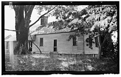
Mount Hermon is a township in Pasquotank County, North Carolina. Bordering Nixonton, Providence, Elizabeth City, and Perquimans County, this township has an area of 34.7 square miles and a population of 4,206.

The Elizabeth City Micropolitan Statistical Area, as defined by the United States Census Bureau, is an area consisting of two counties in the Inner Banks region of eastern North Carolina, anchored by the area of Elizabeth City. It is part of a bigger Virginia Beach-Norfolk, VA-NC Combined Statistical Area.

The 1972 United States presidential election in North Carolina took place on November 7, 1972, as part of the 1972 United States presidential election. Voters chose 13 representatives, or electors to the Electoral College, who voted for president and vice president.
Gabriel Jacobs, born about 1650, was the progenitor of the Jacobs family of free African Americans originating in Northampton County, Virginia. A number of his descendants migrated south in the mid-1700s, primarily to southeastern North Carolina. His story and that of his descendants is representative of the experiences of hundreds of other freedmen originating in early southern American colonies.