Northumberland Islands

Last updated

Northumberland Islands
Native name:
Nu Tannik Ckelo
Australia location map.svg
Red pog.svg
Northumberland Islands
Geography
Location Coral Sea
Coordinates 21°30′S149°40′E / 21.500°S 149.667°E / -21.500; 149.667
ArchipelagoNorthumberland Isles
Administration
Australia
State Queensland
Demographics
Population150 (Tourism)
Map all coordinates using: OpenStreetMap

The Northumberland Islands are a scattered island chain off the eastern coast of Queensland, Australia. [1]

Contents

Geography and history

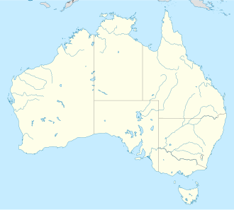
The Northumberland Islands are to the south-east of the city of Mackay roughly between the latitudes 21°S and 22°S. All islands are of the continental type. The island group was named by James Cook during his historic voyage along Australia's eastern seaboard in 1770, after the First Duke of Northumberland, Hugh Percy. [2] Both Cook and Matthew Flinders make note of the island group in their journals, Cook describing them as such:

As soon as we got round the Cape [Cape Townshend] we hauld our wind to the Westward in order to get within the Islands which lay scatter'd up and down in this bay [Shoalwater Bay] in great number, and extend out to Sea as far as we could see from the Masthead; how much farther will hardly be in my power to determine; they are as Various in their height and Circuit as they are numerous. [3]

In 1855, a botany expedition led by naturalist Frederick Strange visited the islands on his ship Vision. Four of the expedition were killed by Aboriginal people at Middle Percy Island. Those killed were Frederick Strange and his assistant Richard Spinks, William Spurling (ship's mate) and Andrew Gittings (ship's cook and steward). Captain Chimmo of the Royal Navy vessel HMS Torch, sailed to the island and conducted an investigation. He decided to take ten of the islanders prisoner. These prisoners, including three women and three children, were sent to Sydney for trial. One child died in custody and the rest were eventually shipped back to Gladstone. [4] [5]

The island group is remote, and apart from charter flights to Marble Island they are accessible only by private yacht.

The Northumberland Islands are further subdivided into smaller groups: the Bedwell Group, Beverley Group, Broad Sound Islands, Duke Islands, Flat Isles, Guardfish Cluster and Percy Isles (within the locality The Percy Group). The islands are listed below, with the geographical coordinates of the largest islands given. Only the major islands of each group are listed.

Bedwell Group

Name origin: Staff Commander E. P. Bedwell, surveyor [6]

Beverley Group

Name origin: Unknown [7]

Broad Sound Islands

Name origin: Situated at the mouth of Broad Sound, a vast inlet named by Cook in 1770 [8]

Duke Islands

Western side of Hunter Island looking toward Tynemouth Island (Duke Islands) Hunter Island looking toward Tynemouth Island.jpg
Western side of Hunter Island looking toward Tynemouth Island (Duke Islands)

Name origin: Unknown [9]

Flat Isles

Name origin: Named by Flinders in 1802 due to their height [10] - Avoid Island is the highest at 33 metres above sea level

Guardfish Cluster

Name origin: Unknown [11]

Percy Isles

A-Frame yacht club on Middle Percy Island (Percy Isles) A frame yacht club on Middle Percy Island, Australia.jpg
A-Frame yacht club on Middle Percy Island (Percy Isles)

Name origin: Named by Flinders in 1802 after the Duke of Northumberland's family name [12]

See also

Related Research Articles

South Cumberland Islands is a national park in Queensland, Australia, 831 km northwest of Brisbane. It is famous for the marine stingers which can be found in the waters of the park between October and May.

<span class="mw-page-title-main">Duke of Northumberland</span> Dukedom in the Peerage of Great Britain

Duke of Northumberland is a noble title that has been created three times in English and British history, twice in the Peerage of England and once in the Peerage of Great Britain. The current holder of this title is Ralph Percy, 12th Duke of Northumberland.

<span class="mw-page-title-main">Whitsunday Islands</span> Island group in Queensland, Australia

The Whitsunday Islands are 74 continental islands of various sizes off the central coast of Queensland, Australia, 900 kilometres north of Brisbane. The northernmost of the islands are off the coast by the town of Bowen, while the southernmost islands are off the coast by Proserpine. The island group is centred on Whitsunday Island, while the commercial centre is Hamilton Island. The traditional owners of the area are the Ngaro people and the Gia people, whose Juru people has the only legally recognised native title in the Whitsunday Region.

The Cumberland Islands form a group of 70 islands at 20°34′S149°08′E on the Great Barrier Reef, off the coast of Mackay in Queensland, Australia. They were discovered by Captain James Cook in 1770.

<span class="mw-page-title-main">Wellesley Islands</span> Suburb of Shire of Mornington, Queensland, Australia

The Wellesley Islands, also known as the North Wellesley Islands, is a group of islands off the coast of Far North Queensland, Australia, in the Gulf of Carpentaria. It is a locality within the Shire of Mornington local government area. The traditional owners of the islands are the Lardil people. In the 2016 census, the Wellesley Islands had a population of 1,136 people, all living on the largest island, Mornington Island.

<span class="mw-page-title-main">Seventeen Seventy, Queensland</span> Town in Queensland, Australia

Seventeen Seventy, sometimes inaccurately written as 1770 or Town of 1770, is a coastal town and locality in the Gladstone Region, Queensland, Australia. In the 2016 census, the locality of Seventeen Seventy had a population of 69 people.

Cape Manifold is a coastal headland in central Queensland, Australia.

<span class="mw-page-title-main">Keppel Bay</span>

Keppel Bay is a bay in Central Queensland, Australia at the mouth of the Fitzroy River on the coast of the Coral Sea.

<span class="mw-page-title-main">Barellan Point, Queensland</span> Suburb of Ipswich, Queensland, Australia

Barellan Point is a rural residential suburb in the City of Ipswich, Queensland, Australia. In the 2016 census Barellan Point had a population of 1,159 people.

<span class="mw-page-title-main">Whitehaven Beach</span> Beach on Whitsunday Island, Australia

Whitehaven Beach is on Whitsunday Island, Queensland, Australia. The island is accessible by boat, seaplane & helicopter from Airlie Beach, as well as Hamilton Island. It lies across from Stockyard Beach, better known as Chalkie's Beach, on Haslewood Island. The beach is known for its crystal white silica sands and turquoise coloured waters. The beach has tour barbeque and camping facilities.

<span class="mw-page-title-main">Glenmorgan railway line</span>

The Glenmorgan Branch is a railway line in south west Queensland, Australia. It opened in a series of sections between 1908 and 1931. It was intended to reach Surat but construction ceased during the 1930s depression and never recommenced.

Rossville is a town and coastal locality in the Shire of Cook, Queensland, Australia. In the 2016 census, the locality of Rossville had a population of 204 people.

Koumala is a rural town and coastal locality in the Mackay Region, Queensland, Australia. In the 2016 census, the locality of Koumala had a population of 831 people.

Stanage is a coastal rural town and locality in the Livingstone Shire, Queensland, Australia. In the 2016 census, Stanage had a population of 83 people.

<span class="mw-page-title-main">Curtis Island, Queensland</span> Suburb of Gladstone Region, Queensland, Australia

Curtis Island is a locality in the Gladstone Region, Queensland, Australia. In the 2016 census, Curtis Island had a population of 323 people.

The Percy Group is a locality consisting of a number of islands in the Coral Sea within the Isaac Region, Queensland, Australia. In the 2016 census, The Percy Group had a population of 0 people. The islands are uninhabitated as they are within national parks and conservation parks.

Kunwarara is a rural locality in the Livingstone Shire, Queensland, Australia. In the 2016 census Kunwarara had a population of 71 people.

References

  1. "Northumberland Islands – island group in Isaac Region (entry 24762)". Queensland Place Names. Queensland Government . Retrieved 4 July 2017.
  2. "Northumberland Islands (entry 24762)". Queensland Place Names. Queensland Government . Retrieved 28 August 2015.
  3. "Captain Cook's Journal during his first voyage round the world, by James Cook (Chapter8)". Archived from the original on 17 June 2006. Retrieved 3 April 2006.
  4. Rowland, Michael J. (2020). ""By savage hands his steps were stayed! Life and death on the Percy Isles, 1854"". Proceedings of the Royal Society of Queensland. Archived from the original on 14 May 2021. Retrieved 14 May 2021.
  5. Multiple Authors. "Letters to the Colonial Secretary relating to Moreton Bay and Queensland" (PDF). Archived (PDF) from the original on 29 December 2017. Retrieved 12 February 2018.
  6. "Bedwell Group (entry 2038)". Queensland Place Names. Queensland Government . Retrieved 13 September 2015.
  7. "Beverley Group (entry 2430)". Queensland Place Names. Queensland Government . Retrieved 15 September 2015.
  8. "Broad Sound (entry 4593)". Queensland Place Names. Queensland Government . Retrieved 13 September 2015.
  9. "Duke Islands (entry 10764)". Queensland Place Names. Queensland Government . Retrieved 13 September 2015.
  10. "Flat Isles (entry 12726)". Queensland Place Names. Queensland Government . Retrieved 13 September 2015.
  11. "Guardfish Cluster (entry 14927)". Queensland Place Names. Queensland Government . Retrieved 13 September 2015.
  12. "Percy Isles (entry 26441)". Queensland Place Names. Queensland Government . Retrieved 13 September 2015.