
The Orange County Transportation Authority (OCTA) is the transportation planning commission for Orange County, California in the Los Angeles metropolitan area. OCTA is responsible for funding and implementing transit and capital projects for the transportation system in the county, including freeway expansions, express lane management, bus and rail transit operation, and commuter rail funding and oversight.

The Los Angeles County Metropolitan Transportation Authority (LACMTA), branded as Metro, is the county agency that plans, operates, and coordinates funding for most of the public transportation system in Los Angeles County, California, the most populated county in the United States, and the largest public transit agency in the county as well.
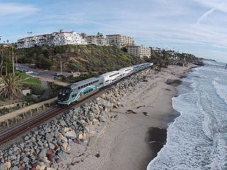
Metrolink is a commuter rail system in Southern California, serving Los Angeles, Orange, Riverside, San Bernardino, and Ventura counties, as well as to Oceanside in San Diego County. The system consists of eight lines and 69 stations operating on 545.6 miles (878.1 km) of track. Arrow is operated under a contract with the San Bernardino County Transportation Authority (SBCTA).

Los Angeles has a complex multimodal transportation infrastructure, which serves as a regional, national and international hub for passenger and freight traffic. The system includes the United States' largest port complex; an extensive freight and passenger rail infrastructure, including light rail lines and rapid transit lines; numerous airports and bus lines; vehicle for hire companies; and an extensive freeway and road system. People in Los Angeles rely on cars as the dominant mode of transportation, but since 1990 the Los Angeles County Metropolitan Transportation Authority has built over one hundred miles (160 km) of light and heavy rail serving more and more parts of Los Angeles and the greater area of Los Angeles County. As a result, Los Angeles was the last major city in the United States to get a permanent rail system installed.

The C Line is a 19.3-mile (31.1 km) light rail line running between Redondo Beach and Norwalk within Los Angeles County, California. It is one of six lines forming the Los Angeles Metro Rail system and opened on August 12, 1995. Along the route, the line serves the cities of Downey, El Segundo, Hawthorne, Norwalk and Lynwood, the Los Angeles community of Westchester, and several unincorporated communities in the South Los Angeles region including Athens, Del Aire, and Willowbrook. A free shuttle bus to Los Angeles International Airport (LAX) is available at the line's Aviation/LAX station.

Chatsworth station is an intermodal passenger transport station in the Los Angeles neighborhood of Chatsworth, United States. It is served by Amtrak Pacific Surfliner inter-city rail service, Metrolink Ventura County Line commuter rail service, and the Metro G Line of the Los Angeles Metro Busway bus rapid transit. The station is also served by Los Angeles Metro Bus and Simi Valley Transit local buses, plus Santa Clarita Transit and LADOT Commuter Express regional express bus routes.

Lakewood Boulevard station is a below-grade light rail station on the C Line of the Los Angeles Metro Rail system. It is located in the median of Interstate 105, below Lakewood Boulevard, after which the station is named in the city of Downey, California.

Harbor Freeway station is a transport hub located on the Harbor Transitway, within the Judge Harry Pregerson Interchange of Interstate 105 and Interstate 110 near Figueroa Street in the neighborhood of South Los Angeles. The station is served by the light rail C Line, the bus rapid transit J Line and other bus services. The station is owned by the California Department of Transportation (Caltrans) and operated by the Los Angeles County Metropolitan Transportation Authority (Metro).
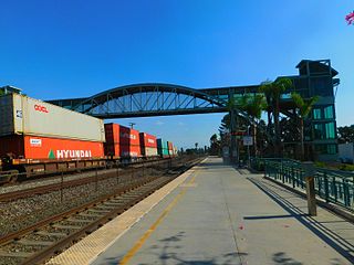
Norwalk/Santa Fe Springs station is a Metrolink rail station in the city of Norwalk, California. It is served by Metrolink's 91/Perris Valley Line from Los Angeles Union Station to Riverside and Metrolink's Orange County Line running from Los Angeles Union Station to Oceanside. On weekdays, this station is served by 19 Orange County Line trains and nine 91/Perris Valley Line trains. On weekends, eight Orange County Line trains and four 91/Perris Valley Line trains serve this station.

Manchester station is a busway station located in Los Angeles, California. It is situated between the Slauson and Harbor Freeway stations on the J Line, a bus rapid transit route which runs between El Monte, Downtown Los Angeles and San Pedro as part of the Los Angeles Metro Busway system. The station consists of two side platforms in the center of Interstate 110 above Manchester Avenue. The station serves the Vermont Knolls, Vermont Vista, Florence, and Broadway-Manchester neighborhoods of Los Angeles.

Rosecrans station is a busway station located in Los Angeles, California. It is situated between the Harbor Freeway station and the Harbor Gateway Transit Center on the J Line, a bus rapid transit route which runs between El Monte, Downtown Los Angeles and San Pedro as part of the Metro Busway system. The station consists of two side platforms in the center of Interstate 110 under Rosecrans Avenue. The station serves the Harbor Gateway neighborhoods of Los Angeles.

Harbor Gateway Transit Center, formerly Artesia Transit Center, is a large bus station at the southern end of the Harbor Transitway that serves as a transport hub for the South Bay region of Los Angeles County including the Harbor Gateway neighborhood of Los Angeles and cities of Carson, Gardena, and Torrance. The station consists of one large island platform with 12 bus bays and a 980 space park and ride parking lot located in the southwest corner of Interstate 110 and California State Route 91.

Cal State LA station is a commuter train and bus station located on the El Monte Busway. The station is located between Interstate 10 and its namesake, the campus of California State University, Los Angeles. It is located in the El Sereno neighborhood of the City of Los Angeles and Eastside region, in southern California. The busway portion of the station opened on February 18, 1975 and the Metrolink platform was added on October 26, 1994.

El Monte Station is a large regional bus station in the city of El Monte, California, United States, adjacent to Interstate 10, serving the Metro J Line, Foothill Transit, Greyhound Lines, and El Monte Transit. It is the Metro J Line's eastern terminus.

Norwalk Transit is a municipal transit company providing fixed-route and paratransit bus transit services in Norwalk, California, United States, and also operates in portions of Artesia, Bellflower, Cerritos, La Habra, La Mirada, Santa Fe Springs and Whittier in southeast Los Angeles County and northwestern Orange County. In 2023, the system had a ridership of 998,000, or about 4,200 per weekday as of the fourth quarter of 2023.

Sierra Madre Villa station is a light rail station on the A Line of the Los Angeles Metro Rail system. It is located in the median of Interstate 210, at Sierra Madre Villa Avenue, in Pasadena, California. The light rail station opened on July 26, 2003, as the northern terminus of the original Gold Line, then known as the "Pasadena Metro Blue Line" project. The station, under naming schemes, is named for Sierra Madre Villa Avenue rather than the nearby city of Sierra Madre, although the major thoroughfare leads to Sierra Madre.
Measure R was a ballot measure during the November 2008 elections in Los Angeles County, California, that proposed a half-cent sales taxes increase on each dollar of taxable sales for thirty years in order to pay for transportation projects and improvements. The measure was approved by voters with 67.22% of the vote, just over the two-thirds majority required by the state of California to raise local taxes. The project was touted as a way to "improve the environment by getting more Angelenos out of their cars and into the region's growing subway, light rail, and bus services." It will result in the construction or expansion of a dozen rail lines in the county.

Arcadia station is an at-grade light rail station on the A Line of the Los Angeles Metro Rail system. It is located at the intersection of 1st Avenue and Santa Clara Street in Arcadia, California, after which the station is named.
Harbor Beacon Park & Ride is a park and ride lot located in San Pedro, California, served by the Metro J Line, a bus rapid transit route. The parking lot has 180 spaces and is located at the end of Interstate 110.
The North Hollywood to Pasadena Transit Corridor is a proposed 18-mile (29 km) bus rapid transit line in the Los Angeles Metro Busway system in Los Angeles, California. It is planned to operate between Pasadena and the North Hollywood station in the San Fernando Valley, where it will connect with the B Line in the Los Angeles Metro Rail system and the G Line in the Los Angeles Metro Busway system. The project completed its scoping phase in 2019, was approved by the Metro board on April 28, 2022 and is estimated to be completed by 2027. It is part of Metro's Twenty-eight by '28 initiative.


