Oak Orchard Creek

Last updated
Oak Orchard Creek
Oak Orchard River - Point Breeze.jpg
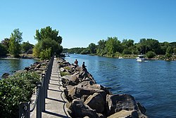
The mouth of the creek, at Point Breeze
USA New York relief location map.svg
Red pog.svg
Location of the mouth of the Oak Orchard Creek in New York State.
Usa edcp relief location map.png
Red pog.svg
Oak Orchard Creek (the United States)
Location
Country United States
State New York
Counties Orleans, Genesee
Physical characteristics
Source 
  location Elba, Genesee County
  coordinates 43°02′40″N78°12′44″W / 43.04444°N 78.21222°W / 43.04444; -78.21222 [1]
Mouth Lake Ontario
  location
Carlton, Orleans County
  coordinates
43°22′18″N78°11′32″W / 43.37167°N 78.19222°W / 43.37167; -78.19222 [1]
Discharge 
  locationKenyonville [2]
  average346 cu ft/s (9.8 m3/s)

Oak Orchard Creek (sometimes called Oak Orchard River) is a tributary of Lake Ontario in Orleans County, New York in the United States. [1]

Contents

The creek flows through Oak Orchard Creek Marsh, 600 acres (2.4 km2) of which were declared a National Natural Landmark in May 1973. [3] The marshlands through which Oak Orchard Creek flows are a major stopover points for migratory birds, and are protected by state- and federally-designated conservation areas.

Course

Aerial view of Oak Orchard Creek, 2013. The creek is slightly right of center in the photo, running roughly vertically from the bottom of the image to the lake at top. Aerial - NY Lake Ontario shore near Oak Orchard Marine Park 03 - white balanced (9645354673).jpg
Aerial view of Oak Orchard Creek, 2013. The creek is slightly right of center in the photo, running roughly vertically from the bottom of the image to the lake at top.

Oak Orchard Creek rises south of Oak Orchard Creek Marsh (also called the "Alabama Swamp") at the border of Orleans and Genesee counties. The swamp contains a state reserve, Oak Orchard Wildlife Management Area, and a national reserve, the Iroquois National Wildlife Refuge, both of which are known as major stopover points for migratory birds. Oak Orchard Creek Marsh was designated a National Natural Landmark in May 1973. [4] The swamp is a result of a partial blockage of the river by glacial drift and an outcrop of limestone and dolomite known as the Lockport Formation which forms the Niagara Escarpment.

Waterport Pond, also known as Lake Alice, is the widest point of Oak Orchard Creek Oak Orchard River - Lake Alice.jpg
Waterport Pond, also known as Lake Alice, is the widest point of Oak Orchard Creek

After flowing through the swamp, it flows northward, across the escarpment in a series of waterfalls and rapids at Shelby Center, thence passing through the Village of Medina to the small Glenwood Lake north of the village. The creek departs the town of Ridgeway at its northeast corner, cuts through the northwest corner of the town of Gaines, and widens before entering the town of Carlton. The widest part is now known as Waterport Pond (Lake Alice), and the hamlet of Waterport is on the south bank. A dam at the northeast end of the pond controls water flow.

Oak Orchard Creek narrows again and passes underneath Route 18 and the Lake Ontario State Parkway before entering Lake Ontario at Point Breeze where Oak Orchard State Marine Park is located. The lower part of the creek remains relatively ice-free during winters presumably due to steady flow of water and hydro-plant at Waterport.

Sporting activities

Boating

Several boat launch locations exist in the lower Oak Orchard Creek. Two are near Point Breeze at the state park. Three more are near the Route 18 overpass. Boating is limited to a short distance upstream from a point called Toms Landing due to the shallow depth. Most boaters enter the creek in order to fish.

There is some concern about pollutants from anti-fouling paint on boat hulls.

Fishing

The state fish hatcheries release brown trout, salmon and steelhead each year into the river. Fishing may be done from boats in the lower part, by wading in the upper parts, and from the shore along its length.

Other activities

The entire area of public lands is open for birdwatching and hiking. Within the Oak Orchard Swamp other activities, such as hunting and trapping, can be done by permit. Boating is restricted to non-powered boats, and picnicking and camping are restricted to specific areas.

See also

Related Research Articles

<span class="mw-page-title-main">Carlton, New York</span> Town in New York, United States

Carlton is a town in Orleans County, New York, United States. The population was 2,994 at the 2010 census. The name is derived from Carleton, a shipbuilding district near Ottawa, Ontario, Canada.

<span class="mw-page-title-main">Humber River (Ontario)</span> River in Canada

The Humber River is a river in Southern Ontario, Canada. It is in the Great Lakes Basin, is a tributary of Lake Ontario and is one of two major rivers on either side of the city of Toronto, the other being the Don River to the east. It was designated a Canadian Heritage River on September 24, 1999.

<span class="mw-page-title-main">Rouge River (Ontario)</span> River in Ontario, Canada

The Rouge River is a river in Markham, Pickering, Richmond Hill and Toronto in the Greater Toronto Area of Ontario, Canada. The river flows from the Oak Ridges Moraine to Lake Ontario at the eastern border of Toronto, and is the location of Rouge Park, the only national park in Canada within a municipality. At its southern end, the Rouge River is the boundary between Toronto and southwestern Pickering in the Regional Municipality of Durham.

<span class="mw-page-title-main">Goose Creek State Park</span> State park in North Carolina, United States

Goose Creek State Park is a North Carolina state park near Washington, Beaufort County, North Carolina in the United States. It covers 1,672 acres (6.77 km2) just off of Pamlico Sound, in North Carolina's Coastal Plain. Goose Creek State Park is home to a wide variety of wildlife that make their homes in the extensive salt water marshes, inlets and creeks on the northern side of the sound. Goose Creek State Park is open for year-round recreation, east of Washington, two miles (3 km) south of U.S. Route 264 on Camp Leach Road.

Montezuma National Wildlife Refuge is a wildlife preserve operated by the United States Fish and Wildlife Service, encompassing part of the Montezuma Swamp at the north end of Cayuga Lake. The 10,004-acre (40.48 km2) preserve is composed of swamps, pools and channels and is a stopping point for migratory birds.

<span class="mw-page-title-main">Lake Scugog</span> Lake in southern Ontario, Canada

Lake Scugog is an artificially flooded lake in Scugog, Regional Municipality of Durham and the unitary city of Kawartha Lakes in central Ontario, Canada. It lies between the communities of Port Perry and Lindsay. The lake has been raised and lowered several times over its history. Though not technically part of the Kawartha lakes due to its shallow depths, it is often geographically linked to them. Its sole outflow, the Scugog River, connects to Sturgeon Lake. Lake Scugog is in the Great Lakes Basin and forms part of the Trent–Severn Waterway.

<span class="mw-page-title-main">Ruby Lake National Wildlife Refuge</span>

The Ruby Lake National Wildlife Refuge is located in southwestern Elko County and northwestern White Pine County in the northeastern section of the state of Nevada in the western United States. Established in 1938, it encompasses 37,632 acres (152.29 km2) of wetlands in Ruby Valley, just east of the Ruby Mountains and just south of Harrison Pass. It is 16 miles (26 km) long, up to 3 miles (4.8 km) in width, and lies at an elevation of 6,000 feet (1,800 m). Once the bed of a 200-foot (61 m) deep lake, it is now a network of spring-fed marshes and shallow ponds serving as a habitat for hundreds of species of native and migratory birds and mammals.

<span class="mw-page-title-main">Paynes Prairie Preserve State Park</span> Protected ecological system in Florida

Paynes Prairie Preserve State Park is a Florida State Park, encompassing a 21,000-acre (85 km2) savanna in Alachua County, Florida lying between Micanopy and Gainesville. It is also a U.S. National Natural Landmark. It is crossed by both I-75 and U.S. 441. It is in the center of the Paynes Prairie Basin. The basin's primary source of drainage is Alachua Sink. During occasional wet periods, the basin will become full. A notable period occurred from 1871 to 1891 when the Alachua Sink was temporarily blocked. During this period, shallow draft steamboats were a frequent sight on Alachua Lake in the center of the prairie. The region was also historically known as the Alachua Savannah. Its drainage has been modified by several canals. Since 1927, Camps Canal has linked the basin to the River Styx which leads to Orange Lake and eventually the Atlantic Ocean through the St. Johns River. That reduced the basins water intake by half. Additional changes to the prairie's environment have been detrimental to its hydrology. In 1970, the state of Florida acquired the land and has been in the process of restoring the environment to a more natural condition ever since.

Tinker's Creek, in Cuyahoga, Summit and Portage counties, is the largest tributary of the Cuyahoga River, providing about a third of its flow into Lake Erie.

<span class="mw-page-title-main">New York State Route 279</span> State highway in Orleans County, New York, US

New York State Route 279 (NY 279) is a north–south state highway in Orleans County, New York, in the United States. The southern terminus of the route is at an intersection with NY 98 north of the village of Albion in the town of Gaines. Its northern terminus is at a junction with NY 18 in Carlton near where NY 18 meets the western end of the Lake Ontario State Parkway. The entirety of NY 279 north of NY 104 is maintained by Orleans County; south of NY 104, the route is maintained by the New York State Department of Transportation. NY 279 is a rural connector highway that serves only one community, the hamlet of Waterport on the banks of Oak Orchard Creek in Carlton.

<span class="mw-page-title-main">Grand River (Ohio)</span> River in Ohio, United States

The Grand River is a tributary of Lake Erie, 102.7 miles (165.3 km) long, in northeastern Ohio in the United States. Via Lake Erie, the Niagara River and Lake Ontario, it is part of the watershed of the St. Lawrence River, which flows to the Atlantic Ocean. It drains an area of 712 mi² (1844 km²).

<span class="mw-page-title-main">Patterson River</span> River in Victoria, Australia

The Patterson River is a partly man-made urban river of the Port Phillip catchment in the Australian east coast state of Victoria, located in the outer southeastern suburbs of the Greater Melbourne region. Under the name "Patterson", it is the shortest river in Victoria at only 5 km (3.1 mi) in length, although its main stem tributary and de facto upper section, the Dandenong Creek, is over 53 km (33 mi) long.

<span class="mw-page-title-main">Colt Creek State Park</span> State park in Florida, United States

Colt Creek State Park is a Florida State Park in Central Florida, 16 miles (26 km) north of Lakeland off of State Road 471. This 5,067 acre park nestled within the Green Swamp Wilderness Area and named after one of the tributaries that flows through the property was opened to the public on January 20, 2007. Composed mainly of pine flatwoods, cypress domes and open pasture land, this piece of pristine wilderness is home to many animal species including the American bald eagle, Southern fox squirrel, gopher tortoise, white-tailed deer, wild turkey and bobcat.

Eighteen Mile Creek, or Eighteenmile Creek, is a tributary of Lake Ontario located entirely in Niagara County, New York in the United States. The name of "Eighteen Mile" Creek refers not to the length of the creek, but to its distance from the Niagara River to the west.

Twelve Mile Creek is a waterway located on the Niagara Peninsula in the Regional Municipality of Niagara in Southern Ontario, Canada. Its headwaters are located in the town of Pelham, encompassing some of the most unspoiled and natural areas of Niagara area. The creek's lower reaches flow through urban areas of Thorold and St. Catharines and has been heavily altered by human activity for almost two centuries. The creek was first known as "Ashquasing" by the Mississaugas Indigenous people, the name meaning "that which lies at the end" in the Anishinaabe language.

Mississippi Lake is a lake in Lanark County in Ontario, Canada. Ontario's Mississippi River flows northeast and north through the lake. Several small creeks including Cranberry Creek, McCrearys Creek, and McGibbon Creek drain into the lake from adjoining forest and agricultural land. The lake is distinctive for having one side that is part of the Canadian shield, while the other is mostly limestone. The lake is a remnant of the old Champlain Sea, which flooded eastern Ontario at the end of last ice age. The former shoreline of the sea can still be traced inland from the north shore of the lake.

The West Branch Lackawanna River is a tributary of the Lackawanna River in Susquehanna County, Pennsylvania, in the United States. It is approximately 9.5 miles (15.3 km) long and flows through Ararat Township, Herrick Township, and Union Dale. The watershed of the river has an area of 16.8 square miles (44 km2). The river is not designated as an impaired stream and it has a high level of water quality. Lakes and wetlands in the river's watershed include Ball Lake, Fiddle Lake, Hathaway Lake, Lake Romobe, Lewis Lake, Lowe Lake, and Sink Hole Swamp. The river is also dammed by at least two dams: the Romobe Lake Dam and the Hathaway Pond Dam.

<span class="mw-page-title-main">Toronto waterway system</span>

The Toronto waterway system comprises a series of natural and man-made watercourses in the Canadian city of Toronto. The city is dominated by a large river system spanning most of the city including the Don River, Etobicoke Creek, Highland Creek, Humber River, Mimico Creek and Rouge River.

<span class="mw-page-title-main">McKay Lake (Ottawa)</span> Lake in Ontario, Canada

McKay Lake is a meromictic lake located in the former Village of Rockcliffe Park in Ottawa, Ontario, Canada.

References

  1. 1 2 3 "Oak Orchard Creek". Geographic Names Information System . United States Geological Survey, United States Department of the Interior . Retrieved May 5, 2016.
  2. "0422016550 Oak Orchard Creek near Kenyonville, NY, Water Data Report 2013" (PDF). National Water Information System. United States Geological Survey. 2012–2013. Retrieved May 5, 2016.
  3. "National Natural Landmarks - National Natural Landmarks (U.S. National Park Service)". www.nps.gov. Retrieved 2019-04-15. Year designated: 1973
  4. "Oak Orchard Creek Marsh". National Natural Landmarks Program. National Park Service. June 28, 2012. Retrieved May 5, 2016.