
Bouse is a census-designated place (CDP) and ghost town in La Paz County, Arizona, United States. Founded in 1908 as a mining camp, the economy of Bouse is now based on tourism, agriculture, and retirees. The population was 996 at the 2010 census. It was originally named Brayton after the store owner John Brayton Martin.
Arizona Village is a census-designated place (CDP) on the Fort Mojave Indian Reservation in Mohave County, Arizona, United States. The population was 1,057 at the 2020 census, up from 946 in 2010 and 351 in 2000.

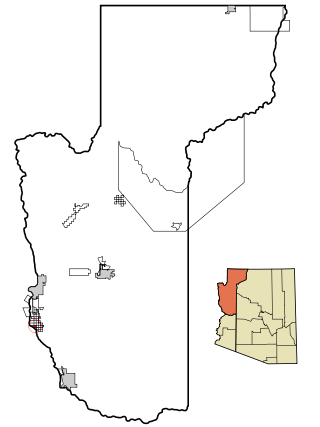
Desert Hills is an unincorporated community and census-designated place (CDP) in Mohave County, Arizona, United States. The population was 2,764 at the 2020 census, up from 2,245 at the 2010 census.

Shonto is a census-designated place (CDP) in Navajo County, Arizona, United States, in the Navajo Nation. The population was 591 at the 2010 census.

Fortuna Foothills is a census-designated place (CDP) in Yuma County, Arizona, United States. The population was 26,265 at the 2010 census. It is part of the Yuma Metropolitan Statistical Area. Development of the area began in the 1960s, when local developer Hank Schechert purchased 3,000 acres east of Yuma. Fortuna Foothills serves as a bedroom community for Yuma, Yuma Proving Ground, and Marine Corps Air Station Yuma. Fortuna Foothills is also an area with a large amount of seasonal residents.

Gadsden is a census-designated place (CDP) in Yuma County, Arizona, United States. The population was 953 at the 2000 census. It is part of the Yuma Metropolitan Statistical Area.
Guilford is a census-designated place (CDP) in Franklin County, Pennsylvania, United States. The population was 2,923 at the 2020 census.

Grand Canyon West is a census-designated place (CDP) in Mohave County, Arizona, United States, located on the Hualapai Reservation. The population was reported as 0 at the 2020 census. Grand Canyon West is home to the tribe's Grand Canyon business operations, including the Grand Canyon West Airport and the Grand Canyon Skywalk. Typically, they are open from 8:00 a.m. – 6:00 p.m., including all holidays.

Avenue B and C or B&C Colonia is a census-designated place (CDP) and colonia in Yuma County, Arizona, United States. The population was 4,176 at the 2010 census. Areas that are part of Avenue B and C were first subdivided in the 1920s and 1930s. The colonia received a sewer system in 2011. It is the fifth most populous community in Yuma County and second most populous CDP.
Enoree is a Census-designated place located in Spartanburg County in the U.S. state of South Carolina. According to the 2010 United States Census, the population was 665.

Aztec is a census designated place situated in Yuma County, Arizona, United States. It had a population of 47 as of the 2010 U.S. Census. As of July 2015, Aztec had an estimated population of 52. It has an estimated elevation of 509 feet (155 m) above sea level. It is located along Interstate 8 to the west of Tenmile Wash.
Clacks Canyon is a census-designated place (CDP) in Mohave County, Arizona, United States. The population was 167 at the 2020 census.
Crystal Beach is an unincorporated community and census-designated place (CDP) in Mohave County, Arizona, United States. The population was 250 at the 2020 census.
Buckshot is a census-designated place (CDP) in Yuma County, Arizona, United States. The population was 153 at the 2010 census.
Drysdale is a census-designated place (CDP) in Yuma County, Arizona, United States. The population was 272 at the 2010 census.
El Prado Estates is a census-designated place (CDP) in Yuma County, Arizona, United States. The population was 504 at the 2010 census.
Donovan Estates is a census-designated place (CDP) in Yuma County, Arizona, United States. The population was 1,508 at the 2010 census.
Martinez Lake is a census-designated place (CDP) in Yuma County, Arizona, United States. The population was 798 at the 2010 census. It was founded in 1958 as a fishing community. It remains primarily a vacation community.
McConnico is an unincorporated community and census-designated place (CDP) in Mohave County, Arizona, United States. The population was 63 at the 2020 census.
Padre Ranchitos is a census-designated place (CDP) situated near both the international border with Mexico, and the state border with California, in Yuma County, Arizona, United States. The population was 171 at the 2010 census.

