Arizona Village is a census-designated place (CDP) on the Fort Mojave Indian Reservation in Mohave County, Arizona, United States. The population was 1,057 at the 2020 census, up from 946 in 2010 and 351 in 2000.

Desert Hills is an unincorporated community and census-designated place (CDP) in Mohave County, Arizona, United States. The population was 2,764 at the 2020 census, up from 2,245 at the 2010 census.

Grand Canyon West is a census-designated place (CDP) in Mohave County, Arizona, United States, located on the Hualapai Reservation. The population was reported as 0 at the 2020 census. Grand Canyon West is home to the tribe's Grand Canyon business operations, including the Grand Canyon West Airport and the Grand Canyon Skywalk. Typically, they are open from 8:00 a.m. – 6:00 p.m., including all holidays.
Charco is both a census-designated place (CDP) and a populated place in Pima County, Arizona, United States. The population was 52 at the 2010 census.
Crozier is an unincorporated community and census-designated place (CDP) in Mohave County, Arizona, United States. The population was 21 at the 2020 census.
Clacks Canyon is a census-designated place (CDP) in Mohave County, Arizona, United States. The population was 167 at the 2020 census.
Crystal Beach is an unincorporated community in Mohave County, Arizona, United States. The population was 250 at the 2020 census. For statistical purposes, the United States Census Bureau has defined Crystal Beach as a census-designated place (CDP).
Buckshot is a census-designated place (CDP) in Yuma County, Arizona, United States. The population was 153 at the 2010 census.
Drysdale is a census-designated place (CDP) in Yuma County, Arizona, United States. The population was 272 at the 2010 census.
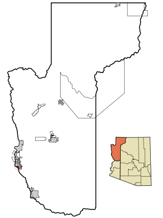
El Prado Estates is a census-designated place (CDP) in Yuma County, Arizona, United States. The population was 504 at the 2010 census.
Haivana Nakya is a census-designated place (CDP) in Pima County, Arizona, United States. The population was 96 at the 2010 census.
Donovan Estates is a census-designated place (CDP) in Yuma County, Arizona, United States. The population was 1,508 at the 2010 census.
Ko Vaya is a census-designated place (CDP) in Pima County, Arizona, United States. The population was 46 at the 2010 census.
Maish Vaya is a census-designated place (CDP) in Pima County, Arizona, United States. The population was 158 at the 2010 census.
Martinez Lake is a census-designated place (CDP) in Yuma County, Arizona, United States, located on Martinez Lake. The population was 798 at the 2010 census. It was founded in 1958 as a fishing community. It remains primarily a vacation community.
McConnico is an unincorporated community and census-designated place (CDP) in Mohave County, Arizona, United States. The population was 63 at the 2020 census.
Nelson is a census-designated place (CDP) in Pima County, Arizona, United States. The population was 259 at the 2010 census.
Nolic is a census-designated place (CDP) located on the Tohono O'odham Indian Reservation in Pima County, Arizona, United States. The population was 37 at the 2010 census.
Pimaco Two is a census-designated place (CDP) located in Pima County, Arizona, United States. The population was 682 at the 2010 census.
Pinion Pines is an unincorporated community and census-designated place (CDP) in Mohave County, Arizona, United States. The population was 158 at the 2020 census.


