Route 7 is 97 kilometres (60 mi) long and runs from Fredericton, near an interchange with Route 8, to an interchange with Route 1 in Saint John. Most of the highway is either a divided expressway or has limited access.
Route 2 is a major provincial highway in the Canadian province of New Brunswick, carrying the main route of the Trans-Canada Highway in the province. The highway connects with Autoroute 85 at the border with Quebec and Highway 104 at the border with Nova Scotia, as well as with traffic from Interstate 95 in the U.S. state of Maine via the short Route 95 connector. A core route in the National Highway System, Route 2 is a four-lane freeway in its entirety, and directly serves the cities of Edmundston, Fredericton, and Moncton.

The Nashwaak River, located in west-central New Brunswick, Canada, is a tributary of the Saint John River. It is 113 kilometres long. The river rises from Nashwaak Lake and flows south and east through uninhabited land and rapids to the village of Stanley. From Stanley, the Nashwaak flows southeast to Nashwaak Bridge and Taymouth, then south the through several rural communities such as Durham Bridge, the historic town of Nashwaak Village and Penniac before it reaches the town of Marysville. It flows into the Saint John River opposite downtown Fredericton.

5th Canadian Division Support Base Gagetown, formerly known as and commonly referred to as CFB Gagetown, is a large Canadian Forces Base covering an area over 1,100 km2 (420 sq mi), located in southwestern New Brunswick.
Route 101 is 76 kilometres long and runs from downtown Fredericton to a junction with Route 7 in Welsford.
Fredericton Junction is a Canadian village in Sunbury County, New Brunswick.
Tracy is a Canadian village in Sunbury County, New Brunswick at Route 101 and the Eastern Terminus of Route 645.

The Fredericton Railway Bridge is a former railway bridge in Fredericton, New Brunswick, Canada now used to carry pedestrians and cyclists.

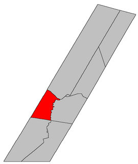
Blissville is a civil parish in Sunbury County, New Brunswick, Canada.

Southampton is a civil parish in York County, New Brunswick, Canada.
The Daaquam River is a river primarily flowing in the administrative region of Chaudière-Appalaches, at South of Quebec in Canada and northern Maine, in United States. The river runs from its source, south of Sainte-Justine, northeast across the Canada–United States border to the Northwest Branch of the Saint John River in Maine.

The Northwest Branch Saint John River is a 15.5-mile-long (24.9 km) river primarily in Aroostook County, Maine, USA. Its origin is Frontier Lake (Quebec-Maine) in Quebec, Canada. After crossing the Canada–United States border, the Northwest Branch runs south close to the border until it picks up its tributary, the Daaquam River, which also flows out of Canada. The Northwest Branch then runs generally eastward to its confluence with the Southwest Branch to form the Saint John River.
The Southwest Branch Saint John River is a 62.0-mile-long (99.8 km) river in Maine and Quebec. The branch originates in "Little Saint John Lake" on the international boundary between Saint-Zacharie, Quebec and Seboomook Lake Township 5, Range 20, WELS. The branch forms the Canada–United States border as it flows northeasterly to a confluence with the Little Southwest Branch Saint John River in Seboomook Lake Township 9, Range 18, WELS. The Southwest Branch flows briefly into Quebec and then through Maine to its confluence with the Baker Branch Saint John River in Seboomook Lake Township 9, Range 17, WELS. The Southwest Branch finally joins with the Northwest Branch to form the Saint John River.
Lincoln is a civil parish in Sunbury County, New Brunswick, Canada.
Route 655 is a 15.3-kilometre (9.5 mi) long mostly east–west secondary highway in the southwestern portion of New Brunswick, Canada. Most of the route is in New Maryland Parish.
Route 785 is a 68.8-kilometre (42.8 mi) long mostly north–south secondary highway in the southwestern portion of New Brunswick, Canada. Locally, this road may be known as either the "Shin Crick Road" or the "Mine Road". In the early 1980s, a mine was established off Route 785, at Mount Pleasant. Today, Adex Mining holds a mineral claim on the mine however the mine is currently in an idle state. As a result of mine development at Mount Pleasant, Route 785 was heavily developed and rerouted from the original stage coach trail. Another name for the road is the "Sheldon Lee Highway", a satirical reference to former New Brunswick Minister of Transportation, Hon. Sheldon Lee, who continued developed the road during his terms in office, especially on the portion of road north of Mount Pleasant. Mr. Lee lived in the community of Bonny River, which is located near the southern end of Route 785, and like many people today, frequently used Route 785 for travel to Fredericton from the St. George area, roughly shaving off 40km per trip when compared to highway travel. Today, the road is heavily used by forest operations.

Burton is a civil parish in Sunbury County, New Brunswick, Canada.

Gladstone is a civil parish in Sunbury County, New Brunswick, Canada.
Greater Fredericton is the name given to the area encompassing the City of Fredericton in New Brunswick, Canada and its surroundings. Most of this area is along the Saint John River mainly on portions of Route 105, Route 102 and Route 101. Some of the areas mentioned below are included in the area of Greater Fredericton. It is also known as Greater Fredericton Census Metropolitan Area, Fredericton CMA, or The Capital Region and is located in New Brunswick, Canada. In 2006, the population of the census agglomeration was 94,268, and the metro population was 105,688.

Saint David is a civil parish in Charlotte County, New Brunswick, Canada, located northeast of St. Stephen and northwest of Saint Andrews. It comprises a single local service district (LSD), which is a member of the Southwest New Brunswick Service Commission (SNBSC).
