 |  |
 | |
The following outline is provided as an overview of and topical guide to Sudan:
Contents
- General reference
- Geography of Sudan
- Environment of Sudan
- Regions of Sudan
- Demography of Sudan
- Government and politics of Sudan
- Branches of the government of Sudan
- Foreign relations of Sudan
- Law and order in Sudan
- Military of Sudan
- Local government in Sudan
- History of Sudan
- Culture of Sudan
- Visual and performing arts in Sudan
- General culture of Sudan
- Sports in Sudan
- Displacement
- Economy and infrastructure of Sudan
- Education in Sudan
- Health in Sudan
- See also
- References
- External links
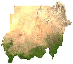
Sudan – North Eastern African state, bordered by Egypt to the north, the Red Sea to the northeast, Eritrea and Ethiopia to the southeast, South Sudan to the south, the Central African Republic to the southwest, Chad to the west and Libya to the northwest. Internally, the river Nile divides the country into eastern and western regions. The population of Sudan is a combination of indigenous African inhabitants and descendants of migrants from the Arabian Peninsula. The overwhelming majority of the population today adhere to Islam.