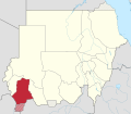
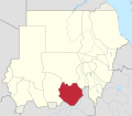
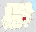
Below is a list of the 18 states of the Sudan (Arabic names are in parentheses). Prior to 9 July 2011, the Republic of the Sudan was composed of 25 states. The ten southern states now form part of the independent country of South Sudan. Two additional states were created in 2012 within the Darfur region, and one in 2013 in Kordofan, bringing the total to 18.
There were numerous new provinces created on 1 July 1973. North and South Darfur were created from Darfur, while Kurdufan divided into North and South Kordofan. Gezira and White Nile were split off from Blue Nile. River Nile split off from Northern. Red Sea was split off from Kassala.
A further fracturing of provinces occurred in 1976. Lakes split from Bahr al Ghazal, and Jonglei split off from Upper Nile. Equatoria divided into Eastern and Western Equatoria. There were thus eighteen provinces. In 1991, the government reorganized the administrative regions into nine federal states, matching the nine provinces that had existed from 1948 to 1973. On 14 February 1994, the government reorganized yet again, creating twenty-six wilayat (states). The majority of the wilayat were either the old provinces or administrative subregions of a province. As part of the new government structure in South Sudan in 2005, Bahr al Jabal was renamed Central Equatoria. In 2006, West Kurdufan was split and merged with North Kurdufan and South Kordofan.
In January 2012, the new states of Central Darfur and East Darfur were created in the Darfur region, bringing the total number of states to 17.[2] In July 2013, West Kurdufan was reestablished.[3][4]
Since the 2019 Sudanese coup d'état, the states in Sudan have been without state governments and legislative councils.
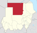
Provinces of Anglo-Egyptian Sudan in 1948. Provinces of the future South Sudan are coloured in red.Regions of Sudan, July 2006
On 9 July 2011, the ten southern states became the independent country of South Sudan. They were further divided into 86 counties.
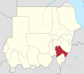
Special administrative areas
The Abyei Area, located on the border between South Sudan and the Republic of the Sudan, currently has a special administrative status and is governed by an Abyei Area Administration. It was due to hold a referendum in 2011 on whether to be part of South Sudan or part of the Republic of Sudan.
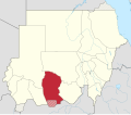
Regional bodies
In addition to the states, there also exist regional administrative bodies established by peace agreements between the central government and rebel groups:
This page is based on this Wikipedia article Text is available under the CC BY-SA 4.0 license; additional terms may apply. Images, videos and audio are available under their respective licenses.