The Overland Route remains a common name for the line from northern California to Chicago, now owned entirely by the Union Pacific.[2] The route is now primarily used for freight, with a few portions used by Amtrak'sCalifornia Zephyr passenger train.
History
Display ads for the CPRR and UPRR the week the rails were joined on May 10, 1869The Overland's SF ticket office at the Palace HotelDonner Lake (left) and the now abandoned original CPRR (later SPRR) Track #1 grade over Donner PassOverland Route schedule, December 1945
While the Council Bluffs/Omaha to San Francisco "Pacific Railroad" grade was opened in 1869, the name “Overland” was not formally adopted for any daily extra-fare train over the route until almost two decades later. On November 13, 1887, the Union Pacific inaugurated service of its Overland Flyer between Omaha and Ogden, Utah, where passengers and through cars were transferred to the Southern Pacific, which had acquired the CPRR's operations on that line in 1885 under a 99-year lease. The UP changed its designation to the Overland Limited on November 17, 1895, and service continued as a daily train under that name in one form or another for almost seven decades.[3][4] For the first dozen years that the SP met the UP's Overland trains, however, it dubbed its service the "Ogden Gateway Route"; its connecting westbound trains operated as the Pacific Express and eastbound trains as the Atlantic Express. The SP finally adopted the name the Overland Limited in 1899 for its portion of the run as well.
The original 1,911 miles (3,075km) of the route from Omaha to San Francisco traversed some of the most desolate (as well some of the most picturesque) lands of the western two-thirds of the North American continent. While the trip originally took low-fare emigrant trains a full week (or more) to complete, by 1906 the electric lighted all-Pullman Overland Limited covered the route in just 56 hours.[5]
E. H. Harriman bought the bankrupt Union Pacific in 1897; in 1901, he assumed control of the Central Pacific and Southern Pacific as well. The rebuilding of the Overland Route followed: hundreds of miles of double track, hundreds of miles of signals, and dozens of realignments to reduce grades, curvature, and perhaps distance. (The rebuilding actually started before the CP/SP acquisition—the map in the May 1969 issue of Trains shows the Howell-to-Bossler stretch realigned in 1899.)
By 1926, the UP route from Council Bluffs/Omaha to Ogden was continuous double track, except for the Aspen Tunnel (east of Evanston, Wyoming), which remained a bottleneck until 1949. The CP/SP portion of the route was also largely double-tracked during this period, with the completion of such projects as the 1909 Hood Realignment between Rocklin and Newcastle, double-tunneling along the Sierra Grade including at Cisco and the summit (Tunnel #41), and the 1924 agreement to share tracks across Nevada with the Western Pacific Railroad's Feather River Route.[6]
Among the most important improvements to the original grade was the Lucin Cutoff, a new 102.9-mile (165.6km) stretch from just west of Ogden to Lucin, a few miles east of the Nevada border. It included a 12-mile (19km) trestle on wooden pilings across the Great Salt Lake. Opened in 1904, this line cut 43.8 miles (70.5km) off the line, eliminated 3,919 degrees of curvature, and removed 1,515 feet (462m) of climb from the route, thus decreasing the steepest SP grade east of Lucin from 90 feet per mile to 21.
But many other sections of the original 1860s grade were harder to improve on, notably over the Sierra Nevada between Colfax, California, and Reno, Nevada. The newer second track follows a better route here and there, but the original route changed little (except for the removal of the wooden snowsheds, or their replacement by nonflammable concrete ones) until the 1993 abandonment of the 6.7-mile section of the Track No. 1 crossing of the summit between Norden and Eder which includes the original 1,659-foot-long (506m)Summit Tunnel (No. 6). Traffic was sent instead over the easier-to-maintain Track No. 2 and through the 10,322-foot-long (3,146m) tunnel called “The Big Hole” (No. 41) which had been driven under Mt. Judah a mile south of the Pass when that portion of the line was double tracked in 1925. Aside from those modifications, the Sierra grade looks much the same to train passengers as it did when the line opened in 1868.
"Drumhead" logos such as this often adorned the ends of the observation cars on the Overland Limited.
As intercity passenger rail travel began to decline after World War II and into the 1950s with the growth of the airline industry and development of the Interstate Highway System, the Overland route gradually lost its luster and service declined. After almost seven decades of continuous operation, the Overland Limited came to an end as a daily train on July 16, 1962, when the Interstate Commerce Commission approved termination of the service. While the train continued to run until Labor Day (with some additional holiday runs from Christmas to the New Year), the name “Overland” did not appear in the schedules of the UP or SP again after its last run on January 2, 1963. The only daily passenger train between Omaha and the San Francisco Bay area today is the California Zephyr, operated by Amtrak and mostly along a different, more scenic route. The Zephyr only uses the Overland Route in the states of California and Nevada, passing through Salt Lake City instead of Ogden and traveling via the Central Corridor to Denver instead of Cheyenne.[9][10][pageneeded] In 1996, the Union Pacific again acquired the Southern Pacific, resulting in the entire Chicago-Oakland line being owned by a single company.[11]
Route description
Council Bluffs/Omaha to Ogden (via the Union Pacific)
UPRR & CPRR "Great American Over-Land Route" Timetable cover 1881The "Thousand Mile Tree" located 1,000 miles (1,600km) west of Omaha, Nebraska, on the UPRR grade of the Overland Route
Heading west from Council Bluffs/Omaha over the same wide-open plains of Nebraska's Platte River Valley that had been followed by so many wagon trains from the 1840s through the 1860s, Overland trains passed first through Fremont, Grand Island, and Kearney (196 miles from Omaha) where all the wagon trails from the Missouri River communities between Omaha and Kansas City had once converged. There the famous Fort Kearney had been built by the U.S. Army in 1858 to protect the Oregon–California Trail heading west, and from which, under the direction of Union Generals U.S. Grant and W.T. Sherman, soldiers had been dispatched to protect UP surveyors and construction crews from Indian attack as the road progressed across Nebraska towards Wyoming.
By the time travelers on the Overland Route crossed into Wyoming at Pine Bluffs, they had traveled some 470 miles (760km) westward and risen in elevation above sea level from the 1,033 feet (315m) at Omaha to 5,047 feet (1,538m). The Rocky Mountains first came into passengers’ view 20 miles (32km) further on at Hillsdale with the appearance of the dark crests of the Laramie Range. About 36 miles (58km) further west the route reached Sherman, the highest point on the line at 8,013 feet (2,442m), on a high and rugged upland with bold rock masses eroded into fantastic, picturesque shapes.
The route crossed the Continental Divide at Creston, some 737 miles (1,186km) west of Omaha. At Green River passengers were treated to views of two of the most spectacular rock formations in Wyoming—Man's Face directly southwest of the station, and Castle Rock just north of it. Six miles after crossing the Bear River at Evanston the route entered Utah, a land which would provide passengers with close-up views of some of the most unusual rock formations of the entire trip.
After passing Henefer where Brigham Young and his Mormon pioneers had turned southward in 1847 to cross the Wasatch Mountains into Emigration Cañon, perhaps the two most famous features on the Union Pacific's section of the Overland, Thousand Mile Tree and Devil's Slide, came into view on the west, and south sides of the track, respectively. Entering the Valley of the Great Salt Lake, the route soon reached Ogden, some 1,029 miles (1,656km) from Omaha. Here the Union Pacific lines diverged to Los Angeles and the Pacific Northwest while the Southern Pacific (which acquired operational control of the CPRR's original Pacific route under lease in 1885) took charge of the “Overland Limited” and other trains on to San Francisco.
Ogden to San Francisco (via the Central Pacific/Southern Pacific)
When the route opened in 1869, trains reached the San Francisco Bay.
For the 35 years after the driving of the “Last Spike” at Promontory Summit in 1869, all trains traveling west of Ogden passed over the site of that seminal event as they made their way around the northern end of the Great Salt Lake. In November 1903, the SP opened the Lucin Cutoff, a 102.9-mile (165.6km) stretch of track featuring a 12-mile (19km) trestle built on pilings across the Great Salt Lake. Ten miles past Lucin, the “Overland” crossed into Nevada at Tecoma, the nearest railroad town to the silver, copper, and lead deposits discovered in the region in 1874.
Passing through other western Nevada mining centers and through Wells, an important supply point on the old Emigrant Trail, the line then followed the valley of the 300-mile (480km) long Humboldt River. Devil's Peak, a perpendicular rock rising 500 feet (150m) from the edge of the Humboldt River, dominated the canyon scenery at Palisade while the last major stop in Nevada was Reno with the Sierra Nevada mountains dominating the view ahead.
The next hundred miles of grade from Reno to Colfax, California, were by far the most challenging to build and provided the most impressive views of the whole route, although for much of that stretch passengers could see nothing as trains traveled through miles of tunnels and snowsheds. After passing Verdi, Nevada—which in November 1870 had become the site of the first train robbery on the Pacific coast—the Overland Route crossed into California and followed the Truckee River up a picturesque canyon to the town of Truckee on Donner Lake where the ill-fated George Donner party had been snowbound in the winter of 1846–7.
A serpentine climb around the east end of the lake and up Mt. Judah brought the Overland to the 1,659-foot-long (506m) Summit Tunnel at 7,018 feet at Donner Pass and the start of a 105-mile (169km) descent to Sacramento located just 35 feet (11m) above sea level. Travel over this section could be quite treacherous in the winter as the Southern Pacific had to clear as much as 50 to 60 feet (15 to 18m) of snowfall as well as ice from water dripping in the tunnels. The miles of showsheds needed to keep the line passable left the impression among passengers that they were “railroading in a tunnel” for much of the route. The wooden snowsheds sometimes caught fire from lightning strikes or embers from steam locomotives.
Still there were some extensive views available to passengers in the Sierras, the most famous of which[citation needed] was that from “Cape Horn”[12] just above the town of Colfax where the grade was carved out of the side of a mountain, providing a panoramic view across Green Valley of the American River flowing in a canyon some 1,322 feet (403m) below. This spot was so popular that for many years the Southern Pacific stopped the Overland and most other trains for a few minutes so that passengers could get off the train and take it all in from a special observation area.[citation needed]
When the route opened in 1869, trains reached the San Francisco Bay area from Sacramento via a 140-mile (230km) line (built by the original Western Pacific Railroad) by way of Stockton over Altamont Pass, and on through Niles Canyon first to a pier at Alameda, and shortly thereafter to the nearby two-mile long Oakland Long Wharf (later called the "SP Mole") from which San Francisco was then accessed by ferry. In 1876, however, the CPRR acquired a line built by the California Pacific Railroad from Sacramento to Vallejo and in 1879 completed an extension of that road 17 miles (27km) across the Suisun Marsh to Benicia. There the CPRR established a ferry service to carry its trains a little more than a mile across the Carquinez Strait to Port Costa from which they ran down the southern shoreline of the Strait and San Pablo Bay, and then along eastern side of the San Francisco Bay to the Oakland Long Wharf, thereby cutting about 50 miles (80km) off the journey from Sacramento. After half a century of operation, the train ferry was replaced in October 1930 by a massive drawbridge built by the SP between Benicia and Martinez. It is still in use today.[13]
Magazine display advertisement for the "Overland Limited"c.1905
The West portal of the "Summit Tunnel" (#6) at Donner Pass
Union Pacific Overland Route promotional image, c.1900
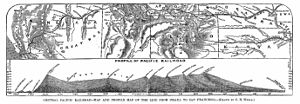
Original profile of the CPRR/UPRR "Over-Land Route" of the Pacific Railroad
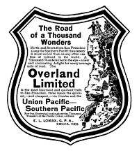
"The Overland Route to the Road of a Thousand Wonders: The Route of the Union Pacific & Southern Pacific from Omaha to San Francisco - A Journey of Eighteen Hundred Miles Where Once the Bison & the Indian Reigned" Union and Southern Pacific Railroad Passenger Departments, 1908.
↑ The Official Guide of the Railways and Steam Navigation Lines of the United States, Porto Rico, Canada, Mexico and Cuba. New York: National Railway Publication Co. July 1906. p.654.
↑ Cooper, Bruce Clement, ed. (2010). The Classic Western American Railroad Routes. New York: Chartwell Books/Worth Press. pp.44–45. ISBN978-0-7858-2573-9.
The Central Pacific Railroad (CPRR) was a rail company chartered by U.S. Congress in 1862 to build a railroad eastwards from Sacramento, California, to complete the western part of the "First transcontinental railroad" in North America. Incorporated in 1861, CPRR ceased operation in 1959 when assets were formally merged into the Southern Pacific Railroad.
Theodore Dehone Judah was an American civil engineer who was a central figure in the original promotion, establishment, and design of the First transcontinental railroad. He found investors for what became the Central Pacific Railroad (CPRR). As chief engineer, he performed much of the route survey work to determine the best alignment for the railroad over the Sierra Nevada, which was completed six years after his death.
America's first transcontinental railroad was a 1,911-mile (3,075 km) continuous railroad line built between 1863 and 1869 that connected the existing eastern U.S. rail network at Council Bluffs, Iowa, with the Pacific coast at the Oakland Long Wharf on San Francisco Bay. The rail line was built by three private companies over public lands provided by extensive U.S. land grants. Building was financed by both state and U.S. government subsidy bonds as well as by company-issued mortgage bonds. The Western Pacific Railroad Company built 132 miles (212 km) of track from the road's western terminus at Alameda/Oakland to Sacramento, California. The Central Pacific Railroad Company of California (CPRR) constructed 690 miles (1,110 km) east from Sacramento to Promontory Summit, Utah Territory. The Union Pacific Railroad (UPRR) built 1,085 miles (1,746 km) from the road's eastern terminus at the Missouri River settlements of Council Bluffs and Omaha, Nebraska, westward to Promontory Summit.
A transcontinental railroad or transcontinental railway is contiguous railroad trackage, that crosses a continental land mass and has terminals at different oceans or continental borders. Such networks can be via the tracks of either a single railroad or over those owned or controlled by multiple railway companies along a continuous route. Although Europe is crisscrossed by railways, the railroads within Europe are usually not considered transcontinental, with the possible exception of the historic Orient Express. Transcontinental railroads helped open up interior regions of continents not previously colonized to exploration and settlement that would not otherwise have been feasible. In many cases they also formed the backbones of cross-country passenger and freight transportation networks. Many of them continue to have an important role in freight transportation and some like the Trans-Siberian Railway even have passenger trains going from one end to the other.
Promontory is an area of high ground in Box Elder County, Utah, United States, 32 mi (51 km) west of Brigham City and 66 mi (106 km) northwest of Salt Lake City. Rising to an elevation of 4,902 feet (1,494 m) above sea level, it lies to the north of the Promontory Mountains and the Great Salt Lake. It is notable as the location of Promontory Summit, where the First transcontinental railroad from Sacramento to Omaha in the United States was officially completed on May 10, 1869. The location is sometimes confused with Promontory Point, a location further south along the southern tip of the Promontory Mountains. Both locations are significant to the Overland Route; Promontory Summit is where the original, abandoned alignment crossed the Promontory Mountains while the modern alignment, called the Lucin Cutoff, crosses the mountains at Promontory Point.
The golden spike is the ceremonial 17.6-karat gold final spike driven by Leland Stanford to join the rails of the first transcontinental railroad across the United States connecting the Central Pacific Railroad from Sacramento and the Union Pacific Railroad from Omaha on May 10, 1869, at Promontory Summit, Utah Territory. The term last spike has been used to refer to one driven at the usually ceremonial completion of any new railroad construction projects, particularly those in which construction is undertaken from two disparate origins towards a common meeting point. The spike is now displayed in the Cantor Arts Center at Stanford University.
The Southern Pacific was an American Class I railroad network that existed from 1865 to 1996 and operated largely in the Western United States. The system was operated by various companies under the names Southern Pacific Railroad, Southern Pacific Company and Southern Pacific Transportation Company.
The California Zephyr was a passenger train that ran between Chicago, Illinois, and Oakland, California, via Omaha, Denver, Salt Lake City, Winnemucca, Oroville and Pleasanton in the United States. It was operated by the Chicago, Burlington & Quincy (CB&Q), Denver & Rio Grande Western (D&RGW) and Western Pacific (WP) railroads, all of which dubbed it "the most talked about train in America" on March 19, 1949, with the first departure the following day. The train was scheduled to pass through the most spectacular scenery on its route in the daylight. The original train ceased operation in 1970, though the D&RGW continued to operate its own passenger service, the Rio Grande Zephyr, between Salt Lake City and Denver, using the original equipment until 1983. In 1983 a second iteration of the California Zephyr, an Amtrak service, was formed. The current version of the California Zephyr operates partially over the route of the original Zephyr and partially over the route of its former rival, the City of San Francisco.
Donner Pass is a 7,056-foot-high (2,151 m) mountain pass in the northern Sierra Nevada, above Donner Lake and Donner Memorial State Park about 9 miles (14 km) west of Truckee, California. Like the Sierra Nevada themselves, the pass has a steep approach from the east and a gradual approach from the west.
The Western Pacific Railroad was a Class I railroad in the United States. It was formed in 1903 as an attempt to break the near-monopoly the Southern Pacific Railroad had on rail service into northern California. WP's Feather River Route directly competed with SP's portion of the Overland Route for rail traffic between Salt Lake City/Ogden, Utah, and Oakland, California, for nearly 80 years. The Western Pacific was one of the original operators of the California Zephyr passenger line.
The Lucin Cutoff is a 102-mile (164 km) railroad line in Utah, United States that runs from Ogden to its namesake in Lucin. The most prominent feature of the cutoff was a twelve-mile-long (19 km) railroad trestle crossing the Great Salt Lake, which was in use from 1904 until the late 1950s, when it was replaced by an earthen causeway.
The City of San Francisco was a streamlined through passenger train which ran from 1936 to 1971 on the Overland Route between Chicago, Illinois and Oakland, California, with a ferry connection on to San Francisco. It was owned and operated jointly by the Chicago and North Western Railway (1936–55), Chicago, Milwaukee, St. Paul and Pacific Railroad (1955–71), the Union Pacific Railroad, and the Southern Pacific Railroad. It provided premium extra fare service from Chicago to San Francisco when introduced in 1936 with a running time of 39 hours and 45 minutes each way.
The Oakland Long Wharf was an 11,000-foot railroad wharf and ferry pier along the east shore of San Francisco Bay located at the foot of Seventh Street in West Oakland. The Oakland Long Wharf was built, beginning 1868, by the Central Pacific Railroad on what was previously Oakland Point. Beginning November 8, 1869, it served as the west coast terminus of the First transcontinental railroad. In the 1880s, Southern Pacific Railroad took over the CPRR, extending it and creating a new ferry terminal building with the official station name Oakland Pier. The entire structure became commonly and popularly called the Oakland Mole. Portions of the Wharf lasted until the 1960s. The site is now part of the facilities of the Port of Oakland, while passenger train service operates at the nearby Jack London Square/Dellums Station and another nearby station in Emeryville.
The Feather River Route is a rail line that was built and operated by the Western Pacific Railroad. It was constructed between 1906 and 1909, and connects the cities of Oakland, California, and Salt Lake City, Utah. The line was built to compete with the Central Pacific Railroad, which at the time held a nearly complete monopoly on Northern California rail service. The route derives its name from its crossing of the Sierra Nevada, where it follows both the North and Middle Forks of the Feather River. The route is famous for its impressive engineering qualities and its considerable scenic value. All of the route is now owned and operated by the Union Pacific Railroad; however, the Union Pacific has transferred significant portions of the route to other lines. The portion still called the Feather River Route by the Union Pacific runs from the California Central Valley to Winnemucca, Nevada and has been divided into three subdivisions named the Sacramento, Canyon and Winnemucca subdivisions.
The Central Corridor is a rail line operated by the Union Pacific Railroad from near Winnemucca, Nevada to Denver, Colorado in the western United States. The line was created after the merger with the Southern Pacific Transportation Company by combining portions of lines built by former competitors. No portion of the line was originally built by the Union Pacific; in fact, some portions were built specifically to compete with the Union Pacific's Overland Route. The line is known for significant feats of engineering while crossing the Wasatch Mountains of Utah and the Rocky Mountains of Colorado. The line features numerous tunnels, the longest and highest of these is the Moffat Tunnel.
The Overland Limited was an American named passenger train which for much of its history was jointly operated by three railroads on the Overland Route between San Francisco and Chicago. The Southern Pacific Railroad handled the train west of Ogden, Utah, the Union Pacific Railroad between Ogden and Omaha, Nebraska/Council Bluffs, Iowa, and east of the Missouri River to Chicago it was operated by the Chicago and North Western Railway as well as, for a few years starting in 1955, by the Chicago, Milwaukee, St. Paul and Pacific Railroad.
The Bayshore Cutoff is the rail line between San Francisco and San Bruno along the eastern shore of the San Francisco Peninsula. It was completed by Southern Pacific (SP) in 1907 at a cost of $7 million, and included five tunnels, four of which are still used by Caltrain, the successor to Southern Pacific's Peninsula Commute service. Fill from the five tunnels was used to build the Visitacion or Bayshore Yard, the main SP classification yard near the city of Brisbane. The Del Monte was similarly rerouted over the line at some point in its operational history.
The Pacific Limited was an American named passenger train which from 1913 to 1947 was jointly operated by three railroads on the Overland Route between Portland, Oregon, Oakland, California, Los Angeles, California and Chicago. The Southern Pacific Railroad (SP) handled the train west of Ogden, Utah, the Union Pacific Railroad (UP) between Ogden and Omaha, Nebraska, and east of the Missouri River to Chicago it was operated at different times by the Chicago, Milwaukee, St. Paul and Pacific Railroad (MILW) or the Chicago and North Western Railway (CNW). While the train was advertised as going to San Francisco, it actually went to Oakland. Passengers completed the trip by ferry from Oakland Pier to the San Francisco Ferry Building at the foot of Market Street in San Francisco.
The California Zephyr is a long-distance passenger train operated by Amtrak between Chicago and the San Francisco Bay Area, via Omaha, Denver, Salt Lake City, and Reno. At 2,438 miles (3,924 km), it is Amtrak's longest daily route, and second-longest overall after the Texas Eagle's triweekly continuation from San Antonio to Los Angeles, with travel time between the termini taking approximately 511⁄2 hours. Amtrak claims the route as one of its most scenic, with views of the upper Colorado River valley in the Rocky Mountains, and the Sierra Nevada. The modern train is the second iteration of a train named California Zephyr; the original train was privately operated and ran on a different route through Nevada and California.
The Elko Subdivision is a railway line in Nevada owned and operated by the Union Pacific Railroad running from Weso to the freight yard in Elko. It is part of both the Overland Route and the Central Corridor. The line generally follows the Humboldt River and has several small tunnels while traversing the Palisade and Carlin Canyons, the longest tunnel is called the Carlin Tunnel.
This page is based on this Wikipedia article Text is available under the CC BY-SA 4.0 license; additional terms may apply. Images, videos and audio are available under their respective licenses.