Ansted is a town in Fayette County in the U.S. state of West Virginia. The population was 1,404 at the 2010 census. It is situated on high bluffs along U.S. Route 60 on a portion of the Midland Trail a National Scenic Byway near Hawks Nest overlooking the New River far below.

Thurmond is a town in Fayette County, West Virginia, United States, on the New River. The population was five at the 2020 census. During the heyday of coal mining in the New River Gorge, Thurmond was a prosperous town with a number of businesses and facilities for the Chesapeake and Ohio Railway.

Princeton, is a city in and the county seat of Mercer County, West Virginia, United States. The city is coined the "Heart of Mercer County" or the "Jewel of the South" in past decades. The population was 6,432 at the 2010 census with approximately 35,000 residents living in the greater Princeton area. It is part of the Bluefield, WV-VA micropolitan area which has a population of 107,342. The city hosts the Princeton WhistlePigs baseball club of the Appalachian League. A main tourist destination of the city is the Mercer Street Grassroots District located in Downtown Princeton. This area has been revitalized and is now home to cafes, restaurants, shops, and artistic venues.

The Virginian Railway was a Class I railroad located in Virginia and West Virginia in the United States. The VGN was created to transport high quality "smokeless" bituminous coal from southern West Virginia to port at Hampton Roads.

Hawk's Nest, the site of Hawks Nest State Park, is a peak on Gauley Mountain in Ansted, West Virginia, USA. The cliffs at this point rise 585 ft above the New River. Located on the James River and Kanawha Turnpike, many early travelers on this road stopped to see the view of the river below. In modern times, the Midland Trail carries U.S. Route 60 through the same general route. Ample parking at the overlook in the state park provides tourists with free access to the views. English writer Harriet Martineau, who passed through the area in the 1830s, found the view at Hawk's Nest nearly as moving as Niagara Falls. Martineau also reported the legend that John Marshall, as a surveyor in his youth, had been its first white discoverer.

The Chesapeake and Ohio Railway was a Class I railroad formed in 1869 in Virginia from several smaller Virginia railroads begun in the 19th century. Led by industrialist Collis P. Huntington, it reached from Virginia's capital city of Richmond to the Ohio River by 1873, where the railroad town of Huntington, West Virginia, was named for him.

William Nelson Page was an American civil engineer and industrialist. He was active in the Virginias following the U.S. Civil War. Page was widely known as a metallurgical expert by other industry leaders and investors as well as state and federal authorities.

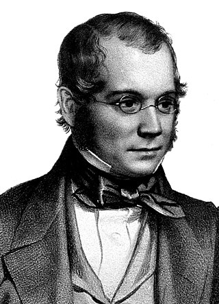
David Thomas Ansted FRS was an English professor of geology and author of numerous books on geology. His role as a teacher at Addiscombe Military Seminary, where future East India Company army officers were trained, had an influence on the study of geology in the colonies.
Page is a census-designated place (CDP) and coal town in Fayette County, West Virginia, United States. As of the 2010 census, its population was 224. It was named for William Nelson Page (1854-1932), a civil engineer and industrialist who lived in nearby Ansted, where he managed Gauley Mountain Coal Company and many iron, coal, and railroad enterprises.

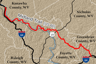
The Midland Trail is a National Scenic Byway which carries U.S. Route 60 (US 60) through a portion of the southern part of the U.S. state of West Virginia between Charleston and Sam Black Church. It was part of the longer transcontinental Midland Trail.

The Western Maryland Railway was an American Class I railroad (1852–1983) which operated in Maryland, West Virginia, and Pennsylvania. It was primarily a coal hauling and freight railroad, with a small passenger train operation.

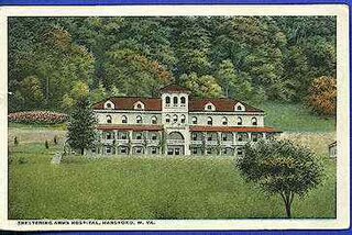
See article Sheltering Arms Hospital for other hospitals with the name located in Richmond, Virginia and Minneapolis, Minnesota.

Cass Scenic Railroad State Park is a state park and heritage railroad located in Cass, Pocahontas County, West Virginia.

Hawks Nest State Park is located on 370 acres (150 ha) in Fayette County near Ansted, West Virginia. The park's clifftop overlook along U.S. Route 60 provides a scenic vista of the New River, some 750 feet below. The hydro-electric project tunnel that passes underneath nearby Gauley Mountain was the scene of the Depression-era Hawks Nest Tunnel disaster.
The Winding Gulf Coalfield is located in western Raleigh County and eastern Wyoming County, in southern West Virginia. It is named after the Winding Gulf stream, a tributary of the Guyandotte River. In the early 20th century, it was promoted as the "Billion Dollar Coalfield".

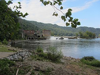
Glen Ferris is a census-designated place (CDP) on the western bank of the Kanawha River in Fayette County, West Virginia, United States. It is situated approximately one mile south of the town of Gauley Bridge. The sole highway linking Glen Ferris to the area is U.S. Route 60, known also as the Midland Trail. As of the 2010 census, its population was 203; the community had 104 housing units, 87 of which were occupied. The village is roughly a mile and a half in length. Glen Ferris is home to two churches, one Apostolic and one Methodist. A railway owned by Norfolk Southern runs parallel to US Route 60 through the village.

Colonel John Page was a planter, slave trader, merchant and politician in colonial Virginia. Born in East Bedfont, Middlesex, Page eventually migrated to the colony of Virginia, where he lived in Middle Plantation and served as a member of the House of Burgesses from 1665 to 1677 and a member of the Virginia Governor's Council from 1677 to 1692. A wealthy landowner, Page donated land and funds towards construction of the Bruton Parish Church. Page was also involved in the establishment of the College of William & Mary in 1693, as well as being a chief proponent of Middle Plantation being designated the colony's capital in 1698.

Kay Moor, also known as Kaymoor, is the site of an abandoned coal mine, coal-processing plant, and coal town near Fayetteville, West Virginia. The town site is located in the New River Gorge at Kaymoor Bottom (38°03′00″N81°03′17″W). It is linked to the mine portal 560 feet (170 m) above on Sewell Bench (38°02′52″N81°03′58″W) in the wall of the Gorge by conveyors.

The Nuttallburg Coal Mining Complex and Town Historic District is located near Winona, West Virginia in New River Gorge National Park and Preserve. The townsite is almost directly across from the Kay Moor mine and townsite, now abandoned. Like Kay Moor, the town is built around the railroad line at the bottom of the gorge, with an array of coke ovens and mining structures, as well as a bridge across the New River to South Nuttall.
Jodie, also known as Imboden, is an unincorporated community in Fayette County, West Virginia, United States. It is located along the Gauley River at the mouth of Rich Creek, 4 miles (6.4 km) northeast of Gauley Bridge. Due to its proximity to the county line, Jodie is part of the Nicholas County ZIP code of 26690; it had its own post office until its closure on July 23, 2005.


