
Pathein Township is a township of Pathein District in the Ayeyawady Region of Myanmar. The administrative seat of the Township, District and Region is Pathein. The city of Pathein is the largest city in the Region and has historically been an important center of trade, including a deepwater port.

Ngapudaw Township or Ngaputaw Township is a township of Pathein District in the Ayeyarwady Region of Myanmar. The western portion of the township includes Ngayokaung Subtownship and the southern portion of the township includes Hainggyikyun Subtownship, both unofficial divisions used by the Township for statistical and administrative ease. The small village of Kyounku within Hainggyikyun Subtownship is the birthplace of former President of Myanmar Thein Sein.

Thantlang Township is one of the nine townships in Chin State. Thantlang is the administrative town of inclusive nine circles attributed to the geographical and dialectical arrangements of the area. They are Khualhring Tlang, Vanzang Tlang, Zahnak Tlang, Bual Tlang, Vailam Tlang Lautu Tlang, Mara Tlang, Vailam Tlang, Zophei Tlang and Bawipa Tlang. Only four circles speak Lai dialect. Zophei(Zophei and Bawipa circles), Lautu, HawThai speak their tribal language. The other fives circles and in Thantlang town speak Lai dialect. In Thantlang township, Lai dialect is the common use dialect. Lai dialect is also spoken at Hakha township and Falam township.

Kyainseikgyi Township is a township of Kyainn Seikkyi District in the Kayin State of Myanmar. It is the fourth-biggest township in Kayin State. The two main sub-towns are Kyeikdon and Payathonsu. It is drained by the Zami, Winyaw and the Haungtharaw rivers.
Palaw is a town in the Tanintharyi Region, Myanmar. It is the administrative seat of Palaw Township.

Yebyu Township is a township of Dawei District in the Taninthayi Division of Myanmar. The principal town is Yebyu. The eastern portion of the township includes Kaleinaung Subtownship, an unofficial division used by the Township for statistical and administrative ease.

Palaw Township is a township of Myeik District in the Taninthayi Region of Burma (Myanmar). The principal town and administrative seat is Palaw. The township has two other towns - Palauk and Pala.

Saw Township is a township of Pakokku District in the Magway Region of Burma (Myanmar). The principal town and administrative seat is Saw.
Hainggyi Island is a town on the island of Hainggyi Island located at the mouth of the Pathein River in the Ayeyarwady Region of south-west Myanmar. It is the primary town within Hainggyikyun Subtownship within Ngapudaw Township in the Pathein District.
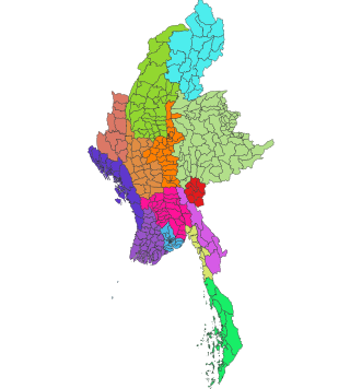
Townships are the third-level administrative divisions of Myanmar. They are the sub-divisions of the Districts of Myanmar. According to the Myanmar Information Management Unit (MIMU), as of December 2015, there are 330 townships in Myanmar.

Aunglan Township is a township of Thayet District in the Magway Region of Burma (Myanmar). Its administrative seat is Aunglan. It is the southeasternmost township in Magway Region.

Seikphyu Township is a township of Pakokku District in Magway Division of Burma (Myanmar). The principal town and administrative seat is Seikphyu. The township has its southeastern border along the Irrawaddy where its principal town, Seikphyu, is a port. The township lies between 20° 51' and 21° 15' north latitude and 94° 09' and 94° 48' east longitude. The Yaw River forms the township's eastern boundary. It is one of the areas destroyed by Cyclone Giri on 23 October 2010.
Myaing Township is a township of Pakokku District in the Magway Region of Burma (Myanmar). Its administrative seat is Myaing.

Pakokku Township is a township of Pakokku District in Magway Division of Burma (Myanmar). The principal town and administrative seat is Pakokku. The township has its eastern and southeastern border along the Irrawaddy where its principal town, Pakokku, is a port. The Yaw River forms the township's southwest border. There is a commercial airport at Lanywa (Lan).
Lanywa or Lan is a town in the Magway Division in Myanmar on the right (western) bank of the Irrawaddy, just above Seikphyu and Chauk. The town hosts a commercial airport, south-east of town.

Yesagyo Township is a township of Pakokku District in the Magway Region of central Burma (Myanmar). The principal town and administrative seat is Yesagyo.

Twante Township also Twantay Township is a township in the Yangon Region of Burma (Myanmar). It is located west across the Hlaing River from the city of Yangon. The principal town and administrative seat is Twante. The township is home to the Shwesandaw Pagoda and it is believed to contain strands of hair from the head of Gautama, and its annual pagoda festival is held on Burmese New Year. Built by the British in 1881, the Twante Canal The longest man made canal in Myanmar is Twante canal is the longest man-made canal in Myanmar, providing a shortcut waterway between Irawaddy River and Yangon river. This divides Twante Township across its which divides Twante Township with its length of 35 km and there is one bridge that spans the canal is called Twante bridge. Baungdawgyoke Monastery in Twante Township is famous as there are pagodas including the replica of Mahabodhi Temple

Kaleinaung Subtownship is a subtownship of Yebyu Township, Dawei District, in Taninthayi Region of Myanmar. The main town is Kaleinaung, located by the Dawei River.

Shwethaungyan Subtownship, also spaced out as Shwe Thaung Yan, is a subtownship in Pathein District, Ayeyarwady Region, Myanmar. The subtownship is split between Pathein Township and Thabaung Township; it has a total area of 178.50 square miles (462.3 km2), with 153.16 square miles (396.7 km2) in Pathein and 25.34 square miles (65.6 km2) in Thabaung.

Ngayokaung Subtownship is a subtownship of Ngapudaw Township in Pathein District, Ayeyarwady Region, Myanmar. The namesake of the subtownship is the town of Ngayokaung, which literally translates to pepper. The subtownship is coastal, bordering the Bay of Bengal to the west. To its north, it borders Pathein Township. To its east and south, it borders the rest of Ngapudaw Township. The eastern bound of the subtownship follows the Mawtin-Pathein road. The Subtownship is mountainous with the southern portions of the Arakan Mountains within the township making the area historically difficult to reach and hard to develop. The subtownship is divided into 11 village tracts consisting of 68 villages and one town, Ngayokaung, split into 2 wards. and a population of only 3,254 people in 2014.


