
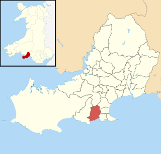
Gower electoral ward is an electoral ward in Britain. It is a ward of the City and County of Swansea, and comprises the western part of the Gower Peninsula. It lies within the UK Parliamentary constituency of Gower.
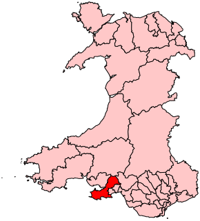
Gower is a constituency created in 1885 and represented in the House of Commons of the UK Parliament by one Member of Parliament (MP). Tonia Antoniazzi of the Labour Party became its MP after winning it from a Conservative in the 2017 UK general election. Her party had previously represented the seat from 1909 until 2015.

Newton is an electoral ward and a village in the City of and County of Swansea, Wales. The Newton ward is a part of the Mumbles community. This "affluent commuter settlement" has been represented by Councillor William Thomas of the Conservatives since May 2017.

Bishopston is a large village and community situated on the Gower Peninsula, some 6 miles (9.7 km) west south west of the centre of Swansea in South Wales.

The electoral ward of Fairwood, City and County of Swansea, Wales, UK consists of some or all of the following areas: Dunvant, Upper Killay, Poundffald and Three Crosses in the parliamentary constituency of Gower.
Bishopston is the name of an electoral ward in the City and County of Swansea, Wales. Most of the area is rural consisting of farmland and small villages. The ward is named after the village of Bishopston which falls within the ward.

Gorseinon is the name of an electoral ward in the City and County of Swansea, Wales.
Penclawdd is an electoral ward in the City and County of Swansea, Wales, UK. It is named after the village of Penclawdd, which falls within the ward.

Gowerton is the name of an electoral ward in the county of Swansea, Wales, UK. It is named after Gowerton village which falls within the ward. The Gowerton community boundaries are coterminous with the ward.
Southgate is a village in the community of Pennard on the Gower Peninsula, Swansea, Wales. It is also a community electoral ward for Pennard Community Council. The population in 2011 was 2,004.

Uplands is name of an electoral ward in the City and County of Swansea, Wales, UK.

The A4118 road is in Swansea, Wales, connecting Dyfatty Street in Swansea City Centre with Port Eynon in the Gower Peninsula. The route runs through suburban areas until it reaches Upper Killay where the road enters rural Gower. It passes over Fairwood Common and through several villages before terminating at Port Eynon.

Mayals is the name of an electoral ward of the City and County of Swansea, Wales, UK. It is also part of the Mumbles Community.

Llangyfelach is an electoral ward in the county of Swansea, Wales, UK. It covers the communities of Llangyfelach and Pontlliw and Tircoed.

West Cross is the name of an electoral ward in the Mumbles community and a suburb in the City and County of Swansea, Wales, UK. The ward falls within the Mumbles community.

Pennard is a village and community on the south of the Gower Peninsula, about 7 miles south-west of Swansea city centre. It falls within the Pennard electoral ward of Swansea. The Pennard community includes the larger settlements of Southgate and Kittle. the population as of 2011 was 2,688.
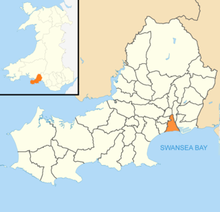
Castle is an electoral ward and community in the City and County of Swansea, Wales, UK. Castle covers most of the heart of the City of Swansea, with Swansea Castle at its centre.
