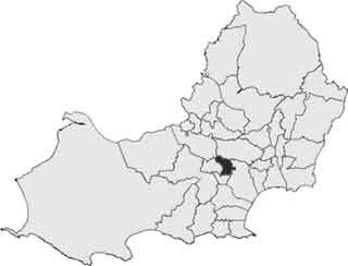
- Map of places in Swansea compiled from this list
- See the list of places in Wales for places in other principal areas.
This is a list of cities, towns and villages in the principal area of Swansea , Wales.
This is a list of cities, towns and villages in the principal area of Swansea , Wales.
| | This section is empty. You can help by adding to it. (July 2010) |
| | This section is empty. You can help by adding to it. (July 2010) |
| | This section is empty. You can help by adding to it. (July 2010) |
| | This section is empty. You can help by adding to it. (July 2010) |
| | This section is empty. You can help by adding to it. (July 2010) |
| | This section is empty. You can help by adding to it. (July 2010) |
| History |  | ||||||||||||||||
|---|---|---|---|---|---|---|---|---|---|---|---|---|---|---|---|---|---|
| Politics |
| ||||||||||||||||
| Communities |
| ||||||||||||||||
| Culture | |||||||||||||||||
| Education | |||||||||||||||||
| Sports | |||||||||||||||||
| Buildings | |||||||||||||||||
| Transport |
| ||||||||||||||||

Gower or the Gower Peninsula is in South West Wales and is the most westerly part of the historic county of Glamorgan, Wales. It projects towards the Bristol Channel. In 1956, the majority of Gower became the first area in the United Kingdom to be designated an Area of Outstanding Natural Beauty.

Gower electoral ward is an electoral ward in Britain. It is a ward of the City and County of Swansea, and comprises the western part of the Gower Peninsula. It lies within the UK Parliamentary constituency of Gower.

Sketty is the name of an electoral ward in the City and County of Swansea, Wales, UK. The electoral ward is coterminous with the community.
Mayals is an electoral ward and suburb of Swansea, Wales. It is located about 6 kilometers west of Swansea City Centre. Mayals is considered a part of the larger district of Mumbles, along with the nine other settlements within the community council region. In 2022, Mayals had a population of 2,600, compared with the 2011 census, at which point Mayals had a population of 2,676. Mayals borders the areas of Sketty, Killay, Fairwood, Bishopston, and West Cross. The majority of Mayals is situated within the Gower Area of Outstanding Natural Beauty, which was the first AONB to be established in 1956.

Killay South was an electoral ward in the City and County of Swansea, Wales. The ward was mainly rural and consisted of some or all of the following areas: Dunvant, Ilston, Killay, Sketty and Upper Killay in the parliamentary constituency of Swansea West.
Killay North is a former electoral ward in the City and County of Swansea, Wales which consisted of some or all of the following areas: Killay, Olchfa and Waunarlwydd, in the parliamentary constituency of Swansea West. The village of Killay is located mainly in this ward, set high above sea level, about 3.5 miles west of Swansea city centre.
Hendrefoilan is an area in Swansea, South Wales. The area overlaps northwest Sketty and east Killay communities.
The suburban district of Sketty is about 2 miles (3.2 km) west of the Swansea city centre on Gower Road. It falls within the Sketty council ward of Swansea. It is also a community.

Morriston ( ) is an electoral ward in Swansea, Wales. It is coterminous with the Morriston community. Morriston is one of two five member wards in the City and County of Swansea local authority area. In population terms, it is the largest ward in the Welsh Assembly constituency of Swansea East and it is the largest ward the City and County of Swansea.
Dunvant and Killay, formerly Dunvant, is an electoral ward in the City and County of Swansea, Wales, UK. It is named after the village of Dunvant and neighbouring Killay, which lie within the ward.

The A4118 road is in Swansea, Wales, connecting Dyfatty Street in Swansea City Centre with Port Eynon in the Gower Peninsula. The route runs through suburban areas until it reaches Upper Killay, where the road enters rural Gower. It passes over Fairwood Common and through several villages before terminating at Port Eynon.

Mayals is the name of an electoral ward of the City and County of Swansea, Wales, UK. It is also part of the Mumbles Community.

Saint Illtyd's Walk is a 64-mile-long (103 km) waymarked long-distance footpath in South Wales. It runs from Pembrey Country Park, west of Burry Port, through rural eastern Carmarthenshire and Neath Port Talbot to end at Margam Country Park, south of Port Talbot.
The geology of the Gower Peninsula in South Wales is central to the area's character and to its appeal to visitors. The peninsula is formed almost entirely from a faulted and folded sequence of Carboniferous rocks though both the earlier Old Red Sandstone and later New Red Sandstone are also present. Gower lay on the southern margin of the last ice sheet and has been a focus of interest for researchers and students in that respect too. Cave development and the use of some for early human occupation is a further significant aspect of the peninsula's scientific and cultural interest.