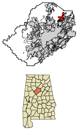
Pinson, Alabama

Last updated

Pinson, Alabama
DOWNTOWN PINSON (1 of 1).jpg
Downtown Pinson
Flag of Pinson, Alabama.png
Seal of Pinson, Alabama.png
Jefferson County Alabama Incorporated and Unincorporated areas Pinson Highlighted 0160648.svg
Location of Pinson in Jefferson County, Alabama.
Coordinates: 33°41′10″N86°40′54″W / 33.68611°N 86.68167°W / 33.68611; -86.68167
Country United States
State Alabama
County Jefferson
Area
[1]
  Total11.59 sq mi (30.02 km2)
  Land11.56 sq mi (29.95 km2)
  Water0.03 sq mi (0.07 km2)
Elevation
[2]
663 ft (202 m)
Population
 (2020)
  Total7,215
  Density623.97/sq mi (240.91/km2)
Time zone UTC-6 (Central (CST))
  Summer (DST) UTC-5 (CDT)
ZIP code
35126, 35123, 35215
Area code(s) 205 & 659
FIPS code 01-60648
GNIS feature ID2424931 [2]
Website thecityofpinson.com

Pinson is a city in Jefferson County near Birmingham, Alabama, United States, northwest of Center Point. As of the 2010 census, the population was 7,163.

Contents

History

Pinson was incorporated in March 2004. [3]

Geography

This city is located at 33°41′11″N86°40′55″W / 33.68639°N 86.68194°W / 33.68639; -86.68194 (33.686301, −86.681913). [4]

According to the U.S. Census Bureau, the community has a total area of 7.0 square miles (18 km2), of which 7.0 square miles (18 km2) is land and 0.04 square miles (0.10 km2) (0.43%) is water.

Pinson is located in an area of SW–NE parallel ridges, with occasional rock outcrops, especially toward the east-facing ridge crests. Pinson is home to the Turkey Creek Nature Preserve and the Alabama Butterbean Festival.

The Palmerdale Homesteads are located within the city limits of Pinson. The Palmerdale Homesteads were the first of five farmers' resettlement communities built in Alabama under President Franklin Roosevelt's New Deal in the 1930s. The first of the 102 homesteads were completed in 1935. A community store and elementary school/community center were completed in 1937 to serve the farming community.

Climate

Climate data for Pinson, Alabama, 1991–2020 normals, extremes 19512014
MonthJanFebMarAprMayJunJulAugSepOctNovDecYear
Record high °F (°C)80
(27)
84
(29)
91
(33)
94
(34)
97
(36)
103
(39)
109
(43)
107
(42)
101
(38)
96
(36)
89
(32)
81
(27)
109
(43)
Mean maximum °F (°C)71.5
(21.9)
76.2
(24.6)
83.8
(28.8)
88.0
(31.1)
90.8
(32.7)
95.4
(35.2)
97.4
(36.3)
97.8
(36.6)
94.3
(34.6)
87.6
(30.9)
79.9
(26.6)
72.2
(22.3)
99.4
(37.4)
Mean daily maximum °F (°C)53.5
(11.9)
58.3
(14.6)
66.6
(19.2)
74.9
(23.8)
81.5
(27.5)
87.5
(30.8)
90.2
(32.3)
89.7
(32.1)
85.2
(29.6)
75.0
(23.9)
64.0
(17.8)
55.7
(13.2)
73.5
(23.1)
Daily mean °F (°C)42.3
(5.7)
46.3
(7.9)
53.8
(12.1)
61.2
(16.2)
68.9
(20.5)
76.0
(24.4)
79.3
(26.3)
78.8
(26.0)
73.3
(22.9)
62.4
(16.9)
51.3
(10.7)
44.7
(7.1)
61.5
(16.4)
Mean daily minimum °F (°C)31.0
(−0.6)
34.3
(1.3)
40.9
(4.9)
47.5
(8.6)
56.4
(13.6)
64.5
(18.1)
68.4
(20.2)
67.8
(19.9)
61.4
(16.3)
49.7
(9.8)
38.7
(3.7)
33.8
(1.0)
49.5
(9.7)
Mean minimum °F (°C)11.4
(−11.4)
15.7
(−9.1)
21.2
(−6.0)
29.2
(−1.6)
40.4
(4.7)
52.3
(11.3)
60.2
(15.7)
58.8
(14.9)
44.3
(6.8)
31.1
(−0.5)
22.9
(−5.1)
14.8
(−9.6)
7.9
(−13.4)
Record low °F (°C)−8
(−22)
1
(−17)
2
(−17)
23
(−5)
31
(−1)
38
(3)
49
(9)
49
(9)
33
(1)
20
(−7)
12
(−11)
−2
(−19)
−8
(−22)
Average precipitation inches (mm)5.11
(130)
5.39
(137)
5.71
(145)
5.04
(128)
4.77
(121)
4.58
(116)
4.98
(126)
4.45
(113)
3.96
(101)
3.28
(83)
4.64
(118)
5.11
(130)
57.02
(1,448)
Average snowfall inches (cm)0.2
(0.51)
0.3
(0.76)
0.8
(2.0)
0.0
(0.0)
0.0
(0.0)
0.0
(0.0)
0.0
(0.0)
0.0
(0.0)
0.0
(0.0)
0.0
(0.0)
0.0
(0.0)
0.1
(0.25)
1.4
(3.52)
Average precipitation days (≥ 0.01 in)10.410.010.17.89.110.010.78.26.25.87.99.9106.0
Average snowy days (≥ 0.1 in)0.30.40.30.00.00.00.00.00.00.00.00.21.2
Source 1: NOAA [5]
Source 2: National Weather Service (mean maxima/minima 1981–2010) [6]

Demographics

Historical population
CensusPop.Note
1990 10,987
2000 5,033−54.2%
2010 7,16342.3%
2020 7,2150.7%
U.S. Decennial Census [7]
2013 Estimate [8]

Note: Census demographic data were enumerated for the Census-Designated Place (CDP) for somewhat different boundaries prior to incorporation in 2004. The 1990 population of 10,987 was for the CDP of Pinson-Clay-Chalkville, [9] which was subdivided in 2000 into their own separate CDPs. [10] Therefore, exact population for the Pinson portion in 1990 cannot be ascertained

2020 census

Pinson racial composition [11]
RaceNum.Perc.
White (non-Hispanic)3,98255.19%
Black or African American (non-Hispanic)2,37332.89%
Native American 140.19%
Asian 370.51%
Pacific Islander 20.03%
Other/Mixed 2413.34%
Hispanic or Latino 5667.84%

As of the 2020 United States census, there were 7,215 people, 2,711 households, and 1,997 families residing in the city.

2010 census

At the 2010 census, there were 7,163 people, 2,731 households, and 2,074 families living in the community. The population density was 1,023.3 inhabitants per square mile (395.1/km2). There were 2,948 housing units at an average density of 421.1 per square mile (162.6/km2). The racial makeup of the community was 79.0% White, 17.0% Black or African American, 0.2% Native American, 0.4% Asian, 0.0% Pacific Islander, 2.2% from other races, and 1.0% from two or more races. 3.7% of the population were Hispanic or Latino of any race.

Of the 2,731 households 32.0% had children under the age of 18 living with them, 58.0% were married couples living together, 13.7% had a female householder with no husband present, and 24.1% were non-families. 20.9% of households were one person and 6.5% were one person aged 65 or older. The average household size was 2.62 and the average family size was 3.04.

The age distribution was 24.4% under the age of 18, 8.0% from 18 to 24, 27.8% from 25 to 44, 27.9% from 45 to 64, and 11.9% 65 or older. The median age was 38 years. For every 100 females, there were 91.7 males. For every 100 females age 18 and over, there were 89.9 males.

The median household income was $56,863 and the median family income was $63,221. Males had a median income of $41,719 versus $36,066 for females. The per capita income for the community was $23,902. About 4.5% of families and 5.7% of the population were below the poverty line, including 8.1% of those under age 18 and 3.2% of those age 65 or over.

2000 census

At the 2000 census, there were 5,033 people, 1,853 households, and 1,450 families living in the community. The population density was 721.2 inhabitants per square mile (278.5/km2). There were 1,953 housing units at an average density of 279.8 per square mile (108.0/km2). The racial makeup of the community was 8.33% Black or African American, 88.1% White, 0.32% Native American, 0.40% Asian, 0.02% Pacific Islander, 0.34% from other races, and 0.76% from two or more races. 2.27% of the population were Hispanic or Latino of any race.

Of the 1,853 households 41.4% had children under the age of 18 living with them, 59.8% were married couples living together, 15.3% had a female householder with no husband present, and 21.7% were non-families. 19.0% of households were one person and 6.3% were one person aged 65 or older. The average household size was 2.71 and the average family size was 3.08.

The age distribution was 28.3% under the age of 18, 9.7% from 18 to 24, 31.7% from 25 to 44, 20.6% from 45 to 64, and 9.8% 65 or older. The median age was 33 years. For every 100 females, there were 93.5 males. For every 100 females age 18 and over, there were 88.8 males.

The median household income was $39,583 and the median family income was $48,707. Males had a median income of $33,843 versus $25,112 for females. The per capita income for the community was $17,704. About 8.6% of families and 10.3% of the population were below the poverty line, including 12.2% of those under age 18 and 10.9% of those age 65 or over.

Education

Media

Three newspapers serve Pinson:

Notable people

Related Research Articles

<span class="mw-page-title-main">Locust Fork, Alabama</span> Town in the United States

Locust Fork is a town in Blount County, Alabama, United States. At the 2010 census the population was 1,186 people, up from 1,016 in 2000.

<span class="mw-page-title-main">Nectar, Alabama</span> Town in Alabama, United States

Nectar is a town in Blount County, Alabama, United States. At the 2020 census, the population was 379.

<span class="mw-page-title-main">Rainbow City, Alabama</span> City in Alabama, United States

Rainbow City is a city in Etowah County, Alabama, United States. It incorporated in 1950. The population was 9,602 at the 2010 census. It is part of the Gadsden Metropolitan Statistical Area.

<span class="mw-page-title-main">Chalkville, Alabama</span> CDP in Alabama, United States

Chalkville is a former census-designated place in Jefferson County, Alabama, United States. At the 2000 census the population was 3,829. The area is now part of the city of Clay.

<span class="mw-page-title-main">Clay, Alabama</span> City in Alabama, United States

Clay is a city in northeastern Jefferson County, Alabama, United States. It is part of the Birmingham–Hoover–Cullman Combined Statistical Area in the north-central part of the state. Local government is run by a mayor and city council.

<span class="mw-page-title-main">Concord, Alabama</span> CDP in Alabama, United States

Concord is a census-designated place in Jefferson County, Alabama, United States. At the 2010 census the population was 1,837, up from 1,809 in 2000. It is northwest from the Birmingham suburb of Hueytown.

<span class="mw-page-title-main">Forestdale, Alabama</span> Unincorporated community in Alabama, United States

Forestdale is an unincorporated community and census-designated place (CDP) in Jefferson County, Alabama, United States. It is north of the Birmingham city neighborhood of Ensley. At the 2020 census, the population was 10,409.

<span class="mw-page-title-main">Graysville, Alabama</span> City in Alabama, United States

Graysville is a city in northwestern Jefferson County, Alabama, United States, located north of Adamsville. At the 2020 census, the population was 1,950.

<span class="mw-page-title-main">Mount Olive, Jefferson County, Alabama</span> Unincorporated community in Alabama, United States

Mount Olive, also spelled Mt. Olive is an unincorporated community and a census-designated place (CDP) in Jefferson County, Alabama. Its location is in the suburbs of Birmingham. As of the 2010 census, the population of the community is 4,079. Mount Olive is bordered on the south and the east by the town of Gardendale, and in fact, some areas that had previously been in Mount Olive have been annexed into Gardendale over the years. Running along part of the border between Mt. Olive and Gardendale is the major expressway, Interstate 65. Eventually, part of Birmingham's Northern Beltline will cut through northwestern sections of Mt. Olive. Mt. Olive has its own elementary school, and was formerly the home of a junior high school.

<span class="mw-page-title-main">Tarrant, Alabama</span> City in Alabama, United States

Tarrant is a city in Jefferson County, Alabama, bordering Birmingham to the north. At the 2020 census, the population was 6,124. It is home to the ABC Coke plant owned by the Drummond Company, "the largest single producer of foundry coke in the U.S.".

<span class="mw-page-title-main">Sulligent, Alabama</span> City in Alabama, United States

Sulligent is a city in Lamar County, Alabama, United States. As of the 2010 census, the population of the city was 1,927, down from its record high of 2,151 in 2000. From 1910-1950 and again in 2000, it was the largest community in Lamar County before losing the distinction both times to the county seat of Vernon. The name is derived from railroad personnel.

<span class="mw-page-title-main">Meridianville, Alabama</span> Census-designated place in Alabama, United States

Meridianville is an unincorporated community and census-designated place (CDP) in Madison County, Alabama, United States, and is included in the Huntsville-Decatur Combined Statistical Area. As of the 2020 census, the population of the CDP was 8,209.

<span class="mw-page-title-main">Roanoke, Alabama</span> City in Alabama, United States

Roanoke is a city in Randolph County, which is in the Piedmont region of eastern Alabama, United States. As of the 2020 census, the population of the city was 5,311, down from 6,074 in 2010 and 6,563 in 2000.

<span class="mw-page-title-main">Pelham, Alabama</span> City in Alabama, United States

Pelham is a city in Shelby County, Alabama, United States. The population was 24,318 at the 2020 census, It incorporated on July 10, 1964 and is a suburb located in the Birmingham metropolitan area, Alabama which was home to nearly 1.2 million residents as of the 2020 census. It was named for Confederate Civil War officer John Pelham.

<span class="mw-page-title-main">Ashville, Alabama</span> City in and county seat of St. Clair County, Alabama

Ashville is a city in and one of the county seats of St. Clair County, Alabama, United States, other seat being Pell City. Its population was 2,212 at the 2010 census, down from 2,260, at which time it was a town. It incorporated in 1822.

<span class="mw-page-title-main">Lake View, Alabama</span> City in Alabama, United States

Lake View is a city in Alabama, United States, with the majority in Tuscaloosa County and with a small portion in Jefferson County. At the 2010 census the population was 1,943, up from 1,357 in 2000. It is part of the Tuscaloosa Metropolitan Statistical Area and the Birmingham metropolitan area. It is located approximately halfway between Tuscaloosa and Birmingham via Interstates 20 and 59.

<span class="mw-page-title-main">Jasper, Alabama</span> City in Alabama, United States

Jasper is a city in and the county seat of Walker County, Alabama, United States. Its population was 14,352 as of the 2010 census. Named in honor of Sergeant William Jasper, an American Revolutionary War hero, Jasper was settled around 1815 and incorporated on August 18, 1886.

<span class="mw-page-title-main">Hanley Hills, Missouri</span> Village in Missouri, United States

Hanley Hills is a village in St. Louis County, Missouri, United States. The population was 2,101 at the 2010 census.

<span class="mw-page-title-main">Skidmore, Texas</span> Census-designated place in Texas, United States

Skidmore is a census-designated place (CDP) in Bee County, Texas, United States. The population was 925 at the 2010 census.

<span class="mw-page-title-main">Sand Creek, Wisconsin</span> Town in Wisconsin, United States

Sand Creek is a town in Dunn County, Wisconsin, United States. The population was 586 at the 2000 census. The unincorporated community of Sand Creek lies within the town, on the Red Cedar River.

References

  1. "2020 U.S. Gazetteer Files". United States Census Bureau. Retrieved October 29, 2021.
  2. 1 2 U.S. Geological Survey Geographic Names Information System: Pinson, Alabama
  3. "Pinson".
  4. "US Gazetteer files: 2010, 2000, and 1990". United States Census Bureau. February 12, 2011. Retrieved April 23, 2011.
  5. "U.S. Climate Normals Quick Access – Station: Pinson, AL". National Oceanic and Atmospheric Administration. Retrieved March 4, 2023.
  6. "NOAA Online Weather Data – NWS Birmingham". National Weather Service. Retrieved March 4, 2023.
  7. United States Census Bureau. "Census of Population and Housing". Archived from the original on April 26, 2015. Retrieved August 10, 2013.
  8. "Annual Estimates of the Resident Population: April 1, 2010 to July 1, 2013" . Retrieved June 7, 2014.
  9. https://www.census.gov/prod/cen1990/cph2/cph-2-2.pdf [ bare URL PDF ]
  10. "Archived copy" (PDF). Archived from the original (PDF) on July 24, 2017. Retrieved December 7, 2017.{{cite web}}: CS1 maint: archived copy as title (link)
  11. "Explore Census Data". data.census.gov. Retrieved December 11, 2021.